- Steinkjer
-
Steinkjer kommune — Municipality — 

Coat of arms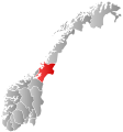
Nord-Trøndelag within
NorwaySteinkjer within Nord-Trøndelag
Coordinates: 64°03′29″N 11°43′08″E / 64.05806°N 11.71889°ECoordinates: 64°03′29″N 11°43′08″E / 64.05806°N 11.71889°E Country Norway County Nord-Trøndelag District Innherad Administrative centre Steinkjer Government – Mayor (2007) Bjørn Arild Gram (Sp) Area – Total 1,564.29 km2 (604 sq mi) – Land 1,423.30 km2 (549.5 sq mi) – Water 140.99 km2 (54.4 sq mi) Area rank 45 in Norway Population (2011) – Total 21,151 – Rank 43 in Norway – Density 14.9/km2 (38.6/sq mi) – Change (10 years) 2.9 % Demonym Steinkjerbygg[1] Time zone CET (UTC+1) – Summer (DST) CEST (UTC+2) ISO 3166 code NO-1702 Official language form Neutral Website steinkjer.kommune.no Data from Statistics Norway  Steinkjer (help·info) is a town and a municipality in Nord-Trøndelag county, Norway. It is part of the Innherad region. The administrative centre of the municipality is the town of Steinkjer, which is also the seat of the county government. The geographical centre of Norway has been calculated to be in Steinkjer municipality.
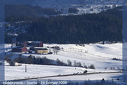
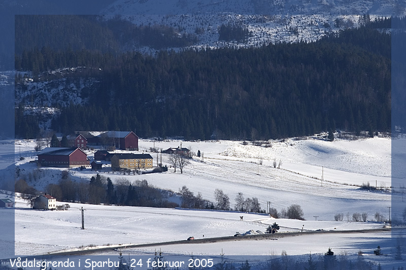
Other populated areas in Steinkjer include the villages of Bartnes, Beitstad, Binde, Byafossen, Følling, Kvam, Lerkehaug, Mære, Sparbu, Sunnan, Vassaunet, Vekre, and Vellamelen.
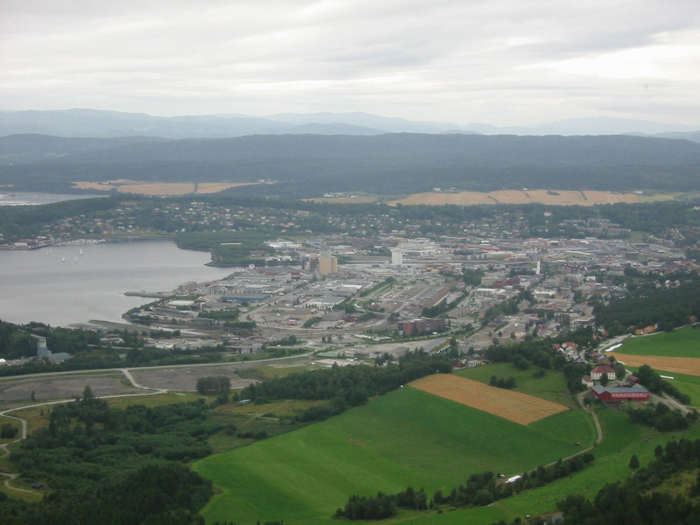
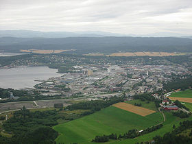 Steinkjer viewed from the east, on top of Ofsenaasen hill, picture taken 250 metres (820 ft) above sea level.
Contents
General information
 Steinkjer town hall
The village of Steinkjer in the municipality of Stod was declared a town in 1857, and then on 23 January 1858 it was separated from Stod to form a municipality of its own. The initial population of Steinkjer was 1,150.
Over time as the town grew, land was annexed from the neighboring municipalities. It started on 1 January 1902 when an unpopulated area from Ogndal was taken for future growth of Steinkjer. Then in 1941, an area (population: 57) was taken from Ogndal to add to Steinkjer. Again in 1948, an area (population: 78) was transferred from Ogndal and another area (population: 70) was transferred from Egge.
On 1 January 1964, a major municipal merger took place: the municipalities of Beitstad, Egge, Kvam, Ogndal, Sparbu, and Stod were all merged together with the town of Steinkjer (population: 4,325) to form a new, larger municipality of Steinkjer.[2]
Toponymy
The town is named after the old Steinkjer farm (Old Norse: Steinker), since it is built on its ground. The first element is steinn (m) which means "stone" or "rock". The last element is ker (n) which means a "barrier made for catching fish".[3]
Coat-of-arms
The coat-of-arms is from modern times; they were granted on 8 March 1957. The arms show a silver star with six points on a blue background. The original meaning of the star was that six main roads crossed in Steinkjer. After the municipal reorganization, the arms were re-granted, but the meaning has slightly changed. Steinkjer now formed the centre of the municipality and the points are directed to the six other districts in the municipality: Beitstad, Egge, Kvam, Ogndal, Sparbu, and Stod.[4]
Churches
The Church of Norway has nine parishes (sokn) within the municipality of Steinkjer. It is part of the Nord-Innherad deanery and the Diocese of Nidaros.
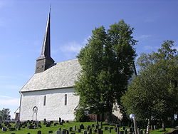 The medieval Mære church
Churches in Steinkjer Parish
(Sokn)Church Name Location
of the ChurchYear Built Beitstad Beitstad Church Beitstad 1869 Bartnes Church Bartnes 1960 Egge Egge Church Egge 1767 Følling Følling Church Følling 1726 Henning Henning Church Vekre 1872 Kvam Kvam Church Kvam 1878 Mære Mære Church Mære c. 1150 Ogndal Skei Church Ogndal 1664 Bodom Church Bodom 1905 Steinkjer Steinkjer Church Steinkjer 1965 Stod For Church Stod 1846 History

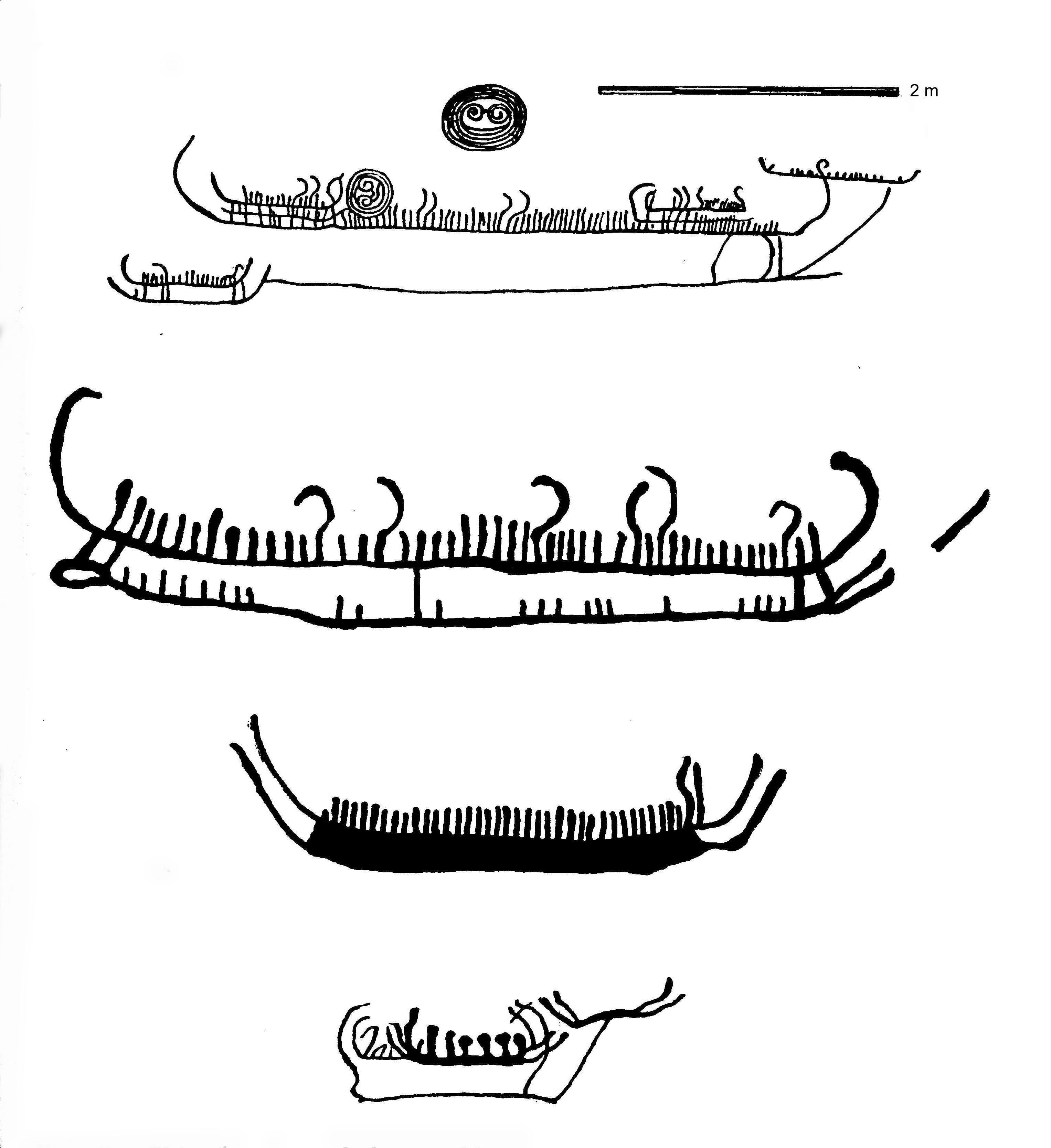
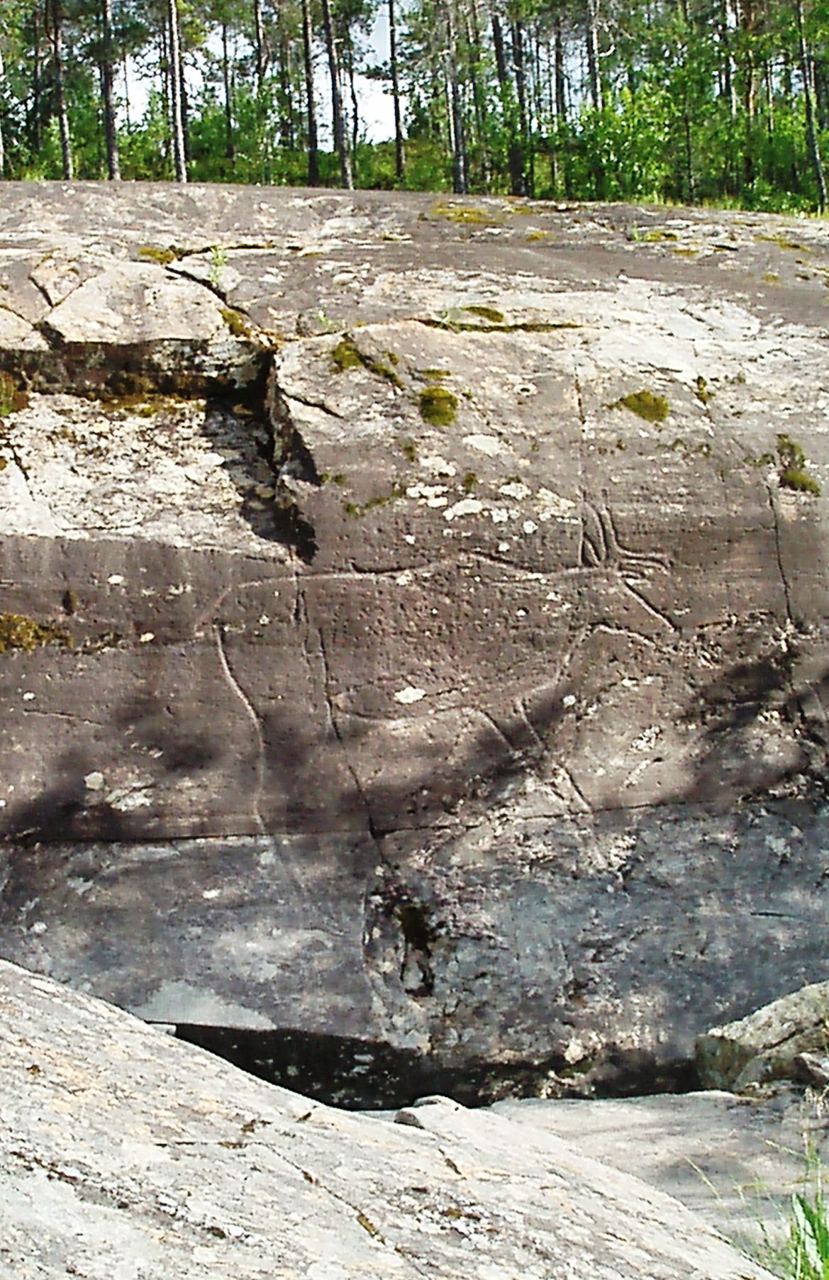
The Steinkjer area has been populated since the Stone Age, as shown by the Bølareinen rock carving, which depicts an almost life-sized reindeer and a bear. There are other rock carvings in the area as well, as in Bardal, the oldest up to 6,000 years old.
See also: Rock carvings in Central NorwayThe Steinkjer area was one of the strongest powerbases in early Viking age. Mære was one of the best known Norse religious places with sacrifices and seasonal gatherings (Norwegian: Hov) before Christianity came to Norway.
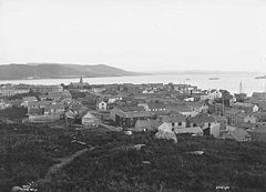 Steinkjer in 1880
Steinkjer has survived two major disasters in modern history. The first was a town-wide fire in the year 1900, which burned down much of the southern parts of the town. The second disaster happened on 21 and 22 April 1940, when the town was struck by Luftwaffe bombers during the Norwegian Campaign. Most of the town was destroyed, but no lives were lost.[5]
This attack destroyed a large part of Steinkjer, and many priceless historical buildings were lost, such as the Steinkjer Cross-church. A large part of Steinkjer's history was ruined by this attack.
The town was however quickly rebuilt after 1945 with much aid from the United States. Much of the architecture of modern Steinkjer originates from the 1950s and 1960s with functionalism architecture inspired style, not as esthetically as the previous Art Nouveau style found in cities like Trondheim and Ålesund. Some historical buildings of Steinkjer survived the bombing, like the train station and town college. These buildings are based upon a neo-classic architectural style, known as Jugendstil. A good example is the railroad station (Jernbanestasjonen) at Steinkjer Station and the administration building for HiNT, Nord-Trøndelag University College (Norwegian: Høgskolen i Nord-Trøndelag).
Geography
Steinkjer is the urban centre of the municipality, Steinkjer kommune, and the administrative centre of the county of Nord-Trøndelag. Steinkjer is located at the head of Beitstadfjorden, the northern branch of the Trondheimsfjord system. To the west, the muncipiality borders the more mountainous Verran municipality. To the east is Sweden, 60 kilometres (37 mi) from Steinkjer. To the north are the Snåsa and Namdalseid municipalities, and to the south are the Inderøy and Verdal municipalities.
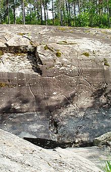 Bølareinen rock carving from the stone age
Situated 60 kilometres (37 mi) inland from the coast, Steinkjer is actually still connected to the Atlantic ocean through the narrow strait of Skarnsundet, some 25 kilometres (16 mi) south of Steinkjer. The longest cable-stayed bridge in Norway, Skarnsund Bridge, crosses the Skarnsund (total length of 1,010 metres / 3,310 feet). Large ships pass through Skarnsundet and this allows tourists to visit this town by ship. Each year ferries from Hurtigruten make trips to the cruise port of Steinkjer, more than 130 kilometres (81 mi) of travel through the fjord system. The landscape is dotted with wavy hills and dense spruce forests, as well as agricultural fields in the lowland areas. There are many lakes in this region including: Gilten, Fossemvatnet, Leksdalsvatnet, Mokkavatnet, Snåsavatnet, and the group of lakes called Bangsjøene.
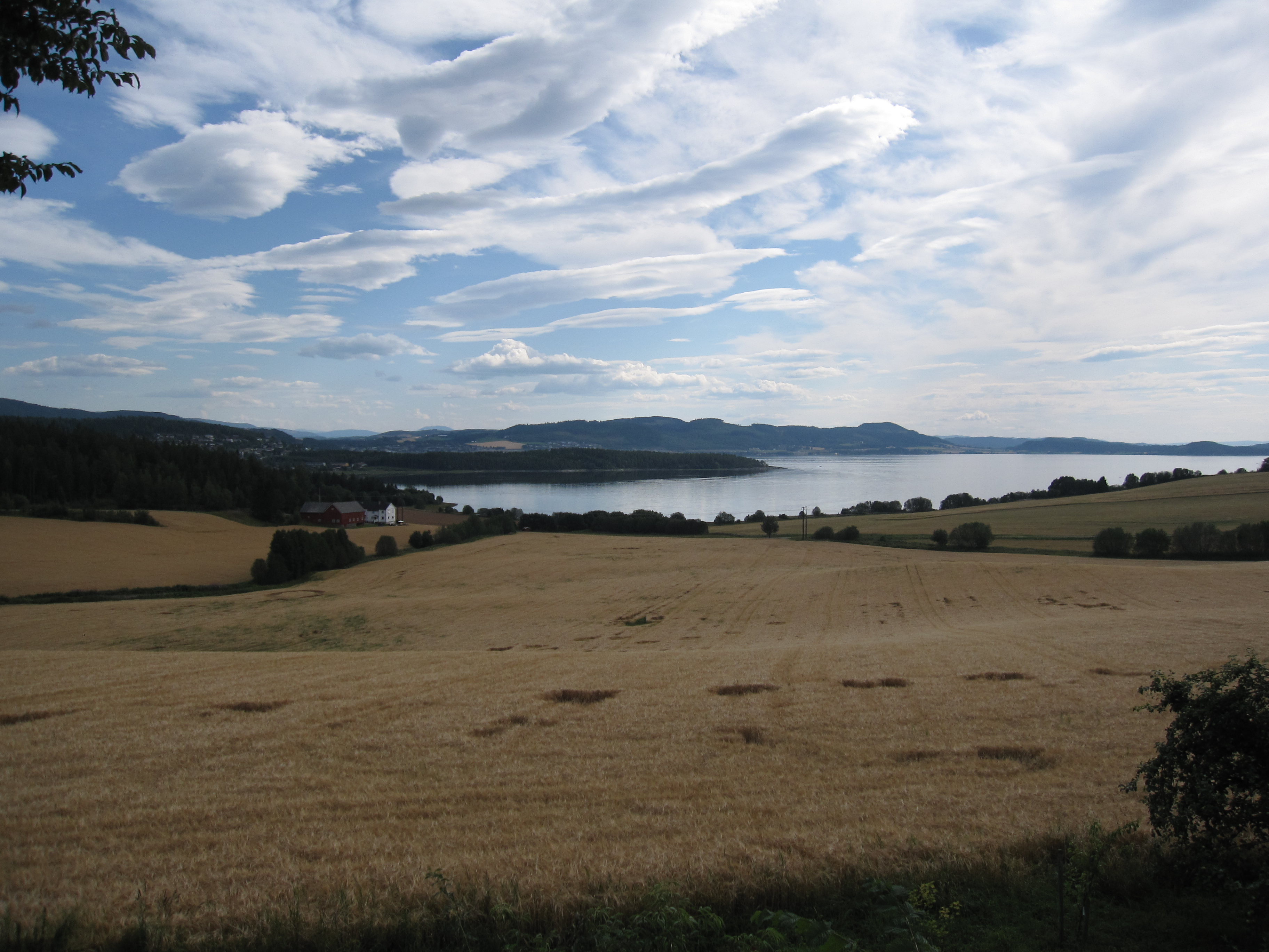
 The municipality covers large areas outside the town itself, much of it farmland or productive forest. View towards the Beitstadfjorden.
Natural resources
Steinkjer is one of Norway’s larger urban municipalities measured by total area. Approximately half the population lives near the town center, while the rest live in rural areas. However, much of the town is today in the process of urbanization, with the building of several apartment blocks in or within the immediate vicinity of the town. Currently, about 500 apartments are being finished.
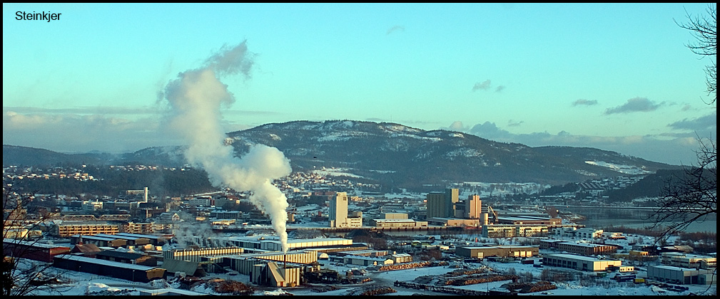
Steinkjer is one of the northernmost areas with rich agriculture, allowing large production of grain. It is obvious from the landscape that Steinkjer is a typical agricultural municipality. In addition, there are large forest resources in the immediate area. The tallest buildings in Steinkjer are two 40-metre (130 ft) tall grain silos, visible several kilometres south of Steinkjer and today mark the skyline, especially when viewed from the south. Kirknesvaag Sag & Høvleri is a large wood mill and industry park producing wood planks and treehouse module components. Almost half of the inner town area consists of the large industrial park for wood products. Most of the ship traffic is related to transportation of the vast forest resources present in Nord-Trøndelag such as timber and cellulose. An important tree species is Norway Spruce.
Climate
Further north from Steinkjer, geographical distances between cities grow. The climate of Steinkjer marks a border with the more harsh conditions typical of inland areas further north. The January average in Steinkjer is −5 °C (23 °F),[6] and the July 24-hr average is 14 °C (57 °F). Steinkjer has a sheltered location and is the most northern town with a summer season long enough to allow reliable cultivation of wheat. Steinkjer is therefore recognized as a "border town" between the more densely populated southern parts of Norway and the less populated northern part. Steinkjer has observed temperatures above 32 °C (90 °F), but also winter temperatures below −25 °C (−13 °F). Temperatures have tended to be warmer in recent years.
Climate data for Steinkjer (10 last years) Month Jan Feb Mar Apr May Jun Jul Aug Sep Oct Nov Dec Year Average high °C (°F) −1
(30)−1
(30)2
(36)8
(46)12
(54)16
(61)19
(66)18
(64)13
(55)7
(45)3
(37)0
(32)8.0
(46.4)Average low °C (°F) −5
(23)−6
(21)−4
(25)2
(36)6
(43)10
(50)12
(54)11
(52)7
(45)3
(37)−1
(30)−3
(27)2.7
(36.8)Source: [7] Birdlife
Steinkjer, with its varied habitats, provides the local birdlife with some of the best localities within the region. One of these is Lake Lømsen with its breeding population of Slavonian Grebe. The surrounding woodlands and farmlands hold a host of the commoner Scandinavian species, some, like Fieldfare and Redwing, can be found in good numbers.
Forests and other habitats
The municipality of Steinkjer includes lowland forests, alpine forests, as well as areas above the treeline. A part of Blåfjella-Skjækerfjella National Park is located in the municipality. Byahalla,[8] the most northerly deciduous temperate forest (hemiboreal) location in the world, with species such as Wych Elm, Hazel, Hepatica, Hedge Woundwort, and Garlic Mustard, is located in Steinkjer, probably due to the sheltered south facing location and the good soil resulting from marine deposits. Some moist locations with spruce forests are classified as boreal rainforests and are part of the Scandinavian coastal conifer forests. The shallow river estuaries in the inner part of the Trondheimsfjord have some of the richest bird life in Norway; thousands of migratory birds feed here.[9] Part of Snåsavatnet, the 6th largest lake in Norway, is located in the municipality, and the river from the lake meets the fjord in the town of Steinkjer.
Transportation
Steinkjer lies about 120 kilometres (75 mi) by road north of the city of Trondheim along the European route E6 highway. The Sneppen Bridge is part of the E6 in the town of Steinkjer, crossing the river Byaelva. Norwegian County Road 17 begins in Steinkjer and heads north. This highway is often referred to as the Coastal highway, whereas the E6 runs to the north, but further inland.
The municipality is situated along the Nordlandsbanen railway line from Trondheim, and is served by Steinkjer Station and Sparbu Station.
Culture
Steinkjer also has a rich culture and hosts one of the most prominent music cultures in central Norway. Steinkjer is also labeled "Steinkjer Punkrock town" by some of its citizens. The music festival Steinkjerfestivalen was established in 2006.[10] Steinkjermartnan, held each year in August, is a happening where trading booths are staged in the town centre's streets and a traditional trade festival with concerts are held.
Steinkjer has the standard cultural facilities like a cinema, town library, culture house (in which many cultural events and concerts are held), and a modern swimming pool called Dampsaga Bad. The swimming pool has a 25-metre (82 ft) long training pool plus heating pools, sauna, two learning pools for kids, and a large swim tube.
Education
Steinkjer houses the administration and Faculty of Society, Commerce, and Nature of Nord-Trøndelag University College. Important studies include the School of Forestry (Norwegian: Skogskolen). Historically, Steinkjer has produced a higher than average amount of university students. Only 25% of the students return to Steinkjer. Steinkjer is therefore a muncipiality that produces many people with higher education students. In Norwegian, municipalities such as Steinkjer that produce many people with higher education who leave the municipality are known as oppvekstkommuner (English: lit. upbringing municipalities').
Notable residents
- Anders Bardal (born 1982), ski jumper
- Andreas Engberg, poet
- Ivar Asbjørn Følling (1888–1973), first scientific description of Phenylketonuria (Følling's disease)
- Ida Jenshus (born 1987), musician
- Laffen, Norways oldest true punkrocker
- Silje Nergaard (born 1966), musician
- Anders Sletvold Moe, artist
- Otto Sverdrup (1854–1930), Arctic explorer
- Arthur Tessem, artist
- Kristofer Uppdal (1878–1961), poet, writer
- Jakob Weidemann (1923–2001), artist
References
- ^ "Personnemningar til stadnamn i Noreg" (in Norwegian). Språkrådet. http://www.sprakrad.no/nb-no/Sprakhjelp/Rettskrivning_Ordboeker/Innbyggjarnamn/.
- ^ Jukvam, Dag (1999). "Historisk oversikt over endringer i kommune- og fylkesinndelingen" (in Norwegian). Statistisk sentralbyrå. http://www.ssb.no/emner/00/90/rapp_9913/rapp_9913.pdf.
- ^ Rygh, Oluf (1903) (in Norwegian) (dokpro.uio.no). Norske gaardnavne: Nordre Trondhjems amt (15 ed.). Kristiania, Norge: W. C. Fabritius & sønners bogtrikkeri. p. 225. http://www.dokpro.uio.no/perl/navnegransking/rygh_ng/rygh_bla.prl?enhid=246544&avid=54743.
- ^ Norske Kommunevåpen (1990). "Nye kommunevåbener i Norden". http://www.ngw.nl/int/nor/s/steinkjer.htm. Retrieved 13 November 2008.
- ^ Ringdal, Nils Johan (1995). "Steinkjer". In Dahl, Hjeltnes, Nøkleby, Ringdal, Sørensen (in Norwegian). Norsk krigsleksikon 1940-45. Oslo: Cappelen. p. 397. ISBN 8202141389. http://www.nb.no/utlevering/nb/d2e8afecb1aba47bf48bb3cd246dd070#&struct=DIV398.
- ^ "Normaler for Steinkjer". Met.no. http://met.no/observasjoner/nord-trondelag/normaler_for_kommune_1702.html?kommuner.
- ^ "Steinkjer average conditions - base period 10 last years". Storm Weather Center. http://www.storm.no/vaer/Steinkjer/klima. Retrieved 3 December 2009.
- ^ "Miljøstatus - Nord-Trøndelag". http://www.miljostatus.no/nord-tr%C3%B8ndelag/tema/biologisk_mangfold/naturvern/verneomrader/byahalla_naturreservat.htm.
- ^ "Inner Trondheimsfjord wetland system". http://www.birdlife.org/datazone/sites/index.html?action=SitHTMDetails.asp&sid=3181&m=0.
- ^ "Steinkjerfestivalen 2009". http://www.steinkjerfestivalen.no.
External links
- Nord-Trøndelag travel guide from Wikitravel
- Municipal fact sheet from Statistics Norway
- Dampsaga Culture House - houses public library, concert hall and cinema of Steinkjer (Norwegian)
- Steinkjer2007.no (Norwegian)
- Steinkjer.net - recent news about commerce and business in Steinkjer (Norwegian)
- Webcameras showing Steinkjer (Norwegian)
Municipalities of Nord-Trøndelag Current 
Former Categories:- Populated places in Nord-Trøndelag
- Municipalities of Nord-Trøndelag
- Cities and towns in Norway
- Steinkjer


Wikimedia Foundation. 2010.