- Namsos
-
Namsos kommune — Municipality — 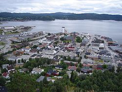

Coat of arms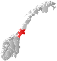
Nord-Trøndelag within
NorwayNamsos within Nord-Trøndelag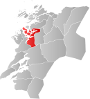
Coordinates: 64°29′38″N 11°30′42″E / 64.49389°N 11.51167°ECoordinates: 64°29′38″N 11°30′42″E / 64.49389°N 11.51167°E Country Norway County Nord-Trøndelag District Namdalen Administrative centre Namsos Government - Mayor (2007) Morten Stene (Ap) Area - Total 777.89 km2 (300.3 sq mi) - Land 751.75 km2 (290.3 sq mi) - Water 26.14 km2 (10.1 sq mi) Area rank 141 in Norway Population (2011) - Total 12,906 - Rank 88 in Norway - Density 17.2/km2 (44.5/sq mi) - Change (10 years) 4.1 % Demonym Namsosing[1] Time zone CET (UTC+1) - Summer (DST) CEST (UTC+2) ISO 3166 code NO-1703 Official language form Neutral Website namsos.kommune.no Data from Statistics Norway  Namsos (help·info) is a town and municipality in Nord-Trøndelag county, Norway. It is part of the Namdalen region. The administrative centre of the municipality is the town of Namsos. Other villages in the municipality include Bangsund, Klinga, Ramsvika, Skomsvoll, and Spillum.
The town of Namsos lies at the mouth of the Namsen river on the Namsenfjorden. The 7.26-square-kilometre (1,790-acre) town has a population (2011) of 9,537. The population density is 1,314 inhabitants per square kilometre (3,400 /sq mi).[2]
The location by the river and the large forests nearby made the town ideal for sawmills. There were eleven mills in their heyday, but only one remains: Moelven Van Severen. In addition, The Norwegian Sawmill museum is located at Spillum just south of the town. The museum is located at the now closed and restored Spillum Dampsag & Hovleri sawmill from 1884.
The town has a swimming pool called Oasen (Oasis) that is built inside a mountain – one of the first, but far from the only, such construction projects in Norway.
Contents
General information
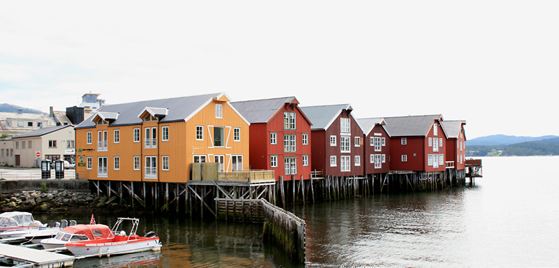
 Namsos waterfront buildings
In 1846, the town of Namsos was established at the mouth of the Namsen river in the Sævik area of Overhalden. It was established as its own municipality, with 591 inhabitants, as it was separated from Vemundvik (Namsos herred/Namsos landdistrikt).[3]
In 1865, Namsos also became a parish in the Church of Norway. It had been decided to build a church in the city in March 1859; the construction was finished in November. In May 1865, the parish was created, with the sub-parishes of Sævik and Vemundvik, formerly within Overhalla parishh, was incorporated into Namsos' parish limits.[4]
Areas of Vemundvik lying adjacent to the town of Namsos were later incorporated within the city limits on numerous occasions. On 1 January 1882, an area with 109 inhabitants was moved to the city; on 1 July 1921 an area with 927 inhabitants; and on 1 July 1957, another area with a population of 6. On 1 January 1964, the size of Namsos was significantly increased as the municipalities Vemundvik (population: 2,040) and Klinga (population: 2,482) were incorporated into it. The same thing happened with the northern part of Otterøy (population: 1,013), and the Finnanger area of Fosnes (population: 116) were incorporated into Namsos. Namsos, which previously had a population of 5,224, had its size increased to 10,875 inhabitants.[3]
Name
The first part of the name comes from the local river Namsen. The last element is os, which means the "mouth of a river".[5]
Coat-of-arms
The coat-of-arms is from modern times; they were granted on 5 May 1961. The arms show a yellow moose on a red background. The moose was chosen as a symbol for the municipality, since Namsos is the capital of the forest-rich Namdalen region, and the moose is the "king of the forest".[5][6]
- See also: Coats-of-arms of Aremark, Namsskogan, Ringsaker and Tynset
Churches
The Church of Norway has four parishes (sokn) within the municipality of Namsos. It is part of the Namdal deanery in the Diocese of Nidaros.
Churches in Namsos Parish
(Sokn)Church Name Location
of the ChurchYear Built Klinga Klinga Church Klinga 1866 Namsos Namsos Church Namsos 1960 Otterøy Otterøy Church Skomsvoll 1858 Vemundvik Vemundvik Church Vemundvik 1875 History
The town of Namsos was founded in 1845. Consisting mostly of wooden houses, it has been burned down to the ground on three occasions during its relatively short history. The first fire was in 1872, caused by two boys playing with matches. The second fire was in 1897, from an unknown cause. The third time was during World War II when the town was bombed by German airplanes on 20 April 1940 to mark Hitler's birthday.[5]
Geography
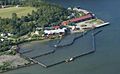
The town is located on a small bay, about 15 miles (24 km) from the sea, near the head of Namsenfjorden and at the mouth of the river Namsen, one of the richest salmon rivers in Europe. The municipality also includes the islands of Otterøya and Hoddøya as well as the southwestern half of Elvalandet island.
The main part of the town is built on a small, low-lying promontory which extends into the bay. To the north, low forested hills rise fairly steeply to over 200 metres (660 ft). There is a viewpoint from the hills above the city which is called Klompen with a height of 114 metres (374 ft) with a road for cars up to the top that is open each summer. To the east extends the wide Namdalen valley. To the south over the bay and mouth of the river Namsen are hills that reach 440 metres (1,440 ft).
Climate
The climate is generally maritime. The average temperature in January is −2.4 °C (27.7 °F), in July it is 13.3 °C (55.9 °F). The mean annual temperature is 5 °C (41 °F) and the annual precipitation is 1,340 millimetres (53 in).[7]
Transportation
Namsos Airport, Høknesøra is located just outside of the town of Namsos. Norwegian County Road 17 runs through part of the municipality. The now-defunct Namsosbanen railway line once ran from Namsos to Grong. The island of Otterøya is connected to the mainland via the Lokkaren Bridge.
Media gallery
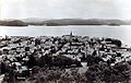
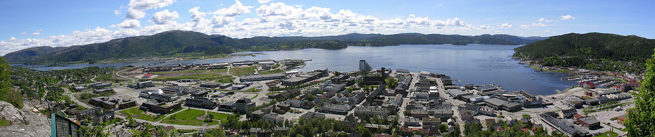 Panorama of the town of Namsos
-

View of the town from the fjord
-
Sawmill Museum
-

View of Bangsund
-

Map of the area
-
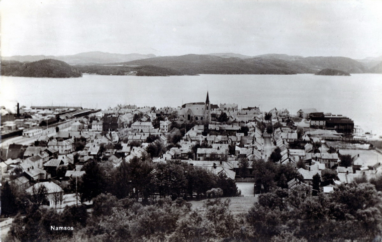
View of the town in 1935
-

View of the town in 1940 after the German bombing
References
- ^ "Personnemningar til stadnamn i Noreg" (in Norwegian). Språkrådet. http://www.sprakrad.no/nb-no/Sprakhjelp/Rettskrivning_Ordboeker/Innbyggjarnamn/.
- ^ Statistisk sentralbyrå (1 January 2011). "Urban settlements. Population and area, by municipality.". http://www.ssb.no/english/subjects/02/01/10/beftett_en/tab-2011-06-17-01-en.html.
- ^ a b Jukvam, Dag (1999). "Historisk oversikt over endringer i kommune- og fylkesinndelingen" (in Norwegian). Statistisk sentralbyrå. http://www.ssb.no/emner/00/90/rapp_9913/rapp_9913.pdf.
- ^ "Namsos" (in Norwegian). DIS-Norge. http://www.disnorge.no/genress/index.php?todo=visKategori&kid=100422. Retrieved 2011-08-22.
- ^ a b c Store norske leksikon. "Namsos" (in Norwegian). http://snl.no/Namsos. Retrieved 2011-08-24.
- ^ Norske Kommunevåpen (1990). "Nye kommunevåbener i Norden". http://www.ngw.nl/int/nor/n/namsos.htm. Retrieved 13 November 2008.
- ^ "Temperaturnormaler for Namsos i perioden 1961 - 1990" (in Norwegian). met.no. http://retro.met.no/observasjoner/nord-trondelag/normaler_for_kommune_1703.html. Retrieved 2008-11-13.
External links
- Nord-Trøndelag travel guide from Wikitravel
- Municipal fact sheet from Statistics Norway
- Oasen Swimming Pool (Norwegian)
- Avinor: Picture showing Namsos Airport and Namsos
Municipalities of Nord-Trøndelag Current 
Former Categories:- Populated places in Nord-Trøndelag
- Municipalities of Nord-Trøndelag
- Cities and towns in Norway
- Namsos


Wikimedia Foundation. 2010.