- Meråker
-
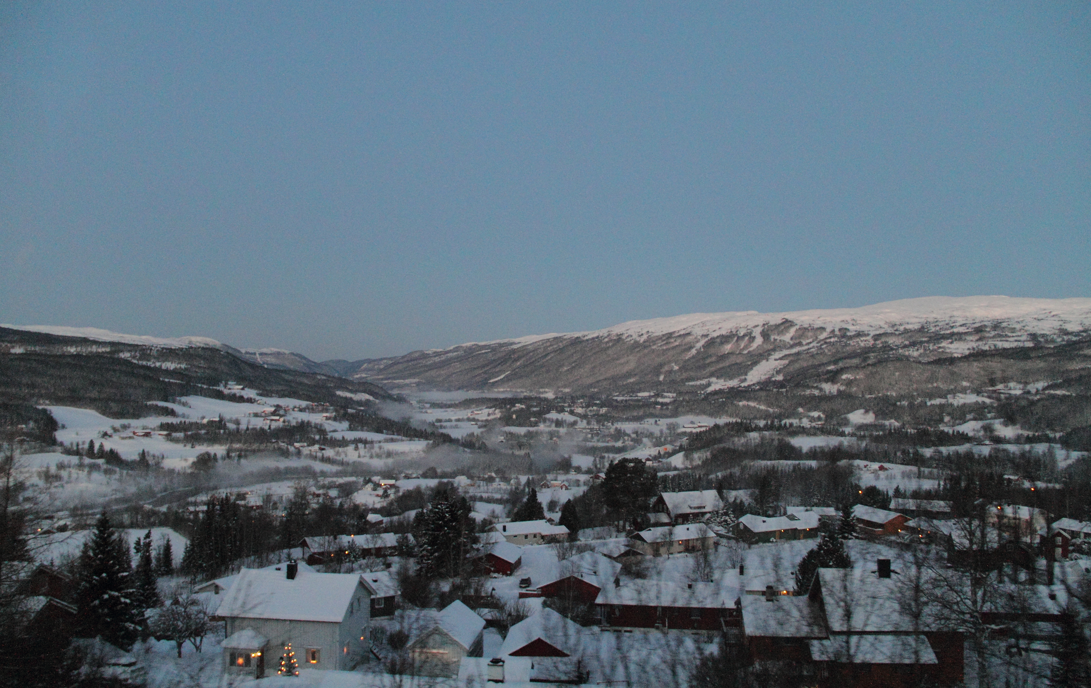
Meråker kommune — Municipality — View of Meråker

Coat of arms
Nord-Trøndelag within
NorwayMeråker within Nord-Trøndelag
Coordinates: 63°26′17″N 11°50′58″E / 63.43806°N 11.84944°ECoordinates: 63°26′17″N 11°50′58″E / 63.43806°N 11.84944°E Country Norway County Nord-Trøndelag District Stjørdalen Administrative centre Meråker Government – Mayor (1995) Bård Langsåvold (Ap) Area – Total 1,273.41 km2 (491.7 sq mi) – Land 1,188.27 km2 (458.8 sq mi) – Water 85.14 km2 (32.9 sq mi) Area rank 74 in Norway Population (2011) – Total 2,503 – Rank 299 in Norway – Density 2.1/km2 (5.4/sq mi) – Change (10 years) -3.5 % Demonym Meråkerbygg[1] Time zone CET (UTC+1) – Summer (DST) CEST (UTC+2) ISO 3166 code NO-1711 Official language form Bokmål Website meraker.kommune.no Data from Statistics Norway Meråker is a municipality in Nord-Trøndelag county, Norway. It is part of the Stjørdalen region. The administrative centre of the municipality is the village of Midtbygda which is about 20 kilometres (12 mi) west of Storlien in Sweden and 46 kilometres (29 mi) east of Stjørdalshalsen in Stjørdal. Other villages in Meråker include Gudåa, Kopperå, and Stordalen.
The municipality markets itself as a recreational area. The main areas of employment are in industry and agriculture. The municipality is noted for its characteristic dialect.
Contents
General information
The municipality of Meråker was established on 1 January 1874 when the old municipality of Øvre Stjørdal was divided into two: Hegra and Meråker. Meråker had an initial population of 1,861. The municipality has not changed since then.[2]
Name
The municipality (originally the parish) is named after the old Meråker farm (spelled "Mørakre" around 1430), since the first church was built there. The meaning of the first element is uncertain (maybe merr which means "mare" or mýrr which means "bog" or "marsh") and the last element is akr which means "field" or "acre".[3]
Coat-of-arms
The coat-of-arms is from modern times; they were granted on 28 September 1990. Traditionally, mining has played a major role in the area and has been of great economic importance for Meråker. Thus a silver mining cart on a red background as a symbol for the municipality was an obvious decision. The cart depicted in the arms, however, is officially described as a cart, not a mining cart.[4]
- See also: Coat-of-arms of Evje og Hornnes
Churches
The Church of Norway has one parish (sokn) within the municipality of Meråker. It is part of the Stjørdal deanery and the Diocese of Nidaros.
Churches in Meråker Parish
(Sokn)Church Name Location
of the ChurchYear Built Meråker Meråker Church Meråker 1874 Kopperå Chapel Kopperå 1936 Stordalen Chapel Stordalen 1863 History
Meråker Smelter
In 1898 a carbide factory was opened at Kopperå, later this factor was rebuilt as a silicon smelter. The smelter was in operation until June 2006. Its main product was microsilica which is used as an additive to cement.
Geography
Meråker is a landlocked municipality in the southern part of Nord-Trøndelag county. To the north is the municipality of Verdal, to the west is Stjørdal, to the south is Selbu and Tydal (both in Sør-Trøndelag county), and to the east is Sweden.
There are three major lakes in Meråker: Feren, Fjergen, and Funnsjøen. The river Stjørdalselva runs through the municipality towards the Trondheimsfjord. The river Rotla begins in the southern part of Meråker. The mountain Fongen sits on the southern border with Tydal and Selbu.
Transportation
The European route E14 highway runs east to west through the municipality connecting to Trondheim Airport, Værnes about 40 kilometres (25 mi) to the west. The Meråker Line railway follows the E14 through the municipality also, with stops at Kopperå Station, Meråker Station, and Gudå Station.
Notable residents
- Frode Estil (born 1972), cross country skier
- Tor Arne Hetland
- Helge Ingstad (1899–2001), author, archeologist
- Magnar Lundemo (1938–1987), cross country skier
- Petter Northug, cross country skier
References
- ^ "Personnemningar til stadnamn i Noreg" (in Norwegian). Språkrådet. http://www.sprakrad.no/nb-no/Sprakhjelp/Rettskrivning_Ordboeker/Innbyggjarnamn/.
- ^ Jukvam, Dag (1999). "Historisk oversikt over endringer i kommune- og fylkesinndelingen" (in Norwegian). Statistisk sentralbyrå. http://www.ssb.no/emner/00/90/rapp_9913/rapp_9913.pdf.
- ^ Rygh, Oluf (1903) (in Norwegian) (dokpro.uio.no). Norske gaardnavne: Nordre Trondhjems amt (15 ed.). Kristiania, Norge: W. C. Fabritius & sønners bogtrikkeri. pp. 2. http://www.dokpro.uio.no/perl/navnegransking/rygh_ng/rygh_bla.prl?enhid=238003&avid=52874.
- ^ Norske Kommunevåpen (1990). "Nye kommunevåbener i Norden". http://www.ngw.nl/int/nor/m/meraker.htm. Retrieved 8 November 2008.
External links
- Nord-Trøndelag travel guide from Wikitravel
- Municipal fact sheet from Statistics Norway
- Meråker Municipality Website (Norwegian)
- Meråker Tourism Website (Norwegian)
- Industrial Museum at Kopperå (Norwegian)
- Map of Cultural Sites in Meråker (Norwegian)
- Meråker Elementary School (Norwegian)
- Lauvlimoen Biathlon team (Norwegian)
Municipalities of Nord-Trøndelag Current 
Former Categories:- Municipalities of Nord-Trøndelag
- Meråker


Wikimedia Foundation. 2010.