- Angola (Portugal)
-
Overseas Province of Angola
Província Ultramarina de Angola (1951-1972)Colony; Overseas Province; State ← 
←
←1575 (establishment of coastal settlement only)–1975  →
→
Flag Coat of arms Portuguese West Africa (Angola and Cabinda)
Capital Luanda Language(s) Portuguese Political structure Colony; Overseas Province; State Head of state - 1640-1656 John IV of Portugal, king - 1974-1975 Francisco da Costa Gomes, president Governor-general - 1837-1839 (first) Manuel Bernardo Vidal - 1975 (last) Leonel Alexandre Gomes Cardoso Governor - 1589-1591 (first) Luís Serrão - 1836- (last) Domingos de Saldanha Oliveira e Daun Historical era Imperialism - Established 1575 (establishment of coastal settlement only) - Fall of Portuguese Empire November 11, 1975 Area - 1970 1,246,700 km2 (481,354 sq mi) Population - 1970 est. 5,926,000 Density 4.8 /km2 (12.3 /sq mi) Currency Angolan escudo (in the XXth century) History of Angola 
This article is part of a seriesPrecolonial history (Prehistory–1575) Colonization (1575–1641) Dutch occupation (1641–1648) Colonial history (1648–1951) Portuguese overseas province (1951–1961) War of Independence (1961–1974) Civil War (1975–2002) Post-war Angola (2002–present)
Angola Portal
Angola (also Portuguese West Africa, Portuguese Angola; since 1951 Overseas Province of Angola and finally State of Angola, since 1972) is the common name by which the Portuguese colony in southwestern Africa was known across different periods of time. The former colony became an independent country in 1975 and now forms the Republic of Angola.
Contents
History
Main article: Colonial history of AngolaThe colonial history of Angola lasted from the foundation of a Portuguese settlement in what today is Luanda, in 1575, until the decolonization of the territory in 1975. During these four centuries, several entirely different situations have to be distinguished.
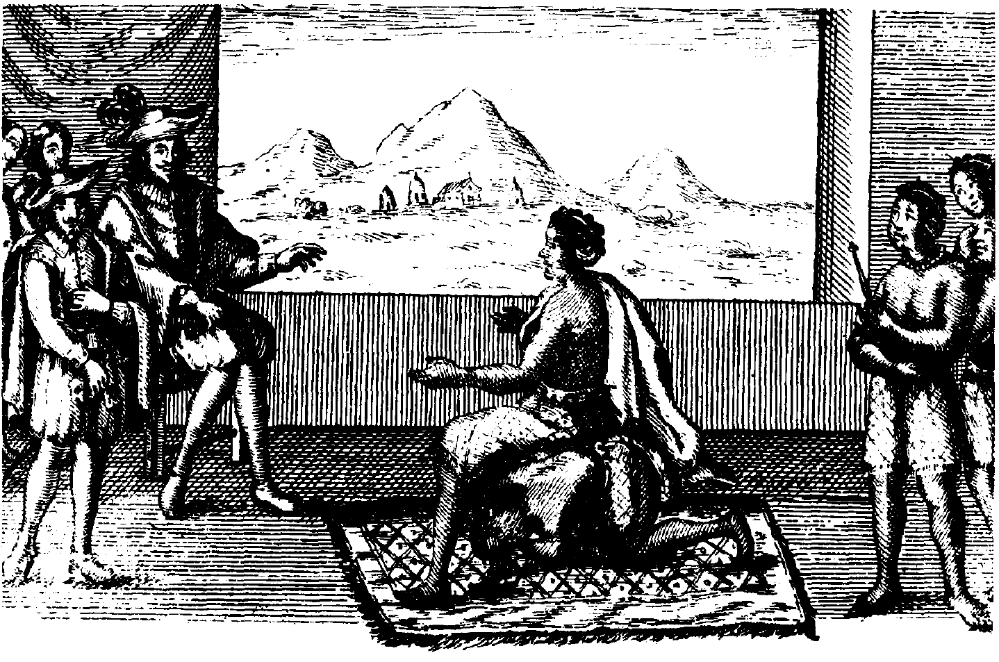
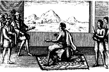 Queen Nzinga in peace negotiations with the Portuguese governor in Luanda, 1657.
When a Portuguese explorer reached the Kongo Kingdom at the end of the 15th century, Angola as such did not exist; on its present territory, a number of independent peoples were living, some of them organized in political units ("kingdoms") of variable size. At first, territorial conquest was out of the question for the Portuguese; they were interested in trade, mainly slave trade. They thus maintained a peaceful and mutually profitable relationship with the rulers and dominant social segment of the Kongo Kingdom, whom they cristianized and taught reading and writing in Portuguese, allowing them a share of the benefits from the slave trade. They established small trading posts on the lower Kongo River, which now belongs to the Democratic Republic of the Congo, and a more importante trading settlement on the Atlantic coast, at Soyo which then belonged to the Kongo Kingdom and is today Angola's nothernmost town.
From 1580 to the 1820s, well over a million people from current-day Angola were exported as slaves to the so-called New World, mainly to Brazil which demanded the most part of black African slaves from Angola, but also to North America where slaves were also usual workforce supply.[1]Kingdom of Portugal sailors, explorers, soldiers and merchants had historically began a process of conquest and establishment of military and trading outposts in Africa with the conquest of Muslim-ruled Ceuta in 1415 and the establishment of bases in current-day Morocco and the Gulf of Guinea. The Portuguese had catholic beliefs and their exploratory and military expeditions included from the very beginning evangelization of foreign peoples. Local African societies were varied, mostly relying on agriculture and trade. Those societies included a multiplicity of ethnicities and forms of political organization, social structure and religious beliefs which varied from region to region. One of the most powerful political unit in the region was that of the Kongo Kingdom.
Portugal defeated the Kongo Kingdom in the Battle of Mbwila on October 29, 1665, but suffered a disastrous defeat at the Battle of Kitombo when they tried to invade Kongo in 1670. Full Portuguese administrative control of the interior was not achieved until the beginning of the 18th century. However, the coastal regions, including fortified Portuguese towns like those of Luanda (established in 1575 with 400 Portuguese settlers) and Benguela (a fort from 1587, a town from 1617) remained almost continuously in Portuguese hands until the independence of Angola in 1975.
In 1884 Britain, which up to that time refused not acknowledged that Portugal possessed territorial rights north of Ambriz, concluded a treaty recognizing Portuguese sovereignty over both banks of the lower Congo, but the treaty, meeting with opposition there and Germany, was not ratified. Agreements concluded with the Congo Free State, the German Empire and France in 1885-1886 fixed the limits of the province, except in the south-east, where the frontier between Barotseland (north-west Rhodesia) and Angola was determined by an Anglo-Portuguese agreement of 1891 and the arbitration award of the King of Italy in 1905.
During the Portuguese’s colonial rule of Angola, cities, towns and trade-posts were founded, railroads were opened, ports built, and a Westernized society was being gradually developed, despite the fact of a deep traditional tribal heritage in Angola which the minority European rulers were neither willing nor interested to eradicate. Since the 1920s, Portugal's administration showed an increasing interest in developing Angola's economy and social infrustructure.[2]
In 1951, the Portuguese Colony of Angola became an Overseas Province of Portugal. In the late 1950s the People's Movement for the Liberation of Angola (MPLA) began to organize strategies and action plans to fight Portuguese rule as well as the remunerated forced labor system which affected many of the native black people from the countryside that were relocated from their homes and had to perform compulsory work, almost always unskilled hard work, in an environment of economic boom.[3] Organized guerrilla warfare began in 1961, the same year that a law was passed to end every sort of forced labor. The conflict, conversibly known as the Colonial War or the War of Liberation, erupted in the north of the territory when UPA rebels based in Republic of the Congo, massacred civilians in surprise attacks. The military effective in Angola were composed by about 40,000 men (20% white and 80% black). After these events the Portuguese Government under the dictatorial Estado Novo regime of António de Oliveira Salazar, sent thousands of troops from Europe in order to perform counterterrorism and counterinsurgency operations, but, despite an overall military superiority of the Portuguese Army in the Angolan theatre, the independence guerrilla movements were never eradicated. In 1972, the Portuguese National Assembly wanting to grant Angola its independence, formed a coalition government (GREA) with the liberation movements, and thus effectively changing Angola's status from an overseas province to an “autonomous state” with authority over internal affairs; Portugal was to retain responsibility for defense and foreign relations. In April 1974, the Portuguese government was overthrown in a military uprising in Lisbon. In May of that year the new revolutionary government of Portugal proclaimed a truce with the guerrillas in an effort to promote peace talks and independence.[4]
These events prompted a mass exodus of Portuguese citizens, both black and white, from Portugal's African territories, creating over a million destitute Portuguese refugees — the retornados.[5] Angola gained its independence on 11 November 1975.
Government
In the 20th century, Portuguese Angola was subject to the Estado Novo regime. In 1951, the Portuguese authorities changed the statute of the territory from Colony to an Overseas Province of Portugal. Legally, the territory was as much a part of Portugal as Lisbon but as an overseas province enjoyed special derogations to account for its distance from Europe. Most members of the government of Angola were from Portugal, but a few were Africans. Nearly all members of the bureaucracy were from Portugal, as most Africans did not have the necessary qualifications to obtain positions.
The government of Angola, as it was in Portugal, was highly centralized. Power was concentrated in the executive branch, and all elections where they occurred were carried out using indirect methods. From the Prime Minister's office in Lisbon, authority extended down to the most remote posts of Angola through a rigid chain of command. The authority of the government of Angola was residual, primarily limited to implementing policies already decided in Europe. In 1967, Angola also sent a number of delegates to the National Assembly in Lisbon.
The highest official in the province was the governor-general, appointed by the Portuguese cabinet on recommendation of the Overseas Minister. The governor-general had both executive and legislative authority. A Government Council advised the governor-general in the running of the province. The functional cabinet consisted of five secretaries appointed by the Overseas Minister on the advice of the governor. A Legislative Council had limited powers and its main activity was approving the provincial budget. Finally, an Economic and Social Council had to be consulted on all draft legislation, and the governor-general had to justify his decision to Lisbon if he ignored its advice.
In 1972, the Portuguese National Assembly changed Angola's status from an overseas province to an “autonomous state” with authority over internal affairs; Portugal was to retain responsibility for defense and foreign relations. Elections were held in Angola for a legislative assembly in 1973.[4]
Geography
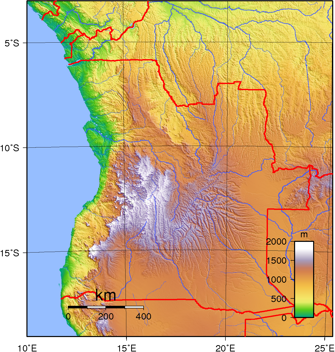
Portuguese Angola was a territory covering 1,246,700 km², an area greater than France and Spain put together. It had 5,198 km of terrestrial borders and a coastline with 1,600 km. Its geography was diverse. From the coastal plain, ranging in width from 25 kilometres in the south to 100-200 kilometers in the north, the land rises in stages towards the high inland plateau covering almost two-thirds of the country, with an average altitude of between 1,200 and 1,600 metres. Angola's two highest peaks were located in these central highlands. They were Moco Mountain (2,620 m) and Meco Mountain (2,538 m).
Most of Angola’s rivers rose in the central mountains. Of the many rivers that drain to the Atlantic Ocean, the Cuanza and Cunene were the most important. Other major streams included the Kwango River, which drains north to the Congo River system, and the Kwando and Cubango Rivers, both of which drain generally southeast to the Okavango Delta. As the land drops from the plateau, many rapids and waterfalls plunge downward in the rivers. Portuguese Angola had no sizable lakes, besides those formed by dams and reservoirs built by the Portuguese administration.
The Portuguese authorities established several national parks and natural reserves across the territory: Bicauri, Cameia, Cangandala, Iona, Mupa, Namibe and Quiçama. Iona was Angola's oldest and largest national park, it was proclaimed as a reserve in 1937 and upgraded to a national park in 1964.
Angola was indeed a territory that underwent a great deal of progress after 1950. The Portuguese government built dams, roads, schools, etc. There was also an economic boom that led to a huge increase of the European population. The white population increased from 44,083 in 1940 to 172,529 in 1960. With around 1,000 immigrants arriving each month. On the eve of the end of the colonial period, the ethnic European residents numbered 400,000 (1974) (excluding enlisted and commissioned soldiers from the mainland) and the mixed race population was at around 100,000 (many were Cape Verdian migrants working in the territory). The total population was around 5.9 million at that time.
Luanda grew from a town of 61,208 with 14.6% of those inhabitants being white in 1940, to a major cosmopolitan city of 475,328 in 1970 with 124,814 Europeans (26.3%) and around 50,000 mixed race inhabitants. Most of the other large cities in Angola had around the same ratio of Europeans at the time, with the exception of Sá da Bandeira (Lubango), Moçâmedes (Namibe) and Porto Alexandre (Tombua) in the south where the white population was more established. All of these cities had European majorities from 50% to 60%.
The capital of the territory was Luanda,[6][7] officially called São Paulo de Luanda. Other cities and towns were:
 Topographic map of Angola.
- Porto Amboim
- Vila Teixeira da Silva
- São Felipe de Benguela[8]
- Vila Robert Williams
- Duque de Bragança
- Vila General Machado
- Vila João de Almeida
- Vila Mariano Machado
- Nova Lisboa[9]
- Silva Porto
- Vila da Ponte
- Lobito[10]
- Sá da Bandeira[11]
- Vila Luso
- Malanje[12]
- Forte República
- São Salvador do Congo
- Serpa Pinto
- Moçâmedes[13]
- Vila Salazar
- Vila Pereira d'Eça
- Vila Henrique de Carvalho
- Santo António do Zaire
- Novo Redondo
- Porto Alexandre
- Carmona[14]
The exclave of Cabinda was to the north.[15]
Economy
Portuguese explorers and settlers had founded trading posts and forts along the coast of Africa since the 15th century, and reached the Angolan coast in the 16th century. Portuguese explorer Paulo Dias de Novais founded Luanda in 1575 as "São Paulo de Loanda", and the region developed as a slave trade market with the help of local Imbangala and Mbundu peoples who were notable slave hunters. Trade was mostly with the Portuguese colony of Brazil in the so called "New World"; Brazilian ships were the most numerous in the ports of Luanda and Benguela. By this time, Angola, a Portuguese colony, was in fact like a colony of Brazil, another Portuguese colony. A strong Brazilian influence was also exercised by the Jesuits in religion and education.[16]
War gradually gave way to the philosophy of trade. The great trade routes and the agreements that made them possible were the driving force for activities between the different areas; warlike states become states ready to produce and to sell. In the Planalto (the high plains), the most important states were those of Bié and Bailundo, the latter being noted for its production of foodstuffs and rubber. The colonial power, Portugal, becoming ever richer and more powerful, would not tolerate the growth of these neighbouring states and subjugated them one by one, so that by the beginning of this[clarification needed] century the Portuguese had complete control over the entire area. During the period of the Iberian Union (1580-1640), Portugal lost influence and power and made new enemies. The Dutch, a major enemy of Castile, invaded many Portuguese overseas possessions, including Luanda. The Dutch ruled Luanda from 1640 to 1648 as Fort Aardenburgh. They were seeking black slaves for use in sugarcane plantations of Northeastern Brazil (Pernambuco, Olinda, Recife) which they had also seized from Portugal. John Maurice, Prince of Nassau-Siegen, conquered the Portuguese possessions of Saint George del Mina, Saint Thomas, and Luanda, Angola, on the west coast of Africa. After the dissolution of the Iberian Union in 1640, Portugal reestablished its authority over the lost territories of the Portuguese Empire.[16]
The Portuguese started to develop townships, trading posts, logging camps and small processing factories. From 1764 onwards, there was a gradual change from a slave-based society to one based on production for domestic consumption and export. Meanwhile, with the independence of Brazil in 1822, the slave trade was abolished in 1836, and in 1844 Angola's ports were opened to foreign shipping. By 1850, Luanda was one of the greatest and most developed Portuguese cities in the vast Portuguese Empire outside Mainland Portugal, full of trading companies, exporting (together with Benguela) palm and peanut oil, wax, copal, timber, ivory, cotton, coffee, and cocoa, among many other products. Maize, tobacco, dried meat and cassava flour also began to be produced locally. The Angolan bourgeoisie was born. From the 1920s to the 1960s, strong economic growth, abundant natural resources and development of infrastruture, led to the arrival of even more Portuguese settlers from the metropole.[16]
Diamond mining began in 1912, when the first gems were discovered by Portuguese prospectors in a stream of the Lunda region, in the northeast. In 1917 Diamang was granted the concession for diamond mining and prospecting in Portuguese Angola. From the mid-1950s until 1974, iron ore was mined in Malanje, Bié, Huambo, and Huíla provinces, and production reached an average of 5.7 million tons per year between 1970 and 1974. Most of the iron ore was shipped to Japan, West Germany, and the United Kingdom, and earned almost US$50 million a year in export revenue. During 1966-67 a major iron ore terminal was built by the Portuguese at Saco, the bay just 12 km North of Moçâmedes (Namibe). The client was the Compania Mineira do Lobito, the Lobito Mining Company, which developed an iron ore mine inland at Cassinga. The construction of the mine installations and a 300 km railway were commissioned to Krupp of Germany and the modern harbour terminal to SETH, a Portuguese company owned by Hojgaard & Schultz of Denmark. The small fishing town of Moçâmedes hosted construction workers, foreign engineers and their families for 2 years. The Ore Terminal was completed on time within one year and the first 250,000 ton ore carrier docked and loaded with ore in 1967.[17][18] The Portuguese discovered petroleum in Angola in 1955. Production began in the Cuanza basin in the 1950s, in the Congo basin in the 1960s, and in the exclave of Cabinda in 1968. The Portuguese government granted operating rights for Block Zero to the Cabinda Gulf Oil Company, a subsidiary of ChevronTexaco, in 1955. Oil production surpassed the exportation of coffee as Angola's largest export in 1973.
By the early 1970s, a variety of crops and livestock were produced in Portuguese Angola. In the north, cassava, coffee, and cotton were grown; in the central highlands, maize was cultivated; and in the south, where rainfall is lowest, cattle herding was prevalent. In addition, there were large plantations run by Portuguese that produced palm oil, sugarcane, bananas, and sisal. These crops were grown by commercial farmers, primarily Portuguese, and by peasant farmers, who sold some of their surplus to local Portuguese traders in exchange for supplies. The commercial farmers were dominant in marketing these crops, however, and enjoyed substantial support from the overseas province's Portuguese government in the form of technical assistance, irrigation facilities, and financial credit. They produced the great majority of the crops that were marketed in Angola's urban centres or exported for several countries.[19]
Fishing in Portuguese Angola was a major and growing industry. In the early 1970s, there were about 700 fishing boats, and the annual catch was more than 300,000 tons. Including the catch of foreign fishing fleets in Angolan waters, the combined annual catch was estimated at over 1 million tons. The Portuguese territory of Angola was a net exporter of fish products, and the ports of Moçâmedes, Luanda and Benguela were among the most important fishing harbous in the region.
Education
Non-urban black African access to educational opportunities was very limited for most of the colonial period, most were not even able to speak Portuguese and did not have knowledge of Portuguese culture and history.[20] Until the 1950s, educational facilities run by the Portuguese colonial government were largely restricted to the urban areas.[20] Responsibility for educating rural Africans were commissioned by the authorities to several Roman Catholic and Protestant missions based across the vast countryside, which taught black Africans in Portuguese language and culture.[20] As a consequence, each of the missions established its own school system, although all were subject to ultimate control and support by the Portuguese.[20]
In mainland Portugal, the homeland of the colonial authorities who ruled in the territory from the 16th century until 1975, by the end of the 19th century the illiteracy rates were at over 80 percent and higher education was reserved for a small percentage of the population. 68.1 percent of mainland Portugal's population was still classified as illiterate by the 1930 census. Mainland Portugal's literacy rate by the 1940s and early 1950s was low by North American and Western European standards at the time. Only in the 1960s did the country make public education available for all children between the ages of six and twelve, and the overseas territories profited from this new educational developments and change in policy at Lisbon.
Starting in the early 1950s, the access to basic, secondary and technical education was expanded and its availability was being increasingly opened to both the African indigenes and the ethnic Portuguese of the territories. Education beyond the primary level became available to an increasing number of black Africans since the 1950s, and the proportion of the age group that went on to secondary school in the early 1970s was an all-time record high enrolment.[20] Primary school attendance was also growing substantially.[20] In general, the quality of teaching at the primary level was acceptable, even with instruction carried on largely by black Africans who sometimes had substandard qualifications.[20] Most secondary school teachers were ethnically Portuguese, especially in the urban centers.[20]
Two state-run university institutions were founded in Portuguese Africa in 1962 by the Portuguese Ministry of the Overseas Provinces headed by Adriano Moreira - the Estudos Gerais Universitários de Angola in Portuguese Angola and the Estudos Gerais Universitários de Moçambique in Portuguese Mozambique - awarding a wide range of degrees from engineering to medicine.[21] In the 1960s, the Portuguese mainland had four public universities, two of them in Lisbon (which compares with the 14 Portuguese public universities today). In 1968, the Estudos Gerais Universitários de Angola was renamed Universidade de Luanda (University of Luanda).
Famous people
- António da Silva Porto
- Agostinho Neto
- Assunção Cristas
- Bonga
- Carlos Castro
- Carlos Cruz
- Daniel Chipenda
- Eduardo Nascimento
- Fernando Nobre
- Fernando José de França Dias Van-Dúnem
- Fernando Peyroteo
- Francisca Van Dunem
- Henrique Galvão
- Holden Roberto
- Horácio Roque
- Isabel dos Santos
- Jacinto João
- Joana Amaral Dias
- João Carqueijeiro
See also
- History of Angola
- 1910s in Angola
- 1920s in Angola
- 1930s in Angola
- 1940s in Angola
- 1950s in Angola
- 1960s in Angola
- 1970s in Angola
- Portuguese East Africa
- Portuguese Guinea
References
- ^ Joseph C. Miller, Way of Death: Merchant Capitalism and the Angolan Slave Trade, 1730-1830, Madison: University of Wisconsin Press, 1988
- ^ [1] More Power to the People, 2006.
- ^ [2], British Broadcasting Company, January 2008.BBC News
- ^ a b Angola, History, The Columbia Electronic Encyclopedia, 6th ed. Copyright © 2007, Columbia University Press
- ^ Dismantling the Portuguese Empire, Time Magazine (Monday, July 07, 1975)
- ^ Angola antes da Guerra, a film of Luanda, Portuguese Angola (before 1975), youtube.com
- ^ LuandaAnosOuro.wmv, a film of Luanda, Portuguese Angola (before 1975), youtube.com
- ^ BenguelaAnosOuro.wmv, a film of Benguela, Overseas Province of Angola, before 1975.
- ^ NovaLisboaAnosOuro.wmv, a film of Nova Lisboa, Overseas Province of Angola, before 1975.
- ^ LobitoAnosOuro.wmv, a film of the Lobito in Portuguese Angola, before independence from Portugal.
- ^ SáDaBandeiraAnosOuro.wmv, a film of Sá da Bandeira, Overseas Province of Angola, before 1975.
- ^ MalanjeAnosOuro.wmv, a film of Malanje, Overseas Province of Angola (before 1975).
- ^ (Portuguese) Angola de outros tempos Moçamedes, Moçâmedes under Portuguese rule before 1975, youtube.com
- ^ Angola-Carmona (Viagem ao Passado)-Kandando Angola, a film of Carmona, Portuguese Angola (before 1975).
- ^ CabindaAnosOuro.wmv, a film of Cabinda, Portuguese Angola (before 1975).
- ^ a b c History of Angola, Republic of Angola Embassy in the United Kingdom
- ^ (Portuguese) Angola - Moçâmedes, minha terra, eu te vi crescer... (Raul Ferreira Trindade), history of Moçâmedes/Namibe
- ^ (Portuguese) Angola de outros tempos Moçamedes, Moçâmedes under Portuguese rule before 1975, youtube.com
- ^ Louise Redvers, POVERTY-ANGOLA: NGOs Sceptical of Govt’s Rural Development Plans, [Inter Press Service News Agency] (June 6, 2009)
- ^ a b c d e f g h Warner, Rachel. "Conditions before Independence". A Country Study: Angola (Thomas Collelo, editor). Library of Congress Federal Research Division (February 1989). This article incorporates text from this source, which is in the public domain.[3]
- ^ (Portuguese) 52. UNIVERSIDADE DE LUANDA
Portuguese Empire North Africa15th century
1415–1640 Ceuta
1458–1550 Alcácer Ceguer (El Qsar es Seghir)
1471–1550 Arzila (Asilah)
1471–1662 Tangier
1485–1550 Mazagan (El Jadida)
1487– middle 16th century Ouadane
1488–1541 Safim (Safi)
1489 Graciosa16th century
1505–1769 Santa Cruz do Cabo
de Gué (Agadir)
1506–1525 Mogador (Essaouira)
1506–1525 Aguz (Souira Guedima)
1506–1769 Mazagan (El Jadida)
1513–1541 Azamor (Azemmour)
1515 São João da Mamora (Mehdya)
1577–1589 Arzila (Asilah)Sub-Saharan Africa15th century
1455–1633 Arguin
1470–1975 Portuguese São Tomé1
1474–1778 Annobón
1478–1778 Fernando Poo (Bioko)
1482–1637 Elmina (São Jorge
da Mina)
1482–1642 Portuguese Gold Coast
1496–1550 Madagascar (part)
1498–1540 Mascarene Islands16th century
1500–1630 Malindi
1500–1975 Portuguese Príncipe1
1501–1975 Portuguese E. Africa
(Mozambique)
1502–1659 St. Helena
1503–1698 Zanzibar
1505–1512 Quíloa (Kilwa)
1506–1511 Socotra
1557–1578 Portuguese Accra
1575–1975 Portuguese W. Africa
(Angola)
1588–1974 Cacheu2
1593–1698 Mombassa (Mombasa)17th century
1642–1975 Portuguese Cape Verde
1645–1888 Ziguinchor
1680–1961 São João Baptista de Ajudá
1687–1974 Portuguese Bissau2
18th century
1728–1729 Mombassa (Mombasa)
1753–1975 Portuguese São Tomé and Príncipe
19th century
1879–1974 Portuguese Guinea
1885–1975 Portuguese Congo1 Part of São Tomé and Príncipe from 1753. 2 Part of Portuguese Guinea from 1879. Southwest Asia16th century
1506–1615 Gamru (Bandar-Abbas)
1507–1643 Sohar
1515–1622 Hormuz (Ormus)
1515–1648 Quriyat
1515–? Qalhat
1515–1650 Muscat
1515?–? Barka
1515–1633? Julfar (Ras al-Khaimah)
1521–1602 Bahrain (Muharraq and Manama)
1521–1529? Qatif
1521?–1551? Tarut Island
1550–1551 Qatif
1588–1648 Matrah17th century
1620–? Khor Fakkan
1621?–? As Sib
1621–1622 Qeshm
1623–? Khasab
1623–? Libedia
1624–? Kalba
1624–? Madha
1624–1648 Dibba Al-Hisn
1624?–? Bandar-e KongIndian subcontinent15th century
1498–1545 Laccadive Islands
(Lakshadweep)16th century
Portuguese India
· 1500–1663 Cochim (Kochi)
· 1502–1661 Quilon (Coulão/Kollam)
· 1502–1663 Cannanore (Kannur)
· 1507–1657 Negapatam (Nagapatnam)
· 1510–1962 Goa
· 1512–1525 Calicut (Kozhikode)
· 1518–1619 Chaul
· 1523–1662 Mylapore
· 1528–1666 Chittagong
· 1531–1571 Chalium
· 1534–1601 Salsette Island
· 1534–1661 Bombay (Mumbai)
· 1535–1739 Baçaím (Vasai-Virar)
· 1536–1662 Cranganore (Kodungallur)
· 1540–1612 Surat
· 1548–1658 Tuticorin (Thoothukudi)16th century (continued)
Portuguese India (continued)
· 1559–1962 Daman and Diu
· 1568–1659 Mangalore
· 1579–1632 Hugli
· 1598–1610 Masulipatnam (Machilipatnam)
1518–1521 Maldives
1518–1658 Portuguese Ceylon (Sri Lanka)
1558–1573 Maldives
17th century
Portuguese India
· 1687–1749 Mylapore
18th century
Portuguese India
· 1779–1954 Dadra and Nagar HaveliEast Asia and Oceania16th century
1511–1641 Portuguese Malacca
1512–1621 Ternate
· 1576–1605 Ambon
· 1578–1650 Tidore
1512–1665 Makassar
1553–1999 Portuguese Macau
1571–1639 Decima (Dejima, Nagasaki)17th century
1642–1975 Portuguese Timor (East Timor)1
19th century
Portuguese Macau
· 1864–1999 Coloane
· 1849–1999 Portas do Cerco
· 1851–1999 Taipa
· 1890–1999 Ilha Verde
20th century
Portuguese Macau
· 1938–1941 Lapa and Montanha (Hengqin)1 1975 is the year of East Timor's Declaration of Independence and subsequent invasion by Indonesia. In 2002, East Timor's independence was recognized by Portugal & the world.
North America and the North Atlantic Ocean16th century
1500–1579? Terra Nova (Newfoundland)
1500–1579? Labrador
1516–1579? Nova ScotiaCentral and South America16th century
1500–1822 Brazil
1536–1620 Portuguese Barbados17th century
1680–1777 Nova Colônia do Sacramento
19th century
1808–1822 Cisplatina (Uruguay)Categories:- Former countries in Africa
- States and territories disestablished in 1975
- 1975 disestablishments
- Former Portuguese colonies
- History of Angola
- Colonialism
- Overseas empires
- Portuguese Empire
- States and territories established in 1655
- Former colonies in Africa
- Portuguese colonisation in Africa


Wikimedia Foundation. 2010.