- Malanje
-
Malanje — Municipality and town — Location in Angola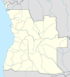
 Malanje
Coordinates: 9°32′S 16°21′E / 9.533°S 16.35°E Country  Angola
Province Malanje Province Elevation 3,789 ft (1,155 m) Population - Total 222,000 Time zone WAT (UTC+1) Malanje is the capital city of Malanje Province in Angola with a population of approximately 222,000. Nearby is the spectacular Calandula waterfalls, 85 km from the city. These falls are 105 metres high and their great width makes them the main tourist attraction in the region. It is a breathtaking sight. Pedras Negras de Pungo Andongo are massive black rocks. The greatest dam in the country is in Malanje, in the municipality of Capanda. The climate is mainly humid, with average temperatures between 20 and 24°C and rainfall 900 mm to 130 mm in the rainy season (October to April).
Contents
History
Portuguese rule
Portuguese settlers founded Malanje in the 19th century. The construction of the railway from Luanda to Malanje, in the fertile highlands, started in 1885. The environs of Malanje included the principal cotton-producing area of Portuguese West Africa and drove its development since the beginning. The town developed in the mid-19th century as an important feira (open-air market) on Portuguese Angola's principal plateau, between Luanda — the territory's capital and largest city, 250 miles (400 km) to the west — and the Cuango valley, inhabited by Mbundu peoples, 125 miles (200 km) to the east. Situated at an elevation of 4,373 feet (1,333 metres), the town had a high-altitude tropical climate, ideal to several agricultural productions. The city developed as an important agricultural, manufacturing, trading and services centre. Its productions included cotton, textiles, coffee, fruit and corn, and among its facilities it had cinema, hospital, railway station and airport.[1] The Cangandala National Park, was established by the Portuguese authorities on 25 June 1970, having previously been classified as an Integral Natural Reserve on 25 May 1963.
After independence from Portugal
The withdrawal of the Portuguese in conjunction with Angola’s independence in 1975, and, later, the Angolan Civil War (1975–2002), severely hampered the production of cotton as well as that of coffee and corn (maize). Malanje was partially destroyed during the civil war, but reconstruction efforts in the years following the end of the conflict have rebuilt the city and its surroundings.
Landmarks
Near the city is the Cangandala National Park, established by the Portuguese authorities on 25 June 1970, it was founded to protect the Giant Sable Antelope which were discovered in 1963. As far as religious buildings are concerned, there is the Evangelical Church at Quêssua and as for funerary constructions, the Tomb of the queen Ana de Sousa Nzinga Mbande and the tomb of José do Telhado, a local Robin Hood. José do Telhado was a white Angolan that in colonial days used to steal from rich whites and distribute to poor blacks. Worth visiting is the Forte de Cabatuquila in the city.
Transportation
Airport
The airport was built during the colonial era. Currently, the following airlines fly from the capital Luanda: TAAG, SAL and Air GEMINI. Malanje is 450 km from the capital.
Railway
The construction of the railway from Luanda to Malanje, in the fertile highlands, started in 1885. After the end of the civil war in 2002, it was expected to be the terminus of a railway from the capital city and port of Luanda once reconstruction was complete.
See also
References
- ^ MalanjeAnosOuro.wmv, a film of Malanje, Overseas Province of Angola (before 1975).
Coordinates: 9°32′S 16°21′E / 9.533°S 16.35°E
 Municipalities of Angola
Bengo Province Benguela Province Bié Province Cabinda Province Cuando Cubango Province Cuanza Norte Province Ambaca · Banga · Bolongongo · Bula Atumba · Cazengo · Cambambe · Dembos · Golungo Alto · Gonguembo · Lucala · N'dalatando · Pango Aluquem · Quiculungo · Samba CajuCuanza Sul Province Amboim · Cassongue · Cela (Waku-Kungo) · Conda · Ebo · Libolo · Mussende · Porto Amboim · Quibala · Quilenda · Seles · SumbeCunene Province Huambo Province Huíla Province Luanda Province Lunda Norte Province Capemba-Camulemba · Caumbo · Caungula · Chitato-Dundo · Cuango · Cuilo · Dundo · Lubalo · Lucapa · Xa-MutebaLunda Sul Province Malanje Province Cacuzo · Calandula · Cambundi-Catembo · Caombo · Cuaba Nzogo · Cunda-dia-Baza · Luquembo · Malanje · Marimba · Massango · Mucari · Quela · Quirima CangandalaMoxico Province Namibe Province Uíge Province Zaire Province Categories:- Populated places in Angola
- Municipalities of Angola
- Malanje Province
- Provincial capitals in Angola
- Angola geography stubs

Wikimedia Foundation. 2010.