- Olinda
-
Olinda — Municipality — The Municipality of Olinda Country  Brazil
Region Northeast State  Pernambuco
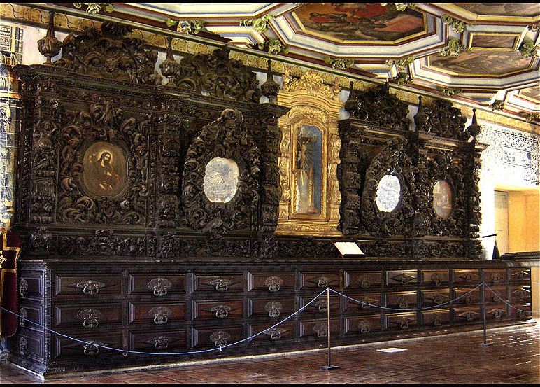
Founded 1535 Incorporated (as village) 1537 Incorporated (as city) 1676 Government - Mayor Renildo V. Calheiros Area - Municipality 43.55 km2 (27.1 sq mi) - Metro 2,768 km2 (1,068.7 sq mi) Elevation 16 m (52 ft) Population (2009) - Municipality 397.268 - Density 9.122/km2 (14.659/sq mi) - Metro 3,768,902 Time zone UTC-3 (UTC-3) HDI (2000) 0.792 – medium Website Olinda, Pernambuco  São Francisco Sacristy
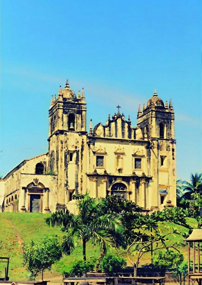
 Sāo Bento Monastery in Olinda
Olinda (Portuguese pronunciation: [oˈlĩdɐ]) is a historic city in the Brazilian state of Pernambuco, located on the country's northeastern Atlantic Ocean coast, just north of Recife and south of Paulista. It has a population of 397.268 people [1] and is one of the best-preserved colonial cities in Brazil.
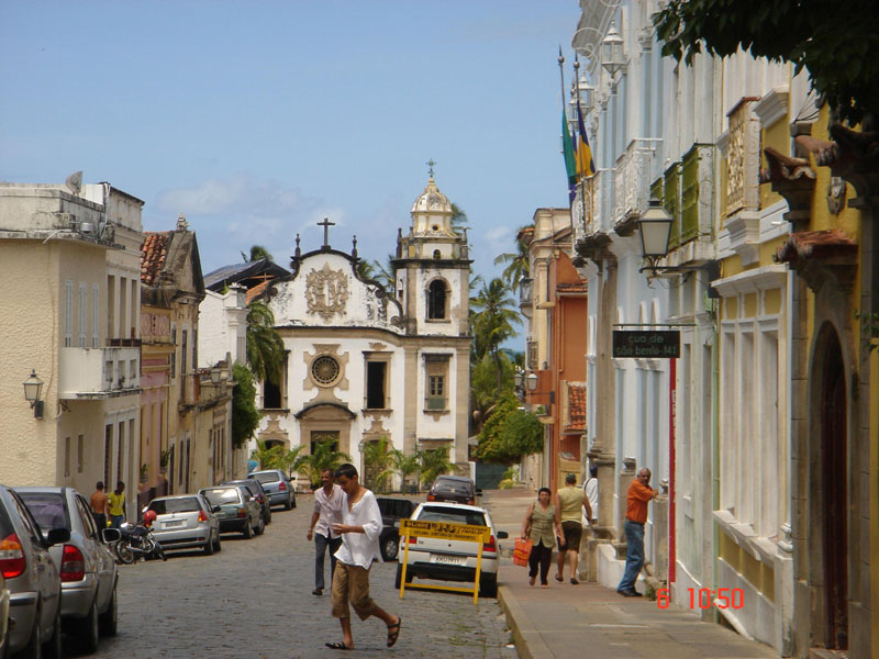
Olinda features a number of major touristic attractions, such as a historic downtown area (World Heritage Site), churches, and the Carnival of Olinda, a popular street party, very similar to traditional Portuguese carnivals, with the addition of African influenced dances. Unlike in Rio de Janeiro and Salvador, in Olinda, admission to Carnival is free. All the festivities are celebrated on the streets, and there are no bleachers or roping. There are hundreds of small musical groups (sometimes featuring a single performer) in many genres.
Contents
History
Historic Centre of the Town of Olinda * UNESCO World Heritage Site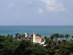
Country Brazil Type Cultural Criteria ii, iv Reference 189 Region ** Latin America and the Caribbean Inscription history Inscription 1982 (6th Session) * Name as inscribed on World Heritage List
** Region as classified by UNESCOSeveral indigenous tribes occupied the coast of Northeastern Brazil for several thousand years, and the hills of the present day municipality of Olinda had settlements of Caetés and Tupinambá tribes, which were frequently at war. French mercenaries are thought to be the first Europeans to get to the region, but the Portuguese exploited intertribal rivalries and managed to build a stronghold on the former Caeté village in the higher hill. Recent studies by the Universidade Federal de Pernambuco have uncovered new evidence of the pre-colonial population of the area. The settlement of Olinda was founded in 1535 by Duarte Coelho Pereira; it was elevated to a town on March 12, 1537. It was made the seat of the Territorial Prelature of Pernambuco in 1614, becoming the Diocese of Olinda in 1676.
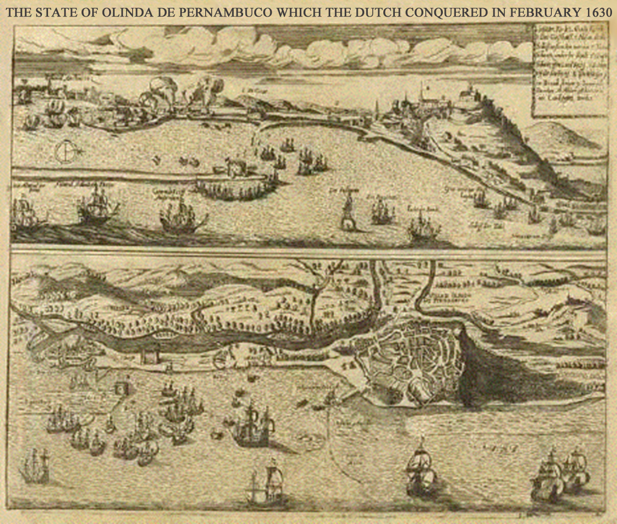
 Map made for the Dutch invasion of Olinda in 1630
Olinda was the capital of the hereditary captaincy of Pernambuco, but was burned by Dutch invaders. The Portuguese built their town on the hill, for practical purposes (sewers) and to make it easier to defend. In the 17th century the Kingdom of Portugal was united with Spain (the 1580-1640 Iberian Union period). Taking advantage of this period of Portuguese weakness, the area around Olinda and Recife was occupied by the Dutch who gained access to the Portuguese sugarcane plantations. John Maurice, Prince of Nassau-Siegen was appointed as the governor of the Dutch possessions in Brazil in 1637 by the Dutch West India Company on recommendation of Frederick Henry. He landed at Recife, the port of Pernambuco and the chief stronghold of the Dutch, in January 1637. By a series of successful expeditions, he gradually extended the Dutch possessions from Sergipe on the south to São Luís de Maranhão in the north. He likewise conquered the Portuguese possessions of Saint George del Mina, Saint Thomas, and Luanda, Angola, on the west coast of Africa. After the dissolution of the Iberian Union in 1640, Portugal would reestablish its authority over the lost territories of the Portuguese Empire.
Besides its natural beauty, Olinda is also one of the most important of Brazil's cultural centers. Declared in 1982 a Historical and Cultural Patrimony of Humanity by the UNESCO, Olinda relives the magnificence of the past every year during the Carnival, in the rhythm of frevo, maracatu and others rhythms.
Geography
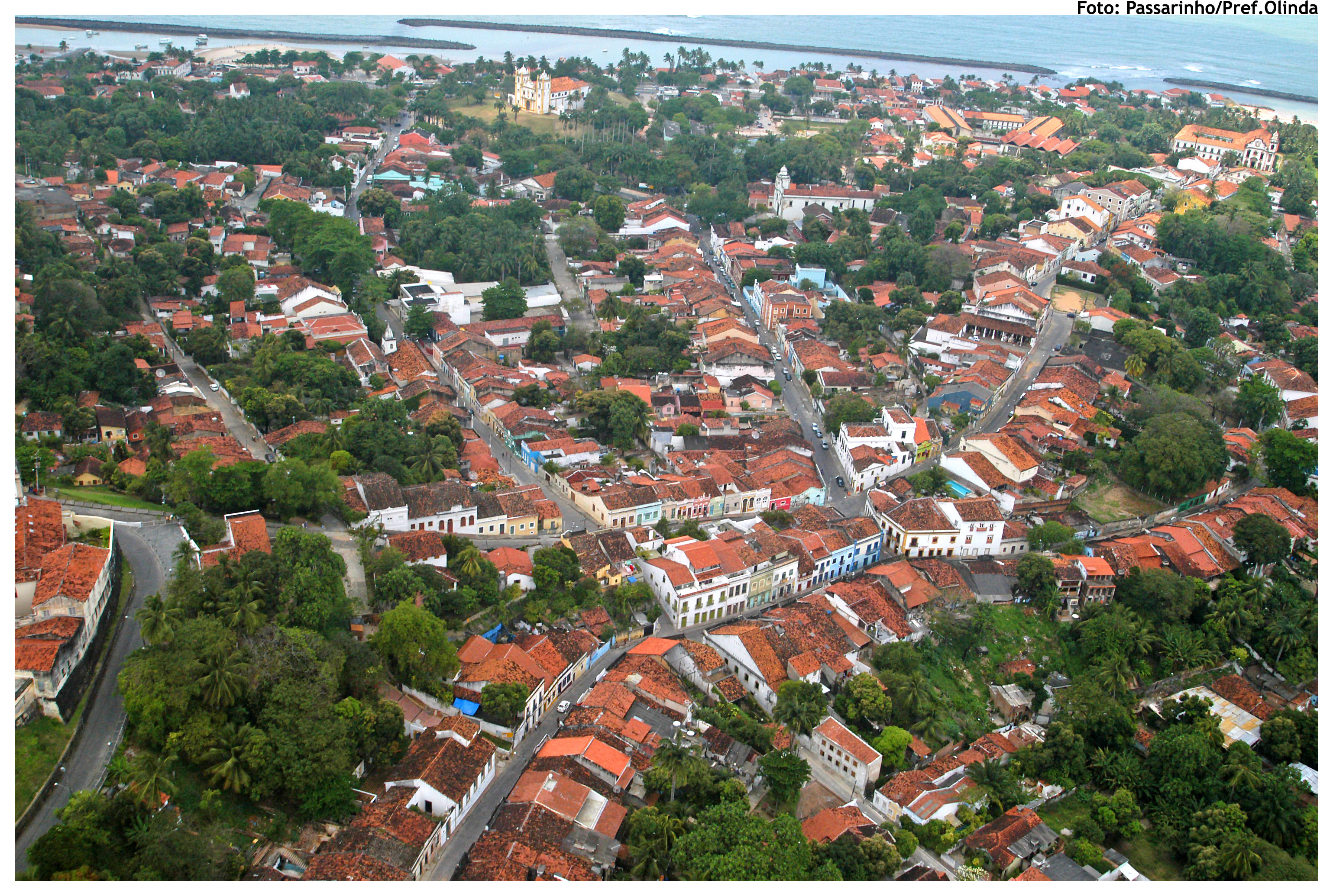
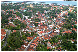 Aerial view of the Historical city center
 Olinda
- Coordinates - 8 00'S , 34 53' W
- State - Pernambuco
- Region - RMR (Recife)
- Boundaries - Paulista (N), Recife (S , W), Atlantic ocean (E)
- Area - 43.55 sqkm (27.1 sqmi)
- Elevation - 16 m (52 ft)
- Hidrography - Beberibe and small coastal rivers
- Urban beaches - Casa caiada and Rio doce
- Vegetation - Atlantic forest, Restinga and Manguezais
- Clima - Hot tropical and humid
- Annual average temperature - 24 c
- Main road - PE 001
- Distance to Recife - 6 km
Economy
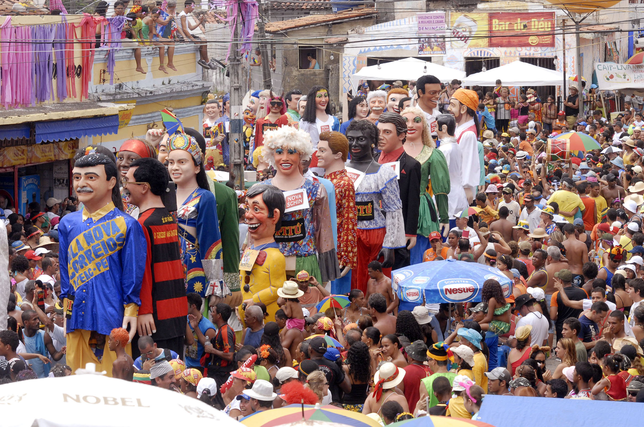
 Giant Dolls - Olinda Carnival
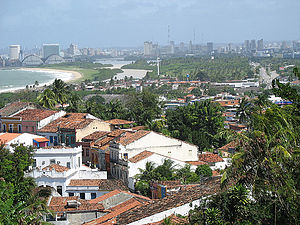 Olinda and Recife OverviewSee also: Largest Cities of Northeast Region, Brazil
The main economic activities in Olinda are based in tourism, commerce, transportation industry and artcraft. The tourist sector has a boom every Carnival when thousands of people are in the old historic town center.
Economic Indicators
Population GDP x(1000 R$).[2] GDP pc (R$) PE RMR 397.268 2.179.183 5.567 3.54 % 5.39 % Economy by Sector
Primary sector Secondary sector Service sector 0.17 % 18.70 % 81.13 % Health Indicators
HDI (2000) Hospitals (2007) Hospitals beds (2007) Children's Mortality every 1000 (2005) 0.792 3 358 18.9 Tourism
See also: Pernambuco Museums- Olinda travel guide from Wikitravel
- Historic town center
- Carnival
- Cultural sites
- Beaches
References
- ^ http://www.ibge.gov.br/home/estatistica/populacao/estimativa2009/POP2009_DOU.pdf IBGE Population 2009 Olinda, page 33]
- ^ Olinda 2007 GDP IBGE page 31
- ^ PE State site - City by city profile
External links
- Olinda's official website
- http://www.olinda.com.br Commercial site
- Video Olinda, Pernambuco (PT) [1]
- Video Olinda street Carnival [2]
World Heritage Sites in Brazil North 

Northeast Brazilian Atlantic Islands: Fernando de Noronha and Atol das Rocas Reserves · Discovery Coast Atlantic Forest Reserves1 · Historic Centre of São Luís · Historic Centre of Salvador da Bahia · Historic Centre of the Town of Olinda · Serra da Capivara National Park
Central-West Brasília · Cerrado Protected Areas: Chapada dos Veadeiros and Emas National Park · Historic Centre of the Town of Goiás · Pantanal Conservation Area
Southeast Atlantic Forest South-East Reserves1 · Discovery Coast Atlantic Forest Reserves1 · Historic Centre of the Town of Diamantina · Historic Town of Ouro Preto · Sanctuary of Bom Jesus do Congonhas
South Atlantic Forest South-East Reserves1 · Iguaçu National Park · Jesuit Missions of the Guaranis2: Ruins of São Miguel das Missões
1 Shared with other region/s · 2 Shared with Argentina Categories:- Populated places established in 1535
- World Heritage Sites in Brazil
- Historic centres
- Populated coastal places in Pernambuco
- Populated places in Pernambuco
- Dutch Brazil


Wikimedia Foundation. 2010.