- Mato Grosso do Sul
-
State of Mato Grosso do Sul — State — 
Flag
Coat of armsLocation of State of Mato Grosso do Sul in Brazil
Country  Brazil
Capital and Largest City Campo Grande Government - Governor André Puccinelli - Vice Governor Murilo Zauith Area - Total 357,124.962 km2 (137,886.7 sq mi) Area rank 6th Population (2010 census)[1] - Total 2,449,341 - Rank 21st - Density 6.9/km2 (17.8/sq mi) - Density rank 20th Demonym Sul-mato-grossense or Mato-grossense-do-sul GDP - Year 2010 estimate - Total R$ 38.484,74 (17th) - Per capita R$ 10,599 (11th) HDI - Year 2005 - Category 0.810 – high (8th) Time zone BRT-1 (UTC-4) - Summer (DST) BRST-1 (UTC-3) Postal Code 79000-000 to 79990-000 ISO 3166 code BR-MS Website ms.gov.br Mato Grosso do Sul (Portuguese pronunciation: [ˈmatu ˈɡɾosu du ˈsuɫ][2]) is one of the states of Brazil.
Neighboring Brazilian states are (from north clockwise) Mato Grosso, Goiás, Minas Gerais, São Paulo and Paraná. It also borders the countries of Paraguay and Bolivia to the west. The economy of the state is largely based on agriculture and cattle-raising. Bisected in the south by the Tropic of Capricorn, Mato Grosso do Sul generally has a warm and humid climate, and is crossed by numerous affluents of the Parana River.
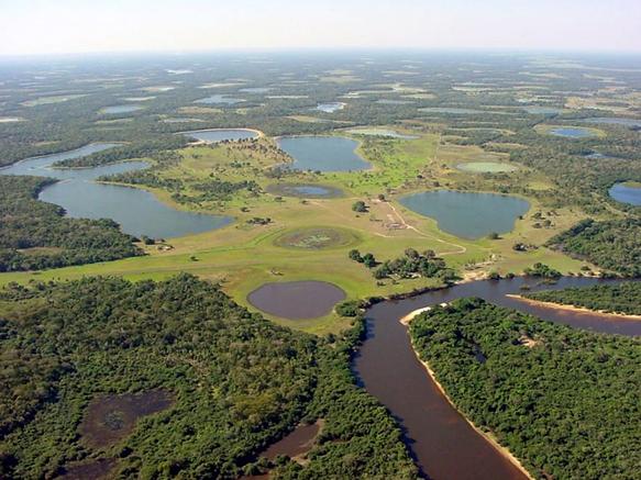
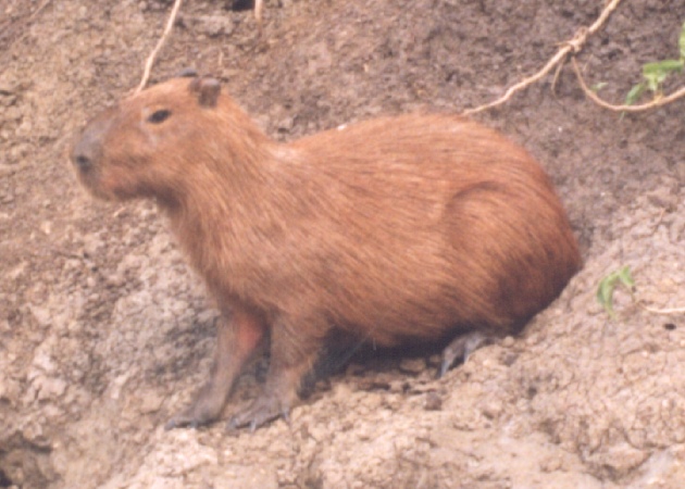
The state is also famous for its natural beauty and is a major destination for domestic and international tourism. The Pantanal lowlands cover 12 municipalities and presents an enormous variety of flora and fauna, with forests, natural sand banks, savannahs, open pasture, fields and bushes. The city Bonito, in the mountain of Bodoquena, has prehistoric caverns, natural rivers, waterfalls, swimming pools and the Blue Lake cavern.
The name "Mato Grosso do Sul" literally means "Thick Forest of the South" in Portuguese, a name inherited from its northern neighbour state of Mato Grosso, of which it was part until the 1970s. It is not uncommon for people to mistakenly refer to Mato Grosso do Sul as simply "Mato Grosso". Other names that were proposed, at the time of the split and afterwards, include "Pantanal" (a reference to its best known geographical feature) and "Maracaju" (a reference to the Maracaju mountain range that crosses the state from north to south).
Contents
Geography
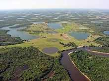 Typical Pantanal Fazenda scenery.
Climate
Mato Grosso do Sul has humid subtropical and tropical climates. The annual rainfall is 1.500 mm. January is the warmest month, with mean maxima of 34 °C (93.2 °F) and minima of 24 °C (75.2 °F) and more rain; July experiences the coldest temperatures, with mean maxima of 25 °C (77 °F) and minima of 15 °C (59 °F) and sun.
Vegetation
The "cerrado" landscape is characterized by extensive savanna formations crossed by gallery forests and stream valleys. Cerrado includes various types of vegetation. Humid fields and "buriti" palm paths are found where the water table is near the surface. Alpine pastures occur at higher altitudes and mesophytic forests on more fertile soils. The "cerrado" trees have characteristic twisted trunks covered by a thick bark, and leaves which are usually broad and rigid. Many herbaceous plants have extensive roots to store water and nutrients. The plant's thick bark and roots serve as adaptations for the periodic fires which sweep the cerrado landscape. The adaptations protect the plants from destruction and make them capable of sprouting again after the fire.
The state is located in western Brazil, in a region mostly occupied by the inland marshes of the Pantanal. The highest elevation is the 1,065 m high Morro Grande.
History
In October 11, 1977, the state was created by dividing the state of Mato Grosso. Its status as a state went into full effect two years later on January 1, 1979.
Demographics
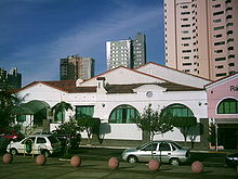
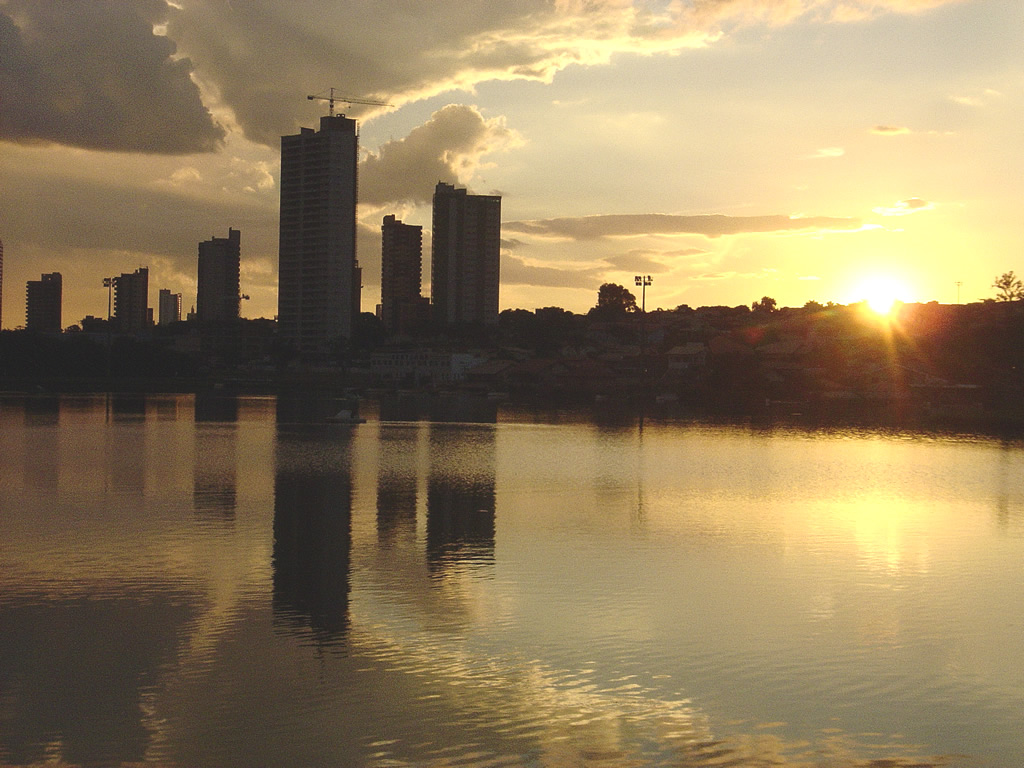
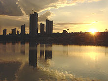 Campo Grande, the capital.
According to the IBGE of 2008, there were 2,372,000 people residing in the state. The population density was 6.4 hab./km².
Urbanization: 84.7% (2006); Population growth: 1.7% (1991–2000); Houses: 689,000 (2006)[3]
The last PNAD (National Research for Sample of Domiciles) census revealed the following numbers: 1,157,000 White people (51.78%), 1,056,000 Brown (Multiracial) people (44.51%), 122,000 Black people (5.15%), 20,000 Amerindian people (0.84%), 15,000 Asian people (0.64%).[4]
In the Cerrado areas, mostly in the south, central and east, there is a predominance of Southern Brazilian farmers of German, Portuguese and Italian descent.
According to an autosomal DNA study from 2008, the ancestral composition of Mato Grosso do Sul is 73,60% European, 13,90% African and 12,40% Native American.[5]
Economy
The service sector is the largest component of GDP at 46.1%, followed by the industrial sector at 22.7%. Agriculture represents 31.2%, of GDP (2004). Mato Grosso do Sul exports: soybean 34.9%, pork and chicken 20.9%, beef 13.7%, ores 8%, leather 7.4%, timber 5.1% (2002).
Share of the Brazilian economy: 1% (2005).
Interesting facts
Vehicles: 835,259 (June 2009); Mobile phones: 2.407 million (July/2009); Telephones: 471,000 (April 2007); Cities: 78 (2007)[6]
Education
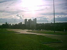 Campo Grande is the most important educational centre of the state.
Portuguese is the official national language, and thus the primary language taught in schools. But English and Spanish are part of the official high school curriculum.
There are more than 44 universities in whole state of Mato Grosso do Sul[7].
Educational institutions
- Universidade Federal de Mato Grosso do Sul (UFMS) (Federal University of Mato Grosso do Sul)
- Universidade Estadual de Mato Grosso do Sul (Uems) (State University of Mato Grosso do Sul)
- Universidade Federal da Grande Dourados (UFGD) (Federal University of Dourados Region)
- Universidade Católica Dom Bosco (UCDB) (Dom Bosco Catholic University)
- Universidade para o Desenvolvimento do Estado e da Região do Pantanal (Uniderp) (University for the Development of the State and Region of the Pantanal)
Culture
 Radio Club in Campo Grande.
Campo Grande Film Festival
It's a film festival held annually in the months of January and February and has been arranged since 2004. It focuses on the independent cinema presenting Brazilian films and foreign films as well. It also presents regional films and short films. As of 2011 the festival is suspended.
Bonito's Winter Festival
"Festival de Inverno de Bonito" (Bonito Winter Festival) is held every year for a week during July or August, with music performances and ecological videos, theatre, folklore and fine arts exhibitions.
Pantanal Micareta
Aquidauana's biggest event is the Pantanal Micareta, which attracts thousands of tourists to Dr. Sabino Avenue, annually.
Tourism and recreation
Bonito
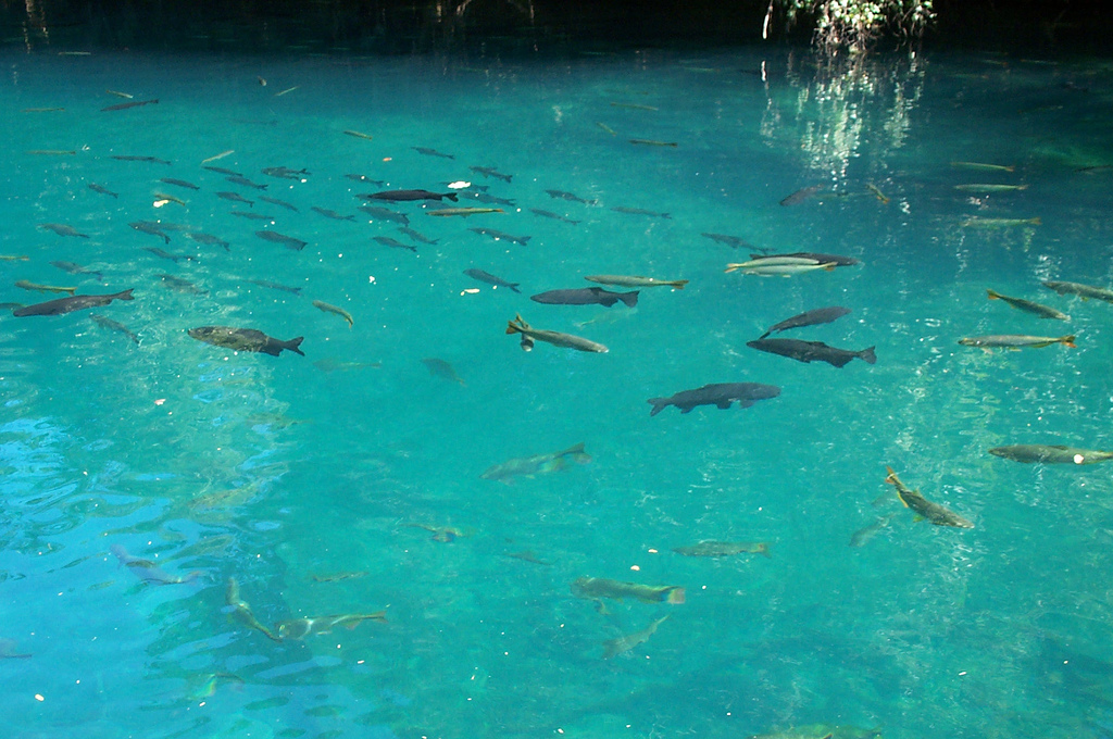
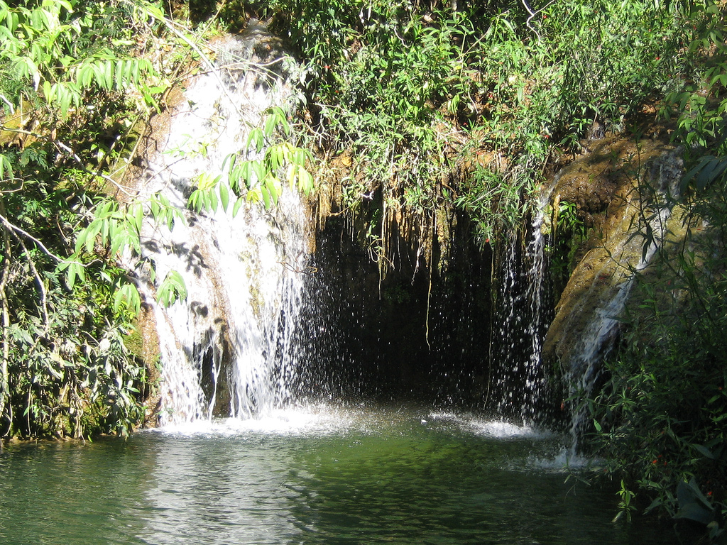
The great concentration of lime in the soil around the area where Bonito is located is responsible for the transparency of the waters and for the existence of a wide variety of geological formations. The best way to appreciate the local natural features is by going on an adventure tour. The most popular activities include diving in caverns, observing the underwater fauna and walking along trails in the forest. Places like Gruta Lago Azul (Blue Lake Cave) and the Fazenda Estancia Mimosa, Aquario Natural (Natural Aquarium), and the rivers Sucuri, Prata, and Formoso, are the most popular.
South Pantanal
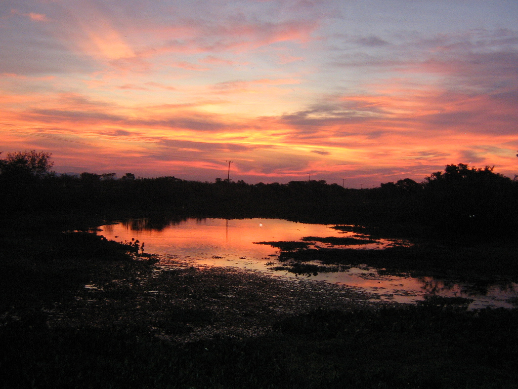
The Pantanal is an ecological paradise right in the heart of Brazil. It is the largest flooded lowland on the planet and the third largest environmental reserve in the world. Its ecological importance is immense, since it is home to one of the richest ecosystems ever found to date, with periodically flooded seasonal forests. It displays the largest concentration of neo-tropical fauna, including several endangered species – mammals, reptiles and fish – and it also serves as habitat for an enormous variety of native birds, as well as those migrating from other areas in the Americas. The Pantanal is one of the best places in Brazil for flora and fauna observation and for fishing – permitted only between March and October – due to its abundance of animals. It has a total area of 230,000 square kilometres, covering 12 townships in the States of Mato Grosso and Mato Grosso do Sul. To the North, there are the Paracis, Azul and Roncador mountains. To the East, the Maracaju Mountain Range. To the South, the Dodoquena Mountain Range. And, to the West, the Paraguayan and Bolivian swamps. The Pantanal is so diverse that researchers subdivided it in sub-regions. Each "Pantanal" – North and South – has its own natural features, activities and ideal period for visitation.
Infrastructure
International Airports
 Campo Grande International Airport.
- Campo Grande - The operation of Campo Grande International Airport is shared with the Campo Grande Air Base. The airport has two runways. Construction of the main runway, made of concrete, began in 1950 and was finished in 1953. The passenger terminal was concluded in 1964, and in 1967 concrete aprons were built for both military and civilian aircraft. As commercial aviation demand grew, it became necessary to widen the civil aircraft apron, which was completed 12 years after its construction. The airport has been administered by Infraero since 1975.
- Corumbá - Corumbá International Airport, located just 3 km (1.86 mi) from the city center, was opened on September 21, 1960, the city's anniversary. Built on a land plot of 290 hectares and at an elevation of 140 meters above sea, it has an asphalt runway measuring 1660 x 30 meters, with one of its thresholds reinforced with concrete for an additional 60 meters. Corumbá International Airport has been administered by Infraero since February 1975.
- Ponta Porã - Ponta Porã International Airport is also administered by Infraero.
Other airports
- Dourados Regional Airport
- Bonito Airport
Highways
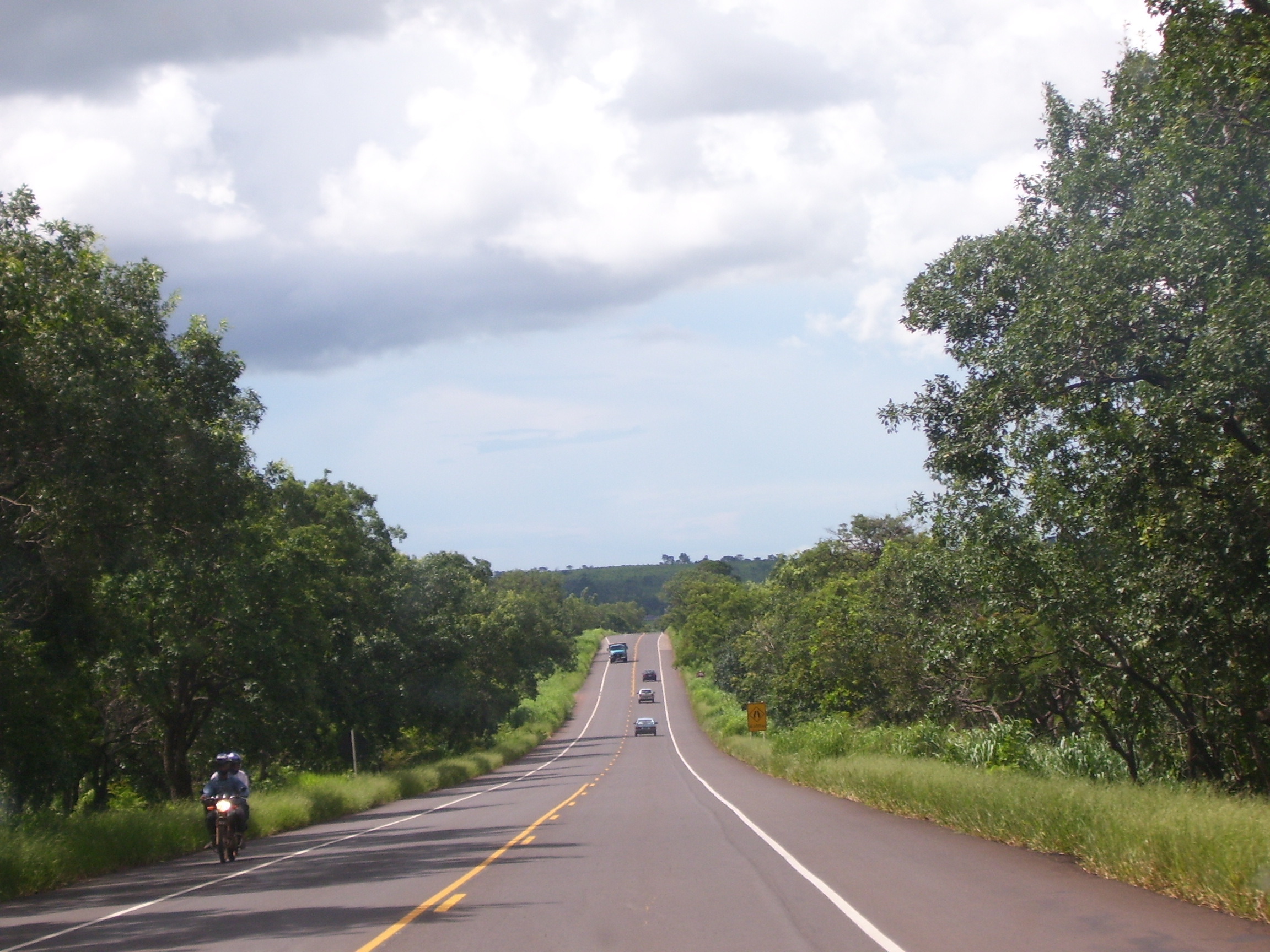
 BR-267 in Mato Grosso do Sul.
- BR-060;
- BR-158;
- BR-163;
- BR-267;
- BR-262;
- BR-359;
- BR-454;
- BR-419;
- BR-487.
Sports
Campo Grande was one of the 18 candidates to host games of the 2014 FIFA World Cup which will take place in Brazil. It did not make to the final list, being one of the 5 cities left off. Maceió gave up its bid before the end of the process.
Flag
Mato Grosso do Sul's flag was designed by Mauro Michael Munhoz. A white stripe divides an upper left green corner from a bottom right blue space with a yellow star. White symbolizes hope, green is an allusion to the state's rich flora, blue represents its vast sky, while the yellow star adds balance, force and serenity.
References
- ^ Censo 2010: população do Brasil é de 190.732.694 pessoas
- ^ In Brazilian Portuguese. The European Portuguese pronunciation is [ˈmatu ˈɡɾosu du ˈsuɫ].
- ^ Source: PNAD.
- ^ (in Portuguese) (PDF). Mato Grosso do Sul, Brazil: IBGE. 2008. ISBN 85-240-3919-1. http://www.sidra.ibge.gov.br/bda/tabela/listabl.asp?z=pnad&o=3&i=P&c=262. Retrieved 2010-01-18.
- ^ http://bdtd.bce.unb.br/tedesimplificado/tde_busca/arquivo.php?codArquivo=3873
- ^ Source: IBGE.
- ^ Universidades no Mato Grosso do Sul
See also
External links
- (Portuguese) Official Website
- (English) Brazilian Embassy in London
BrazilHistory First inhabitants · Colonization · Empire · Old Republic · Vargas Era · Second Republic · Military rule · ContemporaryGeography Regions · States · Mesoregions · Microregions · Municipalities · Islands · Coastline · Climate · Environment · Extreme points · Protected areas · CapitalsGovernment Constitution · Federal government · President · National Congress · Foreign relations · Law · Law enforcement · MilitaryPolitics Economy Society Demographics · People · Languages · Religion · Immigration · Education · Health · Crime · Social issues · Largest cities · ApartheidCulture  Category ·
  Portal ·
  WikiProject
Demographics of Brazil Economic and social Apartheid · Attractions · Law · Crime · Education · GDP · Health · Human Development · Human Rights (LGBT Rights) · Immigration · Languages · People · Politics · Poverty · Races · Religions · Traditions · Wealth
Ethnic groups BrazilAfricaAmericasNorth AmericaCaribbeanHaitianSouth AmericaAsiaBy EthnicityBy Country
or RegionEasternSouthernEast IndianWesternEuropeBy EthnicityBy Country
or RegionNorthernWesternCentralSouthernBalkanEasternRegions and States of Brazil North Northeast Center-West - Goiás
- Mato Grosso
- Mato Grosso do Sul
- Federal District
Southeast South - Fernando de Noronha
- Rocas Atoll
- Saint Peter and Saint Paul
- Trindade and Martim Vaz
Categories:- Mato Grosso do Sul
- States of Brazil
- States and territories established in 1979


Wikimedia Foundation. 2010.