- Trindade and Martim Vaz
-
Not to be confused with Trinidad (disambiguation).
Trindade and Martim Vaz Archipelago Native name: Arquipélago de Trindade e Martim Vaz 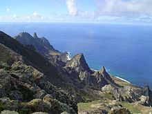
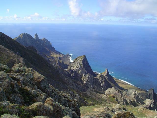
Rocky cliffs of Trindade Island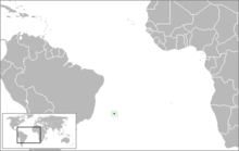
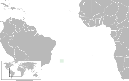
Geography Location Atlantic Ocean Coordinates 20°31′30″S 29°19′30″W / 20.525°S 29.325°WCoordinates: 20°31′30″S 29°19′30″W / 20.525°S 29.325°W Archipelago Arquipélago de Trindade e Martim Vaz Total islands 6 Major islands Trindade; Martim Vaz Area 10.4 km2 (4.02 sq mi) Highest elevation 620 m (2,030 ft) Highest point Pico do Desejado[1] Country Region Southeast State Espírito Santo Administration 1st Naval District of the Brazilian Navy Demographics Population 32 (as of 2009) Additional information Official website First Naval District Trindade and Martim Vaz is an archipelago located about 1,200 kilometers (740 mi) east of Vitória in the Southern Atlantic Ocean, belonging to the State of Espírito Santo, Brazil. The archipelago has a total area of 10.4 km² (4.0 sq mi) and a population of 32 (Brazilian Navy personnel). The archipelago consists of six islands; Trindade being the largest island, with an area of 10.1 km² and Martim Vaz the second largest, with an area of 0.3 km² (30 hectares).
The islands are of volcanic origin and have rugged terrain. They are largely barren, except for the southern part of Trindade. They were discovered in 1502 by Portuguese explorer Estêvão da Gama and stayed Portuguese until they became part of Brazil at its independence. From 1890 to 1896, Trindade was occupied by the United Kingdom until an agreement with Brazil was reached. During the period of British occupation, Trindade was known as "South Trinidad".
Contents
Geography
The individual islands with their respective locations are given in the following:
- Ilha Trindade (20°31′30″S 29°19′30″W / 20.525°S 29.325°W)
- Ilhas de Martim Vaz (20°30′00″S 28°51′00″W / 20.5°S 28.85°W)
- Ilha do Norte, 300 meters north-northwest of Ilha da Racha, 75 meters high. (20°30′00″S 28°51′00″W / 20.5°S 28.85°W)
- Ilha da Racha (Ilha Martim Vaz), 175 meters high near the northwest end. The shores are strewn with boulders. (20°30′18″S 29°20′42″W / 20.505°S 29.345°W)
- Rochedo da Angulha, a flat circular rock 200 meters northwest of Ilha da Racha, is 60 meters high.
- Ilha do Sul, 1,600 meters south of Ilha da Racha, is a rocky pinnacle. Ilha do Sul is the easternmost point of Brazil. (20°31′00″S 28°51′00″W / 20.5166667°S 28.85°W)
Trindade
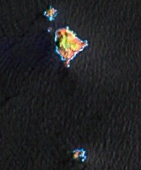
 NASA satellite imagery of Martin Vaz Islands in pseudo-color.
The small island of Trindade, with an area of 10.3 km², lies at the eastern end of an E-W-trending chain of submarine volcanoes and guyots extending about 1,000 km (620 mi) from the continental shelf off the Brazilian coast. The island lies more than halfway between Brazil and the Mid-Atlantic Ridge near the eastern end of the submarine Vitória-Trindade Ridge.
Trindade is a mountainous, dissected volcanic island with numerous phonolitic lava domes and steep-sided volcanic plugs. The highest summit is Pico Desejado, near the center, 620 meters high. Nearby to the northwest are Pico da Trindade (590 m) and Pico Bonifácio (570 m). Pico Monumento, a remarkable peak in the form of a slightly inclined cylinder, rises from the west coast to 270 m. The youngest volcanism, at Vulcão de Paredão (217 m) on the southeast tip of the island, constructed a pyroclastic cone with lava flows that are no older than the Holocene (Almeida, 1961). Remnants of the crater of the 200 m high cinder cone are still preserved. Lava flows traveled from the cone to the north, where they formed an irregular shoreline and offshore islands. Smaller volcanic centers of the latest volcanic stage are found in the Morro Vermelho (515 m) area in the south-central part of the island.
There is a small settlement in the north on Enseada dos Portugueses, supporting a garrison of the Brazilian Navy, 32 strong.
The island is the main nesting site of the green sea turtle in Brazil.
History
16th to 18th century
The Trindade and Martim Vaz Islands were discovered in 1502 by Portuguese navigators led by Estêvão da Gama, and, along with Brazil, became part of the Portuguese Empire.
Many visitors have been to Martim Vaz, the most famous of whom was the English astronomer Edmund Halley, who took possession of the island on behalf of the British Monarchy in 1700.
HMS Rattlesnake, a 198-ton, 12-gun cutter-rigged sloop, was wrecked on Trindade on 21 October 1781, shortly after Commander Philip d’Auvergne RN, Prince de Bouillon had taken over command. Rattlesnake had been ordered to survey the island to ascertain whether it would make a useful base for outward-bound Indiamen. She anchored, but that evening the wind increased and by seven o’clock she was dragging. Two hours later the first cable parted and Commander d’Auvergne club-hauled his way out, setting main and fore sails, and using the remaining anchor cable as a spring. This successfully put Rattlesnake’s head to seaward. The remaining cable was then cut, and the sloop wore round and stood out to sea. However the ground now shallowed quite rapidly and suddenly Rattlesnake struck a submerged rock. She started filling with water, so, in order to preserve the lives of the crew, she was run ashore. The crew lived on the tiny island for three months until taken off by the Bristol, 50 guns, and a convoy of Indiamen, which fortuitously called there in late December.
Captain La Pérouse stopped there at the outset of his 1785 voyage to the Pacific.
19th to 20th century
In 1893 the American James Harden-Hickey claimed the island and declared himself as James I, Prince of Trinidad.[2][3][4] According to James Harden-Hickey's plans, Trinidad, after being recognized as an independent country, would become a military dictatorship and have him as dictator.[5] He designed postage stamps, a national flag, and a coat of arms; established a chivalric order, the "Cross of Trinidad"; bought a schooner to transport colonists; appointed M. le Comte de la Boissiere as Secretary of State; opened a consular office at 217 West 36th Street in New York; and even issued government bonds to finance construction of infrastructure on the island. Despite his plans, his idea was ridiculed or ignored by the world.[6][7][8][9][10] [11]
In July 1895, the British again tried to take possession of this strategic position in the Atlantic.[5] The British planned to use the island as a cable station.[5] However, Brazilian diplomatic efforts, along with Portuguese support[citation needed], reinstated Trindade Island to Brazilian sovereignty.
In order to clearly demonstrate sovereignty over the island, now part of the State of Espírito Santo and the municipality of Vitória, a landmark was built on January 24, 1897. Nowadays, Brazilian presence is marked by a permanent Brazilian Navy base on the main island.
In August 1914 the Imperial German Navy established a supply base for its warships off Trindade. On September 14, 1914 the Royal Navy auxiliary cruiser HMS Carmania fought the German Navy's SMS Cap Trafalgar off Trindade in the Battle of Trindade. The SMS "Cap Trafalgar" was sunk by HMS "Carmania", which sustained severe damage herself. Coincidentally, because both ships were 18,000 ton liners they had disguised themselves as each other before the battle to make it easier to approach ships of the other country's merchant fleet.
See also
- Trindade hotspot
References
- ^ Ilha da Trindade - Infográficos e mapas Folha de São Paulo. Retrieved on 6 June 2009.
- ^ "To Be Prince of Trinidad: He Is Baron Harden-Hickey", New York Tribune, November 5, 1893, p 1
- ^ Bryk, William, "News & Columns", New York Press, v 15 no 50 (December 10, 2002)
- ^ "Principality of Trinidad: John H. Flagler's Son-in-Law Is Its Sovereign, Self-Proclaimed as James I", New York Times, June 10, 1894, p 23
- ^ a b c Bryk (2002)
- ^ "Trinidad's Prince Awake: An Appeal to Washington Against Brazil and Great Britain", New York Times, August 1, 1895, p 1
- ^ "Grand Chancellor of Trinidad: Significant Phases in the Ascent of Male Comte de la Boissiere to His Elevated Diplomatic Post", New York Times, August 2, 1895, p 9
- ^ "Trinidad's Case in Washington: Courteously, the Chancellor Would Permit Britain's Cable Station and Use It, but There Is Graver Trouble", New York Times, August 7, 1895, p 1
- ^ "Trinidad's Diplomat in Action: M. de la Boissiere Asks that His Sovereign's Land Be Recognized as a Neutral Principality", New York Times, August 9, 1895, p 5
- ^ "Trinidad's Prince at Work: Grand Chancellor de la Boissiere Tells How the War Between Great Britain and Brazil Will Be Averted", New York Times, Jan 24, 1896, p 9
- ^ Flags of the World - Trindade and Martins Vaz Islands (Brazil)
Regions and States of Brazil North Northeast Center-West Southeast South - Fernando de Noronha
- Rocas Atoll
- Saint Peter and Saint Paul
- Trindade and Martim Vaz
Categories:- Ecoregions of Brazil
- Islands of Brazil
- Mountains of Brazil
- Volcanoes of Brazil
- Neotropic
- Stratovolcanoes
- Subduction volcanoes
- Tropical and subtropical moist broadleaf forests
- Volcanoes of the Atlantic Ocean
- Volcanic plugs
- Holocene volcanoes
- Espírito Santo
Wikimedia Foundation. 2010.