- Rio Grande do Norte
Infobox Brazilian State
name = State of Rio Grande do Norte

motto =
anthem =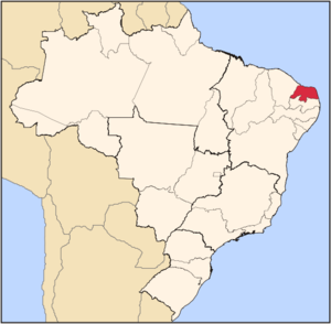
capital = Natal
latd= |latm= |latNS= |longd= |longm= |longEW=
largest_city = Natal
demonym = Potiguar or Norte-rio-grandense
leader_name1 =Wilma de Faria ,Brazilian Socialist Party
leader_name2 = Iberê Paiva Ferreira de Souza
area = 52.796,791
area_magnitude = 1 E10
area_rank = 22th
population_estimate = 3,043,760
population_estimate_rank = 17th
population_estimate_year = 2006
population_census = 3,006,273
population_census_year = 2005
population_density = 57.7
population_density_rank = 10th
GDP = R$ 17,862,000,000
GDP_rank = 18th
GDP_year = 2005
GDP_per_capita = R$ 5,948
GDP_per_capita_rank = 20th
HDI = 0.738
HDI_rank = 20th
HDI_year = 2005
abbreviation = BR-RN
time_zone = BRT
utc_offset = -3
time_zone_DST = BRST
utc_offset_DST = -2Rio Grande do Norte (lit. "Large River of the North", pronounced|xiu ˈgɾɐ̃di du ˈnɔxti [In the
Brazilian Portuguese variant spoken in Rio Grande do Norte. TheEuropean Portuguese pronunciation is IPA| [ʁiw ˈgɾɐ̃ð(ɨ) du ˈnɔɾt(ɨ)] .] ) is one of the states ofBrazil , located in the northeastern part of the country, on the edge of theSouth America n continent. Because of its geographic position, Rio Grande do Norte has a strategic importance. It is the land of the folklorist Câmara Cascudo and is second in theworld having the purestair , second only toAntarctica , according toNASA . Its 410 km (254 mi) of sand, muchsun ,coconut palm s andlagoon s are responsible for the fame ofbeach es, such as the secluded white sandy shores of Praia de Cajueiro, Genibapu (to thenorth of the capital, Natal), with sand dunes reaching 50 m (164 ft) in height. The beach of Baía Formosa, the prettiest of the south coast, has falésias, stretches withreef s and very popular forsurfing . To thesouth , thebeach of Sagi, a little more rustic, has clear waters and smalldune s. In Natal, beside beaches, there are othertourist attractions, such as the fortress of Reis Magos and the Parque das Dunas, the second largest urbanpark in the country.Geography
Rio Grande do Norte is dominated by its coastline. The state is famed for its
beach es andsand dune s, and the air is, according toNASA , the second-cleanest in the world afterAntarctica .Two climates predominate: humid tropical, in the oriental
littoral , and semi-arid, in the remaining (most part) of the State (including the North coast).The rainforest which once covered most of Brazil's coast had its northern end in the south of Rio Grande do Norte; the area north of Natal, the capital, is under dunes, a kind of formation associated with semi-arid climate. The semi-arid climate is characterized not only by the low level but also the irregularity of rainfall; some years can go by with no or very little rain; most of the interior of the State is part of the Polygon of Droughts (an area which receives special attention from the federal government). There are also manymangrove s in the state, and the interior is dominated byrainforest .Rocas Atoll in theAtlantic Ocean , 260 km Northeast of Natal, also belongs to the state of Rio Grande do Norte.History
The first
Europe an to reach the region may have been the SpaniardAlonso de Ojeda in 1499. The northeastern tip ofSouth America ,Cape São Roque , 20 miles to the north of Natal, was first officially visited by European navigators in 1501, in the 1501–1502 Portuguese expedition led byAmerigo Vespucci , who named the spot after the saint of the day. The Vespucci expedition also named thePotengi (Tupi-Guarani for "River of Shrimps") river, whose considerably large mouth contrasted with the nearby bodies of water, "Rio Grande" (Portuguese for "Great River"), after which the Captaincy, Province, and State were named. For decades thereafter, no permanent European settlement was established in the area, inhabited by thePotiguar tribe.In the 16th century (between 1535 and 1598), it was explored by French pirates in search for
brazilwood . In 1598, the Portuguese built the "Forte dos Reis Magos" and, in the following year, founded the city of Natal. Rasing cattle and sugarcane plantation lifted the local development and economy. Inote | "Grande Enciclopédia Universal", page 11442, "Rio Grande do Norte" paragraph 1In 1633, the area became a battleground between the expansionist Portuguese, seeking to take more land for their Brazilian territories, and the Dutch, who gained a foothold in South America.
After a short period of peace and prosperity in
Olinda andRecife , the sugar prices went down in the market of Amsterdam and the region entered into a serious economic crisis. The economic problems led the Portuguese settlers and native Brazilians to revolt against the Dutch in what is known today as the massacres ofCunhaú andUruaçu .The religious confrontations (the Portuguese-Brazilian
Catholicism and the DutchCalvinism ), Portugal's restoration of the throne in 1640 and the reconquest ofMaranhão in 1643, lead the Portuguese-Brazilians to undertake the 1645 uprising, led byAndré Vidal de Negreiros andJoão Fernandes Vieira . The governor ofBahia promised new Portuguese troops, but most of the rebels were Africans and Amerindians. In 1654, the Dutch were finally cast out.During
World War II , Rio Grande do Norte was used as an Allied airbase from which to launch air raids on German-occupiedNorth Africa .In 1964,
Latin America 's first space launch site was constructed in Rio Grande do Norte; "Barreira do Inferno" (Hell 's Barrier), which is often referred to as the "BrazilianNASA ".Demographics
According to the
IBGE of 2007, there were 3,051,000 people residing in the state. The population density was 57.7 inh./km².Urbanization : 72.4% (2006);Population growth : 1.6% (1991–2000);House s: 832,000 (2006). [Source: PNAD.]The last PNAD (National Research for Sample of Domiciles) census revealed the following numbers: 1,864,000
Pardo (Brown) people (61.1%), 1,128,000 White people (37.0%) and 57,000 Black people (1.9%). [cite book|url=ftp://ftp.ibge.gov.br/Indicadores_Sociais/Sintese_de_Indicadores_Sociais_2007/Tabelas|title=Síntese de Indicadores Sociais 2007|publisher=IBGE |location=Rio Grande do Norte, Brazil|format=PDF|isbn=85-240-3919-1|accessdate=2007-07-18|year=2007|language=Portuguese]Interesting facts
Vehicles : 468,289 (March/2007);Mobile phone s: 1.6 million (April/2007);Telephone s: 399 thousand (April/2007);Cities : 167 (2007). [Source:IBGE .]Economy
The
service sector is the largest component ofGDP at 50.2%, followed by theindustrial sector at 44.2%.Agriculture represents 5.6% ofGDP (2004). Rio Grande do Norte exports:fish andcrustacean 30.5%,fruit s 19.3%,woven ofcotton 12.3%,petroleum 10.8%,cashew 8.5%,sugar 5.3%,chocolate 3.9%,sea salt 3.7% (2002).Share of the Brazilian economy: 0.9% (2004). [cite book|url=http://en.wikipedia.org/wiki/List_of_Brazilian_states_by_GDP_participation|title=List of Brazilian states by GDP|publisher=
IBGE |location=Rio Grande do Norte, Brazil|format=PDF|isbn=85-240-3919-1|accessdate=2007-07-18|year=2004|language=Portuguese]Historically, Rio Grande do Norte has relied upon sugar and cattle for its livelihood. However, since the 1980s, the state government has realised that
tourism is a lucrative industry, and more money is being poured into the construction of tourist resorts, and restoring colonial buildings in major cities.Fruit is also grown in Rio Grande do Norte, with the state supplying 70% of Brazil'smelon s, and the state is famed for itsmango andcashew fields. The world's largest cashew tree is located in the state; it has acircumference of 500 centimetres and occupies an area of 7,300cm², making it 70 times the size of average cashew trees. Rio Grande do Norte is also one of three Brazilian states that together produce the world's entire supply ofcarnauba wax.Education
Portuguese is the official national language, and thus the primary language taught in schools. But English and Spanish are part of the official
high school curriculum.Educational institutions
* Universidade Federal do Rio Grande do Norte (UFRN) (Federal University of Rio Grande do Norte);
* Universidade Estadual do Rio Grande do Norte (UERN) (State University of Rio Grande do Norte);
* Universidade Potiguar (UnP) (Potiguar University);
* Universidade Federal Rural do Semi-Árido (Ufersa) (Rural Federal University of Semi-Arid);
* Centro Federal de Educação Tecnológica do Rio Grande do Norte (Cefet-RN);
* and many others.Culture
aint John's Day
Festa Junina was introduced to NortheasternBrazil by the Portuguese for whom St John's day (also celebrated asMidsummer Day in severalEurope an countries), on the 24th of June, is one of the oldest and most popular celebrations of the year. Differently, of course, from what happens on the EuropeanMidsummer Day, the festivities in Brazil do not take place during thesummer solstice but during the tropicalwinter solstice . The festivities traditionally begin after the 12th of June, on the eve of St Anthony's day, and last until the 29th, which is Saint Peter's day. During these fifteen days, there arebonfires ,fireworks , and folk dancing in the streets. Once exclusively a rural festival, today in Brazil it is largely an urban festival during which people joyfully and theatrically mimic peasant stereotypes and clichés in a spirit of jokes and good times. Typical refreshments and dishes are served. It should be noted that, like during Carnival, these festivities involve costume-wearing (in this case, peasant costumes), dancing, heavy drinking, and visual spectacles (fireworks display and folk dancing). Like what happens onMidsummer and St John's Day in Europe,bonfires are a central part of these festivities in Brazil.Carnival
The four-day period before Lent leading up to Ash Wednesday is
carnival time inBrazil . Rich and poor alike forget their cares as they party in the streets.Infrastructure
International Airport
Located virtually at sea level (169 ft), with favorable weather and geographic conditions,
Augusto Severo International Airport in Parnamirim is 18 kilometers from Natal (RN). It takes its name from Augusto Severo de Albuquerque Maranhão, a native son of that state who died in an accident in France in 1902. The airport has a total area of 11.3 thousand square meters and capacity for 1.2 million passengers a year. The installations and passenger terminals are air conditioned with equipment that can put out 630 tons of cooled air. With an area of 5.5 million square meters, the airport complex operates with 16,482 square meters of passenger and cargo terminals and administrative and maintenance installations. There are 6,224 meters of runways and 61.5 square meters of apron space, providing connections from the greater Natal region to the main centers of the world. The airport is the only one in the Northeast Region to receive charter flights fromScandinavia .Highways
*BR-101;
*BR-104;
*BR-110;
*BR-226;
*BR-304;
*BR-405;
*BR-406;
*BR-427;
*RN-117;
*RN-401.Port
The Port of Natal is specialized in cold storage cargo such as
fruit ,fish andshrimp , among others. It has its own customs facilities and is connected toEurope by direct navigation lines, mainly to theport s ofVigo ,Rotterdam andSheerness , which allows great agility and reduced costs for the shipment of your products.Besides having a modern infrastructure, competitive prices and qualified professionals, the access to the management of the Port is easy, meaning less bureaucracy for your transactions.ports
Natal is one of the 18 remaining candidates to host games of the
2014 FIFA World Cup , which will be held inBrazil .Flag
The flag was adopted on
December 3 1957 . It is based on a design by Luis de Camara Cascudo. In the middle of the flag is the coat of arms of the state, which was adopted onJuly 1 1909 . It shows a sailing boat at the coast in the middle, representing the fishing and salt industries. Above it is a bar which shows two flowers on the sides and two cotton bolls in the center. To the sides of the shield are acoconut palm to the right and a carnauba palm to the left, connected by two branches ofsugar cane . The star above represents the state as part of Brazil.References
External links
*pt icon [http://www.rn.gov.br Official website]
*en icon [http://www.brazil.org.uk/page.php?cid=287 Rio Grande do Norte at Embassy of Brazil in London]


Wikimedia Foundation. 2010.