- Ottawa–Streator Micropolitan Statistical Area
-
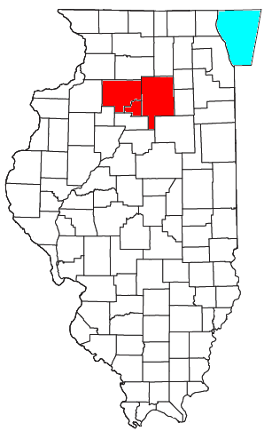
 Location of the Ottawa-Streator Micropolitan Statistical Area in Illinois
The Ottawa-Streator Micropolitan Statistical Area, as defined by the United States Census Bureau, is an area consisting of three counties in north central Illinois, anchored by the cities of Ottawa and Streator.
As of the 2000 census, the μSA had a population of 153,098 (though a July 1, 2009 estimate placed the population at 153,206).[1] It is currently the tenth-largest Micropolitan Statistical Area in the United States.
Contents
Counties
Communities
Places with more than 10,000 inhabitants
Places with 5,000 to 10,000 inhabitants
Places with 1,000 to 5,000 inhabitants
- De Pue
- Earlville
- Granville
- Ladd
- Marseilles
- Oglesby
- Seneca (partial)
- Sheridan
- Walnut
- Wenona (partial)
- Wyanet
Places with 500 to 1,000 inhabitants
Places with less than 500 inhabitants
- Mark
- McNabb
- Millington (partial)
- Mineral
- New Bedford
- Ransom
- Rutland
- Seatonville
- Somonauk (partial)
- Standard
- Troy Grove
Unincorporated places
- Baker
- Brickton
- Danway
- Florid
- Harding
- Jonesville
- Kernan
- Lake Thunderbird
- Lake Wildwood
- Lowell
- Meriden
- Missal
- Mount Palatine
- Munster
- North Ottawa
- Norway
- Peterstown
- Piety Hill
- Prairie Center
- Putnam
- Rockwell
- Rollo
- Science
- South Streator
- Stavanger
- Stoneyville
- Streator East
- Streator West
- Tomahawk Bluff
- Triumph
- Vermilionville
- Wedron
- Woodland Addition
Townships
Bureau County
LaSalle County
Putnam County
Demographics
As of the census[2] of 2000, there were 153,098 people, 60,014 households, and 41,459 families residing within the μSA. The racial makeup of the μSA was 95.50% White, 1.23% African American, 0.18% Native American, 0.52% Asian, 0.02% Pacific Islander, 1.57% from other races, and 0.99% from two or more races. Hispanic or Latino of any race were 5.01% of the population.
The median income for a household in the μSA was $42,011, and the median income for a family was $49,576. Males had a median income of $38,628 versus $21,706 for females. The per capita income for the μSA was $19,506.
See also
References
- ^ "Table 1. Annual Estimates of the Population of Metropolitan and Micropolitan Statistical Areas: April 1, 2000 to July 1, 2009 (CBSA-EST2009-01)" (CSV). 2009 Population Estimates. United States Census Bureau, Population Division. 2010-03-23. http://www.census.gov/popest/metro/tables/2009/CBSA-EST2009-01.csv. Retrieved 2010-03-26.
- ^ "American FactFinder". United States Census Bureau. http://factfinder.census.gov. Retrieved 2008-01-31.
Categories:- Ottawa-Streator micropolitan area
- Geography of LaSalle County, Illinois
- Geography of Bureau County, Illinois
- Geography of Putnam County, Illinois
Wikimedia Foundation. 2010.