- North Utica, Illinois
-
"Utica, Illinois" redirects here. For other uses, see Utica (disambiguation).
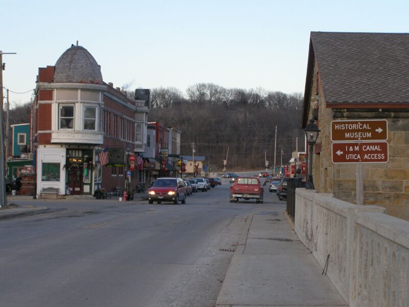
North Utica, Illinois Village 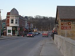 Looking north through Utica
Country United States State Illinois County LaSalle Township Utica Elevation 476 ft (145 m) Coordinates 41°20′32″N 89°0′51″W / 41.34222°N 89.01417°W Area 1.5 sq mi (4 km2) - land 1.5 sq mi (4 km2) Population 977 (2000) Density 648.6 / sq mi (250 / km2) Timezone CST (UTC-6) - summer (DST) CDT (UTC-5) Postal code 61373 Area code 815 and 779 

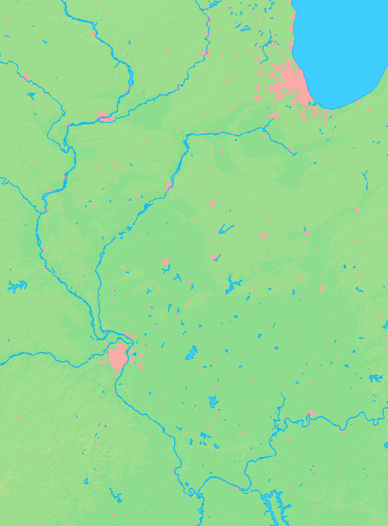
 Location of North Utica within Illinois
Wikimedia Commons: North Utica, Illinois Website: www.utica-il.gov [1] North Utica is a village in Utica Township, LaSalle County, Illinois. The population was 977 at the 2000 United States Census. It is part of the Ottawa–Streator Micropolitan Statistical Area.
While North Utica is the proper name for the city, advertising on nearby Interstates 80 and 39 refers to the village by its original name, Utica. In addition, people that live in the area, official Interstate signage, and signs indicating the city limits all refer to the town as Utica.
Contents
History
The town of Utica had previously been established on the banks of the Illinois River during the 1830s, but flooding and the construction of the Illinois and Michigan Canal a few miles north encouraged redevelopment of the village there as North Utica.
Local attractions include Grizzly Jack's Grand Bear Resort.
Utica is the location of the annual Burgoo Festival on Columbus Day weekend in October. The Burgoo Festival is a fundraising event hosted by the LaSalle County Historical Society.
Utica was the setting, as Tutter, Illinois, in the 1920s, for the Jerry Todd and Poppy Ott children's novels written by Leo Edwards.
Utica is the Hometown of famous baseball player Joe Atkins.
Utica Tornado of 2004
Main article: April 2004 Utica tornado outbreakThere were 9 fatalities during a F3 tornado on April 20, 2004, which heavily damaged the downtown business district.
Geography
North Utica is located at 41°20′32″N 89°0′51″W / 41.34222°N 89.01417°W (41.3422775, -89.0142070).[1]
According to the United States Census Bureau, the village has a total area of 1.5 sq mi (3.9 km2), all of it land.
Demographics
As of the census[2] of 2000, there were 977 people, 420 households, and 268 families residing in the village. The population density was 648.6 people per square mile (249.8/km²). There were 448 housing units at an average density of 297.4 per square mile (114.6/km²). The racial makeup of the village was 97.34% White, 0.31% African American, 0.20% Native American, 0.31% Asian, 0.61% from other races, and 1.23% from two or more races. Hispanic or Latino of any race were 2.05% of the population.
There were 420 households out of which 26.4% had children under the age of 18 living with them, 55.7% were married couples living together, 5.7% had a female householder with no husband present, and 36.0% were non-families. 31.0% of all households were made up of individuals and 12.6% had someone living alone who was 65 years of age or older. The average household size was 2.32 and the average family size was 2.93.
In the village the population was spread out with 22.1% under the age of 18, 7.2% from 18 to 24, 30.4% from 25 to 44, 25.5% from 45 to 64, and 14.8% who were 65 years of age or older. The median age was 39 years. For every 100 females there were 89.0 males. For every 100 females age 18 and over, there were 89.3 males.
The median income for a household in the village was $43,182, and the median income for a family was $54,107. Males had a median income of $37,614 versus $20,074 for females. The per capita income for the village was $23,061. About 3.7% of families and 7.2% of the population were below the poverty line, including 13.1% of those under age 18 and 4.7% of those age 65 or over.
See also
- 2004 LaSalle County, Illinois earthquake
References
External links
Municipalities and communities of LaSalle County, Illinois Cities 
Villages Cedar Point | Dalzell‡ | Dana | Grand Ridge | Kangley | Leland | Leonore | Lostant | Millington‡ | Naplate | North Utica | Ransom | Rutland | Seneca‡ | Sheridan | Somonauk‡ | Tonica | Troy Grove
Townships Adams | Allen | Brookfield | Bruce | Dayton | Deer Park | Dimmick | Eagle | Earl | Eden | Fall River | Farm Ridge | Freedom | Grand Rapids | Groveland | Hope | LaSalle | Manlius | Mendota | Meriden | Miller | Mission | Northville | Ophir | Osage | Ottawa | Otter Creek | Peru | Richland | Rutland | Serena | South Ottawa | Troy Grove | Utica | Vermilion | Wallace | Waltham
Unincorporated
communitiesAltmar | Baker | Blakes | Catharine | Danway | Dayton | Dimmick | Farm Ridge | Fitchmoor | Garfield | Harding | Hitt | Jonesville | Kernan | Lake Holiday | Leeds | Lowell | Meriden | Milla | Mount Palatine‡ | Northville | Norway | Peterstown | Piety Hill | Prairie Center | Richards | Rockwell | Science | Serena | Stavanger | Stoneyville | Sulphur Springs | Ticona | Tomahawk Bluff | Triumph | Vermilionville | Waltham | Wedron | Wilsman | Woodland Addition
Footnotes ‡This populated place also has portions in an adjacent county or counties
Categories:- Villages in Illinois
- Ottawa-Streator micropolitan area
- Populated places in LaSalle County, Illinois

Wikimedia Foundation. 2010.