- Oglesby, Illinois
-
City of Oglesby City 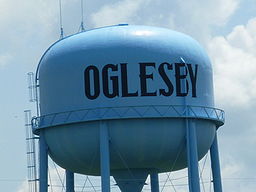 Water tower near I-39 in Oglesby, Illinois
Country United States State Illinois County LaSalle Township LaSalle Elevation 628 ft (191.4 m) Coordinates 41°17′48″N 89°03′58″W / 41.29667°N 89.06611°W Area 4 sq mi (10.4 km2) - land 4 sq mi (10 km2) - water 0 sq mi (0 km2), 0% Population 3,791 (2010) Density 911.6 / sq mi (352 / km2) Government City commission government Mayor Donald Finley Timezone CST (UTC-6) - summer (DST) CDT (UTC-5) Postal code 61348 Area code 815 
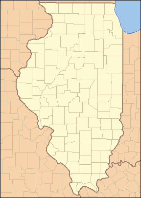
 Location of Oglesby within Illinois
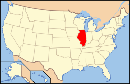 Location of Illinois in the United States
Website: www.oglesby.il.us Oglesby is a city in LaSalle County, Illinois, United States. The population was 3,791 at the 2010 census. It is part of the Ottawa–Streator Micropolitan Statistical Area.
Contents
Schools
Oglesby Lincoln, Oglesby Washington, Holy Family, and Illinois Valley Community College are located in Oglesby.
Geography
Oglesby is located at 41°17′48″N 89°3′58″W / 41.29667°N 89.06611°W (41.296762, -89.066074).[1]
According to the United States Census Bureau, the city has a total area of 4.0 square miles (10 km2), all of it land.
Natural Resources
Oglesby is located near the confluence of the Illinois River and the north-flowing Vermilion River. It was originally called "Portland", due to the cement mined and manufactured in the area that was similar to Portland Cement from England. It was renamed in honor of Richard Oglesby, a former Governor of Illinois.[citation needed]
The surface ground layers around Oglesby has excellent exposed limestone and coal, as well as riverine transport. It soon became an important center for cement manufacture. Before open-pit mining there were several subsurface cement mines:[2]
- Illinois Clay Products Mine, 1913-1924
- Reynolds Clay Mine
- Marquette Cement Mine
As well as several coal mines:
- Jones Mine, 1865-1930
- Oglesby Mine, 1865-1919
- Deer Park Mine, 1900-1920
- Black Hollow Mine, circa
Demographics
As of the census[3] of 2010, there were 3,791 people. The 2000 census showed 1,583 households, and 1,016 families residing in the city. The population density was 911.6 people per square mile (352.0/km²). There were 1,701 housing units at an average density of 425.2 per square mile (164.2/km²). According to the 2010 census The racial makeup of the city was 95.70% White, 0.37% African American, 0.13% Native American, 0.74% Asian, and Hispanic or Latino of any race were 6.52% of the population.
Census 2000 stated that there were 1,583 households out of which 27.8% had children under the age of 18 living with them, 51.6% were married couples living together, 9.0% had a female householder with no husband present, and 35.8% were non-families. 31.5% of all households were made up of individuals and 18.3% had someone living alone who was 65 years of age or older. The average household size was 2.29 and the average family size was 2.88.
In the city the population was spread out with 22.8% under the age of 18, 7.2% from 18 to 24, 28.2% from 25 to 44, 20.7% from 45 to 64, and 21.2% who were 65 years of age or older. The median age was 40 years. For every 100 females there were 91.3 males. For every 100 females age 18 and over, there were 91.2 males.
The median income for a household in the city was $35,000, and the median income for a family was $44,778. Males had a median income of $36,875 versus $20,331 for females. The per capita income for the city was $18,674. About 9.5% of families and 10.1% of the population were below the poverty line, including 14.0% of those under age 18 and 6.9% of those age 65 or over.
Titanic Survivor
Edward Arthur Dorking, 19, originally from Liss, in the East Hampshire district of Hampshire, England was one of the 705 survivors of the RMS Titanic. He boarded at Southampton as a third-class passenger traveling to join his uncle, Fred Cooke, in Oglesby, Illinois. Dorking was rescued in Collapsible B. He was quartered for a period of time at a New York hospital before making his way to Illinois, where he earned money for a time by relating his experiences in a series of public appearances, reported by the local press.
References
- ^ "US Gazetteer files: 2010, 2000, and 1990". United States Census Bureau. 2011-02-12. http://www.census.gov/geo/www/gazetteer/gazette.html. Retrieved 2011-04-23.
- ^ http://www.isgs.uiuc.edu/maps-data-pub/coal-maps/topo-mines/lasalle.pdf
- ^ "American FactFinder". United States Census Bureau. http://factfinder.census.gov. Retrieved 2008-01-31.
Municipalities and communities of LaSalle County, Illinois Cities 
Villages Cedar Point | Dalzell‡ | Dana | Grand Ridge | Kangley | Leland | Leonore | Lostant | Millington‡ | Naplate | North Utica | Ransom | Rutland | Seneca‡ | Sheridan | Somonauk‡ | Tonica | Troy Grove
Townships Adams | Allen | Brookfield | Bruce | Dayton | Deer Park | Dimmick | Eagle | Earl | Eden | Fall River | Farm Ridge | Freedom | Grand Rapids | Groveland | Hope | LaSalle | Manlius | Mendota | Meriden | Miller | Mission | Northville | Ophir | Osage | Ottawa | Otter Creek | Peru | Richland | Rutland | Serena | South Ottawa | Troy Grove | Utica | Vermilion | Wallace | Waltham
Unincorporated
communitiesAltmar | Baker | Blakes | Catharine | Danway | Dayton | Dimmick | Farm Ridge | Fitchmoor | Garfield | Harding | Hitt | Jonesville | Kernan | Lake Holiday | Leeds | Lowell | Meriden | Milla | Mount Palatine‡ | Northville | Norway | Peterstown | Piety Hill | Prairie Center | Richards | Rockwell | Science | Serena | Stavanger | Stoneyville | Sulphur Springs | Ticona | Tomahawk Bluff | Triumph | Vermilionville | Waltham | Wedron | Wilsman | Woodland Addition
Footnotes ‡This populated place also has portions in an adjacent county or counties
Categories:- Cities in Illinois
- Ottawa-Streator micropolitan area
- Populated places in LaSalle County, Illinois


Wikimedia Foundation. 2010.