- Ohio Township, Bureau County, Illinois
-
Ohio Township — Township — Location in Bureau County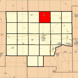 Bureau County's location in Illinois
Coordinates: 41°32′25″N 89°27′25″W / 41.54028°N 89.45694°WCoordinates: 41°32′25″N 89°27′25″W / 41.54028°N 89.45694°W Country United States State Illinois County Bureau Established November 6, 1849 Area – Total 38.02 sq mi (98.47 km2) – Land 38.01 sq mi (98.44 km2) – Water 0.01 sq mi (0.03 km2) 0.03% Elevation 840 ft (256 m) Population (2000) – Total 897 – Density 23.6/sq mi (9.1/km2) Time zone CST (UTC-6) – Summer (DST) CDT (UTC-5) ZIP codes 61328, 61330, 61349, 61356 GNIS feature ID 0429480 Ohio Township is one of twenty-five townships in Bureau County, Illinois, USA. As of the 2000 census, its population was 897[1]. Ohio Township changed its name from Richland Township in June, 1850.
Contents
Geography
According to the United States Census Bureau, Ohio Township covers an area of 38.02 square miles (98.5 km2); of this, 0.01 square miles (0.026 km2) or 0.03 percent is water.
Cities
Unincorporated towns
- Kasbeer
(This list is based on USGS data and may include former settlements.)
Cemeteries
The township contains these two cemeteries: Ohio and Union.
Major highways
Airports and landing strips
- Albrecht Airport
- Zea Mays Field
School districts
- Ohio Consolidated Grade School District 17
- Ohio Community High School District 505
Political districts
- Illinois' 11th congressional district
- State House District 74
- State Senate District 37
References
- "Ohio Township, Bureau County, Illinois". Geographic Names Information System, U.S. Geological Survey. http://geonames.usgs.gov/pls/gnispublic/f?p=gnispq:3:::NO::P3_FID:0429480. Retrieved 2010-01-04.
- United States Census Bureau 2007 TIGER/Line Shapefiles
- United States National Atlas
External links

East Grove Township, Lee County May Township, Lee County Walnut Township 
Lamoille Township  Ohio Township

Bureau Township Dover Township Berlin Township Municipalities and communities of Bureau County, Illinois Cities 
Villages Townships Unincorporated
communitiesGhost town Bourbonais
Footnotes ‡This populated place also has portions in an adjacent county or counties
Categories:- Townships in Bureau County, Illinois
- Populated places established in 1849


Wikimedia Foundation. 2010.