- Milo Township, Bureau County, Illinois
-
Milo Township — Township — Location in Bureau County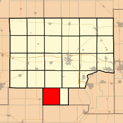 Bureau County's location in Illinois
Coordinates: 41°10′59″N 89°35′04″W / 41.18306°N 89.58444°WCoordinates: 41°10′59″N 89°35′04″W / 41.18306°N 89.58444°W Country United States State Illinois County Bureau Established November 6, 1849 Area – Total 35.02 sq mi (90.7 km2) – Land 35.01 sq mi (90.68 km2) – Water 0.01 sq mi (0.03 km2) 0.03% Elevation 846 ft (258 m) Population (2000) – Total 223 – Density 6.4/sq mi (2.5/km2) Time zone CST (UTC-6) – Summer (DST) CDT (UTC-5) ZIP codes 61314, 61368, 61421 GNIS feature ID 0429371 Milo Township is one of twenty-five townships in Bureau County, Illinois, USA. As of the 2000 census, its population was 223[1].
Contents
Geography
According to the United States Census Bureau, Milo Township covers an area of 35.02 square miles (90.7 km2); of this, 0.01 square miles (0.026 km2) or 0.03 percent is water.
Unincorporated towns
Cemeteries
The township contains these two cemeteries: Boyds Grove and Milo.
Airports and landing strips
- Rinkenberger RLA Airport
School districts
- Bradford Community Unit School District 1
Political districts
- Illinois' 18th congressional district
- State House District 73
- State Senate District 37
References
- "Milo Township, Bureau County, Illinois". Geographic Names Information System, U.S. Geological Survey. http://geonames.usgs.gov/pls/gnispublic/f?p=gnispq:3:::NO::P3_FID:0429371. Retrieved 2010-01-04.
- United States Census Bureau 2007 TIGER/Line Shapefiles
- United States National Atlas
External links

Macon Township Indiantown Township Osceola Township, Stark County 
Wheatland Township  Milo Township

Penn Township, Stark County Saratoga Township, Marshall County Whitefield Township, Marshall County Municipalities and communities of Bureau County, Illinois Cities 
Villages Townships Unincorporated
communitiesGhost town Bourbonais
Footnotes ‡This populated place also has portions in an adjacent county or counties
Categories:- Townships in Bureau County, Illinois
- Populated places established in 1849


Wikimedia Foundation. 2010.