- Clarion Township, Bureau County, Illinois
-
Clarion Township — Township — Location in Bureau County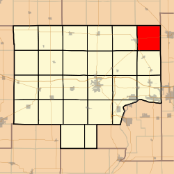 Bureau County's location in Illinois
Coordinates: 41°32′16″N 89°13′31″W / 41.53778°N 89.22528°WCoordinates: 41°32′16″N 89°13′31″W / 41.53778°N 89.22528°W Country United States State Illinois County Bureau Established November 6, 1849 Area - Total 35.34 sq mi (91.53 km2) - Land 35.34 sq mi (91.53 km2) - Water 0 sq mi (0 km2) 0% Elevation 833 ft (254 m) Population (2000) - Total 421 - Density 11.9/sq mi (4.6/km2) Time zone CST (UTC-6) - Summer (DST) CDT (UTC-5) ZIP codes 61330, 61342 GNIS feature ID 0428814 Clarion Township is one of twenty-five townships in Bureau County, Illinois, USA. As of the 2000 census, its population was 421[1].
Contents
Geography
According to the United States Census Bureau, Clarion Township covers an area of 35.34 square miles (91.5 km2).
Cities
- La Moille (east quarter)
Unincorporated towns
- Clarion
- Wendel
(This list is based on USGS data and may include former settlements.)
Cemeteries
The township contains these five cemeteries: Clarion Lutheran, Erbes, German Evangelical, Hetzler and Hill.
Major highways
 US Route 34
 Illinois Route 89
Airports and landing strips
- Ivan E Bauer Heliport
- Keutzer Airport
- Otterbach Farm Airport
School districts
- La Moille Community Unit School District 303
- Mendota Elementary District 289
- Mendota High School District 280
Political districts
- Illinois' 11th congressional district
- State House District 76
- State House District 90
- State Senate District 38
- State Senate District 45
References
- "Clarion Township, Bureau County, Illinois". Geographic Names Information System, U.S. Geological Survey. http://geonames.usgs.gov/pls/gnispublic/f?p=gnispq:3:::NO::P3_FID:0428814. Retrieved 2010-01-04.
- United States Census Bureau 2007 TIGER/Line Shapefiles
- United States National Atlas
External links

Sublette Township, Lee County Lamoille Township 
Mendota Township, LaSalle County
Troy Grove Township, LaSalle County Clarion Township

Berlin Township Westfield Township Municipalities and communities of Bureau County, Illinois County seat: Princeton Cities 
Villages Townships Unincorporated
communitiesGhost town Bourbonais
Footnotes ‡This populated place also has portions in an adjacent county or counties
Categories:- Townships in Bureau County, Illinois
- Populated places established in 1849


Wikimedia Foundation. 2010.