- National Register of Historic Places listings in Monterey County, California
-
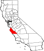
This list includes properties and districts listed on the National Register of Historic Places in Monterey County, California. Click the "Map of all coordinates" link to the right to view a Google map of all properties and districts with latitude and longitude coordinates in the table below.[1]
-
- This National Park Service list is complete through NPS recent listings posted November 10, 2011.[2]
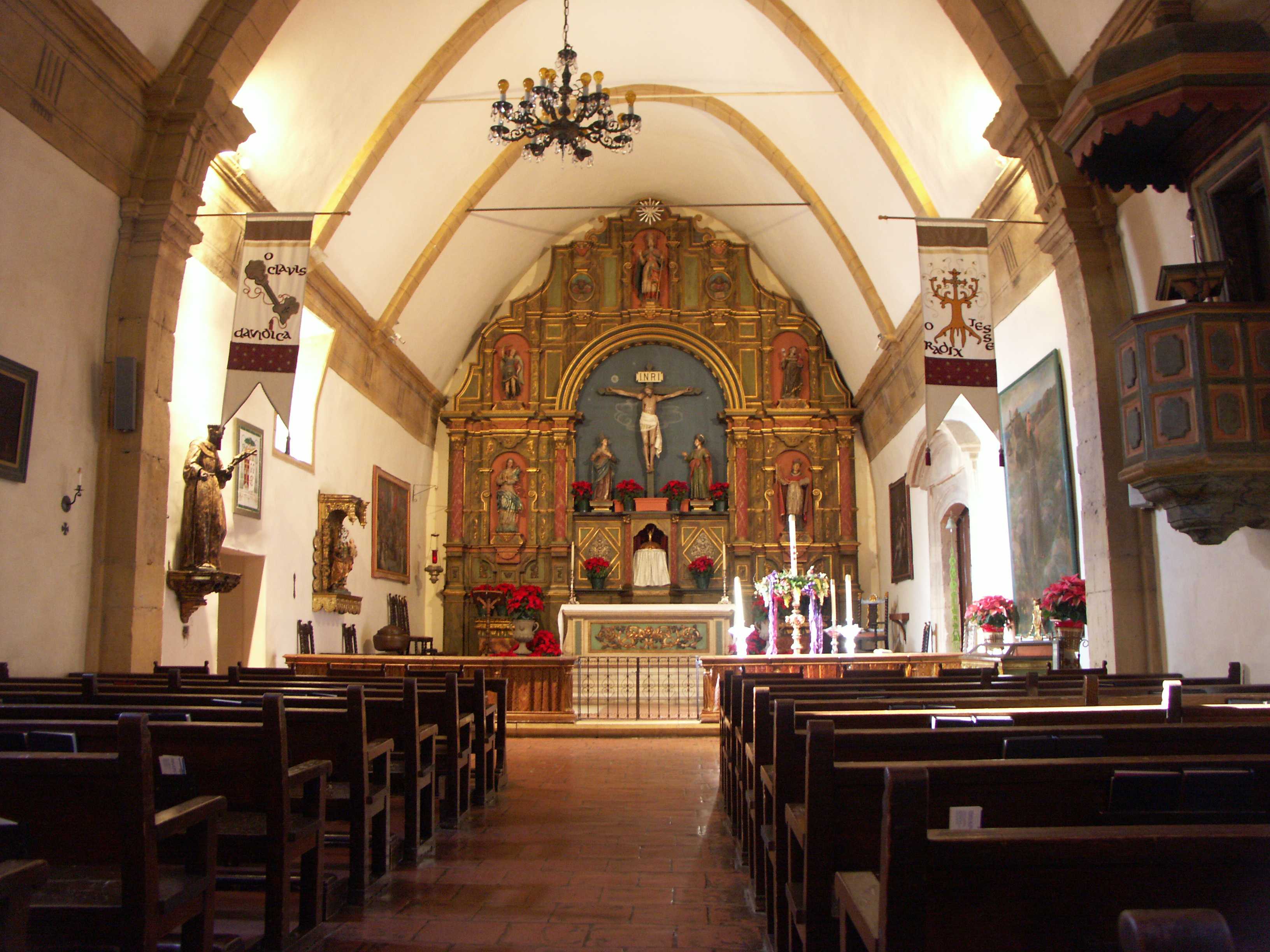
[3] Landmark name [4] Image Date listed Location City or town Summary 1 Asilomar Conference Grounds 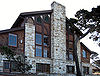
February 27, 1987 Asilomar Blvd.
36°37′11″N 121°55′53″W / 36.619722°N 121.931389°WPacific Grove 2 Berwick Manor and Orchard November 17, 1977 NW of Carmel Valley
36°31′19″N 121°48′45″W / 36.521944°N 121.8125°WCarmel Valley 3 Mary C. W. Black Studio House 
August 24, 1994 556 Abrego St.
36°35′49″N 121°53′30″W / 36.596944°N 121.891667°WMonterey 4 Samuel M. Black House September 20, 1984 418 Pajaro St.
36°40′18″N 121°39′04″W / 36.671667°N 121.651111°WSalinas 5 Peter J. Bontadelli House July 15, 1980 119 Cayuga St.
36°40′37″N 121°46′13″W / 36.676944°N 121.770278°WSalinas 6 Jose Eusebio Boronda Adobe March 20, 1973 Boronda Rd. and W. Laurel Dr.
36°42′04″N 121°40′40″W / 36.701111°N 121.677778°WSalinas 7 Frank LaVerne Buck House 
September 11, 1986 581 Pine Ave.
36°37′08″N 121°55′04″W / 36.618889°N 121.917778°WPacific Grove 8 Carmel Mission 
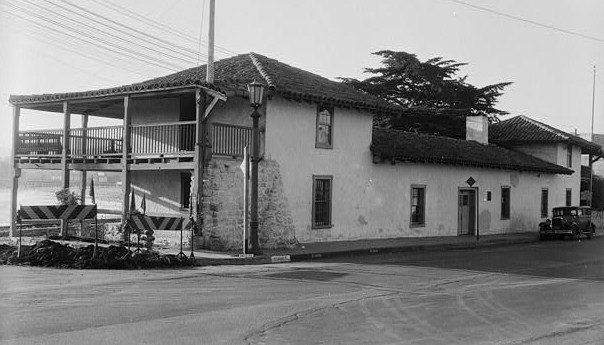
October 15, 1966 Rio Rd.
36°32′34″N 121°55′07″W / 36.542778°N 121.918611°WCarmel 9 Carmel Valley Road-Boronda Road Eucalyptus Tree Row January 10, 2008 Carmel Valley Rd. & Boronda Rd.
36°29′40″N 121°44′46″W / 36.494444°N 121.746111°WCarmel Valley 10 Castroville Japanese Language School October 10, 1995 11199 Geil St.
36°45′54″N 121°45′00″W / 36.765°N 121.75°WCastroville 11 Centrella Hotel 
October 29, 1982 612 Central Ave.
36°37′22″N 121°55′00″W / 36.622778°N 121.916667°WPacific Grove 12 Community Church of Gonzales September 15, 1983 301 4th St.
36°30′32″N 121°26′26″W / 36.508889°N 121.440556°WGonzales 13 Cueva Pintada February 13, 1975 Address Restricted King City 14 Deetjen's Big Sur Inn 
September 13, 1990 CA 1 N of Castro Cr.
36°13′03″N 121°45′01″W / 36.2175°N 121.750278°WBig Sur 15 Dutton Hotel, Stagecoach Station October 14, 1971 King City-Jolon Rd.
35°58′29″N 121°10′29″W / 35.974722°N 121.174722°WJolon 16 El Castillo November 23, 1971 West of Lighthouse Avenue, between Foam and Artillery Streets
36°36′24″N 121°53′42″W / 36.606667°N 121.895°WMonterey 17 James W. Finch House 
October 19, 1982 410 Monroe St.
36°36′04″N 121°53′59″W / 36.601111°N 121.899722°WMonterey 18 Gabilan Lodge No. 372-Independent Order of Odd Fellows October 2, 1986 117 Fourth St.
36°30′28″N 121°26′33″W / 36.507778°N 121.4425°WGonzales 19 Jose Mario Gil Adobe June 7, 1974 Hunter Liggett Military Reservation
35°57′43″N 121°11′14″W / 35.961944°N 121.187222°WJolon 20 Gosby House Inn 
December 2, 1980 643 Lighthouse Ave.
36°37′19″N 121°55′05″W / 36.621944°N 121.918056°WPacific Grove 21 Robinson Jeffers House 
October 10, 1975 26304 Ocean View Ave.
36°32′32″N 121°56′01″W / 36.542222°N 121.933611°WCarmel 22 King City Joint Union High School Auditorium 
July 23, 1991 N. Mildred Ave., northwest of the junction with Broadway St.
36°12′37″N 121°07′55″W / 36.210278°N 121.131944°WKing City 23 Kirk Creek Campground December 31, 1974 Address Restricted Lucia 24 Krough House January 18, 1982 146 Central Ave.
36°40′35″N 121°39′33″W / 36.676389°N 121.659167°WSalinas 25 Larkin House 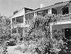
October 15, 1966 464 Calle Principale
36°35′53″N 121°53′42″W / 36.598056°N 121.895°WMonterey 26 Los Coches Rancho January 31, 1979 1 mi (1.6 km), (1.6 km) S of Soledad on U.S. 101
36°24′14″N 121°19′01″W / 36.403889°N 121.316944°WSoledad 27 G. T. Marsh and Sons 
August 8, 2007 599 Fremont St.
36°35′44″N 121°53′16″W / 36.595556°N 121.887778°WMonterey 28 Josiah Merritt Adobe 
November 22, 1977 386 Pacific St.
36°36′04″N 121°53′40″W / 36.601111°N 121.894444°WMonterey 29 Milpitas Ranchhouse 
December 2, 1977 S of King City
36°00′38″N 121°14′34″W / 36.0105°N 121.2427°WKing City 30 Monterey County Court House 
January 8, 2009 240 Church Street
36°40′25″N 121°39′30″W / 36.673611°N 121.658333°WSalinas 31 Monterey County Jail 
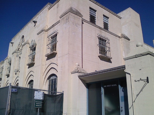
September 24, 2004 142 W. Alisal St.
36°40′24″N 121°39′34″W / 36.673333°N 121.659444°WSalinas 32 Monterey Old Town Historic District April 15, 1970 Boundary undetermined at this time
36°35′59″N 121°53′37″W / 36.599722°N 121.893611°WMonterey 33 Sheriff William Joseph Nesbitt House February 19, 1982 66 Capitol St.
36°40′37″N 121°39′35″W / 36.676944°N 121.659722°WSalinas 34 Olvida Penas April 3, 1978 1061 Majella Rd.
36°36′22″N 121°56′08″W / 36.606111°N 121.935556°WPebble Beach 35 Outlands in the Eighty Acres March 23, 1989 25800 Hatton
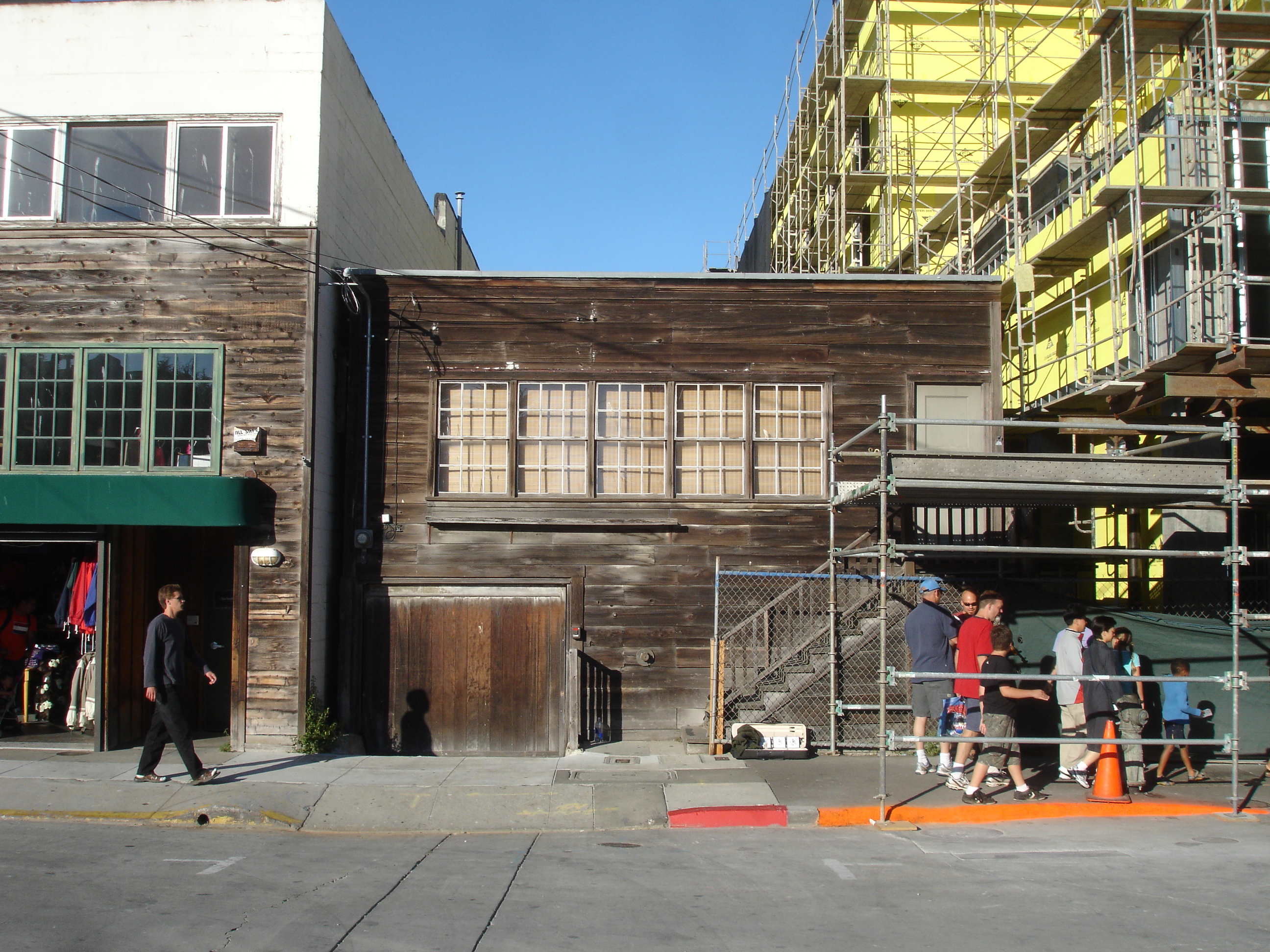
36°32′54″N 121°54′56″W / 36.548333°N 121.915556°WCarmel-by-the-Sea 36 Pacific Biological Laboratories 
December 29, 1994 800 Cannery Row
36°37′01″N 121°53′59″W / 36.616944°N 121.899722°WMonterey 37 Lou Ellen Parmelee House January 7, 1998 570 Archer St.
36°36′40″N 121°54′15″W / 36.611111°N 121.904167°WMonterey 38 Point Pinos Lighthouse 
July 14, 1977 Asilomar Blvd. and Lighthouse Ave.
36°38′00″N 121°55′57″W / 36.633333°N 121.9325°WPacific Grove 39 Point Sur Light Station 
September 3, 1991 Morro Rock on Point Sur, 0.5 mi (0.80 km). W of CA 1
36°18′18″N 121°53′55″W / 36.305°N 121.898611°WBig Sur 40 Porter-Vallejo Mansion 
January 4, 1990 29 Bishop St.
36°54′06″N 121°44′56″W / 36.901667°N 121.748889°WPajaro 41 Joseph W. Post House September 12, 1985 CA 1
36°13′44″N 121°45′47″W / 36.228889°N 121.763056°WBig Sur 42 Rancho Las Palmas November 20, 1978 S of Salinas at 200 River Rd.
36°37′16″N 121°40′11″W / 36.621111°N 121.669722°WSalinas 43 Rancho San Lucas May 6, 1991 1 3/4 mi. southwest of junction of Paris Valley Rd. and Rancho San Lucas entry road
36°02′34″N 121°00′27″W / 36.042778°N 121.0075°WSan Lucas 44 Republic Cafe July 14, 2011 37 Soledad St.
36°40′43″N 121°39′07″W / 36.678611°N 121.651944°WSalinas 45 Royal Presidio Chapel 
October 15, 1966 550 Church St.
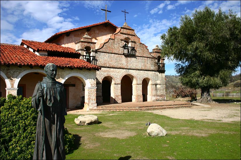
36°35′43″N 121°53′21″W / 36.595278°N 121.889167°WMonterey 46 San Antonio de Padua Mission 
April 26, 1976 NW of Jolon off Del Venturi Rd.
36°00′50″N 121°14′57″W / 36.013889°N 121.249167°WJolon 47 B. V. Sargent House 
October 20, 1980 154 Central Ave.
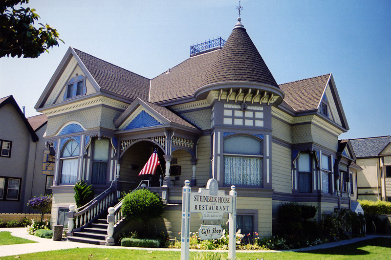
36°40′35″N 121°39′34″W / 36.676389°N 121.659444°WSalinas 48 Site Number 4 Mnt 85 October 29, 1976 Address Restricted Greenfield 49 John Steinbeck House 
August 8, 2000 132 Central Ave.
36°40′36″N 121°39′29″W / 36.676667°N 121.658056°WSalinas 50 Stevenson House 
January 7, 1972 Houston St. between Pearl and Webster Sts.
36°35′51″N 121°53′35″W / 36.5975°N 121.893056°WMonterey 51 Sunset Center January 9, 1998 San Carlos St., between 8th and 10th Sts.
36°32′54″N 121°55′16″W / 36.548333°N 121.921111°WCarmel-by-the-Sea 52 Tidball Store December 12, 1976 Jolon Rd.
35°58′23″N 121°10′28″W / 35.973056°N 121.174444°WJolon 53 Trimmer Hill 
June 28, 1982 230 6th St.
36°37′04″N 121°54′36″W / 36.617778°N 121.91°WPacific Grove 54 U.S. Customhouse 
October 15, 1966 Calle Principal at Decatur St.
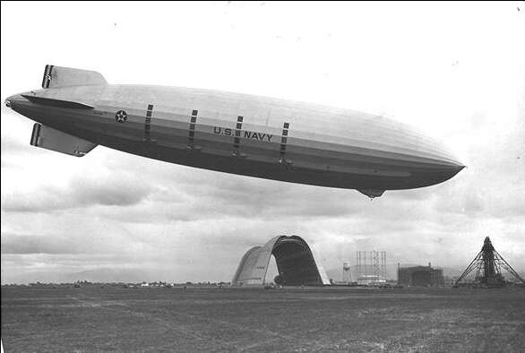
36°35′53″N 121°53′31″W / 36.598056°N 121.891944°WMonterey 55 USS Macon (airship remains) 
January 29, 2010 Address Restricted Big Sur 56 Whalers Cabin 
May 9, 2007 Pt. Lobos State Reserve, 4 mi (6.4 km). S of Carmel
36°31′07″N 121°56′01″W / 36.518611°N 121.933611°WCarmel See also
- National Register of Historic Places listings in California
- List of National Historic Landmarks in California
References
- ^ The latitude and longitude information provided in this table was derived originally from the National Register Information System, which has been found to be fairly accurate for about 99% of listings. For about 1% of NRIS original coordinates, experience has shown that one or both coordinates are typos or otherwise extremely far off; some corrections may have been made. A more subtle problem causes many locations to be off by up to 150 yards, depending on location in the country: most NRIS coordinates were derived from tracing out latitude and longitudes off of USGS topographical quadrant maps created under North American Datum of 1927, which differs from the current, highly accurate GPS system used by Google maps. Chicago is about right, but NRIS longitudes in Washington are higher by about 4.5 seconds, and are lower by about 2.0 seconds in Maine. Latitudes differ by about 1.0 second in Florida. Some locations in this table may have been corrected to current GPS standards.
- ^ "National Register of Historic Places: Weekly List Actions". National Park Service, United States Department of the Interior. Retrieved on November 10, 2011.
- ^ Numbers represent an ordering by significant words. Various colorings, defined here, differentiate National Historic Landmark sites and National Register of Historic Places Districts from other NRHP buildings, structures, sites or objects.
- ^ "National Register Information System". National Register of Historic Places. National Park Service. . http://nrhp.focus.nps.gov/natreg/docs/All_Data.html.
U.S. National Register of Historic Places Topics Lists by states Alabama • Alaska • Arizona • Arkansas • California • Colorado • Connecticut • Delaware • Florida • Georgia • Hawaii • Idaho • Illinois • Indiana • Iowa • Kansas • Kentucky • Louisiana • Maine • Maryland • Massachusetts • Michigan • Minnesota • Mississippi • Missouri • Montana • Nebraska • Nevada • New Hampshire • New Jersey • New Mexico • New York • North Carolina • North Dakota • Ohio • Oklahoma • Oregon • Pennsylvania • Rhode Island • South Carolina • South Dakota • Tennessee • Texas • Utah • Vermont • Virginia • Washington • West Virginia • Wisconsin • WyomingLists by territories Lists by associated states Other  Category:National Register of Historic Places •
  Portal:National Register of Historic Places
Municipalities and communities of Monterey County, California County seat: Salinas Cities Carmel-by-the-Sea | Del Rey Oaks | Gonzales | Greenfield | King City | Marina | Monterey | Pacific Grove | Salinas | Sand City | Seaside | Soledad
CDPs Aromas‡ | Boronda | Bradley | Carmel Valley Village | Castroville | Chualar | Del Monte Forest | Elkhorn | Las Lomas | Lockwood | Moss Landing | Pajaro | Pine Canyon | Prunedale | San Ardo | San Lucas | Spreckels
Unincorporated
communitiesAmbler Park | Blanco | Bolsa Knolls | Bryson | Camphora | Carmel Highlands | Coburn | Confederate Corners | Cooper | Corral de Tierra | Dean | Del Monte | East Garrison | Elsa | Fort Romie | Gabilan Acres | Gorda | Harlem | Jamesburg | Jolon | Lonoak | Lucia | Martinus Corner | Metz | Molus | Moss | Nacimiento | Nashua | Natividad | Neponset | Notleys Landing | Oak Hills | Old Hilltown | Pacific Grove Acres | Parkfield | Pebble Beach | Penvir | Plaskett | Pleyto | Posts | Robles Del Rio | Royal Oaks | San Benancio | Slates Hot Springs | Spence | Spreckels Junction | Sycamore Flat | Tassajara Hot Springs | Valleton | Watsonville Junction | Welby | Wunpost
Ghost towns Achasta | Animpayamo | Carmelito | Docas | Dunbarton | Eagle | Eslanagan | Fort Ord Village | Gabilan | Gem | Griswold | Guayusta | Imusdale | Kakonkaruk | Kalindaruk | Kulul | Lukaiasta | Paisin | Quina | Sans | Sapaywis | Seama | Soccorondo | Steloglamo | Subazama | Tecolom | Teshaya | Tetachoya | Tiubta | Tukutnut | Upland | Vega | Veratina | Wachanaruka | Zassalete | Zumblito
Footnotes ‡This populated place also has portions in an adjacent county
Categories:- History of Monterey County, California
- Monterey County, California
- Buildings and structures in Monterey County, California
- National Register of Historic Places in California by county
- Lists of National Register of Historic Places in California
-


Wikimedia Foundation. 2010.