- Corral de Tierra, California
-
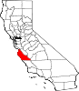
Corral de Tierra — Unincorporated community — Location in California
 Corral de Tierra
Coordinates: 36°34′12″N 121°43′57″W / 36.57°N 121.7325°WCoordinates: 36°34′12″N 121°43′57″W / 36.57°N 121.7325°W Country United States State California County Monterey County Elevation[1] 404 ft (123 m) Corral de Tierra is an unincorporated community in Monterey County, California.[1] It is located in the Corral de Tierra Valley, on the former land grant of Corral de Tierra,[2] at an elevation of 404 feet (123 m).[1]
A post office operated at Corral de Tierra from 1912 to 1931, with moves in 1918 and 1929.[2] The name is from the land grant.[2]
The first person, other than the native Indians, to wander into what is now Corral de Tierra Valley was an unnamed Spanish Corporal in 1776. He had been sent in pursuit of some Rumsen Indians who had escaped from the San Carlos Mission. In his quest he came upon the valley. In John Steinbeck’s book, The Pastures of Heaven, the Corporal is quoted as exclaiming, "Holy Mother, here are the green Pastures of Heaven to which our lord leadeth us." ….
During the Mexican Rancho era the rancheros periodically used a box canyon in the upper valley to hold some of their livestock. No trace of the corral remains today except that the present district carries on the name. The valley remained a wilderness until April 10, 1836 when Nicolas Gutierrez granted one league (4,434 acres) to Francisco Figueroa for his daughter Guadalupe. The rancho was bordered on the south by the Los Laurelos grant in 1844.
The U.S. Lands Commission finally granted the Corral de Tierra to Henry D. McCobb on January 21, 1876. The rancho lay, for the most part, outside the boundaries of the valley that bears its name, except for Calera Canyon, at its center. Closely entwined with the history of Corral de Tierra is the Rancho El Toro (5,668 acres) within which the part of the present-day Markham Ranch is situated. El Toro was granted to Jose Ramon Estrada in 1835 and patented to Charles Wolters in 1862….
There were two schools in the Valley. Washington, at about mid-valley, was established in 1873, and by 1880 had 116 students. The other school was Lincoln School at approximately the intersection of Underwood and Corral de Tierra road built in 1887. It survived for years but was recently torn down.
As time passed and the original land owners passed on or otherwise sold their land , a series of wealthy men bought up the old homesteads. Among them were Andrew Molera, David Jacks and Tom Work. In 1913, C.N. Thorup, a realtor, reacting to the possibility of oil in the Corral de Tierra area, leased 1,403 acres from the Titus and Bramers families to explore that possibility. There is no record of any economically feasible amount ever being found and the leases were allowed to expire.
Development was slow in Corral de Terra until 1959 when the founders of the Corral de Tierra Country Club purchased 120 acres from W.B. Grainger and built the clubhouse and golf course. Homer Hayward was the Club’s first president. This spurred a rush to build homes in the area. That sale and a sale by the Ferrini family of their property along the west side of Highway 68 caused a rash of development in Toro Park, San Benancio, and Corral de Tierra. These early developments soon led to approval by Monterey County of the Coral de Tierra Oaks subdivision on April 28, 1965.
Alan Pattee and the Robley family also owned considerable acreage in Corral de Tierra and it was subdivided into upscale estate lots. In the 1960s the Chamisal Country Club was developed and the area has continued to grow.
In their youth, John Steinbeck and his sister, Mary, played at the base of Castle Rock, the “fence of earth” giving Corral de Tierra its Spanish name. The beautiful valley between Monterey and Salinas, granted by Governor Guiterrez to Francisco Figueroa in 1836, inspired Steinbeck’s short stories and California-based novels. In the last half century, small neighborhoods have been built in the valleys running off the Monterey-Salinas Highway, and a sense of independent identity and community has formed among the residents in the community of Corral de Tierra, California 93908.
There are now approximately 13,500 residents in the Toro Park, San Benancio and Corral de Tierra districts.
The community of Corral de Tierra lies along Highway 68 midway between Salinas and the Monterey Peninsula. State Route (SR) 68 stretches 20 miles between Salinas and Pacific Grove. It is part of the DeAnza Trail, a route that once linked all of California’s mission settlements during the Spanish Colonial era. CalTrans had plans to turn SR 68 into a freeway in the 1950s and 1960s, but environmental concerns stopped the expansion. As of 2006, the route carried 26,000 vehicles a day. Many of these trips are generated by 13,500 residents who now live in the Toro Park, San Benancio and Corral de Tierra districts.
The corner of Corral de Tierra and Highway 68 is 10 miles from the City of Monterey and seven miles from the City of Salinas
References
Municipalities and communities of Monterey County, California Cities Carmel-by-the-Sea | Del Rey Oaks | Gonzales | Greenfield | King City | Marina | Monterey | Pacific Grove | Salinas | Sand City | Seaside | Soledad
CDPs Aromas‡ | Boronda | Bradley | Carmel Valley Village | Castroville | Chualar | Del Monte Forest | Elkhorn | Las Lomas | Lockwood | Moss Landing | Pajaro | Pine Canyon | Prunedale | San Ardo | San Lucas | Spreckels
Unincorporated
communitiesAmbler Park | Blanco | Bolsa Knolls | Bryson | Camphora | Carmel Highlands | Coburn | Confederate Corners | Cooper | Corral de Tierra | Dean | Del Monte | East Garrison | Elsa | Fort Romie | Gabilan Acres | Gorda | Harlem | Jamesburg | Jolon | Lonoak | Lucia | Martinus Corner | Metz | Molus | Moss | Nacimiento | Nashua | Natividad | Neponset | Notleys Landing | Oak Hills | Old Hilltown | Pacific Grove Acres | Parkfield | Pebble Beach | Penvir | Plaskett | Pleyto | Posts | Robles Del Rio | Royal Oaks | San Benancio | Slates Hot Springs | Spence | Spreckels Junction | Sycamore Flat | Tassajara Hot Springs | Valleton | Watsonville Junction | Welby | Wunpost
Ghost towns Achasta | Animpayamo | Carmelito | Docas | Dunbarton | Eagle | Eslanagan | Fort Ord Village | Gabilan | Gem | Griswold | Guayusta | Imusdale | Kakonkaruk | Kalindaruk | Kulul | Lukaiasta | Paisin | Quina | Sans | Sapaywis | Seama | Soccorondo | Steloglamo | Subazama | Tecolom | Teshaya | Tetachoya | Tiubta | Tukutnut | Upland | Vega | Veratina | Wachanaruka | Zassalete | Zumblito
Footnotes ‡This populated place also has portions in an adjacent county
Categories:- Populated places in Monterey County, California
- Unincorporated communities in California
- Monterey County, California geography stubs


Wikimedia Foundation. 2010.