- Boronda, California
Infobox Settlement
official_name = Boronda, California
settlement_type = CDP
imagesize =
image_caption =
image_
imagesize =
image_caption =
image_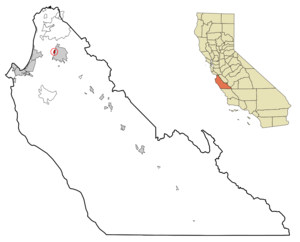
mapsize = 250x200px
map_caption = Location in Monterey County and the state ofCalifornia
mapsize1 =
map_caption1 =
subdivision_type = Country
subdivision_type1 = State
subdivision_type2 = County
subdivision_name =United States
subdivision_name1 =California
subdivision_name2 = Monterey
government_type =
leader_title = N/A
leader_name =
leader_title1 = Senate
leader_name1 =Jeff Denham (R)
leader_title2 = Assembly
leader_name2 =Anna M. Caballero (D)
leader_title3 = U. S. Congress
leader_name3 =Sam Farr (D)
established_date =
area_magnitude =
area_total_km2 = 1.5
area_total_sq_mi = 0.6
area_land_km2 = 1.5
area_land_sq_mi = 0.6
area_water_km2 = 0
area_water_sq_mi = 0
elevation_ft = 62
elevation_m = 19
population_as_of = 2000
population_footnotes =
population_total = 1325
population_metro =
population_density_km2 = 883.3
population_density_sq_mi = 2208.3
timezone = PST
utc_offset = -8
latd = 36 |latm = 41 |lats = 52 |latNS = N
longd = 121 |longm = 40 |longs = 16 |longEW = W
timezone_DST = PDT
utc_offset_DST = -7
postal_code_type =ZIP code
postal_code = 93907
area_code = 831
blank_name = FIPS code
blank_info = 06-07578
blank1_name = GNIS feature ID
blank1_info = 1853377
footnotes =
website =Boronda is a
census-designated place (CDP) in Monterey County,California ,United States . The population was 1,325 at the 2000 census.Geography
Boronda is located at coor dms|36|41|52|N|121|40|16|W|city (36.697797, -121.671204)GR|1.
According to the
United States Census Bureau , the CDP has a total area of 0.6square mile s (1.5km² ), all of it land.Demographics
As of the
census GR|2 of 2000, there were 1,325 people, 309 households, and 269 families residing in the CDP. Thepopulation density was 2,336.4 people per square mile (897.5/km²). There were 332 housing units at an average density of 585.4/sq mi (224.9/km²). The racial makeup of the CDP was 32.08% White, 1.74% Black or African American, 2.26% Native American, 9.74% Asian, 0.60% Pacific Islander, 44.08% from other races, and 9.51% from two or more races. 72.53% of the population were Hispanic or Latino of any race.There were 309 households out of which 53.1% had children under the age of 18 living with them, 63.8% were married couples living together, 13.3% had a female householder with no husband present, and 12.9% were non-families. 9.7% of all households were made up of individuals and 2.9% had someone living alone who was 65 years of age or older. The average household size was 4.27 and the average family size was 4.42.
In the CDP the population was spread out with 35.0% under the age of 18, 11.0% from 18 to 24, 29.6% from 25 to 44, 14.7% from 45 to 64, and 9.7% who were 65 years of age or older. The median age was 28 years. For every 100 females there were 109.3 males. For every 100 females age 18 and over, there were 104.5 males.
The median income for a household in the CDP was $46,797, and the median income for a family was $43,309. Males had a median income of $26,089 versus $22,692 for females. The
per capita income for the CDP was $15,365. About 7.6% of families and 10.9% of the population were below thepoverty line , including 7.6% of those under age 18 and 20.7% of those age 65 or over.Schools
Boronda currently has one active school,
Boronda Meadows Elementary. Boronda Meadows Elementary is part of theSalinas City Elementary School District and was opened in 2005. During the 2005-2006 school year, Boronda Meadows enrolled 571 students in grades K-6. Enrollment is expected to grow as development of the [http://www.borondameadows.com Boronda Meadows] housing project is completed.Boronda School, 1114 Fontes Lane, was closed at the end of the 2005 school year. Many of the students and staff were transferred to Boronda Meadows. Boronda school now houses the Salinas City Elementary School District's continuation school.
External links
* [http://www.borondameadowselementary.com Boronda Meadows Elementary]
* [http://schools.monterey.k12.ca.us/~salcity Salinas City Elementary School District]
Wikimedia Foundation. 2010.