- Carmel Valley Village, California
Infobox Settlement
official_name = Carmel Valley Village, California
settlement_type = CDP
imagesize =
image_caption =
image_
imagesize =
image_caption =
image_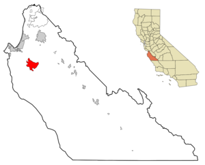
mapsize = 250x200px
map_caption = Location in Monterey County and the state ofCalifornia
mapsize1 =
map_caption1 =
subdivision_type = Country
subdivision_type1 = State
subdivision_type2 = County
subdivision_name =United States
subdivision_name1 =California
subdivision_name2 = Monterey
government_type =
leader_title = N/A
leader_name =
leader_title1 = Senate
leader_name1 =Abel Maldonado (R)
leader_title2 = Assembly
leader_name2 =John Laird (D)
leader_title3 = U. S. Congress
leader_name3 =Sam Farr (D)
established_date =
area_magnitude =
area_total_km2 = 49.4
area_total_sq_mi = 19.1
area_land_km2 = 49.4
area_land_sq_mi = 19.1
area_water_km2 = 0
area_water_sq_mi = 0
elevation_ft = 860
elevation_m = 262
population_as_of = 2000
population_footnotes =
population_total = 4700
population_metro =
population_density_km2 = 95.1
population_density_sq_mi = 246.1
timezone = PST
utc_offset = -8
latd = 36 |latm = 28 |lats = 39 |latNS = N
longd = 121 |longm = 43 |longs = 47 |longEW = W
timezone_DST = PDT
utc_offset_DST = -7
postal_code_type =ZIP code
postal_code = 93924
area_code = 831
blank_name = FIPS code
blank_info = 06-11324
blank1_name = GNIS feature ID
blank1_info = 1867002
footnotes =
website =Carmel Valley Village (also known as Carmel Valley for short) is a
census-designated place (CDP) in Monterey County,California ,United States . At the time of the 2000 census the population was 4,700.Geography
Carmel Valley Village is located at coor dms|36|28|39|N|121|43|47|W|city (36.477473, -121.729832)GR|1.
According to the
United States Census Bureau , the CDP has a total area of 19.1square mile s (49.4km² ), all of it land.Demographics
As of the
census GR|2 of 2000, there were 4,700 people, 1,963 households, and 1,279 families residing in the CDP. Thepopulation density was 246.3 people per square mile (95.1/km²). There were 2,105 housing units at an average density of 110.3/sq mi (42.6/km²). The racial makeup of the CDP was 97.15% White, 0.38% African American, 0.38% Native American, 1.13% Asian, 0.11% Pacific Islander, 2.72% from other races, and 2.06% from two or more races. Hispanic or Latino of any race were 5.81% of the population.There were 1,963 households out of which 26.6% had children under the age of 18, 54.0% were married couples living together, 7.7% had a female householder with no husband present, and 34.8% were non-families. 26.0% of all households were made up of individuals and 9.7% had someone who was 65 years of age or older. The average household size was 2.39 and the average family size was 2.86.
In the CDP the population was spread out with 20.6% under the age of 18, 4.7% from 18 to 24, 22.5% from 25 to 44, 36.2% from 45 to 64, and 16.0% who were 65 years of age or older. The median age was 46 years. For every 100 females there were 94.8 males. For every 100 females age 18 and over, there were 92.2 males.
The median income for a household in the CDP was $70,799, and the median income for a family was $85,191. Males had a median income of $56,083 versus $37,406 for females. The
per capita income for the CDP was $42,991. About 3.1% of families and 3.9% of the population were below thepoverty line , including 3.2% of those under age 18 and 5.1% of those age 65 or over.Notable sites
*The
Jamesburg Earth Station one of the world's largest tracking satellite dish antennas is located in Carmel Valley. This telecommunication facility was used byNASA during itsApollo moon landings .Notable natives
*
Leon Panetta a formerWhite House Chief of Staff toBill Clinton , former member of theUnited States House of Representatives , and the founder and director of the "Panetta Institute".External links
Wikimedia Foundation. 2010.