- Chualar, California
-
Chualar — census-designated place — Location in Monterey County and the state of California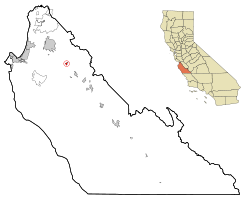
Coordinates: 36°34′14″N 121°31′07″W / 36.57056°N 121.51861°WCoordinates: 36°34′14″N 121°31′07″W / 36.57056°N 121.51861°W Country  United States
State  California
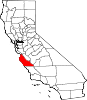
County Monterey Government – N/A – Senate Abel Maldonado (R) – Assembly Anna M. Caballero (D) – U. S. Congress Sam Farr (D) Area[1] – Total 0.626 sq mi (1.622 km2) – Land 0.626 sq mi (1.622 km2) – Water 0 sq mi (0 km2) 0% Elevation[2] 115 ft (35 m) Population (2010) – Total 1,190 – Density 1,901/sq mi (733.7/km2) Time zone PST (UTC-8) – Summer (DST) PDT (UTC-7) ZIP code 93925 Area code(s) 831 FIPS code 06-13364 GNIS feature ID 1655896 Chualar is a census-designated place (CDP) in Monterey County, California, United States. Chualar is located 10 miles (16 km) southeast of Salinas,[3] at an elevation of 115 feet (35 m).[2] The population was 1,190 at the 2010 census, down from 1,444 at the 2000 census.
Contents
Geography
Chualar is located at 36°34′14″N 121°31′07″W / 36.57056°N 121.51861°W.[2]
According to the United States Census Bureau, the CDP has a total area of 0.6 square miles (1.6 km2), all of it land.
In her Spanish and Indian Place Names of California (1914) Sanchez states that Chualar was the indigenous word for an abundant and native goosefoot. This plant could possibly be Chenopodium californicum, the California goosefoot (also known as pigweed). In his 1500 California Place Names (1998), William Bright writes that the name is Spanish for "where the chual grows," chual being Mexican Spanish for pigweed or goosefoot, and derived ultimately from Nahuatl tzoalli.
History
The Chualar post office opened in 1871, closed in 1873, and re-opened in 1874.[3]
Demographics
2010
The 2010 United States Census[4] reported that Chualar had a population of 1,190. The population density was 1,900.5 people per square mile (733.8/km²). The racial makeup of Chualar was 337 (28.3%) White, 1 (0.1%) African American, 2 (0.2%) Native American, 11 (0.9%) Asian, 0 (0.0%) Pacific Islander, 827 (69.5%) from other races, and 12 (1.0%) from two or more races. Hispanic or Latino of any race were 1,151 persons (96.7%).
The Census reported that 1,190 people (100% of the population) lived in households, 0 (0%) lived in non-institutionalized group quarters, and 0 (0%) were institutionalized.
There were 245 households, out of which 179 (73.1%) had children under the age of 18 living in them, 160 (65.3%) were opposite-sex married couples living together, 49 (20.0%) had a female householder with no husband present, 22 (9.0%) had a male householder with no wife present. There were 17 (6.9%) unmarried opposite-sex partnerships, and 4 (1.6%) same-sex married couples or partnerships. 9 households (3.7%) were made up of individuals and 5 (2.0%) had someone living alone who was 65 years of age or older. The average household size was 4.86. There were 231 families (94.3% of all households); the average family size was 4.79.
The population was spread out with 429 people (36.1%) under the age of 18, 137 people (11.5%) aged 18 to 24, 330 people (27.7%) aged 25 to 44, 235 people (19.7%) aged 45 to 64, and 59 people (5.0%) who were 65 years of age or older. The median age was 26.6 years. For every 100 females there were 103.1 males. For every 100 females age 18 and over, there were 95.1 males.
There were 251 housing units at an average density of 400.9 per square mile (154.8/km²), of which 112 (45.7%) were owner-occupied, and 133 (54.3%) were occupied by renters. The homeowner vacancy rate was 0%; the rental vacancy rate was 1.5%. 553 people (46.5% of the population) lived in owner-occupied housing units and 637 people (53.5%) lived in rental housing units.
2000
As of the census[5] of 2000, there were 1,444 people, 279 households, and 261 families residing in the CDP. The population density was 2,392.9 people per square mile (929.2/km²). There were 286 housing units at an average density of 473.9 per square mile (184.0/km²). The racial makeup of the CDP was 15.44% White, 0.42% Black or African American, 0.55% Native American, 3.19% Asian, 76.11% from other races, and 4.29% from two or more races. 93.56% of the population were Hispanic or Latino of any race.
There were 279 households out of which 71.0% had children under the age of 18 living with them, 77.4% were married couples living together, 11.8% had a female householder with no husband present, and 6.1% were non-families. 3.9% of all households were made up of individuals and 1.8% had someone living alone who was 65 years of age or older. The average household size was 5.18 and the average family size was 5.22.
In the CDP the population was spread out with 39.4% under the age of 18, 14.9% from 18 to 24, 30.2% from 25 to 44, 12.0% from 45 to 64, and 3.5% who were 65 years of age or older. The median age was 23 years. For every 100 females there were 115.5 males. For every 100 females age 18 and over, there were 115.5 males.
The median income for a household in the CDP was $43,125, and the median income for a family was $40,000. Males had a median income of $20,667 versus $19,643 for females. The per capita income for the CDP was $10,096. About 12.4% of families and 15.0% of the population were below the poverty line, including 18.9% of those under age 18 and 8.5% of those age 65 or over.
References
- ^ U.S. Census
- ^ a b c U.S. Geological Survey Geographic Names Information System: Chualar, California
- ^ a b Durham, David L. (1998). California's Geographic Names: A Gazetteer of Historic and Modern Names of the State. Quill Driver Books. p. 885. ISBN 9781884995149.
- ^ All data are derived from the United States Census Bureau reports from the 2010 United States Census, and are accessible on-line here. The data on unmarried partnerships and same-sex married couples are from the Census report DEC_10_SF1_PCT15. All other housing and population data are from Census report DEC_10_DP_DPDP1. Both reports are viewable online or downloadable in a zip file containing a comma-delimited data file. The area data, from which densities are calculated, are available on-line here. Percentage totals may not add to 100% due to rounding. The Census Bureau defines families as a household containing one or more people related to the householder by birth, opposite-sex marriage, or adoption. People living in group quarters are tabulated by the Census Bureau as neither owners nor renters. For further details, see the text files accompanying the data files containing the Census reports mentioned above.
- ^ "American FactFinder". United States Census Bureau. http://factfinder.census.gov. Retrieved 2008-01-31.
Municipalities and communities of Monterey County, California Cities Carmel-by-the-Sea | Del Rey Oaks | Gonzales | Greenfield | King City | Marina | Monterey | Pacific Grove | Salinas | Sand City | Seaside | Soledad
CDPs Aromas‡ | Boronda | Bradley | Carmel Valley Village | Castroville | Chualar | Del Monte Forest | Elkhorn | Las Lomas | Lockwood | Moss Landing | Pajaro | Pine Canyon | Prunedale | San Ardo | San Lucas | Spreckels
Unincorporated
communitiesAmbler Park | Blanco | Bolsa Knolls | Bryson | Camphora | Carmel Highlands | Coburn | Confederate Corners | Cooper | Corral de Tierra | Dean | Del Monte | East Garrison | Elsa | Fort Romie | Gabilan Acres | Gorda | Harlem | Jamesburg | Jolon | Lonoak | Lucia | Martinus Corner | Metz | Molus | Moss | Nacimiento | Nashua | Natividad | Neponset | Notleys Landing | Oak Hills | Old Hilltown | Pacific Grove Acres | Parkfield | Pebble Beach | Penvir | Plaskett | Pleyto | Posts | Robles Del Rio | Royal Oaks | San Benancio | Slates Hot Springs | Spence | Spreckels Junction | Sycamore Flat | Tassajara Hot Springs | Valleton | Watsonville Junction | Welby | Wunpost
Ghost towns Achasta | Animpayamo | Carmelito | Docas | Dunbarton | Eagle | Eslanagan | Fort Ord Village | Gabilan | Gem | Griswold | Guayusta | Imusdale | Kakonkaruk | Kalindaruk | Kulul | Lukaiasta | Paisin | Quina | Sans | Sapaywis | Seama | Soccorondo | Steloglamo | Subazama | Tecolom | Teshaya | Tetachoya | Tiubta | Tukutnut | Upland | Vega | Veratina | Wachanaruka | Zassalete | Zumblito
Footnotes ‡This populated place also has portions in an adjacent county
Categories:- Census-designated places in Monterey County, California
- Populated places in California with Hispanic majority populations


Wikimedia Foundation. 2010.