- Del Monte Forest, California
-
Del Monte Forest — census-designated place — Location in Monterey County and the state of California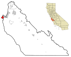
Coordinates: 36°35′11″N 121°56′51″W / 36.58639°N 121.9475°WCoordinates: 36°35′11″N 121°56′51″W / 36.58639°N 121.9475°W Country  United States
State  California
County Monterey Government – N/A – Senate Sam Blakeslee (R) – Assembly Bill Monning (D) – U. S. Congress Sam Farr (D) Area[1] – Total 10.646 sq mi (27.573 km2) – Land 8.034 sq mi (20.807 km2) – Water 2.612 sq mi (6.766 km2) 24.54% Elevation[2] 207 ft (63 m) Population (2010) – Total 4,514 – Density 424/sq mi (163.7/km2) Time zone PST (UTC-8) – Summer (DST) PDT (UTC-7) ZIP code 93953 Area code(s) 831 FIPS code 06-18590 GNIS feature ID 1867013 Del Monte Forest is a census-designated place located in Monterey County, California. As of the 2010 census, the CDP had a total population of 4,514, down from 4,532 at the 2000 census. The census area includes the separate well-known community of Pebble Beach. Alternatively Del Monte Forest is a habitat area of the same location, which originally occupied considerably more area prior to urban development of the 20th century. The forest is dominated by Monterey Pine, but also contains other important tree species and a variety of rare and endangered plant species.
Contents
Geography and ecology
Del Monte Forest is located at 36°35'11" North, 121°56'51" West.[2]
According to the United States Census Bureau, Del Monte Forest has a total area of 10.6 square miles (27 km2), of which, 8.0 square miles (21 km2) of it is land and 2.6 square miles (6.7 km2) of it is water. The total area is 24.54% water.
This location is a habitat for a number of limited range and endangered species.
Demographics
2010
The 2010 United States Census[3] reported that Del Monte Forest had a population of 4,514. The population density was 424.0 people per square mile (163.7/km²). The racial makeup of Del Monte Forest was 3,922 (86.9%) White, 43 (1.0%) African American, 10 (0.2%) Native American, 388 (8.6%) Asian, 3 (0.1%) Pacific Islander, 57 (1.3%) from other races, and 91 (2.0%) from two or more races. Hispanic or Latino of any race were 167 persons (3.7%).
The Census reported that 4,172 people (92.4% of the population) lived in households, 321 (7.1%) lived in non-institutionalized group quarters, and 21 (0.5%) were institutionalized.
There were 1,925 households, out of which 309 (16.1%) had children under the age of 18 living in them, 1,215 (63.1%) were opposite-sex married couples living together, 96 (5.0%) had a female householder with no husband present, 41 (2.1%) had a male householder with no wife present. There were 45 (2.3%) unmarried opposite-sex partnerships, and 18 (0.9%) same-sex married couples or partnerships. 468 households (24.3%) were made up of individuals and 310 (16.1%) had someone living alone who was 65 years of age or older. The average household size was 2.17. There were 1,352 families (70.2% of all households); the average family size was 2.53.
The population was spread out with 748 people (16.6%) under the age of 18, 213 people (4.7%) aged 18 to 24, 541 people (12.0%) aged 25 to 44, 1,449 people (32.1%) aged 45 to 64, and 1,563 people (34.6%) who were 65 years of age or older. The median age was 57.8 years. For every 100 females there were 92.6 males. For every 100 females age 18 and over, there were 90.0 males.
There were 2,811 housing units at an average density of 264.0 per square mile (101.9/km²), of which 1,600 (83.1%) were owner-occupied, and 325 (16.9%) were occupied by renters. The homeowner vacancy rate was 4.0%; the rental vacancy rate was 5.4%. 3,372 people (74.7% of the population) lived in owner-occupied housing units and 800 people (17.7%) lived in rental housing units.
2000
As of the census[4] of 2000, there are 4,531 people, 2,092 households, and 1,456 families residing in the CDP. The population density is 565.4 people per square mile (218.4/km²). There are 2,647 housing units at an average density of 330.3 per square mile (127.6/km²). The racial makeup of the CDP is 91.37% White, 0.40% African American, 0.26% Native American, 5.25% Asian, 0.18% Pacific Islander, 0.88% from other races, and 1.66% from two or more races. 2.34% of the population are Hispanic or Latino of any race.
There are 2,092 households out of which 14.9% have children under the age of 18 living with them, 63.7% are married couples living together, 4.7% have a female householder with no husband present, and 30.4% are non-families. 24.8% of all households are made up of individuals and 16.9% have someone living alone who is 65 years of age or older. The average household size is 2.17 and the average family size is 2.52.
The age distribution is 12.8% under the age of 18, 3.1% from 18 to 24, 12.6% from 25 to 44, 35.6% from 45 to 64, and 35.9% who are 65 years of age or older. The median age is 57 years. For every 100 females there are 86.7 males. For every 100 females age 18 and over, there are 85.4 males.
The median income for a household in the CDP is $99,788, and the median income for a family is $112,741. Males have a median income of $79,431 versus $44,707 for females. The per capita income for the CDP is $70,609. 2.3% of the population and 1.8% of families are below the poverty line. Out of the total population, 4.2% of those under the age of 18 and 2.5% of those 65 and older are living below the poverty line.
Environmental features
The Monterey Pine forest is habitat to numerous rare and endangered species including Hickman's potentilla and Yadon's piperia, both of which are federally protected species.[5]
See also
- Cypress forest
- Pebble Beach, an unincorporated community within the census-defined area.
References
- ^ U.S. Census
- ^ a b U.S. Geological Survey Geographic Names Information System: Del Monte Forest, California
- ^ All data are derived from the United States Census Bureau reports from the 2010 United States Census, and are accessible on-line here. The data on unmarried partnerships and same-sex married couples are from the Census report DEC_10_SF1_PCT15. All other housing and population data are from Census report DEC_10_DP_DPDP1. Both reports are viewable online or downloadable in a zip file containing a comma-delimited data file. The area data, from which densities are calculated, are available on-line here. Percentage totals may not add to 100% due to rounding. The Census Bureau defines families as a household containing one or more people related to the householder by birth, opposite-sex marriage, or adoption. People living in group quarters are tabulated by the Census Bureau as neither owners nor renters. For further details, see the text files accompanying the data files containing the Census reports mentioned above.
- ^ "American FactFinder". United States Census Bureau. http://factfinder.census.gov. Retrieved 2008-01-31.
- ^ C. Michael Hogan and Michael P. Frankis. 2009. Monterey Cypress: Cupressus macrocarpa, GlobalTwitcher.com ed. N. Stromberg
External links
Municipalities and communities of Monterey County, California Cities Carmel-by-the-Sea | Del Rey Oaks | Gonzales | Greenfield | King City | Marina | Monterey | Pacific Grove | Salinas | Sand City | Seaside | Soledad
CDPs Aromas‡ | Boronda | Bradley | Carmel Valley Village | Castroville | Chualar | Del Monte Forest | Elkhorn | Las Lomas | Lockwood | Moss Landing | Pajaro | Pine Canyon | Prunedale | San Ardo | San Lucas | Spreckels
Unincorporated
communitiesAmbler Park | Blanco | Bolsa Knolls | Bryson | Camphora | Carmel Highlands | Coburn | Confederate Corners | Cooper | Corral de Tierra | Dean | Del Monte | East Garrison | Elsa | Fort Romie | Gabilan Acres | Gorda | Harlem | Jamesburg | Jolon | Lonoak | Lucia | Martinus Corner | Metz | Molus | Moss | Nacimiento | Nashua | Natividad | Neponset | Notleys Landing | Oak Hills | Old Hilltown | Pacific Grove Acres | Parkfield | Pebble Beach | Penvir | Plaskett | Pleyto | Posts | Robles Del Rio | Royal Oaks | San Benancio | Slates Hot Springs | Spence | Spreckels Junction | Sycamore Flat | Tassajara Hot Springs | Valleton | Watsonville Junction | Welby | Wunpost
Ghost towns Achasta | Animpayamo | Carmelito | Docas | Dunbarton | Eagle | Eslanagan | Fort Ord Village | Gabilan | Gem | Griswold | Guayusta | Imusdale | Kakonkaruk | Kalindaruk | Kulul | Lukaiasta | Paisin | Quina | Sans | Sapaywis | Seama | Soccorondo | Steloglamo | Subazama | Tecolom | Teshaya | Tetachoya | Tiubta | Tukutnut | Upland | Vega | Veratina | Wachanaruka | Zassalete | Zumblito
Footnotes ‡This populated place also has portions in an adjacent county
Categories:- Census-designated places in Monterey County, California


Wikimedia Foundation. 2010.