- National Register of Historic Places listings in Rankin County, Mississippi
-
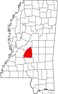 Location of Rankin County in Mississippi
This is a list of the National Register of Historic Places listings in Rankin County, Mississippi.
This is intended to be a complete list of the properties and districts on the National Register of Historic Places in Rankin County, Mississippi, United States. Latitude and longitude coordinates are provided for many National Register properties and districts; these locations may be seen together in a Google map.[1]
There are 14 properties and districts listed on the National Register in the county.
-
- This National Park Service list is complete through NPS recent listings posted November 10, 2011.[2]
Current listings
[3] Landmark name [4] Image Date listed Location City or town Summary 1 Armstrong Site (22RA576) February 2, 1987 Address Restricted Goshen Springs 2 Brandon Cemetery November 18, 2010 Corner of Old Depot Rd. and Mississippi Highway 471 Extension
32°16′33″N 89°59′31″W / 32.275833°N 89.991944°WBrandon 3 Byram Bridge May 23, 1979 Old Byram and Florence Rd.
32°10′35″N 90°14′37″W / 32.176389°N 90.243611°WFrenchs Store Extends into Hinds County 4 Cocke-Martin-Jackson House August 1, 1997 107 Pleasant St.
32°16′18″N 89°58′51″W / 32.271667°N 89.980833°WBrandon 5 Downtown Brandon Historic District November 18, 2010 East and West Government Sts. from Timber St. to College St., 100 blocks of North College St. and Black St.
32°16′23″N 89°59′16″W / 32.273056°N 89.987778°WBrandon 6 Hebron Academy May 5, 1978 South of Brandon on Mississippi Highway 18
32°13′49″N 89°56′36″W / 32.230278°N 89.943333°WBrandon 7 Misterfeldt Home Place December 18, 1986 1101 Old U.S. Route 49, S.
32°12′57″N 90°09′52″W / 32.215833°N 90.164444°WRichland 8 Pearl Street Historic District August 1, 1997 200-204 Pearl St.
32°16′32″N 89°59′26″W / 32.275556°N 89.990556°WBrandon 9 Rankin County Confederate Monument August 1, 1997 Junction of Government and North Sts.
32°16′33″N 89°59′12″W / 32.275833°N 89.986667°WBrandon 10 Rankin County Courthouse August 1, 1997 301 Town Sq.
32°16′24″N 89°59′11″W / 32.273333°N 89.986389°WBrandon 11 South College Street Historic District March 5, 1998 625-713 S. College St.
32°15′23″N 89°59′21″W / 32.256389°N 89.989167°WBrandon 12 Stevens-Buchanan House May 5, 1978 505 College St.
32°16′07″N 89°59′20″W / 32.268611°N 89.988889°WBrandon 13 Turcotte House June 4, 1987 Southeast of Brandon on Mississippi Highway 17
32°11′00″N 89°54′58″W / 32.183333°N 89.916111°WBrandon 14 Woodrow Wilson Bridge November 16, 1988 Spans the Pearl River on Silas Brown St.
32°17′22″N 90°10′44″W / 32.289444°N 90.178889°WJackson Extends into Hinds County See also
- List of National Historic Landmarks in Mississippi
- National Register of Historic Places listings in Mississippi
References
- ^ The latitude and longitude information provided in this table was derived originally from the National Register Information System, which has been found to be fairly accurate for about 99% of listings. For about 1% of NRIS original coordinates, experience has shown that one or both coordinates are typos or otherwise extremely far off; some corrections may have been made. A more subtle problem causes many locations to be off by up to 150 yards, depending on location in the country: most NRIS coordinates were derived from tracing out latitude and longitudes off of USGS topographical quadrant maps created under North American Datum of 1927, which differs from the current, highly accurate GPS system used by Google maps. Chicago is about right, but NRIS longitudes in Washington are higher by about 4.5 seconds, and are lower by about 2.0 seconds in Maine. Latitudes differ by about 1.0 second in Florida. Some locations in this table may have been corrected to current GPS standards.
- ^ "National Register of Historic Places: Weekly List Actions". National Park Service, United States Department of the Interior. Retrieved on November 10, 2011.
- ^ Numbers represent an ordering by significant words. Various colorings, defined here, differentiate National Historic Landmark sites and National Register of Historic Places Districts from other NRHP buildings, structures, sites or objects.
- ^ "National Register Information System". National Register of Historic Places. National Park Service. . http://nrhp.focus.nps.gov/natreg/docs/All_Data.html.
U.S. National Register of Historic Places Topics Lists by states Alabama • Alaska • Arizona • Arkansas • California • Colorado • Connecticut • Delaware • Florida • Georgia • Hawaii • Idaho • Illinois • Indiana • Iowa • Kansas • Kentucky • Louisiana • Maine • Maryland • Massachusetts • Michigan • Minnesota • Mississippi • Missouri • Montana • Nebraska • Nevada • New Hampshire • New Jersey • New Mexico • New York • North Carolina • North Dakota • Ohio • Oklahoma • Oregon • Pennsylvania • Rhode Island • South Carolina • South Dakota • Tennessee • Texas • Utah • Vermont • Virginia • Washington • West Virginia • Wisconsin • WyomingLists by territories Lists by associated states Other  Category:National Register of Historic Places •
  Portal:National Register of Historic Places
Municipalities and communities of Rankin County, Mississippi County seat: Brandon Cities 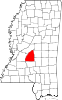
Towns Village Communities Cleary | Cross Roads | Fannin | Goshen Springs | Greenfield | Gulde | Johns | Koch | Langford | Leesburg | Monterey | Piney Woods | Pisgah | Rankin | Sandhill | Star | Whitfield
Footnotes ‡This populated place also has portions in an adjacent county or counties
Categories:- Rankin County, Mississippi
- National Register of Historic Places in Mississippi by county
- Buildings and structures in Rankin County, Mississippi
-

Wikimedia Foundation. 2010.