| [3] |
Landmark name[4] |
Image |
Date listed |
Location |
City or Town |
Summary |
| 1 |
Alexander State Forest Headquarters Building |
|
01987-05-21 May 21, 1987 |
Alexander State Forest
31°8′28″N 92°28′29″W / 31.14111°N 92.47472°W / 31.14111; -92.47472 (Alexander State Forest Headquarters Building) |
Woodworth |
|
| 2 |
Alexandria Garden District |
|
02001-04-09 April 9, 2001 |
Roughly bounded by Marye St., Bolton Ave., White St., and Bayou Hynson
31°17′59″N 92°27′32″W / 31.29972°N 92.45889°W / 31.29972; -92.45889 (Alexandria Garden District) |
Alexandria |
|
| 3 |
Alexandria Hall-Louisiana College |
 |
01986-05-15 May 15, 1986 |
Louisiana College
31°19′31″N 92°25′36″W / 31.32528°N 92.42667°W / 31.32528; -92.42667 (Alexandria Hall-Louisiana College) |
Pineville |
|
| 4 |
Alexandria National Cemetery |
 |
01997-07-09 July 9, 1997 |
209 Shamrock Ave.
31°19′19″N 92°26′34″W / 31.32194°N 92.44278°W / 31.32194; -92.44278 (Alexandria National Cemetery) |
Pineville |
|
| 5 |
Bailey's Dam Site |
 |
01976-06-29 June 29, 1976 |
Red River south of U.S. Route 71
31°19′32″N 92°27′7″W / 31.32556°N 92.45194°W / 31.32556; -92.45194 (Bailey's Dam Site) |
Alexandria |
|
| 6 |
Bayouside |
|
01980-03-26 March 26, 1980 |
North of McNutt off Louisiana Highway 121
31°18′48″N 92°38′38″W / 31.31333°N 92.64389°W / 31.31333; -92.64389 (Bayouside) |
McNutt |
|
| 7 |
Bennett Plantation House |
|
01979-05-14 May 14, 1979 |
6291 Old Baton Rouge Highway
31°13′16″N 92°25′11″W / 31.22111°N 92.41972°W / 31.22111; -92.41972 (Bennett Plantation House) |
Alexandria |
|
| 8 |
Bentley Hotel |
 |
01979-11-15 November 15, 1979 |
801 3rd St.
31°18′43″N 92°26′42″W / 31.31194°N 92.445°W / 31.31194; -92.445 (Bentley Hotel) |
Alexandria |
|
| 9 |
Blanchard House |
|
01982-07-22 July 22, 1982 |
West of Boyce on Bayou Jean de Jean
31°22′57″N 92°42′4″W / 31.3825°N 92.70111°W / 31.3825; -92.70111 (Blanchard House) |
Boyce |
|
| 10 |
Bland House |
|
01985-10-17 October 17, 1985 |
330 Saint James St.
31°18′32″N 92°26′33″W / 31.30889°N 92.4425°W / 31.30889; -92.4425 (Bland House) |
Alexandria |
|
| 11 |
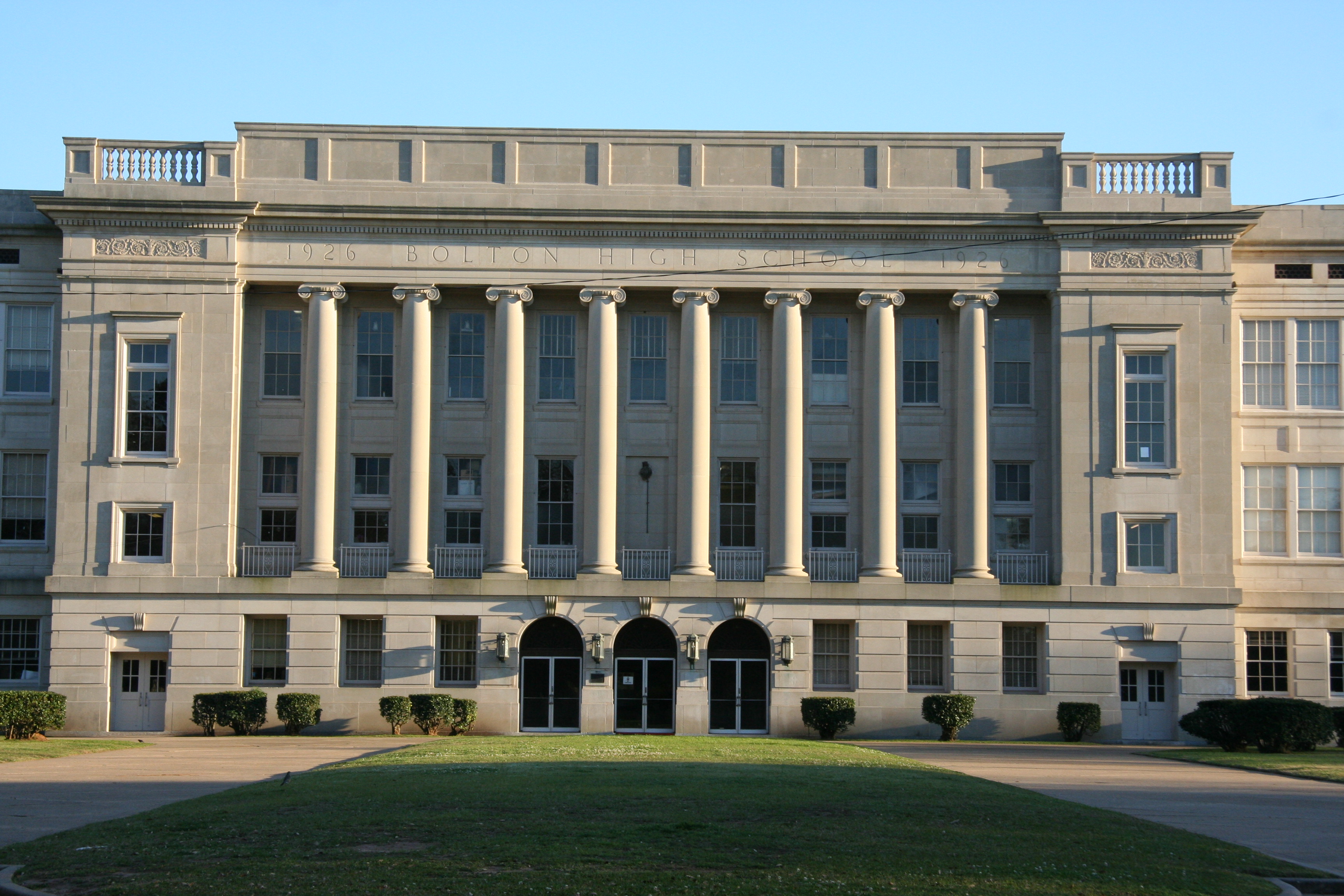
Bolton High School |
 |
01984-01-09 January 9, 1984 |
2101 Vance Ave.
31°17′36″N 92°27′20″W / 31.29333°N 92.45556°W / 31.29333; -92.45556 (Bolton High School) |
Alexandria |
|
| 12 |
James Wade Bolton House |
|
01979-11-15 November 15, 1979 |
1330 Main St.
31°18′35″N 92°26′31″W / 31.30972°N 92.44194°W / 31.30972; -92.44194 (Bolton, James Wade, House) |
Alexandria |
|
| 13 |
Arna Wendell Bontemps House |
|
01993-09-13 September 13, 1993 |
1327 3rd St.
31°18′34″N 92°26′34″W / 31.30944°N 92.44278°W / 31.30944; -92.44278 (Bontemps, Arna Wendell, House) |
Alexandria |
|
| 14 |
Britt Place |
|
01980-11-21 November 21, 1980 |
East of Glenmora on Lake Cocodrie Rd.
30°58′5″N 92°33′47″W / 30.96806°N 92.56306°W / 30.96806; -92.56306 (Britt Place) |
Glenmora |
|
| 15 |
Carnahan House |
|
01995-04-07 April 7, 1995 |
212 Ulster Ave.
31°23′29″N 92°40′8″W / 31.39139°N 92.66889°W / 31.39139; -92.66889 (Carnahan House) |
Boyce |
|
| 16 |
Central Louisiana State Hospital Dairy Barn |
|
01986-05-15 May 15, 1986 |
U.S. Route 165
31°20′1″N 92°26′27″W / 31.33361°N 92.44083°W / 31.33361; -92.44083 (Central Louisiana State Hospital Dairy Barn) |
Pineville |
|
| 17 |
China Grove |
|
01984-12-05 December 5, 1984 |
Louisiana Highway 496
31°18′48″N 92°38′6″W / 31.31333°N 92.635°W / 31.31333; -92.635 (China Grove) |
Gardner |
|
| 18 |
Commercial Building |
|
01978-11-29 November 29, 1978 |
3rd and Johnston Sts.
31°18′38″N 92°26′37″W / 31.31056°N 92.44361°W / 31.31056; -92.44361 (Commercial Building) |
Alexandria |
|
| 19 |
Conerly House |
|
01984-12-05 December 5, 1984 |
Off U.S. Route 71
31°18′46″N 92°27′58″W / 31.31278°N 92.46611°W / 31.31278; -92.46611 (Conerly House) |
Alexandria |
|
| 20 |
Cook House |
|
01979-11-15 November 15, 1979 |
222 Florence Ave.
31°18′24″N 92°27′39″W / 31.30667°N 92.46083°W / 31.30667; -92.46083 (Cook House) |
Alexandria |
|
| 21 |
Cottingham House |
|
01987-09-08 September 8, 1987 |
1403 College Dr.
31°19′41″N 92°25′32″W / 31.32806°N 92.42556°W / 31.32806; -92.42556 (Cottingham House) |
Pineville |
|
| 22 |
Crowell Sawmill Historic District |
|
01993-02-11 February 11, 1993 |
11789 U.S. Route 165, S.
31°0′18″N 92°33′33″W / 31.005°N 92.55917°W / 31.005; -92.55917 (Crowell Sawmill Historic District) |
Long Leaf |
|
| 23 |
Eden |
|
01984-12-05 December 5, 1984 |
Off Louisiana Highway 121
31°19′53″N 92°40′42″W / 31.33139°N 92.67833°W / 31.33139; -92.67833 (Eden) |
Gardner |
|
| 24 |
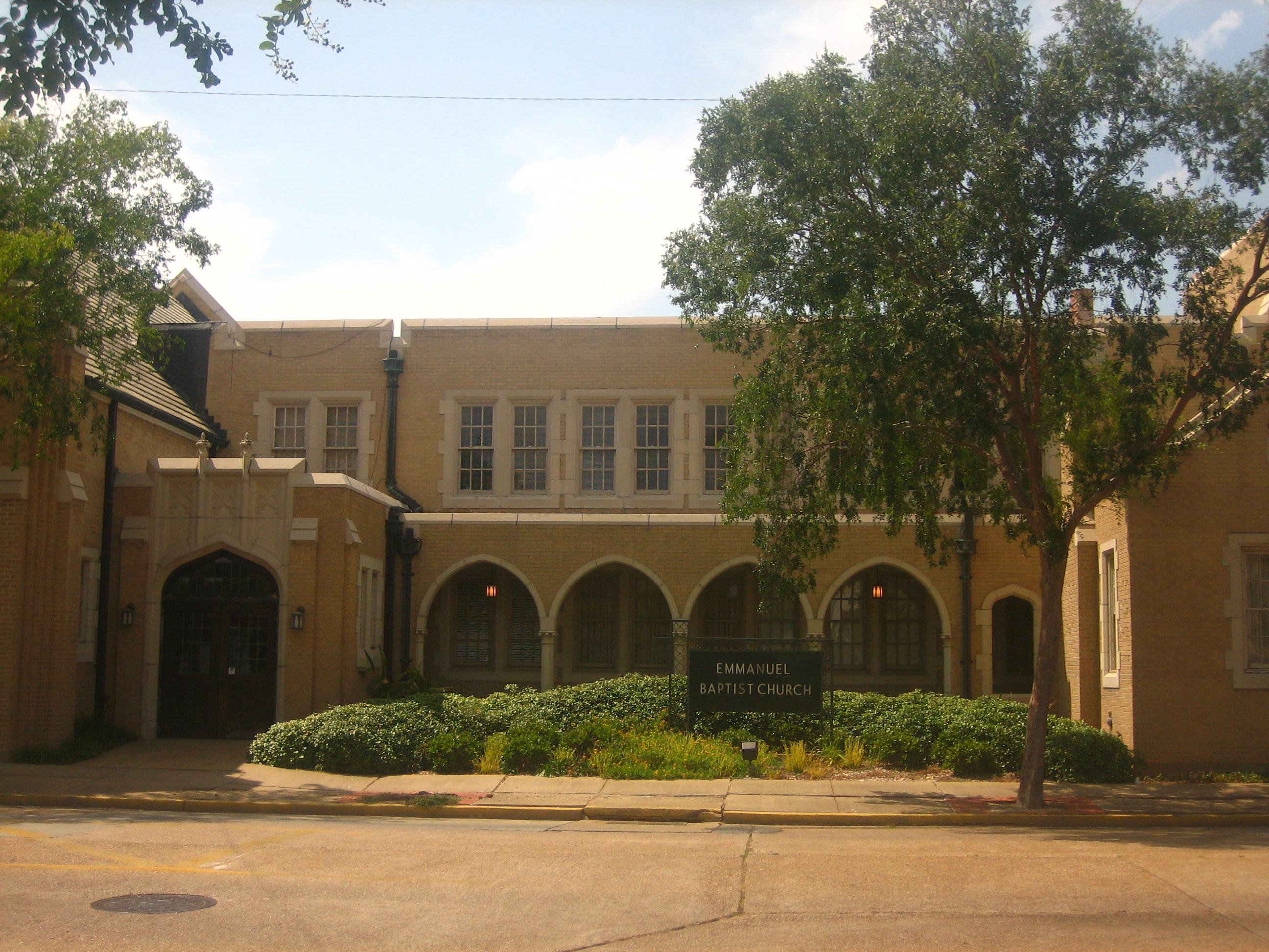
Emmanuel Baptist Church |
 |
02001-11-21 November 21, 2001 |
430 Jackson St.
31°18′42″N 92°26′50″W / 31.31167°N 92.44722°W / 31.31167; -92.44722 (Emmanuel Baptist Church) |
Alexandria |
|
| 25 |
First Methodist Church |
|
01980-06-06 June 6, 1980 |
630 Jackson St.
31°18′37″N 92°26′54″W / 31.31028°N 92.44833°W / 31.31028; -92.44833 (First Methodist Church) |
Alexandria |
|
| 26 |
Fort Buhlow |
|
01981-06-01 June 1, 1981 |
Off U.S. Route 165
31°19′7″N 92°26′56″W / 31.31861°N 92.44889°W / 31.31861; -92.44889 (Fort Buhlow) |
Pineville |
|
| 27 |
Fort Randolph |
|
01981-06-01 June 1, 1981 |
Off U.S. Route 165
31°18′53″N 92°26′54″W / 31.31472°N 92.44833°W / 31.31472; -92.44833 (Fort Randolph) |
Pineville |
|
| 28 |
Geneva |
|
01984-12-05 December 5, 1984 |
Louisiana Highway 496
31°18′50″N 92°30′48″W / 31.31389°N 92.51333°W / 31.31389; -92.51333 (Geneva) |
Alexandria |
|
| 29 |
Hemenway Furniture Co. Building |
|
01983-10-04 October 4, 1983 |
3rd and Jackson Sts.
31°18′44″N 92°26′46″W / 31.31222°N 92.44611°W / 31.31222; -92.44611 (Hemenway Furniture Co. Building) |
Alexandria |
|
| 30 |
Mayer Hirsch House |
|
01979-07-26 July 26, 1979 |
1216 Jackson St.
31°18′30″N 92°44′6″W / 31.30833°N 92.735°W / 31.30833; -92.735 (Hirsch, Mayer, House) |
Alexandria |
|
| 31 |
Hope |
|
01984-12-13 December 13, 1984 |
Off Louisiana Highway 121 and Mill Race Rd.
31°18′43″N 92°39′5″W / 31.31194°N 92.65139°W / 31.31194; -92.65139 (Hope) |
Gardner |
|
| 32 |
Hopson House |
|
01984-12-05 December 5, 1984 |
Brown's Bend Rd.
31°19′1″N 92°29′47″W / 31.31694°N 92.49639°W / 31.31694; -92.49639 (Hopson House) |
Alexandria |
|
| 33 |
Inglewood Plantation Historic District |
|
01988-01-14 January 14, 1988 |
Off U.S. Route 71
31°13′43″N 92°25′12″W / 31.22861°N 92.42°W / 31.22861; -92.42 (Inglewood Plantation Historic District) |
Alexandria |
|
| 34 |
Island Home |
|
01984-12-05 December 5, 1984 |
Across Bayou Rapides off Louisiana Highway 121
31°19′49″N 92°40′35″W / 31.33028°N 92.67639°W / 31.33028; -92.67639 (Island Home) |
Gardner |
|
| 35 |
Wade H. Jones, Sr., House |
|
01987-08-27 August 27, 1987 |
Meeker Rd.
31°3′17″N 92°23′6″W / 31.05472°N 92.385°W / 31.05472; -92.385 (Jones, Wade H., Sr., House) |
Meeker |
|
| 36 |
Kent Plantation House |
|
01971-08-05 August 5, 1971 |
West of Alexandria on Bayou Rapides at Virginia Ave.
31°18′11″N 92°28′58″W / 31.30306°N 92.48278°W / 31.30306; -92.48278 (Kent Plantation House) |
Alexandria |
|
| 37 |
Lamourie Lock |
|
01994-10-14 October 14, 1994 |
Junction of Lamourie Rd. and U.S. Route 71
31°7′46″N 92°24′24″W / 31.12944°N 92.40667°W / 31.12944; -92.40667 (Lamourie Lock) |
Lecompte |
|
| 38 |
Lecompte High School |
|
01992-09-22 September 22, 1992 |
1610 Charter St.
31°5′23″N 92°24′12″W / 31.08972°N 92.40333°W / 31.08972; -92.40333 (Lecompte High School) |
Lecompte |
|
| 39 |
Longview |
|
01984-12-05 December 5, 1984 |
Across Bayou Rapides from Louisiana Highway 121 near its intersection with Louisiana Highway 1200
31°19′44″N 92°40′40″W / 31.32889°N 92.67778°W / 31.32889; -92.67778 (Longview) |
Gardner |
|
| 40 |
Loyd Hall Plantation |
|
01977-04-29 April 29, 1977 |
Northwest of Cheneyville on Loyd Bridge Rd.
31°2′4″N 92°21′18″W / 31.03444°N 92.355°W / 31.03444; -92.355 (Loyd Hall Plantation) |
Cheneyville |
|
| 41 |
Masonic Building |
|
01986-01-16 January 16, 1986 |
4th and Johnston Sts.
31°18′36″N 92°26′42″W / 31.31°N 92.445°W / 31.31; -92.445 (Masonic Building) |
Alexandria |
|
| 42 |
Masonic Home for Children |
|
01987-11-20 November 20, 1987 |
2145 Horseshoe Dr.
31°15′34″N 92°28′41″W / 31.25944°N 92.47806°W / 31.25944; -92.47806 (Masonic Home for Children) |
Alexandria |
|
| 43 |
Dr. Robert E. McGill House |
|
02000-06-02 June 2, 2000 |
2704 Hill St.
31°17′35″N 92°27′49″W / 31.29306°N 92.46361°W / 31.29306; -92.46361 (McGill, Dr. Robert E., House) |
Alexandria |
|
| 44 |
McNutt Rural Historic District |
|
01988-09-15 September 15, 1988 |
Belgard Bend Rd. and Louisiana Highway 121
31°18′44″N 92°38′40″W / 31.31222°N 92.64444°W / 31.31222; -92.64444 (McNutt Rural Historic District) |
McNutt |
|
| 45 |
McNutt School |
|
01997-09-26 September 26, 1997 |
720 Millrace Rd.
31°18′23″N 92°39′30″W / 31.30639°N 92.65833°W / 31.30639; -92.65833 (McNutt School) |
Boyce |
|
| 46 |
Meeker Sugar Refinery |
|
01987-11-16 November 16, 1987 |
U.S. Route 71
31°3′30″N 92°22′43″W / 31.05833°N 92.37861°W / 31.05833; -92.37861 (Meeker Sugar Refinery) |
Meeker |
|
| 47 |
Melady House |
|
01996-02-23 February 23, 1996 |
5800 England Dr.
31°19′53″N 92°30′40″W / 31.33139°N 92.51111°W / 31.33139; -92.51111 (Melady House) |
Alexandria |
|
| 48 |
Mt. Olivet Episcopal Church and Cemetery |
 |
02000-06-22 June 22, 2000 |
335 Main St.
31°19′5″N 92°26′22″W / 31.31806°N 92.43944°W / 31.31806; -92.43944 (Mt. Olivet Episcopal Church and Cemetery) |
Pineville |
|
| 49 |
Old Alexandria Public Library |
 |
01989-01-19 January 19, 1989 |
503 Washington St.
31°18′31″N 92°26′43″W / 31.30861°N 92.44528°W / 31.30861; -92.44528 (Old Alexandria Public Library) |
Alexandria |
|
| 50 |
Old LSU Site |
|
01973-08-14 August 14, 1973 |
North of Pineville at 2500 Shreveport Highway
31°21′31″N 92°26′14″W / 31.35861°N 92.43722°W / 31.35861; -92.43722 (Old LSU Site) |
Pineville |
|
| 51 |
Senator John H. Overton House |
|
01985-07-18 July 18, 1985 |
1128 8th St.
31°18′25″N 92°26′44″W / 31.30694°N 92.44556°W / 31.30694; -92.44556 (Overton, Senator John H., House) |
Alexandria |
|
| 52 |
Oxland |
|
01984-12-05 December 5, 1984 |
Louisiana Highway 1202
31°19′35″N 92°34′35″W / 31.32639°N 92.57639°W / 31.32639; -92.57639 (Oxland) |
Alexandria |
|
| 53 |
Pegram Plantation House |
|
02003-10-24 October 24, 2003 |
881 Chickamaw Rd.
31°5′55″N 92°25′46″W / 31.09861°N 92.42944°W / 31.09861; -92.42944 (Pegram Plantation House) |
Lecompte |
|
| 54 |
Rapides Bank and Trust Company Building |
 |
01980-05-15 May 15, 1980 |
933 Main St.
31°18′43″N 92°26′39″W / 31.31194°N 92.44417°W / 31.31194; -92.44417 (Rapides Bank and Trust Company Building) |
Alexandria |
|
| 55 |
Rapides Cemetery |
|
01979-06-15 June 15, 1979 |
Hardtner and Main Sts.
31°19′0″N 92°26′30″W / 31.316667°N 92.44167°W / 31.316667; -92.44167 (Rapides Cemetery) |
Pineville |
|
| 56 |
Rapides Lumber Company Sawmill Manager's House |
|
01990-11-26 November 26, 1990 |
Junction of U.S. Route 165 and Castor Plunge Rd.
31°8′49″N 92°29′51″W / 31.14694°N 92.4975°W / 31.14694; -92.4975 (Rapides Lumber Company Sawmill Manager's House) |
Woodworth |
|
| 57 |
Rapides Opera House |
|
01981-06-11 June 11, 1981 |
1125 3rd St.
31°18′38″N 92°26′36″W / 31.31056°N 92.44333°W / 31.31056; -92.44333 (Rapides Opera House) |
Alexandria |
|
| 58 |
Rosalie Plantation Sugar Mill |
|
01976-01-02 January 2, 1976 |
South of Alexandria off U.S. Route 71
31°12′7″N 92°24′41″W / 31.20194°N 92.41139°W / 31.20194; -92.41139 (Rosalie Plantation Sugar Mill) |
Alexandria |
|
| 59 |
Rose Cottage |
|
01983-09-15 September 15, 1983 |
Azalea St.
31°19′51″N 92°26′16″W / 31.33083°N 92.43778°W / 31.33083; -92.43778 (Rose Cottage) |
Pineville |
|
| 60 |
Rugg Elementary School |
|
02001-08-10 August 10, 2001 |
1319 Bush Ave.
31°17′42″N 92°27′46″W / 31.295°N 92.46278°W / 31.295; -92.46278 (Rugg Elementary School) |
Alexandria |
|
| 61 |
C.A. Schnack Jewelry Company Store |
|
02000-06-30 June 30, 2000 |
924 3rd St.
31°18′40″N 92°26′42″W / 31.31111°N 92.445°W / 31.31111; -92.445 (Schnack, C.A., Jewelry Co. Store) |
Alexandria |
|
| 62 |
St. Francis Xavier Cathedral |
|
01980-12-03 December 3, 1980 |
626 4th St.
31°18′44″N 92°26′52″W / 31.31222°N 92.44778°W / 31.31222; -92.44778 (St. Francis Xavier Cathedral) |
Alexandria |
|
| 63 |
St. John Baptist Church |
|
01982-06-25 June 25, 1982 |
Off Louisiana Highway 456
31°7′51″N 92°24′37″W / 31.13083°N 92.41028°W / 31.13083; -92.41028 (St. John Baptist Church) |
Lecompte |
|
| 64 |
Tioga Commissary |
|
01986-10-16 October 16, 1986 |
Tioga Rd.
31°22′59″N 92°25′43″W / 31.38306°N 92.42861°W / 31.38306; -92.42861 (Tioga Commissary) |
Tioga |
|
| 65 |
Trinity Episcopal Church |
|
01980-10-16 October 16, 1980 |
Bayou Rapides
31°1′20″N 92°17′23″W / 31.02222°N 92.28972°W / 31.02222; -92.28972 (Trinity Episcopal Church) |
Cheneyville |
|
| 66 |
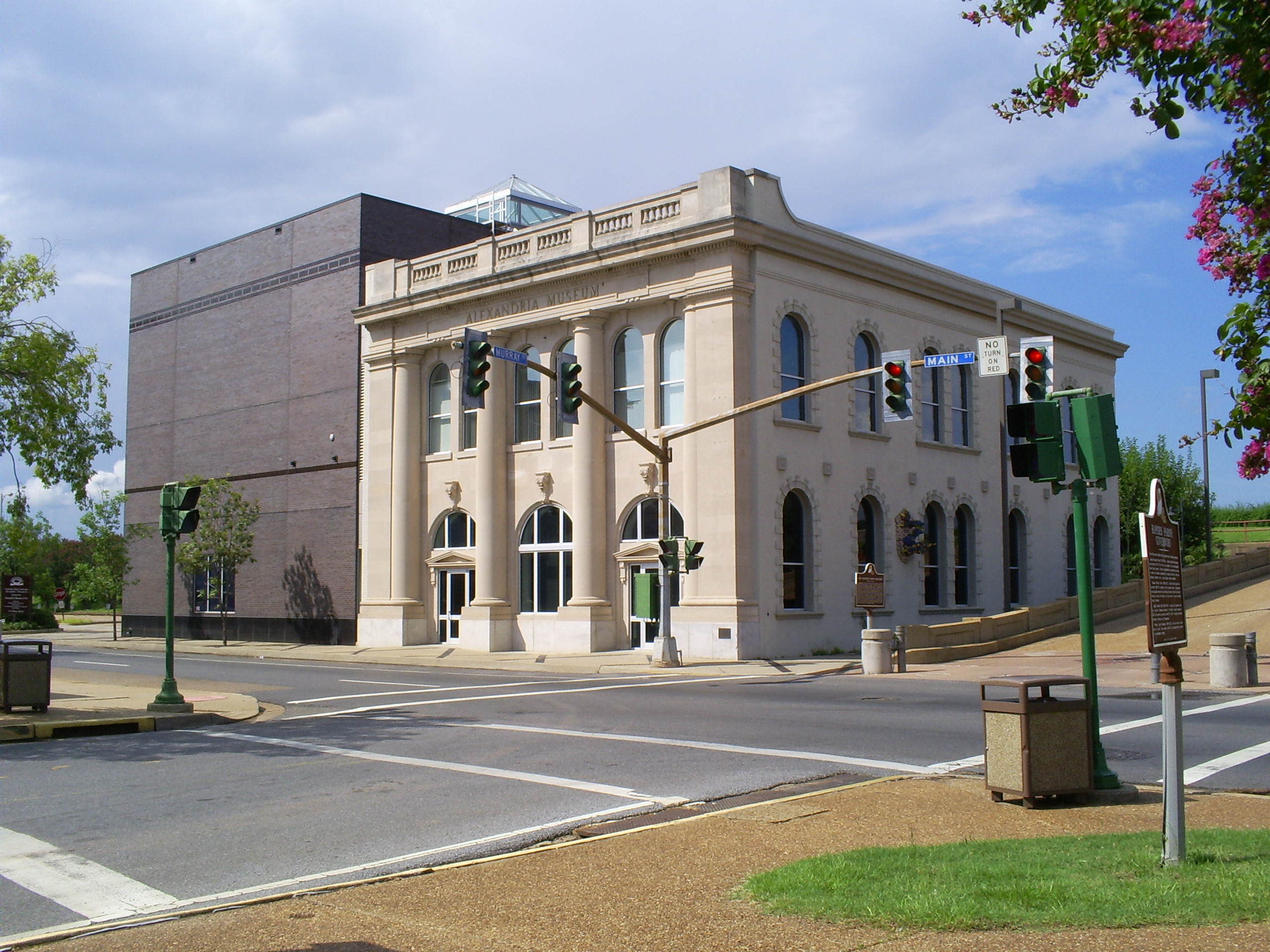
US Post Office and Courthouse-Alexandria |
 |
02000-05-18 May 18, 2000 |
515 Murray St.
31°18′38″N 92°45′40″W / 31.31056°N 92.76111°W / 31.31056; -92.76111 (US Post Office and Courthouse-Alexandria) |
Alexandria |
|
| 67 |
Veterans Administration Medical Center |
|
01986-09-29 September 29, 1986 |
U.S. Routes 71/167
31°21′17″N 92°26′8″W / 31.35472°N 92.43556°W / 31.35472; -92.43556 (Veterans Administration Medical Center) |
Alexandria |
|
| 68 |
Morgan Walker House |
|
01987-01-22 January 22, 1987 |
2400 Horseshoe Dr.
31°15′27″N 92°28′20″W / 31.2575°N 92.47222°W / 31.2575; -92.47222 (Walker, Morgan, House) |
Alexandria |
|
| 69 |
Walnut Grove |
|
01980-11-21 November 21, 1980 |
East of Cheneyville
31°0′37″N 92°15′30″W / 31.01028°N 92.25833°W / 31.01028; -92.25833 (Walnut Grove) |
Cheneyville |
|
| 70 |
Welcek Farmstead |
|
01985-07-18 July 18, 1985 |
Louisiana Highway 107
31°16′37″N 92°18′53″W / 31.27694°N 92.31472°W / 31.27694; -92.31472 (Welcek Farmstead) |
Kolin |
|
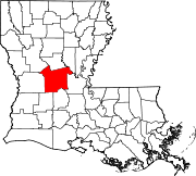
 Location of Rapides Parish in Louisiana