- Curry Village, California
-
Not to be confused with Camp Currie.
Curry Village — Unincorporated community — Curry Village, Yosemite National Park Location in California
 Curry Village
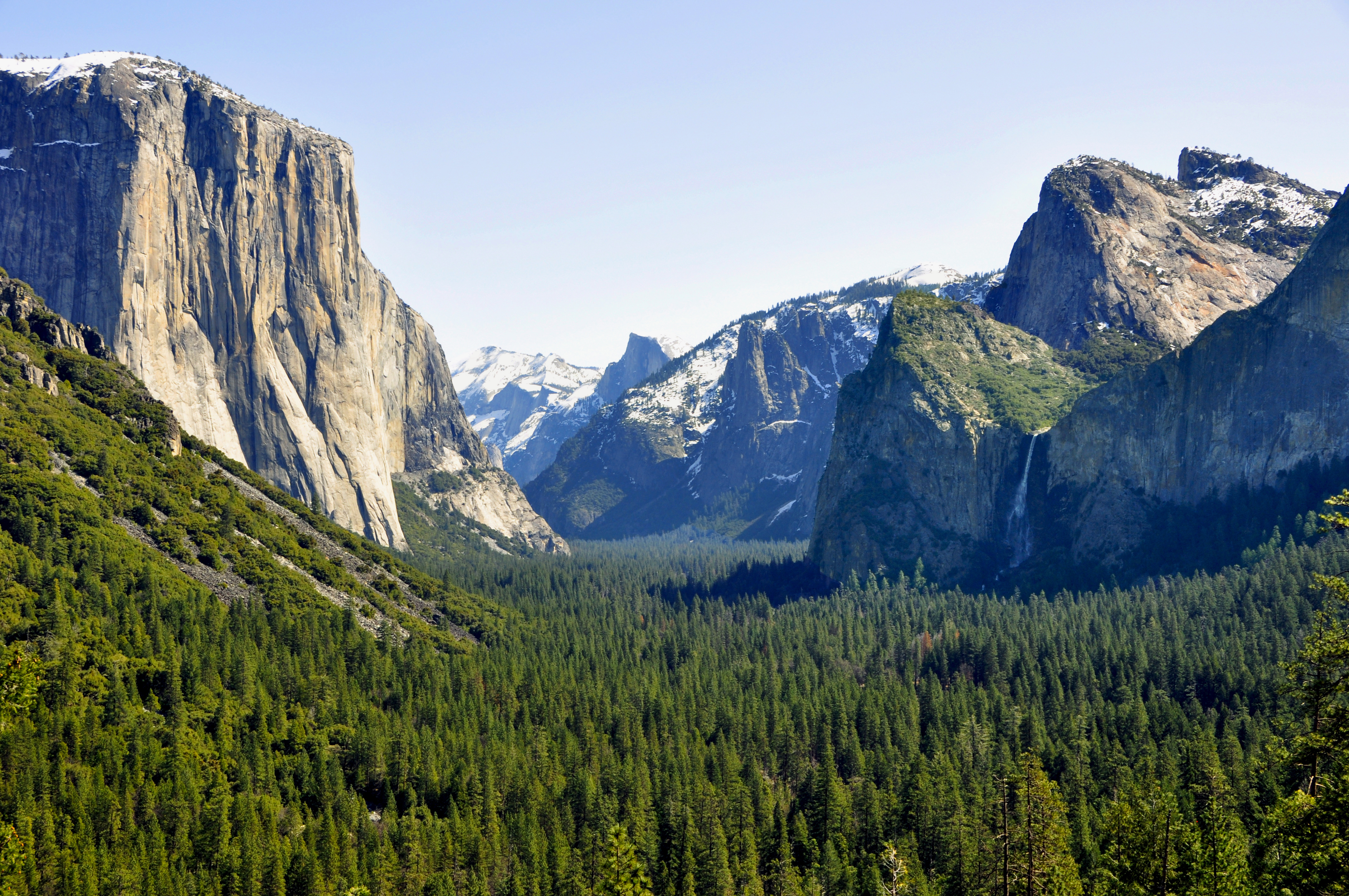
Coordinates: 37°44′13″N 119°34′22″W / 37.73694°N 119.57278°WCoordinates: 37°44′13″N 119°34′22″W / 37.73694°N 119.57278°W Country United States State California County Mariposa County Elevation[1] 4,003 ft (1,220 m) Camp Curry Historic DistrictLocation: Yosemite Valley, Yosemite National Park, California Area: 48 acres (19 ha) Built: 1924 Architectural style: Bungalow/craftsman, Other, Rustic Governing body: Federal NRHP Reference#: 79000315[2] Added to NRHP: November 1, 1979 Curry Village (also, Camp Curry) is an unincorporated community in Mariposa County, California.[1] It is located in the Yosemite Valley of Yosemite National Park 1 mile (1.6 km) southeast of Yosemite Village, at an elevation of 4003 feet (1220 m).[1] Curry Village occupies a central position in the Yosemite Valley.
Contents
History
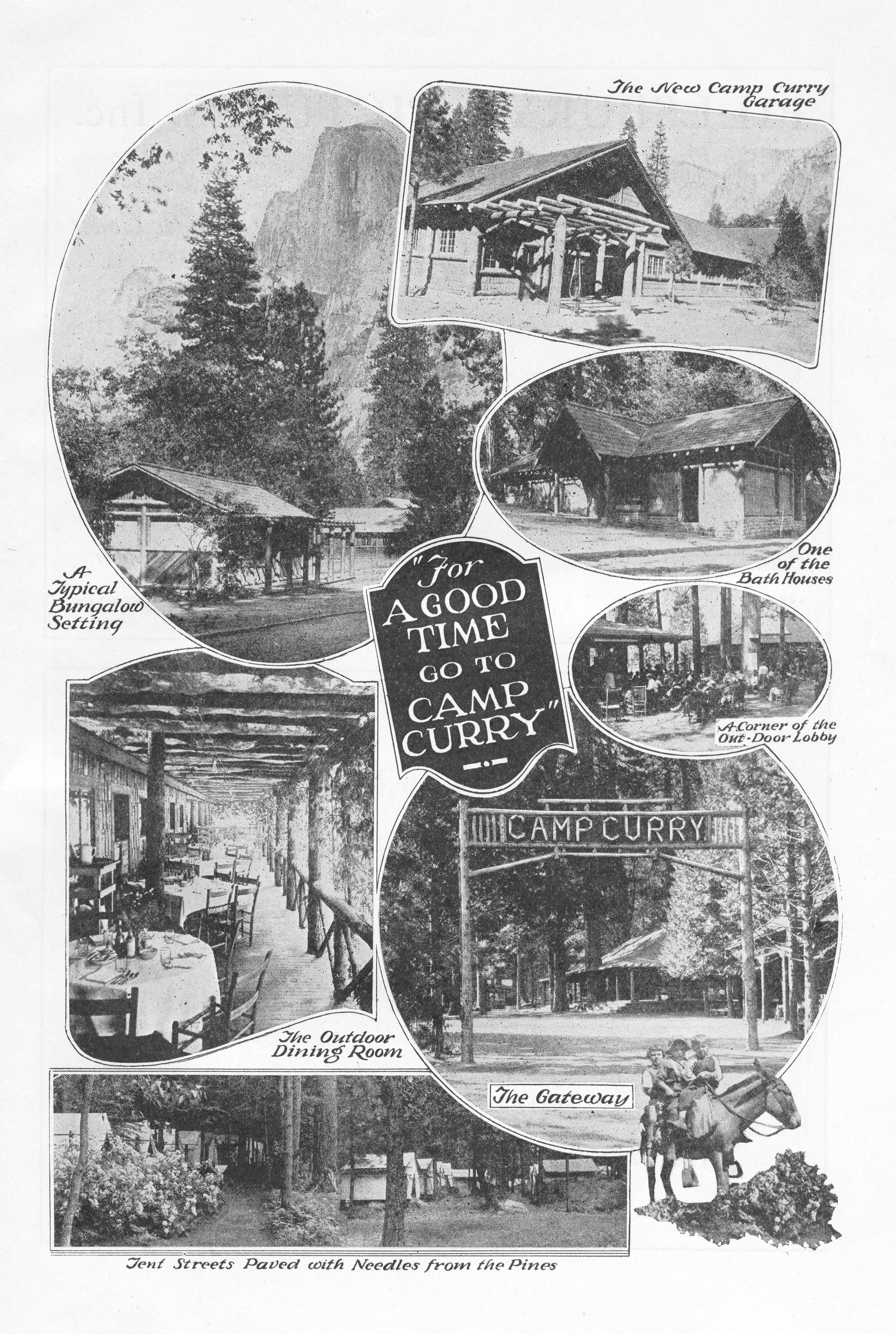
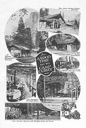 A 1921 advertisement for Camp Curry
In 1899 David Curry and Jenny Etta Foster opened a tented camp so that visitors could enjoy the beauty of Yosemite for a modest price. They advertised "a good bed and clean napkin with every meal" for just $2 a day. Camp Curry celebrated its 100th anniversary in 1999 and it still offers park visitors lodging in the shadow of Glacier Point and Half Dome. Located at the foot of Glacier Point, the complex includes visitor cabins, a store, dining facilities, a lodge and a post office. The camp's structures are rustic wood framed cabins, set on stone foundations with hipped roofs. The camp includes a large number of tent cabins, framed bases with tented roofs, a lower-cost lodging alternative developed in the early 20th century. Significant structures include the 1914 entrance sign, the 1904 Old Registration Office, the 1913 dance hall, now guest lodgings as the Stoneman House, the 1916 Foster Curry cabin and the 1917 Mother Curry's bungalow. Bungalows with en-suite baths were built from 1918 to 1922 and bungalows without plumbing in the 1930s.[3]
The Camp Curry post office opened in 1909, and changed its name to Curry Village in 1970.[4] The village was listed on the National Register of Historic Places on November 1, 1979.[2]
Location
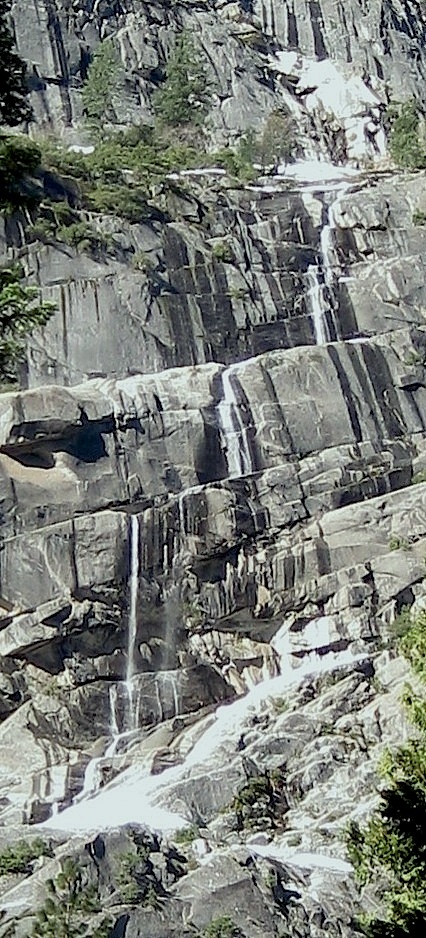
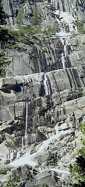 Staircase Falls behind Curry Village
Curry Village is in the heart of Yosemite Valley, sitting directly beneath Glacier Point and next to the Merced River with views of Half Dome. Staircase Falls, on Gossamer Creek, drops into the valley directly behind Curry Village from Glacier Point.
Rockfall
Curry Village is built on a talus cone of debris from old rockfalls.[5] A rockfall occurred in Yosemite National Park at approximately 7:00 am on October 8, 2008, near Curry Village in eastern Yosemite Valley. Park officials estimated the rockfall volume at approximately 6,000 cubic metres (7,800 cu yd), which released near the halfway point up the granite face above Curry Village. Three visitors received minor injuries during the incident. All three were treated and released. The rockfall destroyed an estimated seven visitor cabins; two hard sided, and three tent cabins. At least three other cabins received partial damage. Curry Village visitors were evacuated immediately. [6] Following a study by geologists, 233 visitor accommodations and 43 concessioner housing units were permanently closed in November 2008, approximately a third of the units available in Curry Village. 36 units reopened.[7] Following a three-year study, the National Park Service announced in August 2011 that 72 buildings will be removed from Curry Village. The structures will be documented and historic materials will be salvaged.[8] Most of these are hard-sided structures, including the Foster Curry Cabin.[9]
See also
- Yosemite Park & Curry Company
References
- ^ a b c U.S. Geological Survey Geographic Names Information System: Curry Village, California
- ^ a b "National Register Information System". National Register of Historic Places. National Park Service. 2010-07-09. http://nrhp.focus.nps.gov/natreg/docs/All_Data.html.
- ^ Kaiser, Harvey H. (2002). An Architectural Guidebook to the National Parks: California, Oregon, Washington. Layton, Utah: Gibbs Smith. pp. 108–109. ISBN 1-58685-06-0.
- ^ Durham, David L. (1998). California's Geographic Names: A Gazetteer of Historic and Modern Names of the State. Quill Driver Books. p. 753. ISBN 9781884995149.
- ^ Wieczorek, Gerald F.; Snyder, James B. (1999). "Rock falls from Glacier Point above Camp Curry, Yosemite National Park, California". U.S. Geological Survey. http://pubs.usgs.gov/of/1999/ofr-99-0385/. Retrieved 31 August 2011.
- ^ "Rockfall in Yosemite National Park". NPS. http://www.nps.gov/yose/parknews/rockfall1008.htm. Retrieved 2008-11-17.
- ^ "Geologic Assessment of Recent Rockfalls in Curry Village Completed". National Park Service. November 21, 2008. http://www.nps.gov/yose/parknews/cvrockfall.htm. Retrieved 31 August 2011.
- ^ "Yosemite aims to remove Curry Village cabins over rockfall concerns". KFSN. August 9, 2011. http://abclocal.go.com/kfsn/story?section=news/state&id=8298311. Retrieved 31 August 2011.
- ^ "Curry Village Rockfall Hazard Zone Structures Project Environmental Assessment". National Park Service. http://parkplanning.nps.gov/projectHome.cfm?projectId=29566. Retrieved 31 August 2011.
External links
- Curry Village - Official Web page
- VirtualGuideBooks.com - Panoramic Photo of Camp Curry Accommodation (Apple QuickTime required)
National Register of Historic Places in Yosemite National Park National Historic Landmarks Other historic districts Bagby Stationhouse, Water Tanks and Turntable | Camp Curry Historic District | Great Sierra Mine Historic Site | Yosemite Valley | Yosemite Valley Archeological District | Yosemite Valley Bridges | Yosemite Village Historic District
Other properties Acting Superintendent's Headquarters | Camp 4 | Crane Flat Fire Lookout | Glacier Point Trailside Museum | Great Sierra Wagon Road | Hetch Hetchy Railroad Engine No.6 | Hodgdon Homestead Cabin | Chris Jorgenson Studio | Mariposa Grove Museum | McCauley Cabin | McCauley and Meyer Barns | McGurk Cabin | Merced Grove Ranger Station | Soda Springs Cabin | Tioga Pass Entrance Station | Track Bus No. 19 | Tuolumne Meadows | Tuolumne Meadows Ranger Stations and Comfort Stations | Wawona Covered Bridge | Yosemite Transportation Company Office | Yosemite Valley Chapel | Yosemite Valley Railroad Caboose No. 15
U.S. National Register of Historic Places Topics Lists by states Alabama • Alaska • Arizona • Arkansas • California • Colorado • Connecticut • Delaware • Florida • Georgia • Hawaii • Idaho • Illinois • Indiana • Iowa • Kansas • Kentucky • Louisiana • Maine • Maryland • Massachusetts • Michigan • Minnesota • Mississippi • Missouri • Montana • Nebraska • Nevada • New Hampshire • New Jersey • New Mexico • New York • North Carolina • North Dakota • Ohio • Oklahoma • Oregon • Pennsylvania • Rhode Island • South Carolina • South Dakota • Tennessee • Texas • Utah • Vermont • Virginia • Washington • West Virginia • Wisconsin • WyomingLists by territories Lists by associated states Other Municipalities and communities of Mariposa County, California CDPs Bear Valley | Bootjack | Buck Meadows | Catheys Valley | Coulterville | El Portal | Fish Camp | Greeley Hill | Hornitos | Lake Don Pedro | Mariposa | Midpines | Wawona | Yosemite Valley
Unincorporated
communitiesBagby | Barrett | Ben Hur | Blanchard | Briceburg | Bridgeport | Buena Vista | Clearing House | Curry Village | Darrah | Dogtown | Elliott Corner | Foresta | Granite Springs | Hayward | Hite Cove | Incline | Indian Gulch | Jerseydale | Mormon Bar | Mount Bullion | North Wawona | Ponderosa Basin | South Wawona | Yosemite Village | Yosemite West
Former
settlementsAgua Fria | Bondville | Chinquapin | Drum | Eightmile | Elevenmile | Elkhorn | Emory | Hokokwito | Kocher | Kumaini | Macheto | Minear | Mount Ophir | Newtown | Notomidula | Opie | Phillip's Flat | Quartzburg | Ridleys Ferry | Sakaya | Sloss | Wenger | Wiskala | Yosemite Mill
Categories:- Historic districts in California
- Populated places in Mariposa County, California
- Unincorporated communities in California
- Yosemite National Park
- Populated places established in 1899


Wikimedia Foundation. 2010.