- Mist Trail
-
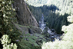 The Mist Trail, looking west from the top of Vernal Fall (Photo taken in 1983)
The Mist Trail is one of the most popular short hikes in Yosemite National Park, California, USA. The hike follows the Merced River, starting at Happy Isles in Yosemite Valley, past Vernal Fall, Emerald Pool, to Nevada Fall.
Contents
Description
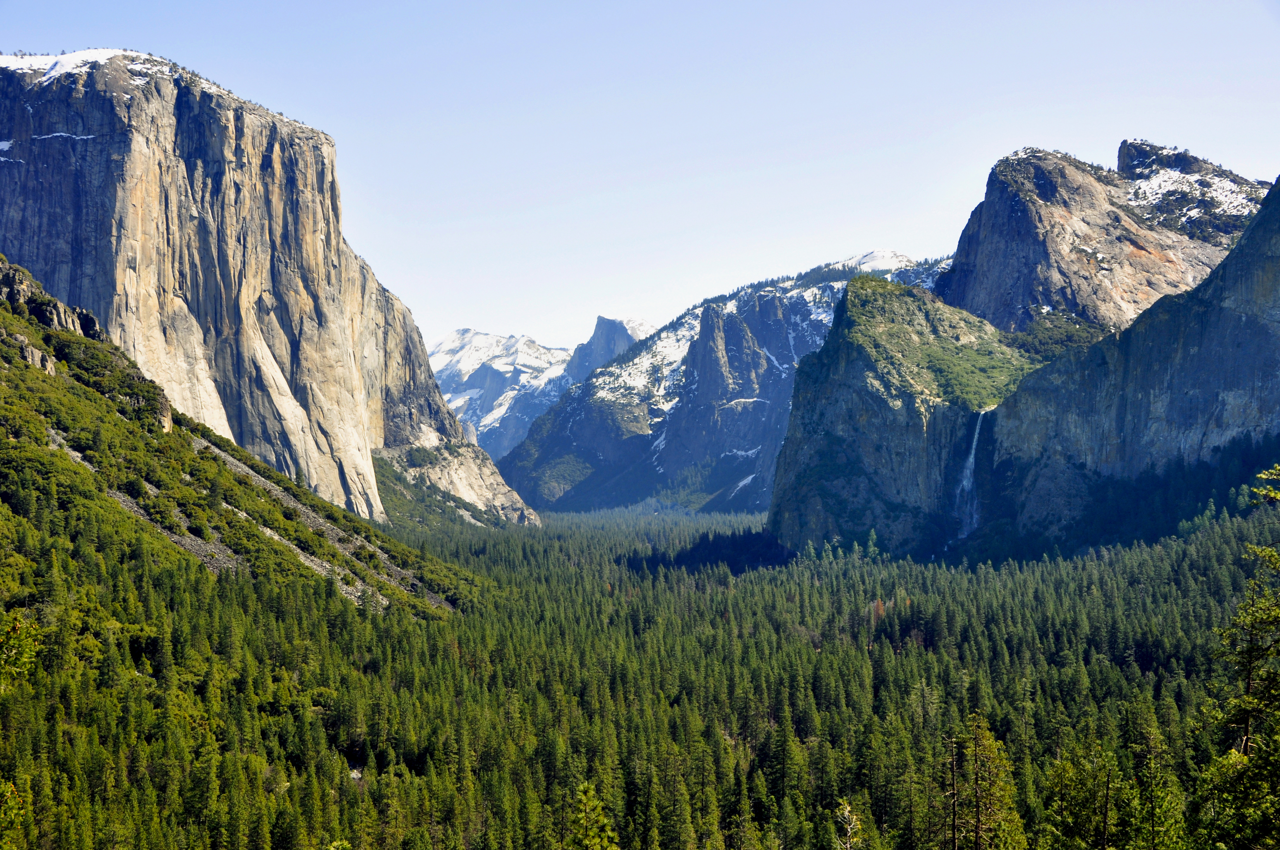
Along the trail, the Merced River is a tumultuous mountain stream, lying in a U-shaped valley. Enormous boulders, some the size of a house, are dwarfed by the sheer faces of exfoliating granite, which rise 3000 feet (914 m) from the river. Through it all, the Merced river rushes down from its source in the High Sierra, and broadens on the floor of Yosemite Valley.
A trail which links to the John Muir Trail starts after crossing from the Happy Isles. Depending on one's conditioning, a bridge which re-crosses the river – the halfway point of a hike to the foot of Vernal Fall – can be reached in 15 to 30 minutes.
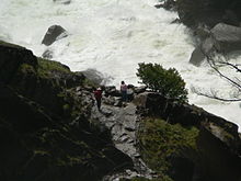 Hikers stop briefly just below the lower margin of the mist from Vernal Fall
To the side of Vernal Fall, the mist from the river blankets the trail, which was improved during the WPA projects of the 1930s. Here is where raingear becomes handy: in the spring, hikers often become completely drenched from water sprayed off Vernal Fall. This is one of the few places where a complete circular rainbow can be viewed. The trail now crosses a sheer face which is made somewhat easier by a single guard rail. At the top of Vernal Fall, the Merced river traverses a shelf of granite, and the hikers frequently sun themselves to dry off.
The Emerald Pool is named for the color of the river here.
Up the trail, Nevada Falls, a waterfall that is over twice the height of Vernal Falls, awaits the hiker, although there is no cascade of mist over the trail at that waterfall. Behind Nevada Falls is Liberty Cap, an impressive lump of granite. The Mist trail then rejoins the John Muir Trail: the hiker can travel in Little Yosemite Valley, or take a side trip to the top of Half Dome, using cables to climb the rock.
Logistics
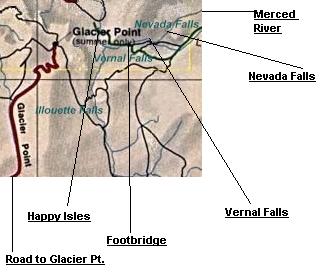
 Map of the trail
Day hikers should be properly equipped (sturdy shoes, raingear, a hat), even for this comparatively small hike, because the trail rises thousands of feet. Fortunately, a prudent walker can simply turn back if the going gets too difficult. The hike ceases to be wheelchair accessible at the Happy Isles, but there are bridges to the Isles themselves.
Hikers are cautioned that they should register a plan with the rangers so that their safety can be monitored;[1] in this day of cell phones, that advice may seem unnecessary, but a cell phone can always be lost or broken and the loss of service is common on the trail.
Beyond the Mist Trail, on the John Muir Trail, hikers may find themselves sharing the trail with a horse and rider; etiquette and safety demand that hikers yield to the horses, because if someone spooks the horse, both horse and rider may be pitched down the mountainside.
Related hikes
- The High Sierra Camps provide a loop through the Yosemite backcountry, with tent cabins spaced one days' hike apart.
- A panoramic view of the Mist Trail can be had from Glacier Point, 3000 feet (900 m) above, looking north. During the summer, shuttle buses from the floor of the valley will take an hour to arrive at Glacier Point.
- The John Muir Trail starts at the same trailhead as the Mist Trail.
Notes
Coordinates: 37°43′37″N 119°32′40″W / 37.72694°N 119.54444°W
External links
Categories:- Yosemite National Park
- Hiking trails in California
- Protected areas of Mariposa County, California
- Visitor attractions in Mariposa County, California


Wikimedia Foundation. 2010.