- Foresta, California
-
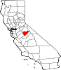
Foresta — Unincorporated community — Location in California
 Foresta
Coordinates: 37°41′54″N 119°45′19″W / 37.69833°N 119.75528°WCoordinates: 37°41′54″N 119°45′19″W / 37.69833°N 119.75528°W Country United States State California County Mariposa County Elevation[1] 4,314 ft (1,315 m) Foresta (formerly, McCauley and Opim)[2] is an unincorporated community in Mariposa County, California, to the immediate west of Yosemite National Park's west boundary.[1] It is located 2.25 miles (3.6 km) northeast of El Portal,[2] at an elevation of 4314 feet (1315 m).[1]
The name comes from the Foresta Land Company, founded by A.B. Davis in 1913.[2] Davis built a resort at Foresta but abandoned it.[2]
The Opim post office operated there from 1882 to 1884.[2]
References
Municipalities and communities of Mariposa County, California CDPs Bear Valley | Bootjack | Buck Meadows | Catheys Valley | Coulterville | El Portal | Fish Camp | Greeley Hill | Hornitos | Lake Don Pedro | Mariposa | Midpines | Wawona | Yosemite Valley
Unincorporated
communitiesBagby | Barrett | Ben Hur | Blanchard | Briceburg | Bridgeport | Buena Vista | Clearing House | Curry Village | Darrah | Dogtown | Elliott Corner | Foresta | Granite Springs | Hayward | Hite Cove | Incline | Indian Gulch | Jerseydale | Mormon Bar | Mount Bullion | North Wawona | Ponderosa Basin | South Wawona | Yosemite Village | Yosemite West
Former
settlementsAgua Fria | Bondville | Chinquapin | Drum | Eightmile | Elevenmile | Elkhorn | Emory | Hokokwito | Kocher | Kumaini | Macheto | Minear | Mount Ophir | Newtown | Notomidula | Opie | Phillip's Flat | Quartzburg | Ridleys Ferry | Sakaya | Sloss | Wenger | Wiskala | Yosemite Mill
Categories:- Populated places in Mariposa County, California
- Unincorporated communities in California
- Mariposa County, California geography stubs


Wikimedia Foundation. 2010.