- Aller, Somerset
-
Coordinates: 51°03′N 2°51′W / 51.05°N 2.85°W
Aller 
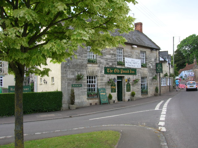
The Old Pound Inn, Aller
 Aller
Aller
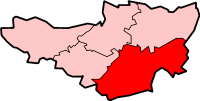
Aller shown within SomersetPopulation 374 [1] OS grid reference ST4029 Shire county Somerset Region South West Country England Sovereign state United Kingdom Police Avon and Somerset Fire Devon and Somerset Ambulance South Western EU Parliament South West England List of places: UK • England • Somerset Aller is a village and parish in Somerset, England, situated 5 miles (8.0 km) west of Somerton on the A372 road towards Bridgwater in the South Somerset district. The village has a population of 374.[1] The parish includes the hamlet of Beer (sometimes Bere) and the deserted medieval village of Oath on the opposite bank of the River Parrett.
Contents
History
Aller was listed in the Domesday Book of 1086 as Alre, meaning 'The alder tree' from the Old English alor.[2]
The parish of Aller was part of the hundred of Somerton.[3]
Most of the valuable meadows had been enclosed by 1577, but the surrounding fields were not enclosed until 1797. Between 1614 and 1616 there was a struggle between the lord, Sir John Davis, who had recently purchased the manor, and the tenants over the building of hedges and gates to increase the value of the remaining 47 acres (190,000 m2) of common ground. The meadows remained open and Davis sold the manor to John Stawell of Cothelstone in 1623.[4]
Oath Lock marks the tidal limit of the River Parrett. It was added when it was realised that the locks at Stanmoor, Langport and Muchelney, with a half-lock at Thorney, would not provide the depth of water specified in the Act of Parliament of 4 July 1836 which authorised the building of the navigation.[5][6]
Governance
The parish council has responsibility for local issues, including setting an annual precept (local rate) to cover the council’s operating costs and producing annual accounts for public scrutiny. The parish council evaluates local planning applications and works with the local police, district council officers, and neighbourhood watch and speed watch groups on matters of crime, security, and traffic. The parish council's role also includes initiating projects for the maintenance and repair of parish facilities, as well as consulting with the district council on the maintenance, repair, and improvement of highways, drainage, footpaths, public transport, and street cleaning. Conservation matters (including trees and listed buildings) and environmental issues are also the responsibility of the council.
The village falls within the Non-metropolitan district of South Somerset, which was formed on 1 April 1974 under the Local Government Act 1972, having previously been part of Langport Rural District.[7] The district council is responsible for local planning and building control, local roads, council housing, environmental health, markets and fairs, refuse collection and recycling, cemeteries and crematoria, leisure services, parks, and tourism.
Somerset County Council is responsible for running the largest and most expensive local services such as education, social services, libraries, main roads, public transport, policing and fire services, trading standards, waste disposal and strategic planning.
It is also part of a county constituency represented in the House of Commons of the Parliament of the United Kingdom. It elects one Member of Parliament (MP) by the first past the post system of election, and part of the South West England constituency of the European Parliament which elects seven MEPs using the d'Hondt method of party-list proportional representation.
Aller today
The social centres of the village are St Andrew's church; the pub; the "Rec" - a recreational playing field with playground equipment for children and a basketball hoop in a Dutch barn; and the Village Hall — home to village council meetings, harvest suppers, famine lunches, other charity events, a sewing circle, and bowls club. These events and other information are shared via the village website, the Aller DragonFlyer, and by a network of messengers known as the Aller Bush Telegraph.
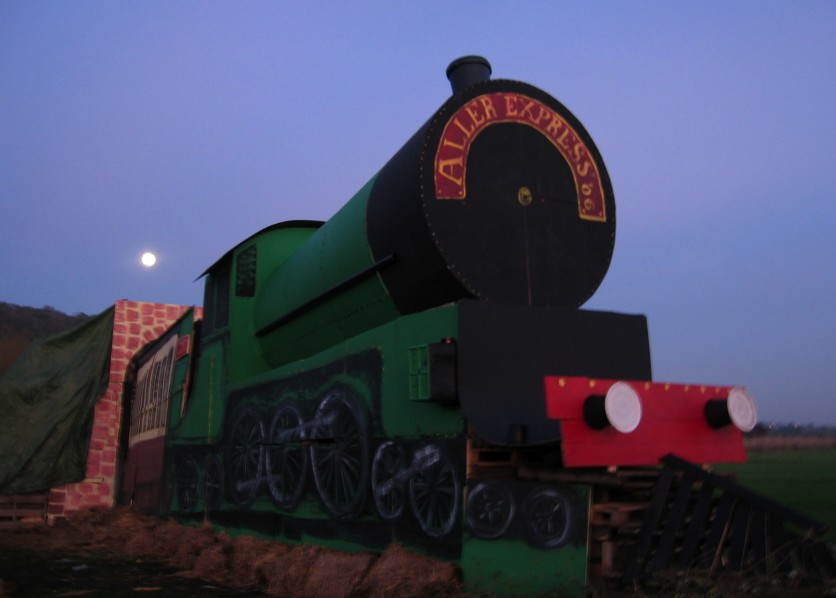
One of the most festive occasions in Aller is its Bonfire Night, when many local residents turn out to witness the torching of a novel artistic creation. In 2006, a full-size model of a steam train engine was set afire. Other years' subjects have included a piano and the Houses of Parliament. A dragon — Aller's mascot — was set afire in 2007. The 2008 bonfire chose a Batman theme.
-
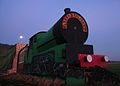
The Aller Express by moonlight — 2006 Bonfire Night
-
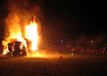
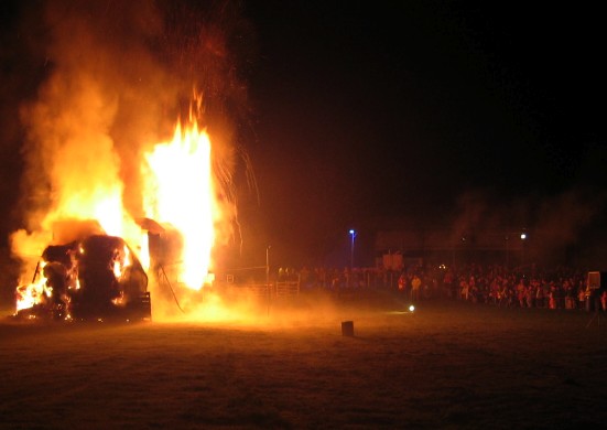
Village residents watch the Aller Express burn
-

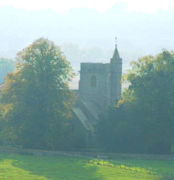
St Andrew's Church, Aller; photo taken from Aller Hill
Near to Aller are the Aller Hill and the Aller and Beer Woods biological Sites of Special Scientific Interest.
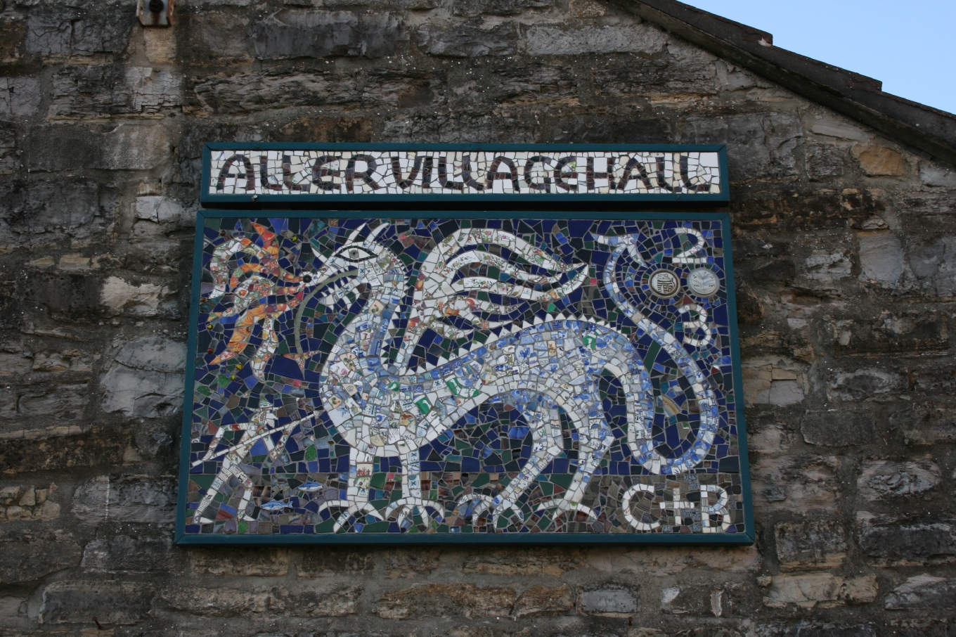
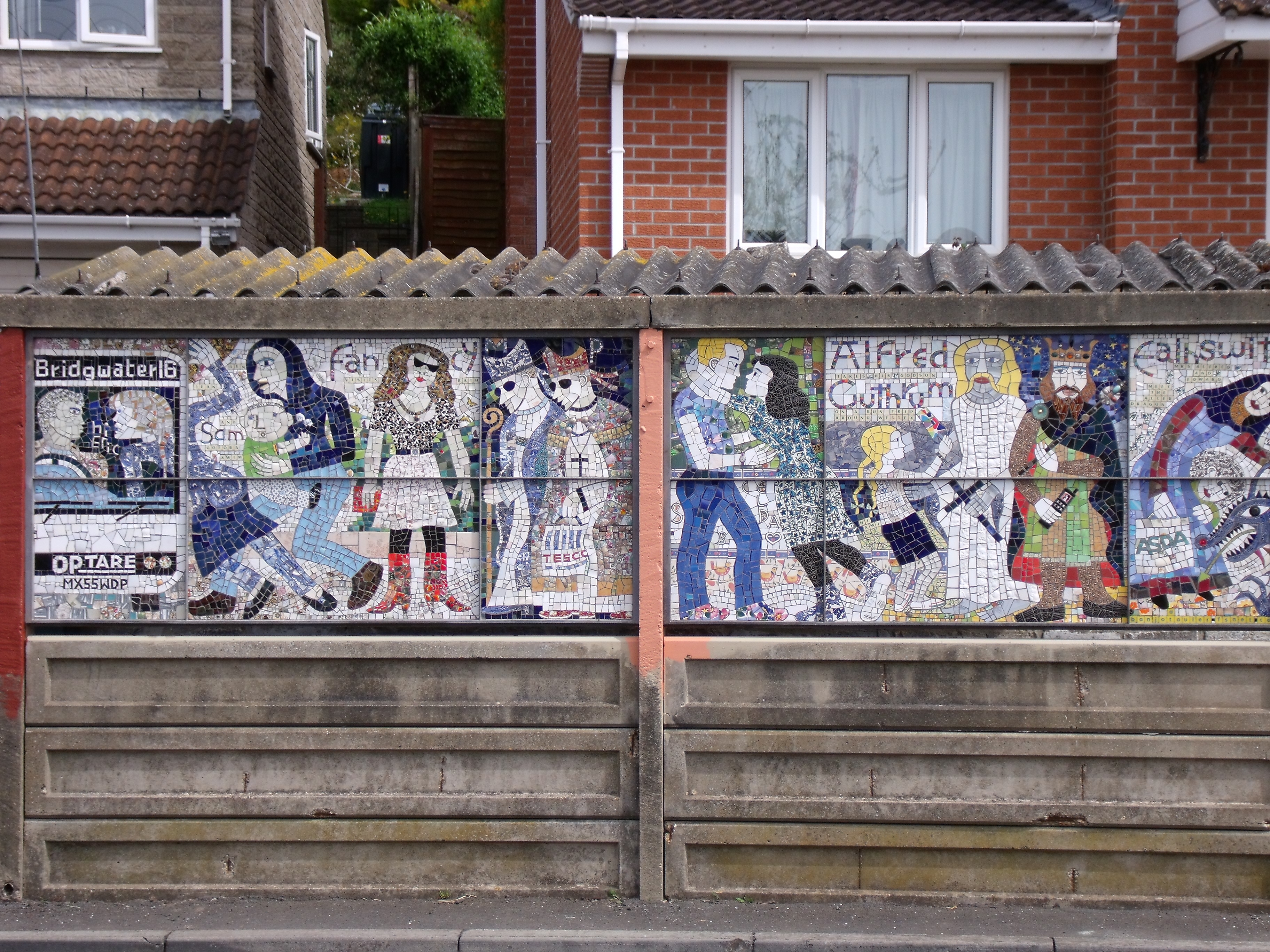
The village is home to two large mosaics by Aller potter and mosaicist Bryan Newman. The first of these, located on the side of the Village Hall, features the village mascot — the Aller Dragon — and was created by Newman and Aller resident Chiggy Little. In 2010 Newman completed a second mosaic, commissioned by the Village Council, to front the village bus shelter. This two-panel work is a lighthearted depiction of historic and contemporary characters who have figured in Aller's past and present — as well as Newman's life. Included are Alfred the Great and Ealhswith his wife; Guthrum, Bishops Peter and Michael Ball, and Newman's late wife, Julia.
-
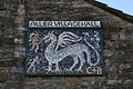
Aller Village Hall Mosaic by Bryan Newman and Chiggy Little
-
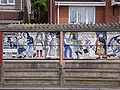
Aller Bus shelter with mosaic by Bryan Newman
Notable residents
Aller was the birthplace of the philosopher Ralph Cudworth in 1617. It is currently the home of Britain's Second Sea Lord 1993–94, the sponsor of the HMS Somerset (F82) and two retired bishops of the Church of England.
Church
The Church of St Andrew has Saxon origins with some parts dating from the 12th and 13th centuries, with restoration work undertaken several times since, the most major of which was in 1861–62 by John Norton. It is a Grade II* listed building.[8]
The font is a simple limestone bowl, less than a metre tall, which is thought to be Saxon in origin, one of only three in England and was possibly the one used for the baptism of Guthrum after his defeat by King Alfred The Great after the Battle of Ethandun in 878.[9] It was retrieved from the pond of the vicarage garden around 1870 and now stands in the south-west corner of the nave.[10] A copy of the font was made by a stonemason in Corvallis, Oregon, in the 1880s, to memorialize the son of the rector of Aller, Rev. J.Y. Nicholson. The copy of Aller's historic font was in the Episcopalian Church of the Good Samaritan.[11]
References
- ^ a b "South Somerset population estimates for 2002". Somerset County Council. http://www.webcitation.org/5lRyCVNCk. Retrieved 18 December 2009.
- ^ Robinson, Stephen (1992). Somerset Place Names. Wimborne: The Dovecote Press Ltd. ISBN 1874336032.
- ^ "Somerset Hundreds". GENUKI. http://www.genuki.org.uk/big/eng/SOM/Miscellaneous/. Retrieved 19 October 2011.
- ^ Havinden, Michael (1982). The Somerset Landscape. The making of the English landscape. London: Hodder and Stoughton. pp. 124–125. ISBN 0340201169.
- ^ G. Body and R. Gallop, (2006), Parrett River Trade, Fiducia Press, ISBN 0-946217-25-4
- ^ Charles Hadfield, (1967), The Canals of South West England, David and Charles
- ^ A Vision of Britain Through Time : Langport Rural District
- ^ "Church of St Andrew". Images of England. http://www.imagesofengland.org.uk/details/default.aspx?id=263068. Retrieved 9 February 2007.
- ^ Pennington, Jim (1989). Avon & Somerset: An Explorer's Guide. Castle Cary: Mendip Publishing. ISBN 0851263305.
- ^ Adkins, Lesley and Roy (1992). A Field Guide to Somerset Archaeology. Stanbridge: Dovecote Press. ISBN 0946159947.
- ^ "One site offers look at art, architecture". Corvallis Gazette-Times. http://gazettetimes.com/news/local/article_afb6acd3-e091-5a18-b63f-6eb89c376c6b.html?mode=story. Retrieved 17 November 2009.
External links
Categories:- Villages in South Somerset
- Somerset Levels
- Civil parishes in Somerset
-

Wikimedia Foundation. 2010.