- Chaffcombe
-
Coordinates: 50°53′14″N 2°55′21″W / 50.887322°N 2.922457°W
Chaffcombe 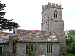
St Michael and All Angels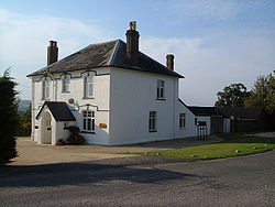
The Old Happy
 Chaffcombe
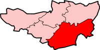
Chaffcombe shown within SomersetPopulation 194 [1] OS grid reference ST352101 Parish Chard District South Somerset Shire county Somerset Region South West Country England Sovereign state United Kingdom Post town CHARD Postcode district TA20 Dialling code 01460 Police Avon and Somerset Fire Devon and Somerset Ambulance South Western EU Parliament South West England UK Parliament Yeovil List of places: UK • England • Somerset Chaffcombe is a village and civil parish in Somerset, England, situated 2 miles (3.2 km) north east of Chard in the South Somerset district. The village has a population of 194.[1]
Contents
History
The name of the village probably comes from a Saxon settler and means "Ceaffa's valley". After the Norman Conquest Chaffcombe was granted to the Bishop of Coutances under whom it was held by Ralph le Sor until it was acquired by Oliver Avenel (died 1226) and inherited by his descendants until 1613 when John Poulett of Hinton St George became lord of the manor and stayed in the Poulett family until 1913.[2]
The parish of Chaffcombe was part of the South Petherton Hundred.[3]
Governance
The parish council has responsibility for local issues, including setting an annual precept (local rate) to cover the council’s operating costs and producing annual accounts for public scrutiny. The parish council evaluates local planning applications and works with the local police, district council officers, and neighbourhood watch groups on matters of crime, security, and traffic. The parish council's role also includes initiating projects for the maintenance and repair of parish facilities, as well as consulting with the district council on the maintenance, repair, and improvement of highways, drainage, footpaths, public transport, and street cleaning. Conservation matters (including trees and listed buildings) and environmental issues are also the responsibility of the council.
The village falls within the Non-metropolitan district of South Somerset, which was formed on April 1, 1974 under the Local Government Act 1972, having previously been part of Chard Rural District.[4] The district council is responsible for local planning and building control, local roads, council housing, environmental health, markets and fairs, refuse collection and recycling, cemeteries and crematoria, leisure services, parks, and tourism.
Somerset County Council is responsible for running the largest and most expensive local services such as education, social services, libraries, main roads, public transport, policing and fire services, trading standards, waste disposal and strategic planning.
It is also part of the Yeovil county constituency represented in the House of Commons of the Parliament of the United Kingdom. It elects one Member of Parliament (MP) by the first past the post system of election, and part of the South West England constituency of the European Parliament which elects seven MEPs using the d'Hondt method of party-list proportional representation.
Landmarks
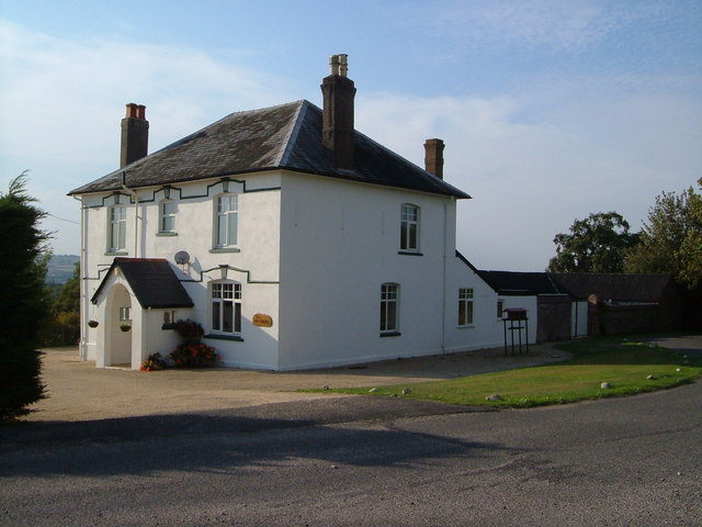
Avishays on Whiteway Hill is a large detached house which was partly built in the 17th century, but substantially altered between 1745 and 1759. The building was first recorded in 1316 as Aveneleseigh, from Oliver Avenel, and then changed hands many times. In the 17th century the Browne family leased it to the Sealy family, who purchased it in 1697, thereafter descendants of the Sealy family held it until it was sold to a Chard solicitor, Edward Clarke, in 1859.[5] In the grounds are an 18th-century former stables and coach house,[6] ice house[7] and various other outbuildings.[8]
The Clock Turret about 180 metres east of Avishays, which is also known as the Monmouth Tower or The Castle, is a 19th century folly.[9] It stands on the site of a former sham castle whch had fallen into ruin, and served as a water tower as well as having a clock on the west side facing the house. The clock, which has a hand wound mechanism, was built by Gillett and Johnson of Croydon and was originally at Highclere Castle in Hampshire.[10] The name Monmouth Tower comes from the escape of Elias Sealy, who owned the house, a follower of the Duke of Monmouth during the Monmouth Rebellion, who hid in a tree in the grounds when the troops of James II came looking for him.[11]
Religious sites
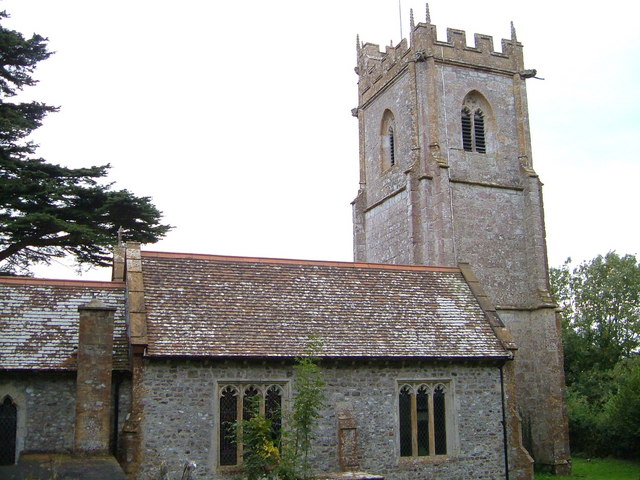
The Anglican parish church of St Michael and All Angels has a tower which partly dates from the 15th century, the remainder being rebuilt under J. M. Allen between 1857 and 1860. It has been designated as a Grade II* listed building. There is a copy of Raphael's Madonna and Child in the north aisle, which was acquired in 1901.[12]
References
- ^ a b "South Somerset population estimates for 2002". Somerset County Council. http://www.webcitation.org/5lRyCVNCk. Retrieved 27 December 2009.
- ^ Bush, Robin (1994). Somerset: the complete guide. Wimborne, Dorset: Dovecote Press. pp. 57–58. ISBN 1874336261.
- ^ "Somerset Hundreds". GENUKI. http://www.genuki.org.uk/big/eng/SOM/Miscellaneous/. Retrieved 20 October 2011.
- ^ A Vision of Britain Through Time : Chard Rural District
- ^ "Avishays". Images of England. English Heritage. http://www.imagesofengland.org.uk/Details/Default.aspx?id=262133. Retrieved 2008-12-07.
- ^ "Former stables and coach house". Images of England. English Heritage. http://www.imagesofengland.org.uk/Details/Default.aspx?id=262135. Retrieved 2008-12-07.
- ^ "Ice house about 100 metres east of Avishays". Images of England. English Heritage. http://www.imagesofengland.org.uk/Details/Default.aspx?id=262136. Retrieved 2008-12-07.
- ^ "Outbuildings about 15 metres north-east of Avishays, and wall linking same to house". Images of England. English Heritage. http://www.imagesofengland.org.uk/Details/Default.aspx?id=262134. Retrieved 2008-12-07.
- ^ "The Clock Turret about 180 metres east of Avishavs". Images of England. English Heritage. http://www.imagesofengland.org.uk/Details/Default.aspx?id=262137. Retrieved 2008-12-07.
- ^ Warren, Derrick (2005). Curious Somerset. Stroud: Sutton Publishing. p. 36. ISBN 978-0-7509-4057-3.
- ^ Holt, Jonathan (2007). Somerset Follies. Bath: Akeman Press. pp. 60–61. ISBN 9780954613877.
- ^ "Church of St Michael and All Angels". Images of England. English Heritage. http://www.imagesofengland.org.uk/Details/Default.aspx?id=262129. Retrieved 2008-12-07.
External links
Categories:- Villages in South Somerset
- Civil parishes in Somerset

Wikimedia Foundation. 2010.