- Corton Denham
-
Coordinates: 51°00′03″N 2°31′17″W / 51.0007°N 2.5215°W
Corton Denham 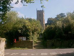
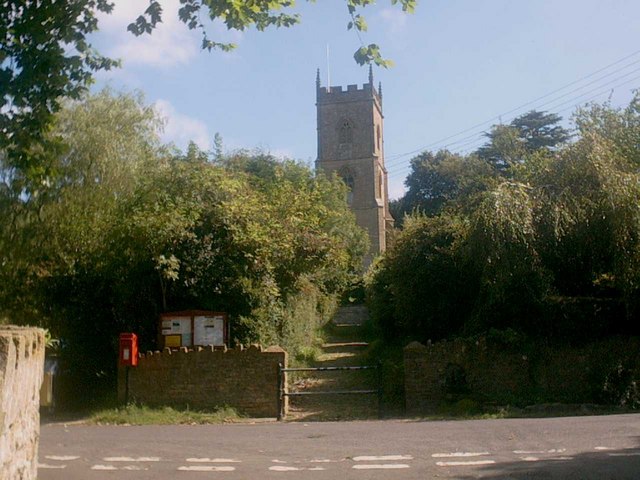
Corton Denham Church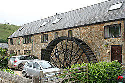
Waterwheel at Whitcombe Farm
 Corton Denham
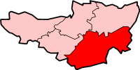
Corton Denham shown within SomersetPopulation 210 [1] OS grid reference ST635225 District South Somerset Shire county Somerset Region South West Country England Sovereign state United Kingdom Post town YEOVIL Postcode district DT9 Dialling code 01963 Police Avon and Somerset Fire Devon and Somerset Ambulance South Western EU Parliament South West England UK Parliament Yeovil List of places: UK • England • Somerset Corton Denham is a village and parish in Somerset, England, situated seven miles north east of Yeovil in the South Somerset district. The village has a population of 210.[1]
Contents
History
The village was named Corfetone in the Domesday Book of 1086, coming from the Old English meaning the settlement in a cutting. The second part of the name comes from the Dynham (later Dynham) family who held the manor from the 12th century until 1509.[2]
The parish was part of the hundred of Horethorne.[3]
In the 19th century an iron waterwheel was installed at Whitcombe Farmhouse.[4]
The village was on the covers of two 2006 calendars.
Governance
The parish council has responsibility for local issues, including setting an annual precept (local rate) to cover the council’s operating costs and producing annual accounts for public scrutiny. The parish council evaluates local planning applications and works with the local police, district council officers, and neighbourhood watch groups on matters of crime, security, and traffic. The parish council's role also includes initiating projects for the maintenance and repair of parish facilities, as well as consulting with the district council on the maintenance, repair, and improvement of highways, drainage, footpaths, public transport, and street cleaning. Conservation matters (including trees and listed buildings) and environmental issues are also the responsibility of the council.
The village falls within the Non-metropolitan district of South Somerset, which was formed on 1 April 1974 under the Local Government Act 1972, having previously been part of Wincanton Rural District.[5] The district council is responsible for local planning and building control, local roads, council housing, environmental health, markets and fairs, refuse collection and recycling, cemeteries and crematoria, leisure services, parks, and tourism.
Somerset County Council is responsible for running the largest and most expensive local services such as education, social services, libraries, main roads, public transport, policing and fire services, trading standards, waste disposal and strategic planning.
It is also part of the Yeovil county constituency represented in the House of Commons of the Parliament of the United Kingdom. It elects one Member of Parliament (MP) by the first past the post system of election, and part of the South West England constituency of the European Parliament which elects seven MEPs using the d'Hondt method of party-list proportional representation.
Religious sites
The parish Church of St Andrew was rebuilt 1869-1870 to a design of Charles Barker-Green for the Rev W.B Portman and the patron Lord Portman of Orchard Portman.[6]
Notable residents
Famous residents have included, Valerie Singleton and Arnold John.
References
- ^ a b "South Somerset population estimates for 2002". Somerset County Council. http://www.webcitation.org/5lRyCVNCk. Retrieved 27 December 2009.
- ^ Bush, Robin (1994). Somerset: The complete guide. Wimbourne: Dovecote Press. p. 61–62. ISBN 1874336261.
- ^ "Somerset Hundreds". GENUKI. http://www.genuki.org.uk/big/eng/SOM/Miscellaneous/. Retrieved 9 October 2011.
- ^ "Waterwheel, 25 metres North of Whitcombe Farmhouse". Images of England. English Heritage. http://www.imagesofengland.org.uk/Details/Default.aspx?id=261802. Retrieved 22 February 2009.
- ^ A Vision of Britain Through Time : Wincanton Rural District
- ^ "Church of St Andrew". Images of England. English Heritage. http://www.imagesofengland.org.uk/Details/Default.aspx?id=261789. Retrieved 22 February 2009.
External links
 Media related to Corton Denham at Wikimedia CommonsCategories:
- Villages in South Somerset
- Civil parishes in Somerset


Wikimedia Foundation. 2010.