- Buryatia
-
For other uses of "Buryatia", see Buryatia (disambiguation).
Republic of Buryatia Республика Бурятия (Russian)
Буряад Республика (Buryat)— Republic — 
Flag
Coat of armsAnthem: Anthem of the Republic of Buryatia 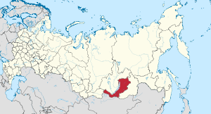
Coordinates: 53°48′N 109°20′E / 53.8°N 109.333°ECoordinates: 53°48′N 109°20′E / 53.8°N 109.333°E Political status Country Russia Federal district Siberian[1] Economic region East Siberian[2] Established May 30, 1923 Capital Ulan-Ude Government (as of August 2010) - President[3] Vyacheslav Nagovitsyn[4] - Legislature People's Khural[3] Statistics Area (as of the 2002 Census)[5] - Total 351,300 km2 (135,637.7 sq mi) Area rank 15th Population (2010 Census)[6] - Total 972,658 - Rank 54th - Density 2.77 /km2 (7.2 /sq mi) - Urban 58.4% - Rural 41.6% Population (2002 Census)[7] - Total 981,238 - Rank 56th - Density 2.79 /km2 (7.2 /sq mi) - Urban 59.6% - Rural 40.4% Time zone(s) IRKST (UTC+09:00)[8] ISO 3166-2 RU-BU License plates 03 Official languages Russian;[9] Buryat[10] http://egov-buryatia.ru/ The Republic of Buryatia (Russian: Респу́блика Буря́тия, Respublika Buryatiya; Buryat: Буряад Республика, Buryaad Respublika) is a federal subject of Russia (a republic). Its capital is the city of Ulan-Ude. Its area is 351,300 square kilometers (135,600 sq mi) with a population of 972,658(preliminary 2010 Census results).[6]
Contents
Geography
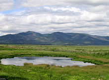 Buryatia countryside just south of Ulan-Ude
The republic is located in the south-central region of Siberia along the eastern shore of Lake Baikal.
- Area: 351,300 km²
- Borders:
- Internal: Irkutsk Oblast (W/NW/N), Zabaykalsky Krai (NE/E/SE/S), Tuva Republic (W)
- International: Mongolia (S/SE)
- Water: Lake Baikal (N)
- Highest point: Mount Munku-Sardyk (3,491 m)
Rivers
Major rivers include:
- Barguzin River
- Irkut River
- Kitoy River
- Oka River
- Selenga River
- Uda River
- Upper Angara River
- Vitim River
Lakes
- Lake Baikal - Buryatia covers 60% percent of the lake's shoreline
- Lake Gusinoye
Mountains
Over 80% of the republic's territory is located in the mountainous region, including the Baikal Mountains on the northern shores of Lake Baikal.
Natural resources
The republic's natural resources include gold, tungsten, zinc, uranium, and more.
Climate
- Average annual temperature: −1.6 °C (29.1 °F)
- Average January temperature: −22 °C (−8 °F)
- Average July temperature: +18 °C (64 °F)
- Average annual precipitation: 244 millimeters (9.6 in)
Administrative divisions
Main article: Administrative divisions of BuryatiaDemographics
- Population: 972,658 (2010 Census preliminary results)[6]
- Population: 981,238 (2002 Census)[7]
- Urban: 584,970 (59.6%)
- Rural: 396,268 (40.4%)
- Male: 467,984 (47.7%)
- Female: 513,254 (52.3%)
- Females per 1000 males: 1,097
- Average age: 31.6 years
- Urban: 31.2 years
- Rural: 32.2 years
- Male: 29.4 years
- Female: 33.9 years
- Number of households: 322,289 (with 958,402 people)
- Urban: 197,651 (with 566,755 people)
- Rural: 124,638 (with 391,647 people)
- Vital statistics
- Source: Russian Federal State Statistics Service
Births Deaths Birth rate Death rate 1970 14,766 6,301 18.1 7.7 1975 17,751 7,586 20.6 8.8 1980 19,859 8,734 21.6 9.5 1985 23,975 9,529 24.1 9.6 1990 19,185 9,602 18.3 9.1 1991 16,868 9,753 16.0 9.3 1992 13,944 10,347 13.3 9.9 1993 11,981 12,388 11.5 11.9 1994 12,327 13,650 11.9 13.1 1995 12,311 12,588 11.9 12.2 1996 12,159 12,441 11.8 12.1 1997 11,555 12,111 11.3 11.8 1998 11,746 11,481 11.6 11.3 1999 11,468 13,114 11.4 13.0 2000 11,654 13,155 11.6 13.1 2001 11,678 13,858 11.8 14.0 2002 12,830 14,404 13.0 14.6 2003 13,177 15,056 13.5 15.4 2004 13,399 14,868 13.8 15.3 2005 13,551 15,144 14.0 15.7 2006 14,193 13,930 14.8 14.5 2007 15,460 12,802 16.1 13.3 2008 16,372 12,948 17.0 13.5 Ethnic groups
According to the 2002 Census, ethnic Russians make up two thirds of the republic's population, while the ethnic Buryats are only 27.8%. Other groups include Ukrainians (1.0%), Tatars (0.8%), and a host of smaller groups, each accounting for less than 0.5% of the total population.
1926 census 1 1939 census 1959 census 1970 census 1979 census 1989 census 2002 census Buryats 214,957 (43.8%) 116,382 (21.3%) 135,798 (20.2%) 178,660 (22.0%) 206,860 (23.0%) 249,525 (24.0%) 272,910 (27.8%) Soyots 161 (0.0%) 2,739 (0.3%) Russians 258,796 (52.7%) 393,057 (72.0%) 502,568 (74.6%) 596,960 (73.5%) 647,785 (72.0%) 726,165 (69.9%) 665,512 (67.8%) Ukrainians 1,982 (0.4%) 13,392 (2.5%) 10,183 (1.5%) 10,769 (1.3%) 15,290 (1.7%) 22,868 (2.2%) 9,585 (1.0%) Tatars 3,092 (0.6%) 3,840 (0.7%) 8,058 (1.2%) 9,991 (1.2%) 10,290 (1.1%) 10,496 (1.0%) 8,189 (0.8%) Evenks 2,808 (0.6%) 1,818 (0.3%) 1,335 (0.2%) 1,685 (0.2%) 1,543 (0.2%) 1,679 (0.2%) 2,334 (0.2%) Others 9,440 (1.9%) 17,277 (3.2%) 15,384 (2.3%) 14,186 (1.7%) 17,630 (2.0%) 27,519 (2.7%) 19,969 (2.0%) - In 1926, the Buryat-Mongolian ASSR included Aga-Buryatia, Ust-Orda Buryatia, and Olkhonsky District. These territories were transferred to Chita and Irkutsk Oblasts in 1937. Consequently, the results of the 1926 Census cannot be compared to the results of the censuses of 1939 and later.
Demographics for 2007 [1]
District Births Deaths Growth Pp (2007) BR DR NGR The Republic of Buryatia 12,337 9,833 2,504 960,000 17.13 13.66 0.35% Ulan-Ude 4,260 3,517 743 373,300 15.22 12.56 0.27% Bichursky District 339 318 21 26,900 16.80 15.76 0.10% Dzhidinsky District 512 309 203 30,800 22.16 13.38 0.88% Yeravninsky District 244 191 53 18,600 17.49 13.69 0.38% Zaigrayevsky District 714 630 84 48,700 19.55 17.25 0.23% Zakamensky District 492 322 170 30,400 21.58 14.12 0.75% Ivolginsky District 498 320 178 31,000 21.42 13.76 0.77% Kabansky District 702 779 -77 64,400 14.53 16.13 -0.16% Kizhinginsky District 303 192 111 18,700 21.60 13.69 0.79% Kyakhtinsky District 629 393 236 40,500 20.71 12.94 0.78% Mukhorshibirsky District 338 319 19 28,000 16.10 15.19 0.09% Pribaykalsky District 423 357 66 28,900 19.52 16.47 0.30% Selenginsky District 628 522 106 47,500 17.63 14.65 0.30% Tarbagataysky District 205 216 -11 16,900 16.17 17.04 -0.09% Tunkinsky District 304 249 55 23,000 17.62 14.43 0.32% Khorinsky District 314 222 92 19,200 21.81 15.42 0.64% Barguzinsky District 367 272 95 25,600 19.11 14.17 0.49% Bauntovsky Evenkiysky District 126 92 34 10,500 16.00 11.68 0.43% Kurumkansky District 232 129 103 15,600 19.83 11.03 0.88% Muysky District 179 112 67 15,600 15.30 9.57 0.57% Okinsky District 73 37 36 5,100 19.08 9.67 0.94% Severo-Baykalsky District 196 161 35 15,200 17.19 14.12 0.31% Severobaykalsk 259 174 85 25,600 13.49 9.06 0.44% History
The area of the present-day Buryatia was first colonized in the 17th century by Russians in search of wealth, furs, and gold. In 1923, the Buryat-Mongolian Autonomous Soviet Socialist Republic was created as a result of the merger of Buryat-Mongol and Mongol-Buryat Oblasts. In 1937, Aga Buryatia and Ust-Orda Buryatia were detached from the Buryat-Mongolian ASSR and merged with Chita and Irkutsk Oblasts, respectively. Besides, Olkhonsky District was transferred from the Buryat-Mongolina ASSR to Irkutsk Oblast.
Politics
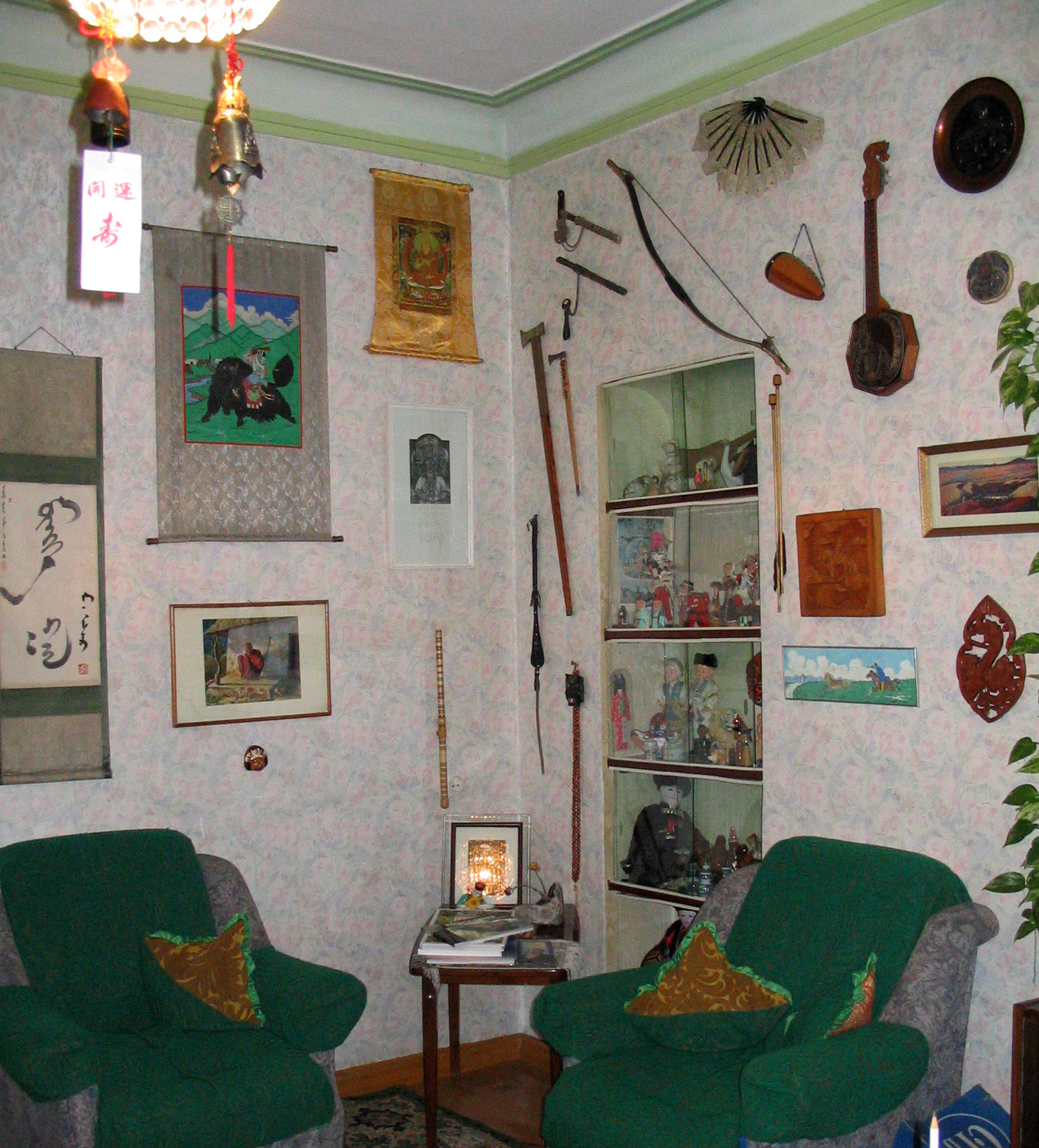
 Modern Buryat home with instruments, scrolls, and weapons typical of Buryatia
The head of the government is the President, who is appointed by the President of Russia for a four-year term. Between 1991-2007, the President was Leonid Vasilyevich Potapov, who was elected on July 1, 1994, re-elected in 1998 (with 63.25% of votes), and then re-elected again on June 23, 2002 (with over 67% of votes). Prior to the elections, Potapov was the Chairman of the Supreme Soviet of the Republic—the highest post at that time.
The Republic's parliament is the People's Khural, popularly elected every four years. The People's Khural has 65 deputies. Alexander Lubsanov is the current Chairman of the People's Khural since 2002.
The Republic's Constitution was adopted on February 22, 1994.
Economy
The republic's economy is composed of important agricultural and commercial products including wheat, vegetables, potatoes, timber, leather, graphite, and textiles. Fishing, hunting, fur farming, sheep and cattle farming, mining, stock raising, engineering, and food processing are also important economic generators.
Education
The higher education institutions of the republic include Buryatia State University, Buryat State Academy of Agriculture, East Siberian State Academy of Arts and Culture, and East Siberia State University of Technology and Managment.
Religion
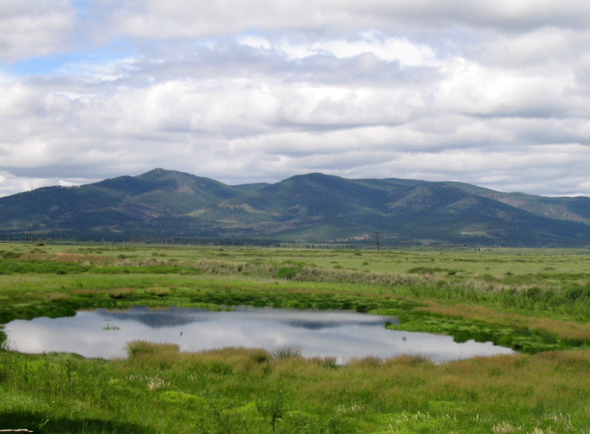
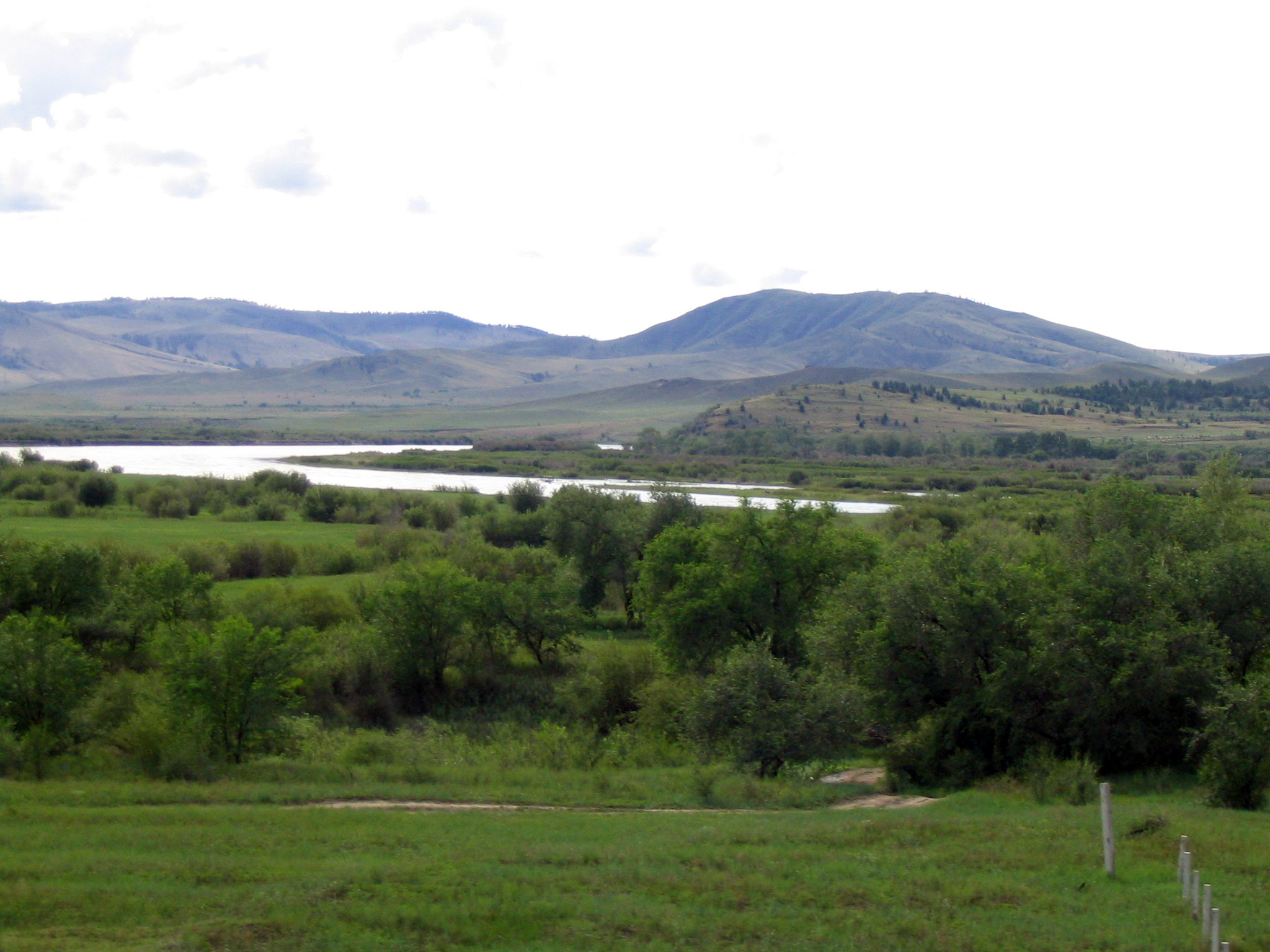
 Landscape of southern Buryatia
Tibetan Buddhism, Shamanism, and Orthodox Christianity are the most widespread religions in the republic.
Tourism
Lake Baikal is a popular tourist destination, especially in summer.
See also
References
- ^ Президент Российской Федерации. Указ №849 от 13 мая 2000 г. «О полномочном представителе Президента Российской Федерации в федеральном округе». Вступил в силу 13 мая 2000 г. Опубликован: "Собрание законодательства РФ", №20, ст. 2112, 15 мая 2000 г. (President of the Russian Federation. Decree #849 of May 13, 2000 On the Plenipotentiary Representative of the President of the Russian Federation in a Federal District. Effective as of May 13, 2000).
- ^ Госстандарт Российской Федерации. №ОК 024-95 27 декабря 1995 г. «Общероссийский классификатор экономических регионов. 2. Экономические районы», в ред. Изменения №5/2001 ОКЭР. (Gosstandart of the Russian Federation. #OK 024-95 December 27, 1995 Russian Classification of Economic Regions. 2. Economic Regions, as amended by the Amendment #5/2001 OKER. ).
- ^ a b Constitution, Article 5.3
- ^ Official website of the President of the Republic of Buryatia. Biography of Vyacheslav Vladimirovich Nagovitsyn
- ^ Федеральная служба государственной статистики (Federal State Statistics Service) (2004-05-21). "Территория, число районов, населённых пунктов и сельских администраций по субъектам Российской Федерации (Territory, Number of Districts, Inhabited Localities, and Rural Administration by Federal Subjects of the Russian Federation)" (in Russian). Всероссийская перепись населения 2002 года (All-Russia Population Census of 2002). Federal State Statistics Service. http://perepis2002.ru/ct/html/TOM_01_03.htm. Retrieved 2011-11-01.
- ^ a b c Федеральная служба государственной статистики (Federal State Statistics Service) (2011). "Предварительные итоги Всероссийской переписи населения 2010 года (Preliminary results of the 2010 All-Russian Population Census)" (in Russian). Всероссийская перепись населения 2010 года (All-Russia Population Census of 2010). Federal State Statistics Service. http://www.perepis-2010.ru/results_of_the_census/results-inform.php. Retrieved 2011-04-25.
- ^ a b Федеральная служба государственной статистики (Federal State Statistics Service) (2004-05-21). "Численность населения России, субъектов Российской Федерации в составе федеральных округов, районов, городских поселений, сельских населённых пунктов – районных центров и сельских населённых пунктов с населением 3 тысячи и более человек (Population of Russia, its federal districts, federal subjects, districts, urban localities, rural localities—administrative centers, and rural localities with population of over 3,000)" (in Russian). Всероссийская перепись населения 2002 года (All-Russia Population Census of 2002). Federal State Statistics Service. http://www.perepis2002.ru/ct/doc/1_TOM_01_04.xls. Retrieved 2010-03-23.
- ^ Правительство Российской Федерации. Постановление №725 от 31 августа 2011 г. «О составе территорий, образующих каждую часовую зону, и порядке исчисления времени в часовых зонах, а также о признании утратившими силу отдельных Постановлений Правительства Российской Федерации». Вступил в силу по истечении 7 дней после дня официального опубликования. Опубликован: "Российская Газета", №197, 6 сентября 2011 г. (Government of the Russian Federation. Resolution #725 of August 31, 2011 On the Composition of the Territories Included into Each Time Zone and on the Procedures of Timekeeping in the Time Zones, as Well as on Abrogation of Several Resolutions of the Government of the Russian Federation. Effective as of after 7 days following the day of the official publication).
- ^ Official the whole territory of Russia according to Article 68.1 of the Constitution of Russia.
- ^ Constitution, Article 67
Sources
- Верховный Совет Республики Бурятия. 22 февраля 1994 г. «Республика Бурятия. Конституция», в ред. Закона №332-IV от 7 июля 2008 г. (Supreme Council of the Republic of Buryatia. February 22, 1994 Republic of Buryatia. Constitution, as amended by the Law #332-IV of July 7, 2008. ).
Further reading
- Leisse, Olaf; Utta-Kristin Leisse (September 2007). "A Siberian Challenge: Dealing with Multiethnicity in the Republic of Buryatia". Nationalities Papers 35 (4): 773–788. doi:10.1080/00905990701475178.
External links
- (English) Official website of the Republic of Buryatia
- (Russian) Official website of the Republic of Buryatia
- Official website of the Republic of Buryatia (in Buryat)
- (Russian) Buryatia.org, site about life in the Republic of Buryatia
Subdivisions of Russia Republics Krais Oblasts - Amur
- Arkhangelsk
- Astrakhan
- Belgorod
- Bryansk
- Chelyabinsk
- Irkutsk
- Ivanovo
- Kaliningrad
- Kaluga
- Kemerovo
- Kirov
- Kostroma
- Kurgan
- Kursk
- Leningrad
- Lipetsk
- Magadan
- Moscow
- Murmansk
- Nizhny Novgorod
- Novgorod
- Novosibirsk
- Omsk
- Orenburg
- Oryol
- Penza
- Pskov
- Rostov
- Ryazan
- Sakhalin
- Samara
- Saratov
- Smolensk
- Sverdlovsk
- Tambov
- Tomsk
- Tula
- Tver
- Tyumen
- Ulyanovsk
- Vladimir
- Volgograd
- Vologda
- Voronezh
- Yaroslavl
Federal cities Autonomous oblasts Autonomous okrugs 1administratively subordinated to Tyumen Oblast 2 administratively subordinated to Arkhangelsk Oblast
Categories:- Republic of Buryatia
- States and territories established in 1923


Wikimedia Foundation. 2010.