- Novgorod Oblast
-
Novgorod Oblast Новгородская область (Russian) — Oblast — 
Flag
Coat of arms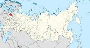
Coordinates: 58°26′N 32°23′E / 58.433°N 32.383°ECoordinates: 58°26′N 32°23′E / 58.433°N 32.383°E Political status Country Russia Federal district Northwestern[1] Economic region Northwestern[2] Administrative center Veliky Novgorod Government (as of March 2011) - Governor Sergey Mitin[3] - Legislature Oblast Duma Statistics Area (as of the 2002 Census)[4] - Total 55,300 km2 (21,351.4 sq mi) Area rank 48th Population (2010 Census)[5] - Total 634,135 - Rank 69th - Density 11.47 /km2 (29.7 /sq mi) - Urban 70.6% - Rural 29.4% Population (2002 Census)[6] - Total 694,355 - Rank 69th - Density 12.56 /km2 (32.5 /sq mi) - Urban 69.8% - Rural 30.2% Time zone(s) MSD (UTC+04:00)[7] ISO 3166-2 RU-NGR License plates 53 Official languages Russian[8] http://www.niac.natm.ru/ Novgorod Oblast (Russian: Новгоро́дская о́бласть, Novgorodskaya oblast) is a federal subject of Russia (an oblast), located between Moscow and Saint Petersburg. Its administrative center is the city of Veliky Novgorod. Some of the oldest Russian cities, including Veliky Novgorod and Staraya Russa, are located there. The historic monuments of Veliky Novgorod are surroundings have been declared a UNESCO World Heritage Site.
Contents
Geography
Novgorod Oblast borders Leningrad Oblast (NW,N), Vologda Oblast (E), Tver Oblast (SE,S) and Pskov Oblast (SW).
The western part is a lowland around the Lake Ilmen, while the eastern part is a highland (northern spurs of the Valdai Hills).[9] The highest point is Mount Ryzhokha (296 m).
Economy
Novgorod Oblast is noted for its science- and labor-intensive sectors, particularly the chemical and forest industries. The engineering and metalworking, electronics, chemical, forest, woodworking, and pulp and paper industries produce nearly half of the oblast's marketable commodities.
The chemical industry is Novgorod Oblast's leading economic sector, accounting for 31.4% of total industrial output. Products include fertilizers, general rubber goods, synthetic resins, plastics, paints, pharmaceuticals, and household chemicals. Fertilizer companies using both local and imported raw materials produce nitrogen fertilizers (Novgorod Chemical Plant).
The engineering industry accounts for 11%+ of all industrial production. It is characterized by science- and labor-intensive production specializing in the output of sophisticated high-precision machines and equipment, electrical equipment, electronics and radioelectronics, instrument making, and shipbuilding, which developed as a result of the Oblast's maritime location. Production of equipment for the chemical industry has also been established.
The forestry complex, which includes the forest, woodworking, and pulp and paper industries, produces 10.9% of the Oblast's industrial goods. Lumber, plywood, and furniture are some of the products of the woodworking industry. Most of the materials for the wood processing industry are supplied from neighboring Oblasts and republics of Northern district.
The development prospects of the forestry complex are tied to high-end timber processing, greater competitiveness of output products, forest regeneration, and improvements in the Oblast's ecological situation.
Along with specialized sectors, there are others that supplement the economic complex, such as the power industry, which accounts for 16.5% of industrial output. The power industry is represented by low- and medium-power thermal and hydroelectric power plants, including a hydroelectric power plant on the Volkhov River. All the plants are integrated into the Northwestern unified energy system and connected with the unified energy system of European Russia. The metallurgical industry is another supplementary sector. Light industry is represented mainly by the textile, leather shoe, and ceramics industries.
The industrial construction complex has interregional significance. Companies in this sector are located in large and medium-sized cities with access to main highways. They produce reinforced concrete components and structures and other building materials. The glass industry is also well developed in Novgorod Oblast.
Novgorod Oblast's economic complex is a combination of companies of regional significance (forestry, power) and specialized companies (radio engineering and chemical industries). The largest industrial centers are Veliky Novgorod (specialized machine engineering, electrical and radio engineering, chemical industry, nitrogen fertilizer production, food industry, ship repair yard, and sawmill); Staraya Russa (instrument making and chemical engineering); and Borovichi (ceramics and glass production).
Rivers
Major rivers (sorted by discharge) include:
Lakes
Major lakes include:
Administrative divisions
Demographics
Population: 634,135 (2010 Census,[5] down from 694,355 recorded by the 2002 Census,[10]
Novgorod Oblast has the lowest population for any oblast in the European part of Russia. One of the reasons for the relatively low population density is that the area suffered heavily during World War II. The population is 70.6% urban.[5]
Ethnic groups: Novgorod Oblast is relatively homogenous, with only five recognized ethnic groups of more than two thousand persons each at the time of the census. The following ethnicities were most numerous: 652,152 Russians (93.92%); 10,449 Ukrainians (1.50%); 5,294 Belarusians (0.76%); 3,388 Roma (0.49%); 2,077 Tatars (0.30%); 1,940 Armenians (0.289%); 1,574 Azeris (0.23%); 1,074 Chechens (0.15%); and 1,010 Germans (0.15%); as well as many other smaller groups. In addition, a further 5,575 persons (0.80%) declined to state their nationality on the census questionnaire.[11]
- Births (2008): 6,912 (10.6 per 1000)
- Deaths (2008): 13,574 (20.9 per 1000) [12]
References
- ^ Президент Российской Федерации. Указ №849 от 13 мая 2000 г. «О полномочном представителе Президента Российской Федерации в федеральном округе». Вступил в силу 13 мая 2000 г. Опубликован: "Собрание законодательства РФ", №20, ст. 2112, 15 мая 2000 г. (President of the Russian Federation. Decree #849 of May 13, 2000 On the Plenipotentiary Representative of the President of the Russian Federation in a Federal District. Effective as of May 13, 2000).
- ^ Госстандарт Российской Федерации. №ОК 024-95 27 декабря 1995 г. «Общероссийский классификатор экономических регионов. 2. Экономические районы», в ред. Изменения №5/2001 ОКЭР. (Gosstandart of the Russian Federation. #OK 024-95 December 27, 1995 Russian Classification of Economic Regions. 2. Economic Regions, as amended by the Amendment #5/2001 OKER. ).
- ^ Official website of Novgorod Oblast. Sergey Gerasimovich Mitin, Governor of Novgorod Oblast (Russian)
- ^ Федеральная служба государственной статистики (Federal State Statistics Service) (2004-05-21). "Территория, число районов, населённых пунктов и сельских администраций по субъектам Российской Федерации (Territory, Number of Districts, Inhabited Localities, and Rural Administration by Federal Subjects of the Russian Federation)" (in Russian). Всероссийская перепись населения 2002 года (All-Russia Population Census of 2002). Federal State Statistics Service. http://perepis2002.ru/ct/html/TOM_01_03.htm. Retrieved 2011-11-01.
- ^ a b c Федеральная служба государственной статистики (Federal State Statistics Service) (2011). "Предварительные итоги Всероссийской переписи населения 2010 года (Preliminary results of the 2010 All-Russian Population Census)" (in Russian). Всероссийская перепись населения 2010 года (All-Russia Population Census of 2010). Federal State Statistics Service. http://www.perepis-2010.ru/results_of_the_census/results-inform.php. Retrieved 2011-04-25.
- ^ Федеральная служба государственной статистики (Federal State Statistics Service) (2004-05-21). "Численность населения России, субъектов Российской Федерации в составе федеральных округов, районов, городских поселений, сельских населённых пунктов – районных центров и сельских населённых пунктов с населением 3 тысячи и более человек (Population of Russia, its federal districts, federal subjects, districts, urban localities, rural localities—administrative centers, and rural localities with population of over 3,000)" (in Russian). Всероссийская перепись населения 2002 года (All-Russia Population Census of 2002). Federal State Statistics Service. http://www.perepis2002.ru/ct/doc/1_TOM_01_04.xls. Retrieved 2010-03-23.
- ^ Правительство Российской Федерации. Постановление №725 от 31 августа 2011 г. «О составе территорий, образующих каждую часовую зону, и порядке исчисления времени в часовых зонах, а также о признании утратившими силу отдельных Постановлений Правительства Российской Федерации». Вступил в силу по истечении 7 дней после дня официального опубликования. Опубликован: "Российская Газета", №197, 6 сентября 2011 г. (Government of the Russian Federation. Resolution #725 of August 31, 2011 On the Composition of the Territories Included into Each Time Zone and on the Procedures of Timekeeping in the Time Zones, as Well as on Abrogation of Several Resolutions of the Government of the Russian Federation. Effective as of after 7 days following the day of the official publication).
- ^ Official the whole territory of Russia according to Article 68.1 of the Constitution of Russia.
- ^ Darby; Richard Brookes, William Darby (1827). Darby's Universal Gazetteer: Or, A New Geographical Dictionary .... Original from the New York Public Library: Bennett & Walton. pp. 837. http://books.google.com/?id=NrsBAAAAYAAJ&pg=PA837&dq=%22Valdai+Lake%22.
- ^ "Всесоюзная перепись населения 1989 г. Численность наличного населения союзных и автономных республик, автономных областей и округов, краёв, областей, районов, городских поселений и сёл-райцентров. (All Union Population Census of 1989. Present population of union and autonomous republics, autonomous oblasts and okrugs, krais, oblasts, districts, urban settlements, and villages serving as district administrative centers.)" (in Russian). Всесоюзная перепись населения 1989 года (All-Union Population Census of 1989). Demoscope Weekly (website of the Institute of Demographics of the State University—Higher School of Economics. 1989. http://demoscope.ru/weekly/ssp/rus89_reg.php. Retrieved 2010-03-23.
- ^ (XLS) National Composition of Population for Regions of the Russian Federation. 2002 Russian All-Population Census. 2002. http://www.perepis2002.ru/ct/doc/English/4-2.xls. Retrieved 2006-07-20.
- ^ http://novgorodstat.natm.ru/digital/operinf/ЕстественноеДвижениеНаселения.htm
External links
- (Russian) Information for tourists
- (Russian) Official website of Novgorod Oblast
- (Russian) Official website of the Novgorod Oblast branch of the State Statistics Service
Categories:- Novgorod Oblast
- States and territories established in 1944


Wikimedia Foundation. 2010.