- Baekdu Mountain
-
Baekdu Mountain 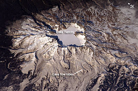
Baekdu Mountain volcano, April 2003Elevation 2,744 m (9,003 ft) Prominence 2,593 m (8,507 ft) Listing Country high point
UltraLocation 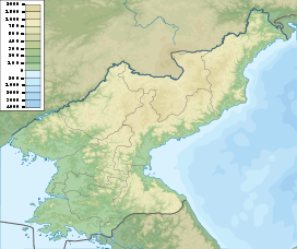
 Baekdu Mountain
 Ryanggang, North Korea
 Jilin, China
Coordinates 42°00′20″N 128°03′19″E / 42.00556°N 128.05528°ECoordinates: 42°00′20″N 128°03′19″E / 42.00556°N 128.05528°E Geology Type Stratovolcano Last eruption 1903[1] Baekdu Mountain Chinese name Traditional Chinese 長白山 Simplified Chinese 长白山 Transcriptions Mandarin - Hanyu Pinyin Chángbái Shān - Wade–Giles Ch'ang-pai Shan Korean name Chosŏn'gŭl 백두산 Hancha 白頭山 Transcriptions - McCune-
ReischauerPaektusan - Revised
RomanizationBaekdusan Manchu name Manchu 
Golmin Šanggiyan AlinBaekdu Mountain, also known in China as Changbai Mountain (when referencing only the mountain[2]) and Baitou Mountain (when referencing both the mountain and its crater lake, Heaven Lake[2]), is a volcanic mountain on the border between North Korea and China, located at 42°00′24″N 128°03′18″E / 42.00667°N 128.055°E. At 2,744 m (9,003 ft), it is the highest mountain of the Changbai mountain range to the north and Baekdudaegan mountain range to the south. It is also the highest mountain in the Korean peninsula and in Northeast China.[3]
The Korean name, Baekdu San (백두산, 白頭山; Baekdu-san), means "white-headed mountain". English-language volcanology resources sometimes refer to the mountain as Baitoushan; this name arose by reading the Korean Hanja 白頭山 as Chinese. The Chinese name, Changbai Shan (長白山/长白山), means "ever-white mountain". The Manchu name, Golmin Šanggiyan Alin, means "white mountain".
Its name variants include Paektu-san[4] (Korean 백두산[5]), Ch’ang Pai,[6] Chang-pai Shan,[7] Chōhaku-san,[8] Hakutō,[9] Hakutō-san,[10] Hakutō-zan,[11] Paik-to-san,[12] Pai-t’ou Shan,[13] Mount Paitoushar,[14] Paitow Shan,[15] Pei-schan[16] and Bai Yun Feng.
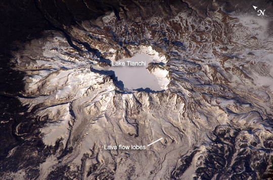
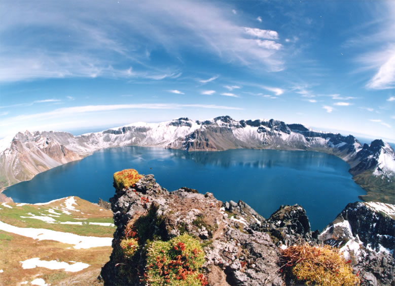
A large crater lake, called Heaven Lake (Korean:천지, Chinese:天池), is in the caldera atop the mountain.
Contents
Etymology
 Etymology of Mount Baitou
All Chinese and Korean names, ever-white or white-head, originate from the Manchu language (or more accurately, Sushen language or Proto-Jurchen language) Šanggiyan Alin (white mountain).
Geography and geology
Baekdu Mountain is a stratovolcano whose cone is truncated by a large caldera, about 5 km (3.1 mi) wide and 850 m (2,789 ft) deep, partially filled by the waters of Heaven Lake.[1] The caldera was created by a major eruption in 969 AD (± 20 years).[17] Volcanic ash from this eruption has been found as far away as the southern part of Hokkaidō, the northern island of Japan. The lake has a circumference of 12 to 14 kilometres (7.5-8.7 miles), with an average depth of 213 m (699 ft) and maximum depth of 384 m (1,260 ft). From mid-October to mid-June, the lake is typically covered with ice. In 2011, experts in North and South Korea met to discuss the potential for a significant eruption in the near future.[18]
The central section of the mountain rises about 3 mm every year, due to rising levels of magma below the central part of the mountain. Sixteen peaks exceeding 2,500 m (8,200 ft) line the caldera rim surrounding Heaven Lake. The highest peak, called Janggun Peak, is covered in snow about eight months of the year. The slope is relatively gentle until about 1,800 metres (5,905 ft).
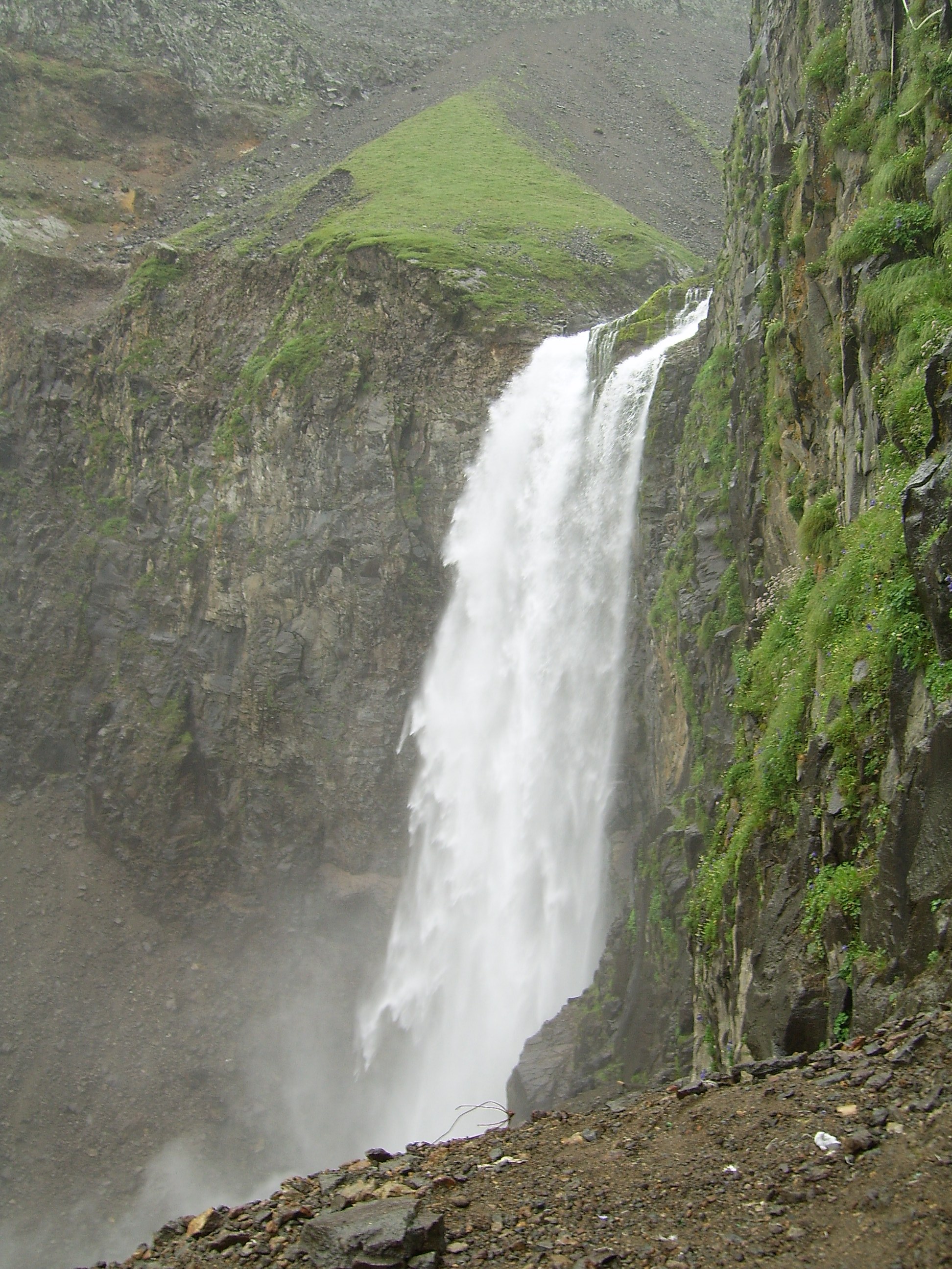
Water flows north out of the lake, and near the outlet there is a 70 metre (230 ft) waterfall. The mountain is the source of the Songhua, Tumen and Yalu rivers.
Climate
The weather on the mountain can be very erratic, sometimes severe. The annual average temperature at the peak is −8.3 °C (17.1 °F). During summer, temperatures of about 18 °C (64 °F) or higher can be reached, and during winter temperatures can drop to −48 °C (−54 °F). Average temperature is about −24 °C (−11 °F) in January, and 10 °C (50 °F) in July, remaining below freezing for eight months of the year. Average wind speed is 42 kilometres (26.1 mi) per hour, peaking at 63 kilometres (39.1 mi) per hour. Relative humidity averages 74%. Summer snow cover on the peak has reduced dramatically during that time.
Flora and fauna
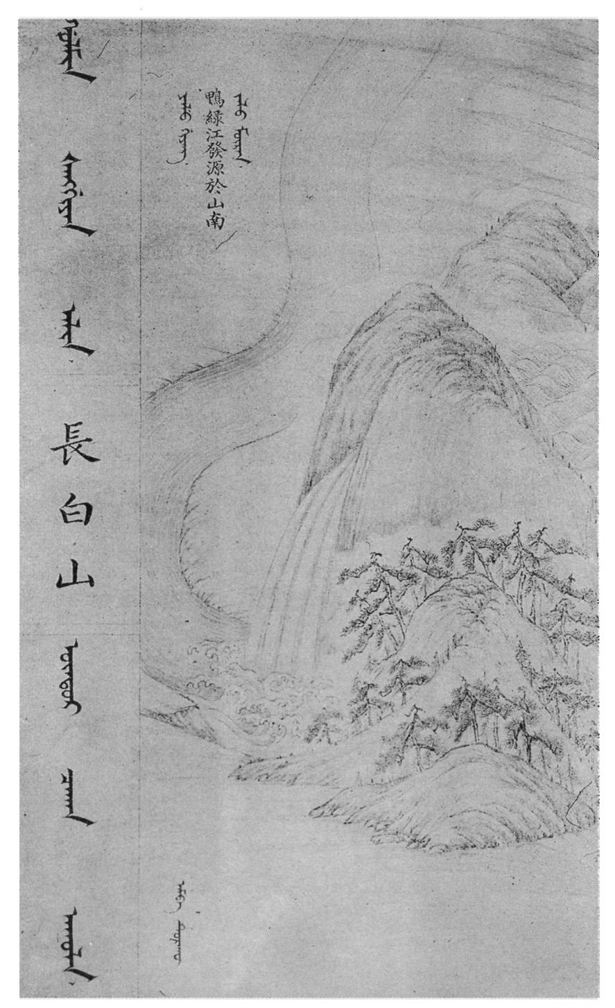
 Painting from the Manchu Veritable Records
There are five known species of plants in the lake on the peak, and some 168 were counted along its shores. The area is a known habitat for tigers, bears, leopards, wolves, and wild boars. Deer in the mountain forests, which cover the mountain up to about 2000 metres, are of the Paekdusan roe deer kind. Many wild birds such as black grouse, owls, and woodpecker are known to inhabit the area. The forest on the Chinese side is ancient and almost unaltered by humans. Birch predominates near the tree line, and pine lower down, mixed with other species. In recent decades, significant climate warming has resulted in changes in the structure of the ancient forests on the upper slopes, with a change over from birch to more pine, and a thickening of the forest canopy. There has been extensive deforestation on the lower slopes on the North Korean side of the mountain.
History
The Baekdu Mountain has been worshipped by the surrounding peoples throughout history. Both the Koreans and Manchus consider it the place of their ancestral origin.
China
It was first recorded in the Chinese classic text Shan Hai Jing with the name Buxian Shan (不咸山,即神仙山, the Mountain with God). It is also called Shanshan Daling (單單大嶺, the Big Big Big Mountain. 《說文》:“單,大也。”) in the Canonical Book of the Eastern Han Dynasty. In the Canonical Book of the Tang Dynasty, it was called Taibai Shan (太白山, the Grand Old White Mountain).[19] The current Chinese name Changbai Shan (長白山, perpetually white mountain) was first used in the Liao Dynasty (907-1125)[20] and then the Jurchen Jin Dynasty (1115–1234).[21]
The Jurchen Jin Dynasty (1115–1234) bestowed the title "the King Who Makes the Nation Prosperous and Answers with Miracles" (興國靈應王, Xingguo Lingying Wang) on the mountain god in 1172 and it was promoted to "the Emperor Who Cleared the Sky with Tremendous Sagehood" (開天宏聖帝, Kaitian Hongsheng Emperor) in 1193.
Korea
Koreans consider Mount Baekdu as the place of their ancestral origin and as a sacred mountain, one of the three[which?] “spirited” mountains; the one contained in the legendary foundation of Korea. From the beginning of history through the Three Kingdoms period, to the Goryeo and Joseon Dynasties, Koreans have spiritually depended upon the “divine” mountain.
The mountain was considered sacred by Koreans throughout history. The legendary beginning of Korea's first kingdom, Gojoseon (2333 BC–108 BC), takes place here. Many subsequent kingdoms of Korea, such as Buyeo, Goguryeo, Balhae, Goryeo and Joseon, considered the mountain sacred and held worshipping rituals for the mountain.[22][23]
The Goryeo dynasty (935–1392) first called the mountain Baekdu,[24] recording that the Jurchens across the Yalu River were made to live outside of Baekdu Mountain. The Joseon Dynasty (1392–1910) recorded volcanic eruptions in 1597, 1668, and 1702. The 15th century, King Sejong the Great strengthened the fortification along the Tumen and Yalu rivers, making the mountain a natural border with the northern peoples.[25] Some Koreans claim that the entire region near Baekdu Mountain and the Tumen River belongs to Korea and part of it was illegally sold by Japanese colonialists to China through the Gando Convention.
Dense forest around the mountain provided bases for Korean armed resistance against the Japanese occupation, and later communist guerrillas during the Korean War. North Korea claims that Kim Il-sung organized his resistance against the Japanese forces there and that Kim Jong-il was born there[citation needed], although records outside of North Korea show that these events took place a short distance within the borders of the Soviet Union.
Border disputes
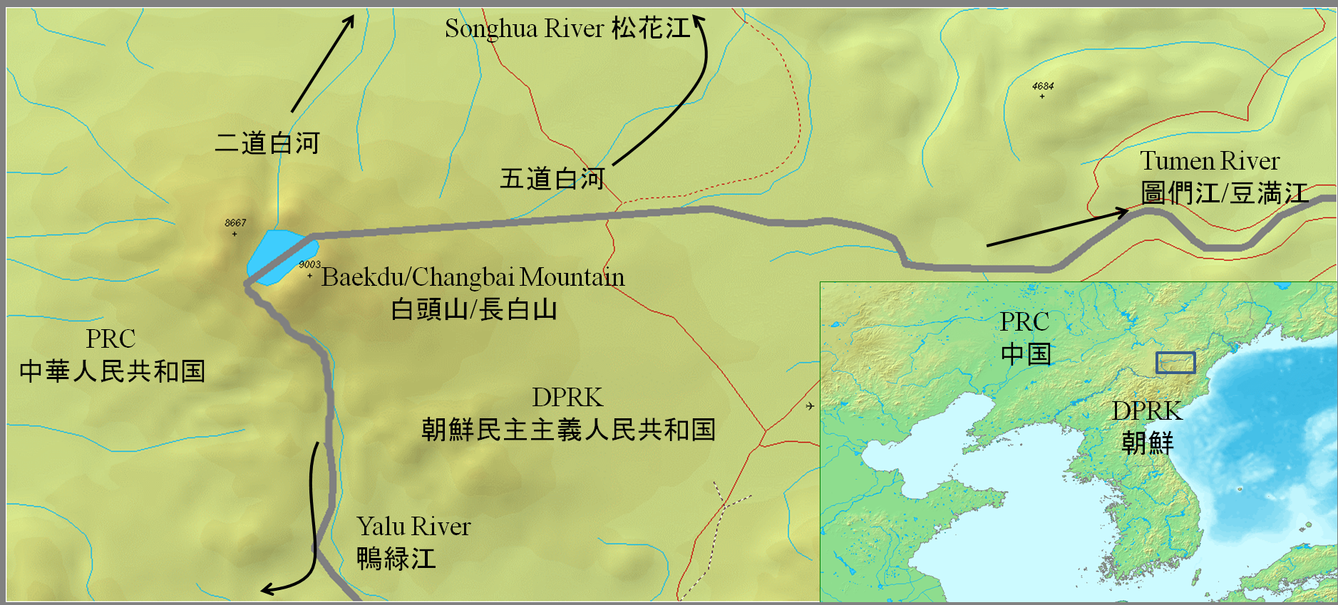
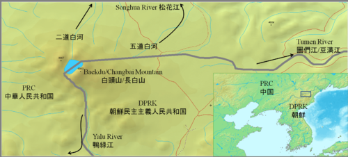 PRC-DPRK border around Baekdu-Changbai Mountain (Google map)
According to Annals of the Joseon Dynasty, the Yalu (鴨綠江) and Tumen Rivers (豆滿江) were set as the borders in the era of the founder of Joseon Dynasty, Taejo of Joseon (1335–1408).[26] Because of the continuous entry of Korean people into Gando, a region in Manchuria that lay north of the Tumen Manchu and Korean officials surveyed the area and negotiated a border agreement in 1712. To mark the agreement, they built a monument describing the boundary at a watershed, near the south of the crater lake at the mountain peak. The interpretation of the inscription caused a territorial dispute from the late 19th century to the early 20th century, and is still disputed by academics today. The 1909 Gando Convention between China and Japan (Japan was responsible for Korea's foreign affairs at the time, according to the Eulsa Treaty, though this treaty was later declared null and void in 1965 by the Treaty on Basic Relations between Japan and the Republic of Korea) recognized the area north and east as Chinese territory. The border was further clarified in 1962, when China and North Korea negotiated a border treaty on the mountain border in response to minor disputes. The two countries agreed to share the mountain and the lake at the peak, with Korea controlling approximately 54.5% and gaining approximately 230 km² in the treaty.[27]
Recent disputes
Some South Korean groups argue that recent activities conducted on the Chinese side of the border, such as economic development, cultural festivals, infrastructure development, promotion of the tourism industry, attempts at registration as a World Heritage Site, and bids for a Winter Olympic Games, are an attempt to claim the mountain as Chinese territory.[28][29] These groups object to China's use of Changbai Mountain, which has been used since Liao Dynasty[20] and the earlier Jin Dynasty (1115–1234).[21] Some groups also regard the entire mountain as Korean territory that was given away by North Korea in the Korean War.[29] Both European maps and Chinese maps dating before the annexation of Baekdu Mountain and Gando show these areas to be under Korean Joseon Dynasty control.[30][31][dead link]
During the 2007 Asian Winter Games, which were held in Changchun, China, a group of South Korean athletes held up signs during the award ceremony which stated "Mount Baekdu is our territory". Chinese sports officials delivered a letter of protest on the grounds that political activities violated the spirit of the Olympics and were banned in the charter of the International Olympic Committee and the Olympic Council of Asia. The head of the Korea Olympic Committee responded by stating that the incident was accidental and held no political meaning.[32][33][34][35] South Korea has attempted to avoid having this issue become a source of friction between South Korea and China. The athletes' gesture did not become as big an issue as Liancourt Rocks and the Sea of Japan naming dispute. The 2007 official National Atlas of Korea [36] clearly shows the boundary as per the 1962 agreement, roughly splitting the mountain and the caldera lake. However, there are some in Taiwan and South Korea[37][38] who do not see the 1962 agreement between China and North Korea as legitimate.
Sightseeing
Foreign visitors, mostly South Koreans, usually climb the mountain from the Chinese side, although Baekdu Mountain is a common tourist destination for the few foreign tourists in North Korea.
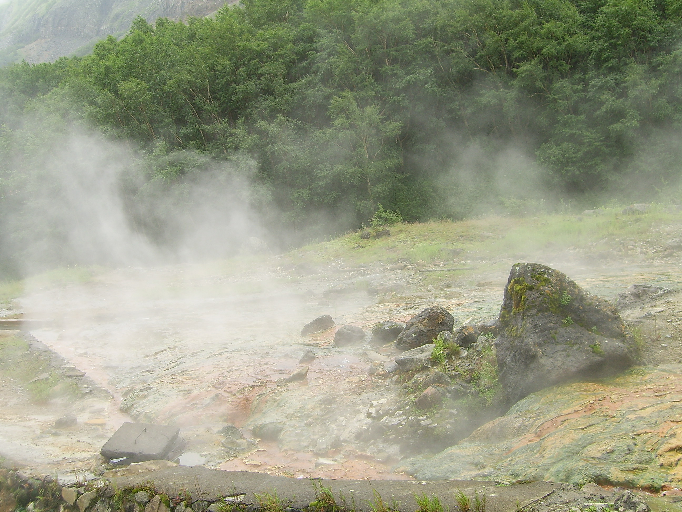
There are a number of monuments on the North Korean side of the mountain. Baekdu Spa is a natural spring and is used for bottled water. Pegae Hill is a famous camp site of the Korean People’s Revolutionary Army (Hangul: 조선인민혁명군, Hanja: 朝鮮人民革命軍) led by Kim Il-sung during their struggle against Japanese colonial rule. There are also a number of secret camps which are now open to the public. There are several waterfalls, including the Hyongje Falls which splits into two separate falls about a third from the top.
-

Baekdu mountain's location
-
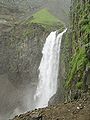
Waterfall
-

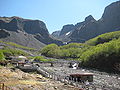
Hot springs
-
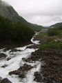
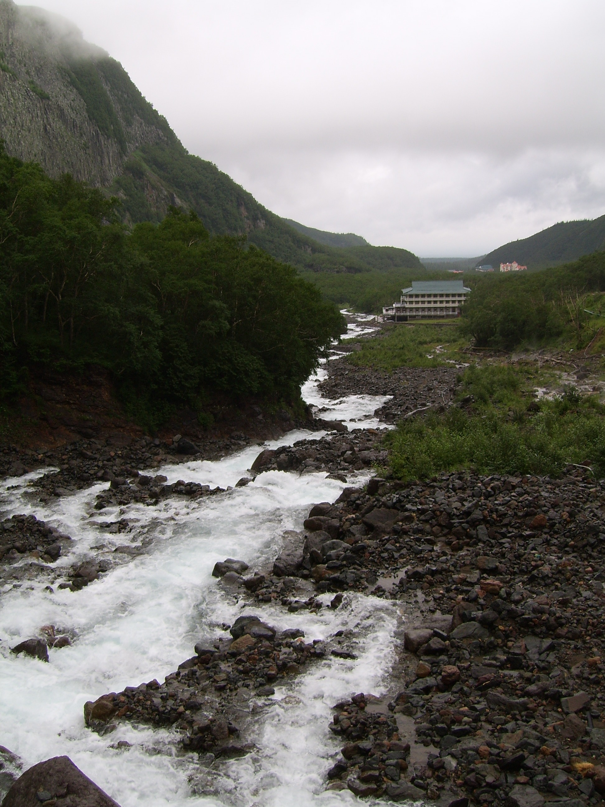
River
-
-
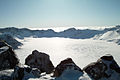
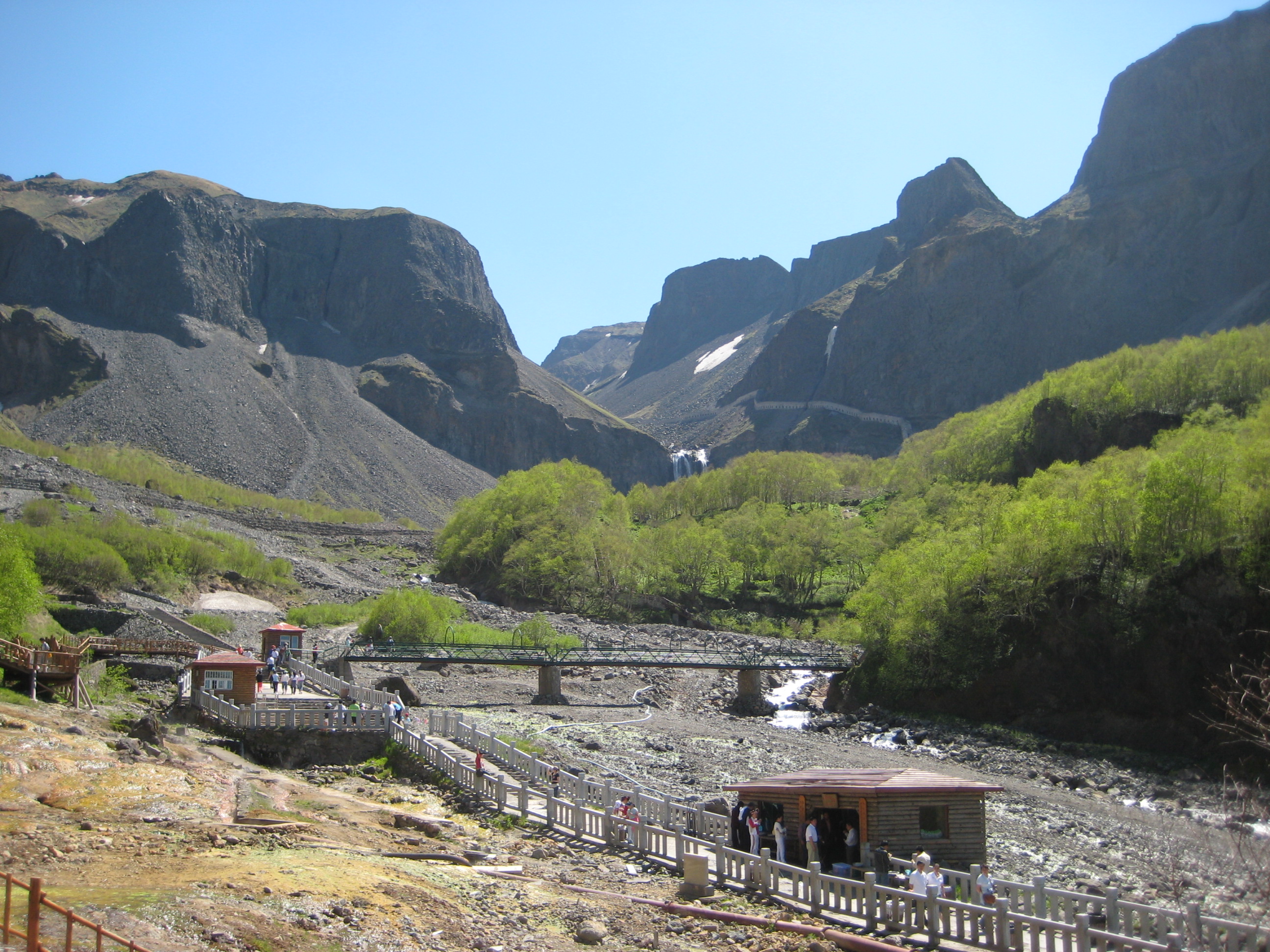
North slope
See also
- Geography of North Korea
- Baekdudaegan Mountain Ranges
- Changbai Mountain Ranges
- List of mountains in Korea
- List of volcanoes in Korea
- List of volcanoes in China
- Geography of China
References
- ^ a b "Baekdusan". Global Volcanism Program, Smithsonian Institution. http://www.volcano.si.edu/world/volcano.cfm?vnum=1005-06-. Retrieved 2009-01-01.
- ^ a b ISBN 7-5031-2136-X page 31
- ^ Ehlers, Jürgen; Gibbard, Philip (2004). Quaternary Glaciations: South America, Asia, Africa, Australasia, Antarctica. Elsevier. "The Changbai Mountain is the highest (2570 m a.s.l.) in north-eastern China (42°N,128°E) on the border between China and Korea."
- ^ "Paektu-san: North Korea". http://www.geographic.org/geographic_names/name.php?uni=-278626&fid=3390&c=north_korea. Retrieved 2010-10-04.
- ^ "백두산: North Korea". http://www.geographic.org/geographic_names/name.php?uni=6529899&fid=3371&c=north_korea. Retrieved 2010-10-04.
- ^ "Ch’ang Pai: China". http://www.geographic.org/geographic_names/name.php?uni=-2613638&fid=1178&c=china. Retrieved 2010-10-04.
- ^ "Chang-pai Shan: China". http://www.geographic.org/geographic_names/name.php?uni=-2613648&fid=1243&c=china. Retrieved 2010-10-04.
- ^ "Chōhaku-san: China". http://www.geographic.org/geographic_names/name.php?uni=-2620251&fid=1243&c=china. Retrieved 2010-10-04.
- ^ "Hakutō: China". http://www.geographic.org/geographic_names/name.php?uni=-2631757&fid=1048&c=china. Retrieved 2010-10-04.
- ^ "Hakutō-san: China". http://www.geographic.org/geographic_names/name.php?uni=-2631758&fid=1243&c=china. Retrieved 2010-10-04.
- ^ "Hakutō-zan: China". http://www.geographic.org/geographic_names/name.php?uni=-2631759&fid=1243&c=china. Retrieved 2010-10-04.
- ^ "Paik-to-san: China". http://www.geographic.org/geographic_names/name.php?uni=-2665391&fid=1145&c=china. Retrieved 2010-10-04.
- ^ "Pai-t’ou Shan: China". http://www.geographic.org/geographic_names/name.php?uni=-278724&fid=1243&c=china. Retrieved 2010-10-04.
- ^ "Mount Paitoushar: China". http://www.geographic.org/geographic_names/name.php?uni=-2665798&fid=1080&c=china. Retrieved 2010-10-04.
- ^ "Paitow Shan: China". http://www.geographic.org/geographic_names/name.php?uni=-2665801&fid=1276&c=china. Retrieved 2010-10-04.
- ^ "Pei-schan: China". http://www.geographic.org/geographic_names/name.php?uni=-2667365&fid=1178&c=china. Retrieved 2010-10-04.
- ^ Horn, Susanne; Schmincke, Hans-Ulrich (2000). "Volatile emission during the eruption of Baitoushan Volcano (China/North Korea) ca. 969 AD". Bulletin of Volcanology 61 (8): 537–555. doi:10.1007/s004450050004.
- ^ Sam Kim, Yonhap (March 22, 2011). "(LEAD) S. Korea agrees to talks on possible volcano in N. Korea". Yonhap News Agency. http://english.yonhapnews.co.kr/northkorea/2011/03/22/55/0401000000AEN20110322003500315F.HTML. Retrieved 22 March 2011.
- ^ Second Canonical Book of the Tang Dynasty.《新唐書.北狄渤海傳》:"契丹盡忠殺營州都督趙翽反,有舍利乞乞仲象者,與靺鞨酋乞四比羽及高麗餘種東走,度遼水,保太白山之東北,阻奧婁河,樹壁自固。"(English translation: Khitan general Jinzhong Li killed Hui Zhao, the commanding officer of Yin Zhou. Officer Dae Jung-sang, with Mohe chieftain Qisi Piyu and Goguryeo remnants, escaped to the east, crossed Liao River, guarded the northeast part of the Grand Old White Mountain, blocked Oulou River, built walls to protect themselves.)
- ^ a b "Records of Khitan Empire". 《契丹国志》:“长白山在冷山东南千余里......禽兽皆白。”(English translation: "Changbai Mountain is a thousand miles to the southeast of Cold Mountain...Birds and animals there are all white.")
- ^ a b "Canonical History Records of the Jurchen Jin Dynasty".《金史.卷第三十五》:"長白山在興王之地,禮合尊崇,議封爵,建廟宇。""厥惟長白,載我金德,仰止其高,實惟我舊邦之鎮。”(English translation: "Changbai Mountain is in old Jurchen's land, highly respectful, suitable for building temples.""Only the Changbai Mountain can carry Jurchen Jin Dynasty's spirit; It is so high; It is a part of our old land.")
- ^ http://enc.daum.net/dic100/viewContents.do?&m=all&articleID=b09b0712b Korea Britannica
- ^ Song, Yong-deok (2007). "The recognition of mountain Baekdu in the Koryo dynasty and early times of the Joseon dynasty". History and Reality v.64.
- ^ Goryeosa (King Gwangjong reign, 959)
- ^ http://kr.dic.yahoo.com/search/enc/result.html?p=%B9%E9%B5%CE%BB%EA&pk=13856900&subtype=&type=enc&field=id Yahoo Korea Encyclopedia
- ^ (Korean)(Chinese) 朝鮮王朝実録太祖8卷4年(1395年)12月14日 “以鴨綠江爲界。”“以豆滿江爲界。”
- ^ 역사비평 (Historical Criticism), Fall, 1992
- ^ Chosun
- ^ a b Donga.
- ^ Korea Focus.
- ^ Hankooki.
- ^ Chosunilbo China Upset with "Baekdu Mountain" Skaters [1] "There are no territorial disputes between China and South Korea. What the Koreans did this time hurt the feelings of the Chinese people and violated the spirit of the Olympic Charter and the Olympic Council of Asia," the official said, according to the China News.
- ^ Yonhap News, "Seoul asks Beijing to respond in composed manner to dispute over Mount Paektu", http://english.yonhapnews.co.kr/Engnews/20070202/610000000020070202150304E1.html, accessed February 2, 2007
- ^ The Korea Times, "Seoul Cautious Over Rift With China", http://times.hankooki.com/lpage/200702/kt2007020218122853460.htm, accessed February 2, 2007
- ^ Sports World Korea
- ^ National Geographic Information Institute, Ministry of Construction and Transportation, The National Atlas of Korea, Gyeonggi-do, (South) Korea, 2007, p. 14, http://www.ngii.go.kr
- ^ [조선만평] 2007년 2월 3일자 - 조선닷컴 포토
- ^ [조선만평] 2007년 2월 2일자 - 조선닷컴 포토
Further reading
- Hetland, E.A. et al. (2004). "Crustal structure in the Changbaishan volcanic area, China, determined by modeling receiver functions". Tectonophysics 386 (3–4): 157–175. doi:10.1016/j.tecto.2004.06.001.
External links
- Yonson Ahn: China and the Two Koreas Clash Over Mount Paekdu/Changbai: Memory Wars Threaten Regional Accommodation (Japan Focus, 27 July 2007)
- Satellite image by Google Maps
- "Changbaishan". Global Volcanism Program, Smithsonian Institution. http://www.volcano.si.edu/world/volcano.cfm?vnum=1005-06-. Retrieved 2009-01-01.
Volcanoes of China Jilin topics Changchun (capital) General Geography Education Culture Visitor attractions Gungnae Fortress • Tomb of the General • Baekdu Mountain • Heaven Lake • Ancient Tombs at Longtou Mountain • Mausoleum of Princess ZhenxiaoCategories:- Crater lakes
- Geography of Jilin
- Mountains of China
- Mountains of North Korea
- Sacred mountains
- Stratovolcanoes
- VEI-6 volcanoes
- Volcanic calderas
- Volcanoes of China
- Volcanoes of North Korea
- Biosphere reserves of North Korea
- Active volcanoes
- China – North Korea border
- Geography of Northeast Asia
- International mountains of Asia
- Tourism in North Korea
- Territorial disputes of North Korea
- Territorial disputes of the People's Republic of China
-


Wikimedia Foundation. 2010.