- Devil's Lake State Park (Wisconsin)
-
- This is about the state park in Wisconsin. For parks with similar names, see Devil's Lake State Park (disambiguation)
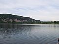
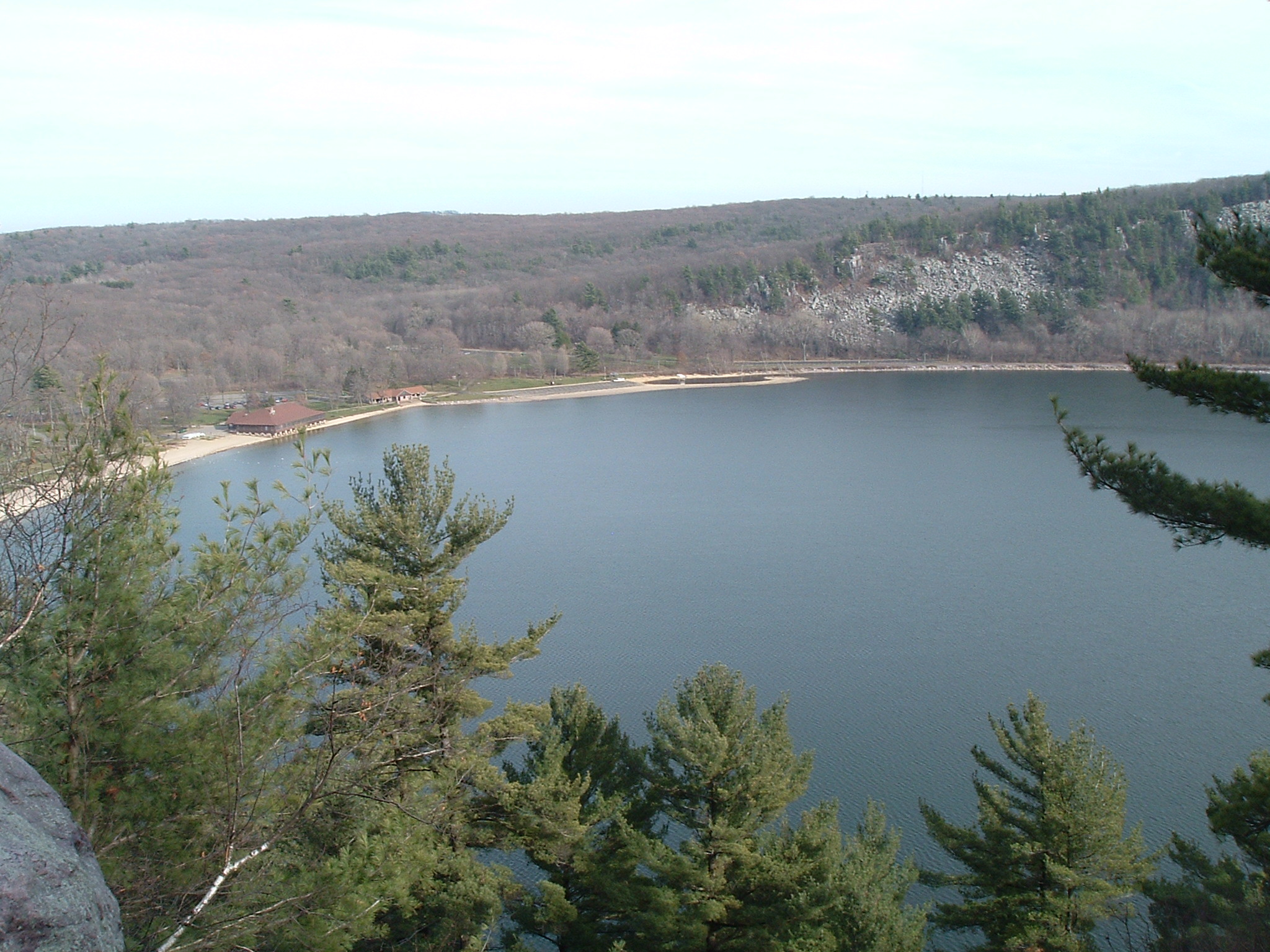
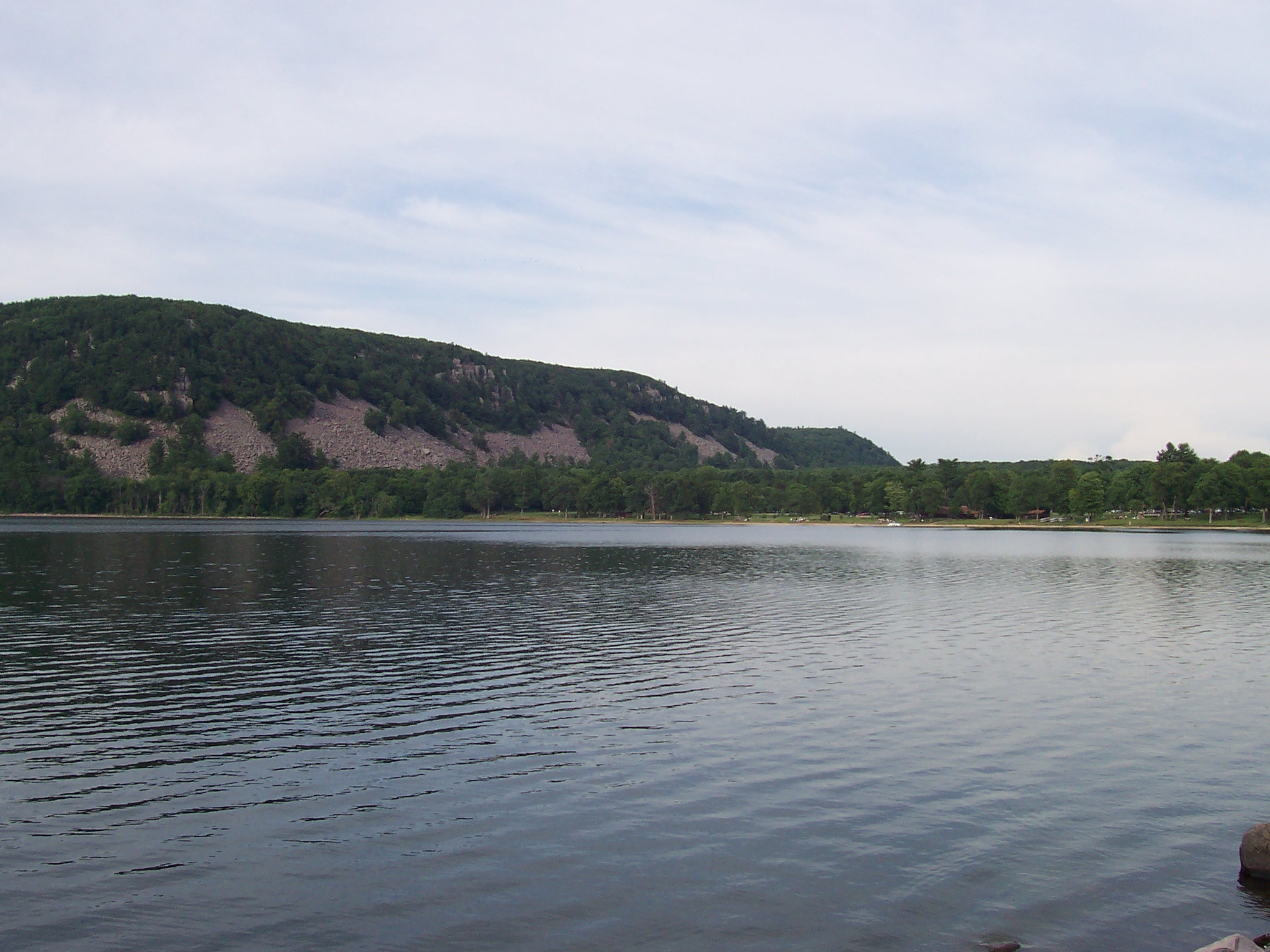
Devil's Lake State Park Wisconsin State Park 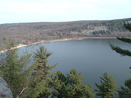 Devil's Lake from the West Bluff
Country  United States
State  Wisconsin
County Sauk Location Baraboo - elevation 1,329 ft (405 m) [1] - coordinates 43°24′53″N 89°42′47″W / 43.41472°N 89.71306°W Area 9,217 acres (3,730 ha) Founded 1911 Management Wisconsin Department of Natural Resources Unit of Ice Age National Scientific Reserve 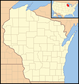
 Location of Devil's Lake State Park in Wisconsin
Devil's Lake State Park is a state park located in the Baraboo Range in eastern Sauk County, just south of Baraboo, Wisconsin, USA. This 9,217-acre (3,730 ha)[2] state park is known for its 500-foot-high (150 m) quartzite bluffs along the 360-acre (150 ha) Devil's Lake, which was created by a glacier during the last ice age approximately 12,000 years ago. The sand at the bottom of Devil's Lake is thought to be deposited by glaciers. However, the Baraboo Hills are much older; they are approximately 1.6 billion years old and were once part of the Baraboo Range which is thought to have been taller than the Rocky Mountains. Loess covers most of the hills and forms the parent material of a brown silt loam soil. During the autumn, the park's brilliant foliage makes it a popular attraction. The lake is surrounded by a mixed conifer-deciduous forest. Its scenic beauty along with its proximity to the Wisconsin Dells has made it one of the most popular of Wisconsin's state parks for both day use and overnight camping; the park receives over 1.2 million visitors annually.
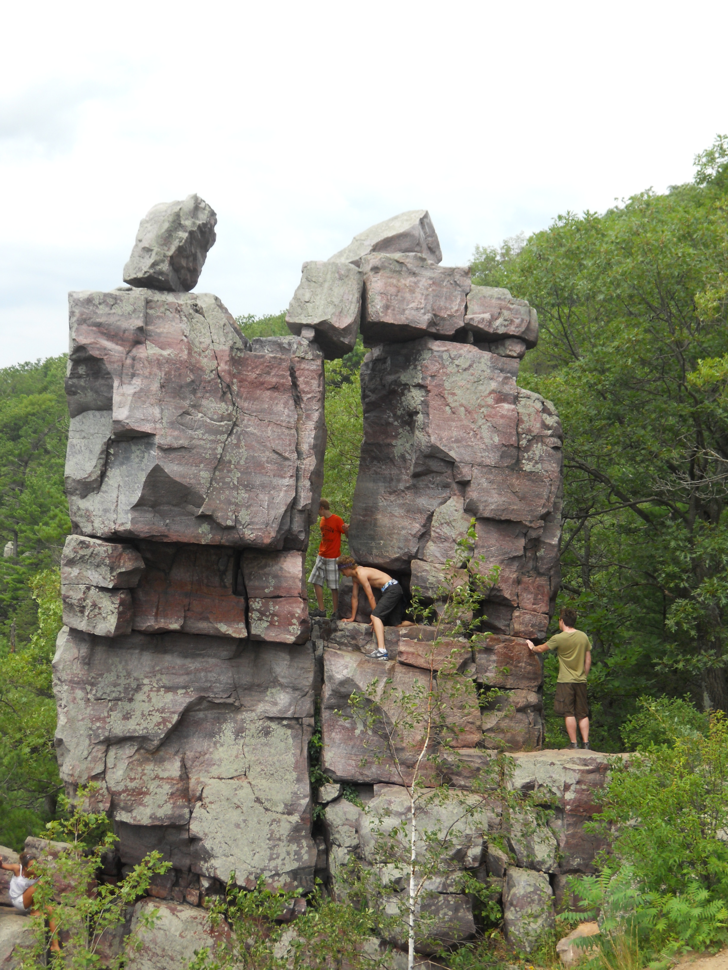
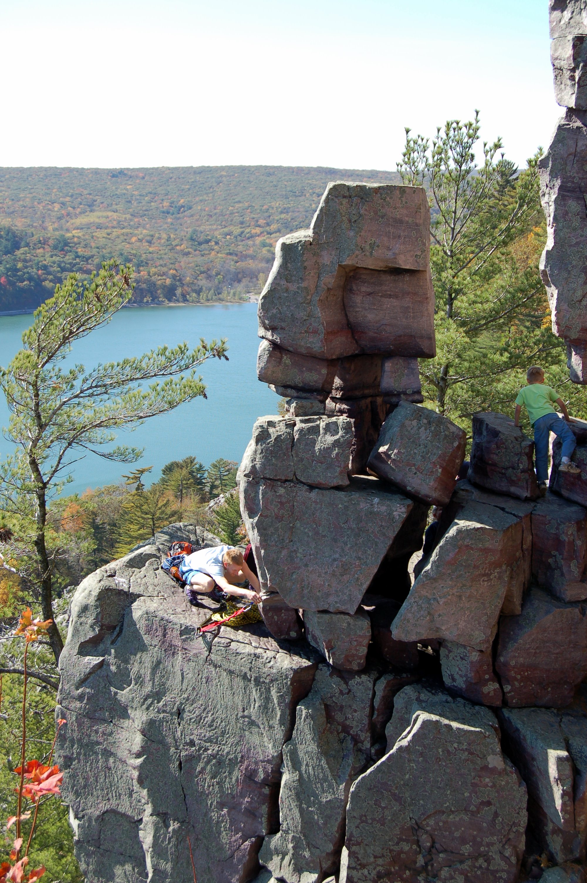
Both the north and south shores have food courts and modern restroom facilities. The park has trails ranging from handicapped accessible paved trails to difficult hiking or bouldering trails. There are also designated climbing areas for all levels of experienced rock climbers. There are three popular campgrounds at the park. There are many quartzite rock formations, such as Balanced Rock and Devil's Doorway, throughout the park. Effigy mounds are also located throughout the park. The park contains approximately twelve miles of the 1,200-mile (1,900 km) Ice Age Trail.
Parfrey's Glen, Wisconsin's first state natural area, is managed by the Devil's Lake State Park and located just east of the park.
Nearby attractions include Devil's Head Resort, Cascade Mountain Resort, and the Circus World Museum.
Contents
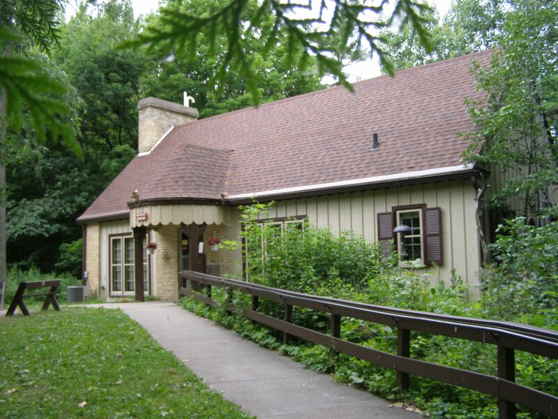
Nature Center
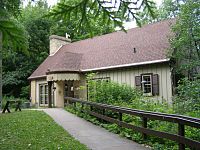 Nature Center just off the main entrance road
The exhibits at the park's nature center focus on the geology and natural history of the area. Public nature programs are offered in the summer, as well as evening programs on Saturday nights in the Northern Lights Amphitheater.
Glacial Features
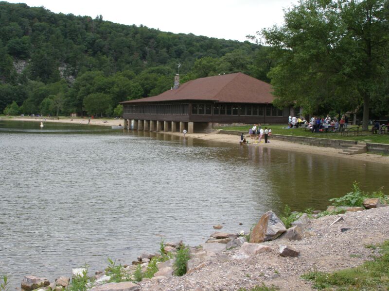
North Glacial Moraine is well covered by the north shore developments. The parking lots, concession building and the picnic shelter all sit atop the moraine. This moraine forms the northern border of Devil's Lake.[3] The moraine is approximately 80 feet (24 m) thick.[4]
Southeast Glacial Moraine - is located between the East Bluff-South Face and the South Bluff. The Group Camp is located atop the moraine. It is best scen from the Roznos Meadow parking area along State Route 113.[3] The moraine is approximately 130 feet (40 m) thick.[4]
-
Southeast moraine between the South Bluff and the East Bluff-South Face
-
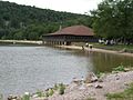
The Concession building atop the North Glacial Moraine
-
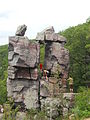
Devil's Doorway rock formation.
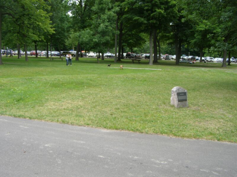
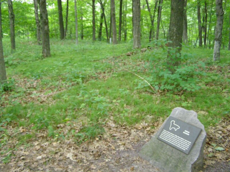
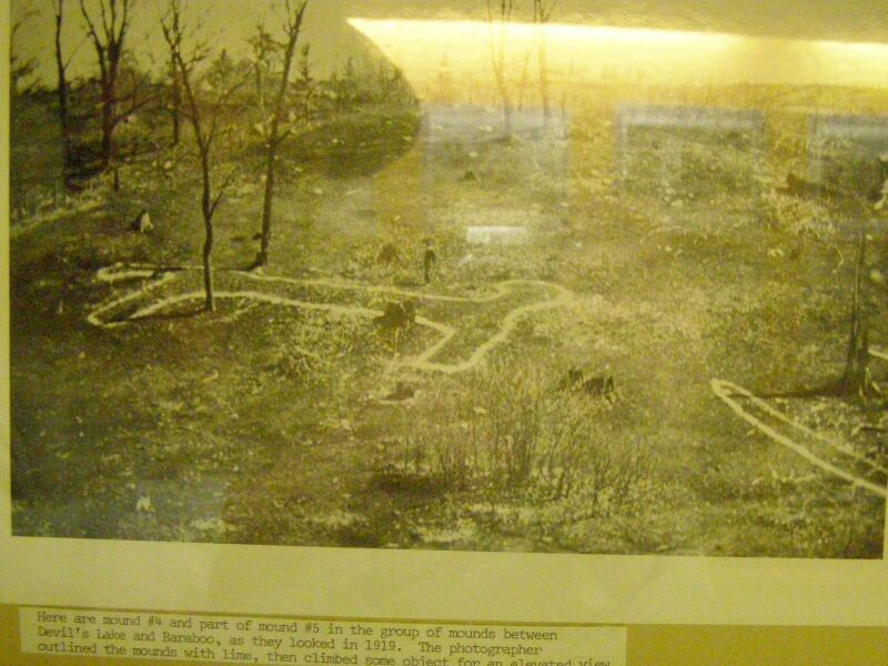
Mounds
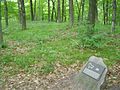
The park has several American Indian mounds. Most are extremely small. Across the parking lot from the nature center are effigy mounds built in stylized animal shapes, such as a lynx and a sparrow. In front of the concession building is a linear mound, one of several geometric mounds in the park. These mounds were used as an ancient burial site by early North Americans. The nature center offers specific courses designed to teach individuals about the history of the effigy mounds.[5][6]
-
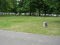
Linear mound near the concession building
-
Lynx mound near the nature center
-
Even when discovered, the mounds were small
Baraboo Range
The Baraboo Range National Natural Landmark is 50,700 acres (20,500 ha) in southern Wisconsin. It is an exhumed mountain range consisting of the largest contiguous forest in southern Wisconsin.[7]
Hiking Trails
- Balanced Rock Trail (0.4 miles (0.64 km), 45 min.) - Difficult
- CCC Trail (0.3 miles (0.48 km), 45 min.) - Difficult
- Devil's Doorway Trail (0.1 miles (0.16 km), 15 min.) - Easy
- East Bluff Trail (1.7 miles (2.7 km), 1½ hrs.) - Medium
- East Bluff Woods Trail & Loop (3.4 miles (5.5 km), 2½ hrs.) - Easy/Medium
- Grottos Trail (0.7 miles (1.1 km), 31 min.) - Easy
- Potholes Trail (0.3 miles (0.48 km), 30 min.) - Difficult
- Tumbled Rocks Trail (1.0 mile (1.6 km), 45 min.) - Easy
- West Bluff Trail (1.4 miles (2.3 km), 1½ hrs.) - Medium
- Johnson Moraine Loop Trail (2.8 miles (4.5 km), 1½ hrs.) - Easy
- Steinke Basin Loop Trail (2.4 miles (3.9 km), 1½ hrs.) - Easy
- Upland Loop Trail (3.8 miles (6.1 km), 2¾ hrs.) - Medium
- Panfrey's Glen Trail (0.7 miles (1.1 km), 1 hr.) - Easy/Medium
- Ice Age Trail Entire Loop (13.7 miles (22.0 km), 8-10 hrs.) - Medium/Difficult
- Sauk Point Trail (4.5 miles (7.2 km), 3½ hrs.) - Medium/Difficult
- Ronznos Meadow Trail (1.8 miles (2.9 km), 1 2/4 hrs.) - Easy/Medium
There is a total of 41 miles (66 km) of hiking trails in the park. At the highest point, you are 500 feet (150 m) above Devil's Lake. Be watchful for loose footing and step drop offs.[8]
Rock climbing
The geology of the Baraboo Hills surrounding Devil's Lake makes it one of the premier rock climbing areas in the Midwest, with climbs of varying difficulty. The Baraboo Hills are primarily granite and quartzite, which is solid enough to climb. Most outcroppings in the region, especially in the Driftless Area, are composed of sandstone or limestone, which are too brittle to climb safely.
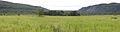
-
Beach on south end of Devil's Lake
-
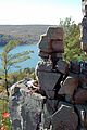
Chimney Rock
-
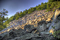
Boulder field on Eastern bluff at Devil's Lake
See also
References
Citations:
- ^ "Devils Lake State Park". Geographic Names Information System. United States Geological Survey. 1980-08-29. http://geonames.usgs.gov/pls/gnispublic/f?p=gnispq:3:::NO::P3_FID:1563943. Retrieved 2011-03-18.
- ^ "Pick a Park - WDNR". Wisconsin Department of Natural Resources. http://dnr.wi.gov/org/land/parks/specific/pickapark.html. Retrieved 2009-01-25.
- ^ a b Devil's Lake State Park, Landmark Nature Trail; Baraboo, Wisconsin, 2008
- ^ a b Devil's Lake State Park, West Bluff Self-Guide Tour; Baraboo, Wisconsin, 2008
- ^ Wisconsin Department of Natural Resources (2011-01-05). "Effigy Mounds of Devil's Lake". http://dnr.wi.gov/org/land/parks/interp/school/devilslake/effigy.html.
- ^ Wayside exhibits located by each mound
- ^ Final Environmental Impact Statement-Badger Army Ammunition Plant
- ^ Map and Trail Guide to Devil's Lake State Park, baraboo, Wisconsin; 2004
See also:
- Lange, Kenneth I. (1989), Ancient Rocks and Vanished Glaciers: A Natural History of Devil's Lake State Park, Wisconsin; Stevens Point, Wisconsin: Worzalla Publishing Company.
Bagg, Alan R. (1978), 50 Short Climbs in the Midwest http://openlibrary.org/works/OL6693475W/50_short_climbs_in_the_Midwest, p. 63, 139
External links
Protected Areas of Wisconsin Federal Driftless Area · Fox River · Gravel Island · Green Bay · Horicon Marsh · Necedah · Trempealeau · Upper Mississippi River · Whittlesey Creek
State Amnicon Falls · Aztalan · Belmont Mound · Big Bay · Big Foot Beach · Blue Mound · Brunet Island · Buckhorn · Capital Springs · Copper Culture · Copper Falls · Council Grounds · Devil's Lake · Governor Dodge · Governor Nelson · Governor Thompson · Harrington Beach · Hartman Creek · Heritage Hill · High Cliff · Interstate · Kinnickinnic · Kohler-Andrae · Lake Kegonsa · Lake Wissota · Lakeshore · Merrick · Mill Bluff · Mirror Lake · Natural Bridge · Nelson Dewey · New Glarus Woods · Newport · Pattison · Peninsula · Perrot · Potawatomi · Rib Mountain · Roche-a-Cri · Rock Island · Rocky Arbor · Straight Lake · Tower Hill · Whitefish Dunes · Wildcat Mountain · Willow River · Wyalusing · Yellowstone Lake
Bayshore Blufflands · Kangaroo Lake · Natural Bridge · Pewits Nest · Rush River Delta · Spread Eagle Barrens · Two Creeks Buried Forest
State Recreation
AreasBlack River · Brule River · Coulee Experimental · Flambeau River · Governor Knowles · Havenwoods · Kettle Moraine - Lapham Peak Unit · Kettle Moraine - Loew Lake Unit · Kettle Moraine - Northern & Southern Units · Kettle Moraine - Pike Lake Unit · Northern Highland-American Legion · Peshtigo River · Point Beach
State Wildlife AreasBuena Vista Marsh · Crex Meadows · Dewey Marsh · Horicon Marsh · Mead
Categories:- Climbing areas of the United States
- Ice Age National Scientific Reserve
- Nature centers in Wisconsin
- Protected areas established in 1911
- Protected areas of Sauk County, Wisconsin
- Wisconsin state parks

Wikimedia Foundation. 2010.