- Ovayok Territorial Park
-
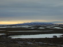
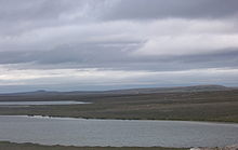
Ovayok Territorial Park (sometimes Uvajuq, formerly Mount Pelly) is a park situated 15 km (9.3 mi) east of Cambridge Bay, Kitikmeot, Nunavut, Canada. The park is relatively small and covers an area of approximately 16 km2 (6.2 sq mi). The park can be accessed by vehicle from the community as a gravel road runs directly to it.
The park has a wide variety of wildlife with muskox being predominant; there are also barren-ground caribou, arctic hare, arctic fox, and North American brown lemmings. There are several lakes within the park and most contain Arctic char and lake trout. Birds include Arctic terns, ptarmigan, Canada geese, snowy owls and the common raven.
There are several archaeological sites within the park and these include tent rings and food caches. Thule and Paleo-Eskimo camp sites and artifacts has also been found nearby, suggesting that the area has been in use for at least a 1,000 years.
The predominant feature of the park is the large esker known as Ovayok (Mount Pelly) that rises to approximately 183 m (600 ft). Behind this are two more eskers called Inuuhuktu (Baby Pelly) and Amaaqtuq (Lady Pelly).
Inuit legend says that the three hills are a family of starving giants. They were crossing Victoria Island looking for food and the father, Ovayok, died first. Next the son, Inuuhuktu (English; "son"[1]), died and was followed by the mother, Amaaqtuq (English; "packing baby",[2] see amauti), who was carrying her baby.
Contents
See also
References
- ^ "Inuuhuktu". Asuilaak Living Dictionary. http://www.livingdictionary.com/search/viewResults.jsp?resultsId=1195324950343ri. Retrieved 2007-02-16.
- ^ Ohokak, G.; M. Kadlun, B. Harnum. Inuinnaqtun-English Dictionary. Kitikmeot Heritage Society.
- Nunavut Handbook - Joe Otokiak
- Cambridge Bay Elders
- Nunavut Parks (archived from the original version on 2006-05-11)
Further reading
- Pelly, David F., Elsie Anaginak Klengenberg, and Kim Crockatt. Uvajuq The Origin of Death. Cambridge Bay, Nunavut: Kitikmeot Heritage Society, 1999. ISBN 0969078382
External links
Coordinates: 69°10′43″N 104°43′38″W / 69.17861°N 104.72722°W
Protected Areas of Nunavut Bird sanctuaries Akimiski Island · Boatswain Bay · Bylot Island · Dewey Soper · East Bay · Harry Gibbons · McConnell River · Prince Leopold Island · Queen Maud Gulf · Seymour Island
National parks National Wildlife Areas Territorial parks Inuujarvik · Iqalugaarjuup Nunanga · Katannilik · Kekerten · Kugluk/Bloody Falls · Mallikjuaq · Northwest Passage · Ovayok · Pisuktinu Tunngavik · Qaummaarviit · Sylvia Grinnell · Tamaarvik · Taqaiqsirvik · TupirvikWildlife refuges Categories:- Parks in Kitikmeot Region
- Archaeological sites in Canada
- Prehistory of the Arctic
- Former populated places in Arctic Canada
- Former populated places in the Kitikmeot Region
- Kitikmeot Region, Nunavut geography stubs
- Canadian protected area stubs
Wikimedia Foundation. 2010.


