- Ukkusiksalik National Park
Infobox_protected_area|name=Ukkusiksalik National Park
iucn_category=II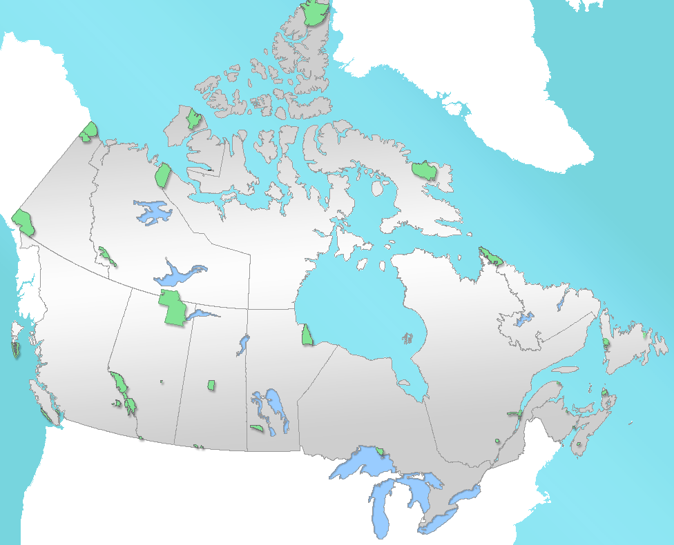
caption=Location of "Ukkusiksalik National Park" in Canada
locator_x=135
locator_y=98
location=Nunavut ,Canada
nearest_city=Chesterfield Inlet
lat_degrees=65
lat_minutes=20
lat_seconds=30
lat_direction=N
long_degrees=87
long_minutes=18
long_seconds=20
long_direction=W
area=20,500 km²
established=August 23 2003
visitation_num =
visitation_year =
governing_body=Parks Canada Ukkusiksalik National Park is a
national park inNunavut ,Canada .Ukkusiksalik National Park is a convert|20500|km2|sqmi|lk=on
tundra and coastalmudflat region extending south of theArctic Circle and the hamlet of Repulse Bay, fromHudson Bay 'sRoes Welcome Sound towards the westernBarrenlands and the source of Brown River. The park surroundsWager Bay , a convert|100|km|mi|lk=on long inlet on the Hudson Bay. Although the smallest of Nunavut's four national parks, it is the sixth largest in Canada. Its name relates to steatite found there: "Ukkusiksalik" means "where there is material for the stone pot" (from "ukkusik", meaning "pot" or "saucepan" like qulliq).In addition to a reversing
waterfall and 500 archeological sites, including an oldHudson's Bay Company (HBC)trading post , the region is home to such species aspolar bear s,grizzly bear s, theArctic Wolf , caribou, seals andPeregrine Falcon s. Vegetation in the park is typical low tundra, with dwarf birch, willow and mountain avens. Scattered patches of boreal forest can be encountered in river valleys.The park is uninhabited now, but the
Inuit lived there from 1000s to the 1960s. Remains of fox traps, tent rings, and food caches have been discovered in the area. The HBC had an operating trading post in the area from 1925 to 1947.The park was created on
August 23 2003 , becoming Canada's 41st national park, and the fourth inNunavut . It can be reached by flights fromWinnipeg ,Manitoba andYellowknife ,Northwest Territories .History
Little is known about Wager Bay's early history, as until the 19th century the area was inhabited by Inuit who traditionally passed down their history by word-of-mouth.
There is, however, a remarkable quantity of stone relics, mainly "tent rings" from
Thule people , inuksuit, caches and shelters which give evidence that the coast of Wager Bay was inhabited since thousands of years. About 500 archaeological sites have been identified within the last years as well fromDorset culture (500 BC - 1000 AD), as from Thule culture (1000 - 1800) and the last two centuries.Barrenland Inuit (or
Caribou Inuit ) were not a homogeneous tribe, but families of quite diverse groups:*"Ukkusiksalingmiut" from
Back River andHayes River regions
*"Aivilingmiut " from Repulse Bay region,
*"Qairnirmiut" from Baker Lake and Chesterfield Inlet regions
*"Netsilik Inuit (Natsilingmiut)" [Inuktitut doesn't have "e" and "o"] from around Kugaaruk and Taloyoak.First Europeans
In 1742, Christopher Middleton on his sailing ship "Furnace" was the first
Europe an to enter thefjord , which he could not leave for several weeks because of ice flow.He named the bay after Sir
Charles Wager , First Lord of the British Admiralty, and an inlet where he anchored "Douglas Harbour" after "James" and "Henry Douglas", sponsors of his expedition. The Savage Islands nearby he named after "savageEskimo s" (wild Eskimos) he met there.Middleton was not successful in his search for the
Northwest Passage , and neither was William Moore with hissloop "Discovery" five years later. As the region was too far away from Europe and considered to be "useless", the bay was not mentioned or visited by outsiders for more than 100 years. In the 1860s, American explorer Charles Francis Hall's in a two-masted ship, "Monticello", while searching forJohn Franklin 's lost Northwest Passage expedition of 1845, reached Roes Welcome Sound in 1864 and had to overwinter at the mouth of Wager Bay.In 1879, another American expedition led by Lieutenant
Frederick Schwatka searching for John Franklin passed nearby Wager Bay by land. The region eventually became recognized when thefur trade started there at the end of 19th century.Early 20th century
At the beginning of the 20th century, the Canadian government showed an interest in the Wager Bay region and sent geologist
Albert Peter Low on "Neptune" in order to establish Canada'ssovereignty over the Arctic north.At nearly the same time, in 1900, the American
whaler George G. Cleveland , working alone, established awhaling station near the entrance of the bay, that operated for the next four years. Despite his closure of the station, Scottish whalers for some time tried their luck to huntmarine mammal s in the Wager area. Large ironharpoon heads and other remnants are still found on the Savage Islands.In 1910, the Royal Northwest Mounted Police (RNWMP, precursor of the
Royal Canadian Mounted Police ) set up a police post at Wager Bay coast, near Savage Islands. A police boat wreck, in a small inlet on the south-east shore of Wager Bay is testimony to the brief presence of police there.In 1915, George Cleveland set up a temporary, and the region's first, trading post near the mouth of Wager Bay. In 1919, Cleveland now working for the HBC, again set up a trading post in the mouth of Wager Bay. It was transferring building materials for the establishment of the Repulse Bay HBC post. Situated at a favorable place at the northern end of Roes Welcome Sound this post became important for the company's intention to expand their business towards the north.
Hudson's Bay Company station at Ford Lake
Alongside these local activities, the Hudson's Bay Company, during the first years of the 20th century, made great effort to get the fur trade under control. They started to build up a large and dense network of posts from the barrenlands of northwest Hudson Bay to the northern coast of the continent. According to those plans, a post at the outermost edge of Wager Bay should play a key role. That new post was meant to include the Ukkusiksalingmiut area to the Back River estuary, convert|250|km|mi|abbr=on to the northwest, into the company's strategy, thereby, if ever possible, preventing commercial activities of competitors,
Revillon Frères , operating from their Baker Lake base. In the late summer of 1925, the two-masted schooner "Fort Chesterfield" entered the channel, and, following the advice of local Inuit, found a well protected inlet in "Tusjujak" (now "Ford Lake", named after J. L. Ford, post manager in 1929) to establish their strategic station.During the first years, things went quite well. Besides offering usual supply goods, the post supported the Inuit in general, and gave, as far as possible, medical assistance. Thus, it became a meeting point that allowed Inuit from distant camps to exchange news as well. In December 1929, twenty-two Inuit families were counted, 107 persons in total, camping in their
igloo s nearby. Soon later, fur trade stopped booming. Hudson's Bay Company changed their major post into an outpost in 1933 and entrusted an Inuk, Iqungajuq (Wager-Dick), with its management. He thereby got the chance to start his own business in the fur trade. Wager-Dick and his family lived in the post buildings and ran the outpost until 1946. The company was eventually successful with its strategy towards its competitor and bought "Revillon Frères" in 1936.Catholic missionaries,
Missionary Oblates of Mary Immaculate , who passed by in those years set up a small mission on one of Savage Islands, but never had great success and withdrew, when the activities of Hudson's Bay Company ended by mid-1940s and the Inuit had migrated into communities.Presence
Some 30 years later, from 1979 to 1981, Inuit from Rankin Inlet tried to revive their former homeland, but without success.
In the autumn of 1986 and the spring of 1987, descendants of Inuit from the area built "Sila Lodge" at Wager Bay’s north coast. The lodge was only opened for a few weeks during the summertime to allow nature enthusiasts to stay in the area, which was in fact untouched for the rest of the year. Due to the high expenses of the flights, the owners could not maintain the lodge after 2002.
Landscape
At Hudson Bay’s northwest corner, some convert|200|km|mi|abbr=on northeast of Chesterfield Inlet, near the Capes Fullerton and Kendall, is the entrance of Roes Welcome Sound, which extends northwards between the Barrenlands of the
Kivalliq Region (meaning: border of the land) andSouthampton Island to Repulse Bay, where there is a settlement of that name, situated at theArctic circle. Wager Bay is an inlet of Roes Welcome Sound, pretty much in its geographical center, near Cape Dobbs.Wager Bay is the core of the national park. Its entrance is a rather narrow bottleneck, it is more than convert|30|km|mi|abbr=on long and approximately convert|4|km|mi|abbr=on wide at its narrowest spot. The
tide s rise and fall up to convert|8|m|ft|lk=on and currents are extraordinary and cause large accumulations of ice masses during most of the year, often preventing the passage of watercraft. During early summer the rising flood water washes large quantities of drifting ice andiceberg s into the bay. These accumulate during ebb tide, close the bottleneck like a cork and may stay for hours or even days.In some places, Wager Bay is more than convert|250|m|ft|abbr=on deep. The fjord is up to convert|35|km|mi|abbr=on wide and almost convert|200|km|mi|abbr=on long, extending northwest into Kivalliq-Barrenlands. It reaches latitude 66°, therefore some convert|40|km|mi|abbr=on from the Arctic Circle.
Even at its western end, tides are impressive, between Wager Bay and the convert|2|km|mi|abbr=on wide Ford Lake (Tusjujak in Inuktitut), so-called "Reversing Falls" occur. In Canada, only three of those phenomena are known,
Reversing Falls inNew Brunswick and Barrier Inlet,Hudson Strait , Nunavut are the others. The strongest ones are inNorway , convert|30|km|mi|abbr=on east ofBodø ,Nordland . They are calledSaltstraumen and considered world’s strongest tidal currents.The soil of the area is characteristic of the
Canadian Shield .Climate
The prevailing climate is arctic-maritime; relatively little precipitation, low temperatures, and strong winds. It has
North America 's highestwind chill and largestsnowdrift s. Due to this, the National Park is considered to be "high arctic".A remarkable feature is that at the south shore of Wager Bay a steep
mountain range , gorged by formerglacier s, strongly influences the weather. Due to its proximity to Hudson Bay, drops in temperature and strong fog are normal during summertime, as blizzards are during early autumn. The bay is not completely free of ice before the end of July, although temperatures may range from cool to very warm between May and September.Fauna
According to actual zoological research, there live sixteen species of
mammal s in the park. At Wager Bay’s south shore is a largepolar bear denning area. Therefore in July and at the beginning of August, polar bears can be observed, from a boat, on floes, on islands or swimming from close up. Caribou (Rangifer tarandus) and curiousArctic Ground Squirrel s (Spermophilus parryii) come close to Sila Lodge. More rarely to be seen are the shylemming s (Lemmus sibiricus). Due to their camouflage,Arctic Fox es (Alopex lagopus) andArctic Hare s (Lepus arcticus), are not easily spotted but are most likely seen when fleeing. Other animals seen occasionally include theArctic Wolf (Canis lupus arctos), themuskox (Ovibos moschatus), theSnowshoe Hare (Lepus americanus) and thewolverine (Gulo gulo).Several species of
marine mammal s can be seen in the park’s area:Ringed Seal s (Phoca hispida) andBearded Seal s (Erignathus barbatus) live here in large numbers, and from time to time awalrus (Odobenus rosmarus), aCommon Seal (Harbour Seal, Phoca vitulina), a beluga (Delphinapterus leucas) or anarwhal (Monodon monoceros) may appear in Wager Bay.Only four species of fish have been reported up to now:
Arctic char (Salvelinus alpinus),lake trout (Salvelinus namaycush), lumpfish (Cyclopterus lumpus) andninespine stickleback (Pungitius pungitius).Birders are able to observe up to forty species, including:
*Birds of prey (Falconiformes )
**Golden Eagle (Aquila chrysaetos)
**Gyrfalcon (Falco rusticolus, bird of the Northwest Territories)
**Peregrine Falcon (Falco peregrinus)
** Rough-legged Hawk (Buteo lagopus)
*Waterfowl
**Common Eider (Somateria mollissima)
**King Eider (Somateria spectabilis)
** Oldsquaw (Clangula hyemalis)
**Northern Pintail (Anas acuta)
**Canada Goose (Branta Canadensis)
**Snow Goose (Chen caerulescens)
** Brant Goose (Branta bernicla)
** Common Loon (Gavia immer)
** Yellow-billed Loon (Gavia Adamsii)
** Pacific Loon (Gavia pacifica)
** Red-throated Loon (Gavia stellata)
**Glaucous Gull (Larus hyperboreus)
**Ivory Gull (Pagophila eburnea)
** Long-tailed Jaeger (Stercorarius longicaudus)
**Herring Gull (Larus argentatus)
**Thayer's Gull (Larus thayeri)
**Black Guillemot (Cepphus grylle)
**Arctic Tern (Sterna paradisaea)
**Tundra Swan (Cygnus columbianus)
*Other ground nesting birds
**Sanderling (Calidris alba)
**Baird's Sandpiper (Calidris Bairdii)
**Pectoral Sandpiper (Calidris melanotos)
**Semipalmated Sandpiper (Calidris pusilla)
**White-rumped Sandpiper (Calidris fuscicollis)
**Semipalmated Plover (Charadrius semipalmatus)
**American Golden Plover (Pluvialis dominica)
**Snow Bunting (Plectrophenax nivalis)
** Lapland Longspur (Calcarius lapponicus)
**Common Raven (Corvus corax)
** Rock Ptarmigan (Lagopus muta, bird of Nunavut)
** Willow Ptarmigan (Lagopus lagopus)
**Sandhill Crane (Grus canadensis)
** Horned Lark (Eremophila alpestris)
**Snowy Owl (Bubo scandiacus)
**Water Pipit (Antus spinoletta)Flora
On the one hand, the national park is a typical rocky tundra area, on the other hand, beneath
algae ,bryophyte andlecanorales lichen s grows a flora of 25 families offlowering plant s. They are closely related to , but different. Following families and species are found:
*Birch family (Betulaceae) - Dwarf Birch ("Betula nana"), American Dwarf Birch ("Betula glandulosa")
*Bladderwort family (Lentibulariaceae) - Common Butterwort ("Pinguicula vulgaris")
*Bluebell family (Campanulaceae) – Bluebell ("Campanula uniflora")
*Borage family (Boraginaceae) - Sea Lungwort ("Mertensia maritima")
*Buckwheat family (Polygonaceae) –Alpine Bistort ("Polygonum viviparum"), Mountain Sorrel ("Oxyria digyna")
*Buttercup family (Ranunculaceae) -Birdfoot Buttercup ("Ranunculus pedatifidus"), Pygmy Buttercup ("Ranunculus pygmaeus")
*Clubmosses (Lycopodiaceae) - Mountain Clubmoss ("Lycopodium selago")
*Crowberry family (Ericaceae) –Crowberry ("Empetrum nigrum ")
*Daisy family (Asteraceae) - Alpine Daisy ("Arnica alpina"),Arctic Daisy ("Dendranthema arcticum"),Lacerate Dandelion ("Taraxacum lacerum"), Mastodon Flower ("Senecio congestus "), Pussy-Toes ("Antennaria" ssp.),Sea-Shore Chamomile ("Matricaria ambigua"), Wormwood ("Artemisia borealis")
*Diapensia family (Diapensiaceae) –Diapensia ("Diapensia lapponica")
*Fern s (Polypodiaceae ) -Fragrant Shield Fern ("Dryopteris fragrans")
*Figwort family (Scrophulariaceae) -Arctic Lousewort (Pedicularis arctica),Hairy Lousewort ("Pedicularis hirsuta"),Labrador lousewort ("Pedicularis labradorica"),Lapland Lousewort ("Pedicularis lapponica"),Sudetan Lousewort ("Pedicularis sudetica")
*Grasses (Poaceae or Gramineae) -Alpine Fescue ("Festuca brachyphylla"), Bluegrass ("Poa alpina"),Reed-Bentgrass ("Calamagrostis lapponica"),Sea Lyme-Grass ("Elymus arenarius"),Spike Trisetum ("Trisetum spicatum"), Wild Barley (Foxtail barley, "Hordeum jubatum")
*Heath family (Ericaceae) -Arctic Bell Heather ("Cassiope tetragonal"), Black Bearberry ("Arctostaphylos alpina"), Bilberry (Bog Bilberry or Northern Bilberry, "Vaccinium uliginosum"),Bog-rosemary ("Andromeda polifolia"),Lapland Rose-Bay ("Rhododendron lapponicum"),Labrador tea (Ledum decumbens), Mountain cranberry ("Vaccinium vitis-idaea")
*Horsetails ("Equisetum") - Horsetail ("Equisetum arvense")
*Leadwort family (Plumbaginaceae) - Thrift ("Armeria maritime")
*Lily family (Melanthiaceae ) -False Bog Asphodel ("Tofieldia pusilla")
*Mustard family (Brassicaceae or Cruciferae) -Arctic Bladderpod (Lesquerella arctica)
*Pea family (Fabaceae,Faboideae ] ) -Alpine milk vetch ("Astragalus alpinus"),Arctic Oxytrope ("Oxytropis arctica"),Blue Oxytrope (Oxytropis arctobia),Liquorice-Root (Eskimo Potato) ("Hedysarum alpinum"),Sweet Vetch ("Hedysarum Mackenziei"),Yellow Oxytrope ("Oxytropis maydelliana")
*Pink family (Caryophyllaceae) -Arctic bladder campion ("Melandrium affine"), Knotted Pearlwort ("Sagina nodosa"), moss campion ("Silene acaulis"),Mouse-Ear Chickweed ("Cerastium alpinum"),Purple bladder campion ("Melandrium apetalum"), seabeach sandwort ("Honckenya peploides"),Star Chickweed ("Stellaria longipes")
*Poppy family (Papaveraceae) - Arctic poppy ("Papaver radicatum")
*Rose family (Rosaceae) - Cinquefoil ("Potentilla") or Silverweed ("Potentilla anserina" or "Argentina anserina"),Cloudberry ("Rubus chamaemorus"), Mountain avens ("Dryas octopetala") (flower of the Northwest Territories),Snow Cinquefoil ("Potentilla nivea")
*Saxifrage family (Saxifragaceae,Saxifrage ) - Bulblett Saxifrage ("Saxifraga cernua"), Golden Saxifrage (Chrysosplenium),Grass of Parnassus ("Parnassia"),Prickly Saxifrage ("Saxifraga tricuspidata"), Purple Saxifrage ("Saxifraga oppositifolia") (flower of Nunavut)
*Sedges (Cyperaceae) -Arctic Cotton ("Eriophorum scheuchzeri "),Cotton Grass ("Eriophorum vaginatum "), Sedge ("Carex" ssp.)
*Plantain family (Plantaginaceae (seeHippuris or Hippuridaceae)) -Common Mare's Tail ("Hippuris vulgaris")
*Willow family (Salicaceae, salix) - Arctic willow ("Salix arctica"),planeleaf willow ("Salix planifolia"), Least Willow ("Salix herbacea"), Net-leaved Willow ("Salix reticulata"),Trailing Willow ("Salix arctophila")
*Willowherb family (Onagraceae) -Fireweed ("Epilobium angustifolium") (flower of Yukon)
*Wintergreen family (Pyrolaceae) -Large-flowered Wintergreen ("Pyrola grandiflora")Tourism
Usually, the park can only visited during a very few summer weeks, from the beginning of July until the beginning of August. Before that, Wager Bay has too much ice to be visited by boat, and in the autumn the Inuit say: "During summertime, you may watch polar bears. Afterwards, they will watch you!"
The place can almost only be reached by a hired plane – usually one would depart from Baker Lake, about convert|350|km|mi|abbr=on away, where scheduled flights arrive from Rankin Inlet. Information can be obtained at Rankin Inlet's "Baker Lake Lodge". One might also approach by
motorboat from Repulse Bay, whereParks Canada runs a station, but due to possible problems with ice this might take longer and therefore will only be considered by explorers or movie teams who have to bring a lot of equipment.Until 2002, Sila Lodge was the base camp for all activities; an air strip for
bush plane s like the Twin Otter is situated near the lodge.From Sila Lodge, guided tours were offered, for instance boating tours to the Wager Bay islands, or to Ford Lake across the reversing falls, to the former Hudson's Bay Company outpost, or walks to the surrounding area, where one would find impressive relics of earlier settlements, such as tent rings, qarmait (
sod house ) and Inuksuit, along with relics of the Hudson's Bay Company and Roman Catholic missions.Trekking routes
;The following valleys, water falls and lakes can be reached by walking:
* First (lowest) waterfall of Sila River - total: convert|4|km|mi|abbr=on | time to walk: 1 hr | total time: 1.5 hrs | height difference: convert|40|m|ft|abbr=on | peak: convert|4|m|ft|abbr=on | difficulty: easy
* Traversing Tinittuktuq Flats - total: convert|6|km|mi|abbr=on | time to walk: 1.5 hrs | total time: 5 hrs | height difference: convert|80|m|ft|abbr=on | peak: convert|30|m|ft|abbr=on | difficulty: easy
* To Ship's Cove - total: convert|10|km|mi|abbr=on | time to walk: 2.5 hrs | total time: 4 hrs | height difference: convert|50|m|ft|abbr=on | peak: convert|30|m|ft|abbr=on | difficulty: easy-medium
* Second waterfall of Sila River - total: convert|8|km|mi|abbr=on | time to walk: 2.5 hrs | total time: 5 hrs | height difference: convert|160|m|ft|abbr=on | peak: convert|110|m|ft|abbr=on | difficulty: medium
* Third and fourth waterfall of Sila River and Falcon Gorge - total: convert|8|km|mi|abbr=on | time to walk: 2.5 hrs | total time: 5 hrs | height difference: convert|416|m|ft|abbr=on | peak: convert|110|m|ft|abbr=on | difficulty: medium-difficult
* Fisherman's Hike - total: convert|10|km|mi|abbr=on | time to walk: 3 hrs | total time: 5 hrs | height difference: convert|200|m|ft|abbr=on | peak: convert|150|m|ft|abbr=on | difficulty: medium-difficult
* To Butterfly Lake - total: convert|16|km|mi|abbr=on | time to walk: 5 hrs | total time: 8 hrs | height difference: convert|400|m|ft|abbr=on | peak: convert|250|m|ft|abbr=on | difficulty: (very) difficultBooks
* Nunavut Handbook, Iqaluit 2004 ISBN 0-9736754-0-3
* Walk, Ansgar: "Der Polarbär kam spät abends – Skizzen von der Wager Bay", Pendragon Verlag Bielefeld, 2002 ISBN 3-934872-22-0 (German) [“The Polar Bear Came Late at Night: Sketches of Wager Bay”; there is no English edition of the book.]Photo gallery
ee also
*
List of Nunavut parks External links
* [http://www.pc.gc.ca/pn-np/nu/ukkusiksalik/index_E.asp Ukkusiksalik National Park of Canada]
* [http://www.cbc.ca/canada/north/story/2003/08/23/auyg23newparksign08232003.html CBC News article]
* [http://www.pc.gc.ca/apprendre-learn/prof/itm2-crp-trc/pdf/ukkusiksalik_e.pdf Parks Canada] (pdf)
* [http://ess.nrcan.gc.ca/2002_2006/nrd/wchurchill/pdf/project8_4_pres_4.pdf on Wager Bay project]
* [http://www.yukonreservation.com/yukon/adv_info36.html www.yukonreservation.com on Ukkusiksalik – Wager Bay – Sila Lodge]
* [http://dsp-psd.pwgsc.gc.ca/Collection/M44-2005-B2E.pdf dsp-psd.pwgsc.gc.ca Schultz Lake and Wager Bay areas (pdf)]
* [http://www.newparksnorth.org/nunavut.htm#Ukkusiksalik New Parks North]
* [http://www.pc.gc.ca/docs/v-g/nation/pdf/SysPlan_e.pdf National Park System Plan]
Wikimedia Foundation. 2010.