- Interstate Park
-
For other places with the same name, see Breaks Interstate Park.
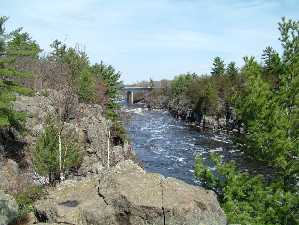
Interstate Park Minnesota State Park, Wisconsin State Park  The Dalles of the St. Croix River seen from the Wisconsin bank.
Country  United States
States  Minnesota,
  Wisconsin
Counties Chisago County, Minnesota, Polk County, Wisconsin City Taylors Falls, Minnesota, St. Croix Falls, Wisconsin Elevation 886 ft (270 m) [1] Coordinates 45°23′30″N 92°39′55″W / 45.39167°N 92.66528°W Area 1,628 acres (659 ha) Founded 1895 Management Minnesota Department of Natural Resources, Wisconsin Department of Natural Resources Unit of Ice Age National Scientific Reserve 
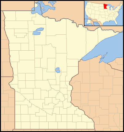
 Location of Interstate State Park in MinnesotaInterstate State Park WPA/Rustic Style Historic District
Location: Chisago County, Minnesota and Polk County, Wisconsin Nearest city: Taylors Falls, Minnesota Governing body: Minnesota Department of Natural Resources MPS: Minnesota State Park CCC/WPA/Rustic Style MPS NRHP Reference#: 89001664 Added to NRHP: June 11, 1992 Interstate State Park CCC/WPA/Rustic Style CampgroundLocation: Off US 8 SW of Taylors Falls, Shafer Township Nearest city: Taylors Falls, Minnesota Governing body: Minnesota Department of Natural Resources MPS: Minnesota State Park CCC/WPA/Rustic Style MPS NRHP Reference#: 92000638 Added to NRHP: June 11, 1992 Interstate Park comprises two adjacent state parks on the Minnesota-Wisconsin border, both named Interstate State Park. They straddle the Dalles of the St. Croix River, a deep basalt gorge with glacial potholes and other rock formations. The Wisconsin park is 1,330 acres (538 ha) and the Minnesota park is 298 acres (121 ha). The towns of Taylors Falls, Minnesota and St. Croix Falls, Wisconsin are adjacent to the park. Interstate Park is within the Saint Croix National Scenic Riverway and the Ice Age National Scientific Reserve. The western terminus of the Ice Age National Scenic Trail is on the Wisconsin side. On the Minnesota side, two areas contain National Park Service Rustic style buildings and structures that are listed on the National Register of Historic Places.
Contents
Geology
1.1 billion years ago, a series of volcanic eruptions from the Midcontinent Rift System sent at least ten separate lava flows across the region that now includes Interstate Park.[2] These flows hardened into basalt, which fractured at several joints. In the Cambrian period, Between 530 and 470 million years ago, the region was covered by a shallow sea which deposited sandstone and siltstone atop the basalt. This epoch of the Cambrian, the Furongian, was originally called the Croixian in North America because the layers exposed in this area were its type locality.[3]
At the end of the last glacial period 10,000 years ago, torrents of water flowed south from the melting glaciers, carving the St. Croix River Valley. The soft Cambrian sediments were easily eroded into a wide valley, but the hard basalt was resistant to erosion and when it reached the hard basalt floor, the river was channeled into a deep, steep-walled gorge.[3] The river switched courses over time, carving several small ravines. At one stage the flow entered the current channel on the Wisconsin side below the modern gorge, hollowing out an area which is now a backwater lake called Lake O' the Dalles.[4] When the river began carving the main gorge, it intersected an old joint running through the basalt. The water naturally followed this easier path, resulting in the sharp bend in the St. Croix River at Angle Rock.[5] The walls of the Dalles rise from 50 to 250 feet (76 m) above the river.[6]
The Glacial St. Croix River carved a series of terraces along its banks. Sand and gravel were occasionally caught in eddies or whirlpools and were swirled around with such force that they drilled holes straight down into the rock. Larger rocks caught in the spin would polish the shafts smooth.[5] The Glacial Gardens area on the Minnesota shore contains more than 80 of these glacial potholes, the greatest concentration in the world.[3][7] The volume of the St. Croix River eventually lessened, exposing many of the potholes to the air. Dirt, vegetation, and rainwater have collected in them, disguising their true depths. Some have been excavated; one, the Bottomless Pit, is 10 feet (3.0 m) wide and 60 feet (18 m) deep, the deepest explored pothole in the world.[7] Other unexcavated potholes in the park are even wider, suggesting that they may be deeper as well.[5]
Weathering has created other rock formations. The Old Man of the Dalles on the Wisconsin shore resembles a human face. Another formation resembling a Maltese cross has been erroneously claimed as the origin of the name St. Croix ('holy cross' in the French language).[8] A former formation on the Minnesota side called the Devil's Chair looked like a high-backed throne.
Biology
Several habitats are found within the parks. Originally most of the land was forested with large eastern white pines, but was denuded by loggers.[6] Most of the vegetation today is second-growth forest, with some sections dominated by maples and basswoods and others by eastern white pines.[7] Drier areas support oak savanna while wetter areas bear floodplain forest. The driest hilltops even support prickly pear cactus. Early successional species take hold on the exposed basalt rocks. Over 400 species of ferns and flowering plants have been catalogued in the Wisconsin park.[9]
Mammals found in the parks include white-tailed deer, foxes, raccoons, gray squirrels, otters, mink, muskrats, and beavers, and 150 species of birds have been identified in the park,[6] of whom at least 75 species are known to nest in the area.[9]
Cultural history
 The Dalles of the St. Croix River seen from the Minnesota bank.
The St. Croix River was an important transportation route for Native Americans. Prehistoric tools have been found in the park, but no village sites.[4] The first Europeans to pass through the Dalles were Daniel Greysolon, Sieur du Lhut, and his 1680 expedition, though he made no particular mention of the site. Fur traders used the river extensively, and a French fort was located near the Minnesota campground in the early 18th century.[6]
During the logging era from 1837 to 1898, logs were rafted down the St. Croix River. By 1857 a sawmill was operating near what is now the Minnesota campground, joined in 1867 by a boat-building yard.[6] Both were owned by a leading citizen of Taylors Falls, W.H.C. Folsom, after whom an island in the park is named. The narrow gorge and the sharp turn at Angle Rock caused severe logjams in 1865, 1877, 1883, and 1886.[4] The June 1886 jam is believed to have been the worst in history; at least 150 million board feet of logs were backed up for three miles (5 km).[9] Neither dynamite nor steamboats with tow ropes were able to budge the jam. A crew of 175 men working 24 hours a day under electric lights took six weeks to break the jam, during which time several mills downstream went out of business.[4][10] To control the water flow and prevent further catastrophic jams, the Nevers Dam was built upstream in 1890 in what is now Wild River State Park.[5]
During this same period, the Dalles of the St. Croix became a popular visitor attraction. Steamboat service to Taylors Falls began in 1838, and a railroad connection was finished in 1880.[7] The catastrophic logjams drew tourists in droves, as many as a thousand a day.[10]
In the 1860s businessmen from St. Paul proposed mining the basalt of the Dalles to make gravel, a plan which galvanized interest in protecting the area.[10] Locals had also been growing concerned by encroaching buildings and vandalism of the rock formations.[11] A travel agent named George Hazzard became the leading advocate for a park, and gained the support of newspapers, several landowners in the area, influential people like W.H.C. Folsom, and ultimately the state senator and representative. These last two introduced a bill to the Minnesota Legislature calling for the creation of the State Park of the Dalles of the St. Croix and urging cooperation with Wisconsin to protect both sides of the Dalles.[11] The bill passed in 1895, creating the second state park in Minnesota.[12] Hazzard and his allies had a more difficult time lobbying the Wisconsin Legislature, but succeeded in 1900 with the creation of the first state park in Wisconsin,[10] resulting in the first interstate parkland collaboration in the United States.[13]
In 1906 the commissioner of the Minnesota park asked a family from Stillwater to conduct boat tours of the Dalles. Beginning with a small powerboat, this concession business grew quickly. In 1910 they began renting canoes and rowboats, and offered tours on progressively larger boats. Today they are still in business, family-owned for four generations.[14]
U.S. Route 8 descends through the Minnesota park in a road cut blasted in 1931.[15] The Minnesota Department of Transportation built stone overlooks and guardrails along the highway in the mid 1930s.[16] Civilian Conservation Corps Company 633 arrived in 1935, building roads, trails, picnic grounds, plumbing, the beach and beach house on Lake O' the Dalles, and retaining walls.[4] The CCC camp departed in December 1937 and were replaced by the 4610th Company of the Works Progress Administration in July 1938.[16] Using basalt quarried in the park by the CCC, they built restrooms, picnic shelters, water fountains, and retaining walls. These historical structures are clustered in two separate areas of the Minnesota park: in the campground and near the Glacial Gardens.[15] The two areas were added to the National Register of Historic Places in 1992.[13]
In April 2005 a landmark rock formation called the Devil's Chair collapsed. An investigation found that the basalt pinnacle was toppled by vandals using crowbars and possibly a hydraulic spreader. Despite a reward for tips, the culprits have never been identified.[17]
Recreation
Located an hour's drive from Minneapolis – Saint Paul, Interstate Park has received annual visitation comparable to many U.S. national parks since the 1930s.[13][15]
The two parks are administered separately and require separate vehicle permits. In 1987 each park began honoring the other state's permit on weekdays,[11] but the practice has since ceased. It is possible to walk between the parks by crossing the U.S. Route 8 bridge. Both parks have a visitor center with interpretive displays and a gift shop.
The Wisconsin park has two campgrounds with 85 sites. A group campsite accommodates up to 60 people. There are nine miles (14 km) of trail.[18]
The Minnesota park has a campground with showers and 37 sites, 22 of which have electrical hookups. A group campsite accommodates up to 100 people. There are 4 miles (6.4 km) of trail.[7] A long-standing concession offers scenic boat cruises and canoe and kayak rentals with shuttle service back from near Osceola, Wisconsin, and William O'Brien State Park.
There is a swimming beach on Lake O' the Dalles, in the Wisconsin park. Swimming in the river is dangerous because of strong currents. Rock climbing is permitted on many of the cliffs on either side of the river. Certain sensitive areas, as well as all potholes, are off limits to climbing.[19]
References
- ^ "Interstate State Park". Geographic Names Information System. United States Geological Survey. 1980-01-11. http://geonames.usgs.gov/pls/gnispublic/f?p=gnispq:3:::NO::P3_FID:645436. Retrieved 2011-02-25.
- ^ "Interstate State Park". Minnesota Department of Natural Resources. 2008. http://www.dnr.state.mn.us/state_parks/interstate/index.html. Retrieved 2008-06-24.
- ^ a b c Sansome, Constance J. (1983). Minnesota Underfoot: A Field Guide to the State's Outstanding Geologic Features. Stillwater, MN: Voyageur Press. ISBN 0-89658-036-9.
- ^ a b c d e Pond, Alonzo W. (1937). Interstate Park and Dalles of the St. Croix. St. Croix Falls, Wis: The Standard-Press.
- ^ a b c d Minnesota Department of Natural Resources. Interstate State Park interpretive signage.
- ^ a b c d e Dunn, James Taylor (1982). State Parks of the St. Croix Valley. The Minnesota Parks Foundation.
- ^ a b c d e State of Minnesota, Department of Natural Resources. Interstate State Park. July 2008. [1]
- ^ Dunn, James Taylor (1979). The St. Croix: Midwest Border River. St. Paul, MN: Minnesota Historical Society Press. ISBN 0-87351-141-7.
- ^ a b c Wisconsin Department of Natural Resources. Interstate Park Visitor . April 2004.
- ^ a b c d McMahon, Eileen M.; Theodore J. Karamanski (2002-10-17). "Time and the River: A History of the Saint Croix". National Park Service, U.S. Department of the Interior. http://www.nps.gov/history/history/online_books/sacr/hrs/hrs.htm. Retrieved 2008-09-06.
- ^ a b c Meyer, Roy W. (1991). Everyone's Country Estate: A History of Minnesota's State Parks. St. Paul, MN: Minnesota Historical Society Press. ISBN 0-87351-265-0.
- ^ The first in Minnesota was Itasca State Park, 1891.
- ^ a b c "List of Rustic Style Resources in Minnesota State Parks: Interstate State Park". Minnesota Historical Society. 2008. http://www.mnhs.org/places/nationalregister/stateparks/Interst.html. Retrieved 2008-06-24.
- ^ "Taylors Falls Scenic Boat Tour History". Wild Mountain & Taylors Falls Recreation. http://www.wildmountain.com/boat/boat_history.html. Retrieved 2008-09-07.
- ^ a b c Benson, David R. (2002). Stories in Log and Stone: The Legacy of the New Deal in Minnesota State Parks. St. Paul, MN: Minnesota Department of Natural Resources. ISBN 0-9657127-1-0.
- ^ a b "MnDOT Historic Roadside Development Structures Inventory". Minnesota Department of Transportation. 1998. http://www.dot.state.mn.us/roadsides/historic/files/iforms/CH-SHT-032.pdf. Retrieved 2008-09-06.
- ^ Bauer, Mary. "'Devil's Chair' lives on after destruction — community clings to rock-formation symbol a year after vandalism." St. Paul Pioneer Press May 31, 2006.
- ^ "Interstate State Park". Wisconsin Department of Natural Resources. 2008. http://www.dnr.state.wi.us/org/land/parks/specific/interstate/. Retrieved 2008-06-24.
- ^ Farris, Mike (2000). Rock Climbing Minnesota and Wisconsin. Helena, Montana: Falcon Publishing, Inc.. ISBN 1560449845.
External links
- Interstate State Park, Minnesota
- Interstate State Park, Wisconsin
- Saint Croix National Scenic Riverway
Protected areas of Minnesota National Parks National Monuments National Park Service National Wildlife Refuges Agassiz • Big Stone • Crane Meadows • Glacial Ridge • Hamden Slough • Mille Lacs • Minnesota Valley • Northern Tallgrass Prairie • Rice Lake • Rydell • Sherburne • Tamarac • Upper Mississippi River
National Forests National Natural Landmarks Ancient River Warren Channel • Cedar Creek Ecosystem Science Reserve • Itasca Natural Area • Keeley Creek Natural Area • Lac la Croix Research Natural Area • Lake Agassiz Peatlands Natural Area • Pine Point Research Natural Area • Upper Red Lake Peatland
State Parks Afton • Banning • Bear Head Lake • Beaver Creek Valley • Big Bog State Recreation Area • Big Stone Lake • Blue Mounds • Buffalo River • Camden • Carley • Cascade River • Charles A. Lindbergh • Crow Wing • Cuyuna Country State Recreation Area • Father Hennepin • Flandrau • Forestville Mystery Cave • Fort Ridgely • Fort Snelling • Franz Jevne • Frontenac • Garden Island State Recreation Area • George H. Crosby Manitou • Glacial Lakes • Glendalough • Gooseberry Falls • Grand Portage • Great River Bluffs • Greenleaf Lake State Recreation Area • Hayes Lake • Hill-Annex Mine • Interstate • Itasca • Jay Cooke • John A. Latsch • Judge C. R. Magney • Kilen Woods • Lac qui Parle • Lake Bemidji • Lake Bronson • Lake Carlos • Lake Louise • Lake Maria • Lake Shetek • Maplewood • McCarthy Beach • Mille Lacs Kathio • Minneopa State Park • Minnesota Valley State Recreation Area • Monson Lake • Moose Lake • Myre-Big Island • Nerstrand-Big Woods • Old Mill • Red River State Recreation Area • Rice Lake • Saint Croix • Sakatah Lake • Savanna Portage • Scenic • Schoolcraft • Sibley • Soudan Underground Mine • Split Rock Creek • Split Rock Lighthouse • Temperance River • Tettegouche • Upper Sioux Agency • Whitewater • Wild River • William O'Brien • Zippel Bay
State Forests Badoura • Battleground • Bear Island • Beltrami Island • Big Fork • Birch Lakes • Blackduck • Bowstring • Buena Vista • Burntside • Chengwatana • Cloquet Valley • Crow Wing • D.A.R. • Emily • Finland • Fond du Lac • Foot Hills • General C. C. Andrews • George Washington • Golden Anniversary • Grand Portage • Hill River • Huntersville • Insula Lake • Jeanette • Kabetogama • Koochiching • Lake Isabella • Lake of the Woods • Land O'Lakes • Lost River • Lyons • Mississippi Headwaters • Nemadji • Northwest Angle • Pat Bayle • Richard J. Dorer Memorial Hardwood
Minnesota Department of Natural Resources Protected Areas of Wisconsin Federal Driftless Area · Fox River · Gravel Island · Green Bay · Horicon Marsh · Necedah · Trempealeau · Upper Mississippi River · Whittlesey Creek
State Amnicon Falls · Aztalan · Belmont Mound · Big Bay · Big Foot Beach · Blue Mound · Brunet Island · Buckhorn · Capital Springs · Copper Culture · Copper Falls · Council Grounds · Devil's Lake · Governor Dodge · Governor Nelson · Governor Thompson · Harrington Beach · Hartman Creek · Heritage Hill · High Cliff · Interstate · Kinnickinnic · Kohler-Andrae · Lake Kegonsa · Lake Wissota · Lakeshore · Merrick · Mill Bluff · Mirror Lake · Natural Bridge · Nelson Dewey · New Glarus Woods · Newport · Pattison · Peninsula · Perrot · Potawatomi · Rib Mountain · Roche-a-Cri · Rock Island · Rocky Arbor · Straight Lake · Tower Hill · Whitefish Dunes · Wildcat Mountain · Willow River · Wyalusing · Yellowstone Lake
Bayshore Blufflands · Kangaroo Lake · Natural Bridge · Pewits Nest · Rush River Delta · Spread Eagle Barrens · Two Creeks Buried Forest
State Recreation
AreasBlack River · Brule River · Coulee Experimental · Flambeau River · Governor Knowles · Havenwoods · Kettle Moraine - Lapham Peak Unit · Kettle Moraine - Loew Lake Unit · Kettle Moraine - Northern & Southern Units · Kettle Moraine - Pike Lake Unit · Northern Highland-American Legion · Peshtigo River · Point Beach
State Wildlife AreasBuena Vista Marsh · Crex Meadows · Dewey Marsh · Horicon Marsh · Mead
Wisconsin Department of Natural Resources U.S. National Register of Historic Places Topics Lists by states Alabama • Alaska • Arizona • Arkansas • California • Colorado • Connecticut • Delaware • Florida • Georgia • Hawaii • Idaho • Illinois • Indiana • Iowa • Kansas • Kentucky • Louisiana • Maine • Maryland • Massachusetts • Michigan • Minnesota • Mississippi • Missouri • Montana • Nebraska • Nevada • New Hampshire • New Jersey • New Mexico • New York • North Carolina • North Dakota • Ohio • Oklahoma • Oregon • Pennsylvania • Rhode Island • South Carolina • South Dakota • Tennessee • Texas • Utah • Vermont • Virginia • Washington • West Virginia • Wisconsin • WyomingLists by territories Lists by associated states Other  Category:National Register of Historic Places •
  Portal:National Register of Historic PlacesCategories:
- Protected areas of Chisago County, Minnesota
- Civilian Conservation Corps in Minnesota
- Civilian Conservation Corps in Wisconsin
- Climbing areas of the United States
- Historic districts in Minnesota
- Ice Age National Scientific Reserve
- Minnesota state parks
- National Register of Historic Places in Minnesota
- Protected areas established in 1895
- Protected areas established in 1900
- Protected areas of Polk County, Wisconsin
- Rustic architecture
- Wisconsin state parks
- Works Progress Administration in Minnesota
- Works Progress Administration in Wisconsin

Wikimedia Foundation. 2010.