- Cypress Hills (Canada)
-
Cypress Hills 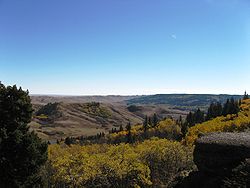
The Cypress HillsElevation 1,468 m (4,816 ft) Location 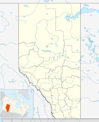
 Cypress Hills
 Canada
Coordinates 49°37′48″N 110°21′34″W / 49.63°N 110.35944°WCoordinates: 49°37′48″N 110°21′34″W / 49.63°N 110.35944°W The Cypress Hills are a region of hills in southwestern Saskatchewan and southeastern Alberta, Canada.
The highest point in Saskatchewan at 1,468 m (4,816 ft) is located at Lookout Point in the Cypress Hills.[1]
Contents
Name
The Cypress Hills have been known by a wide number of native and European names throughout their history. An 1882 Blackfoot–English dictionary written by C. M. Lanning provided the Blackfoot name I-kim-e-kooy, which translates as Striped Earth or Earth over Earth. The Cree name, in use at the same time, was Manâtakâw, (spelled in a variety of anglicized forms including "Mun-a-tuh-gow"), sometimes said to mean Beautiful Upland but more accurately referring to "an area to be respected, protected, taken care of and/or taken care with". Early Metis hunters, who spoke a variation of French, called the hills les montagnes des Cyprès, in reference to the abundance of pine trees. To the Metis, most evergreen trees were easily labelled cyprès, but the region has no true cypress trees. The English translation is Cypress Hills.[2]
Geology
The hills are not true mountains but are rather the remnants of erosion of a Tertiary plateau of sediment formed during the initial uplift of the Rocky Mountains. This uplift caused the plain above which the hills now rise to be elevated, with the result that rivers flowing to the north and south eroded most of the softer sediments onto the lower part of the Great Plains. Today, the Cypress Hills form a major drainage divide separating rivers draining to the Gulf of Mexico (via the Missouri River) from those draining to Hudson Bay and James Bay via the Nelson River; thus the Cypress Hills form a water divide. There is a ranch northwest of Eastend, Saskatchewan, called Dividing Springs Ranch; the water from this spring goes both south to Gulf of Mexico and north to Hudson Bay.
Because they formed a suture zone between the Laurentide and Cordilleran ice sheets, the Cypress Hills are the northernmost point in North America that remained south of the continental ice sheets during the Wisconsin glaciation. In fact, along with northern Yukon, Banks Island, some nunataks (e.g. on the Gaspé Peninsula and western Newfoundland) and possibly the Brooks Peninsula, the hills and their southern slopes are the only unglaciated land in present-day Canada. This gives them an appearance very different from the typical "alpine" mountains of most of Canada, with a flat top and steep sides. This suggests that during a very severe glaciation of the Pre-Illinoian Stage the hills would have become a true nunatak, like the serpentinite hills of Gros Morne National Park, Newfoundland.
The undulating terrain comes from a series of morainal ridges composed of glacial till deposited when a glacier paused during its retreat 15,000 years ago.[3]
Ecology
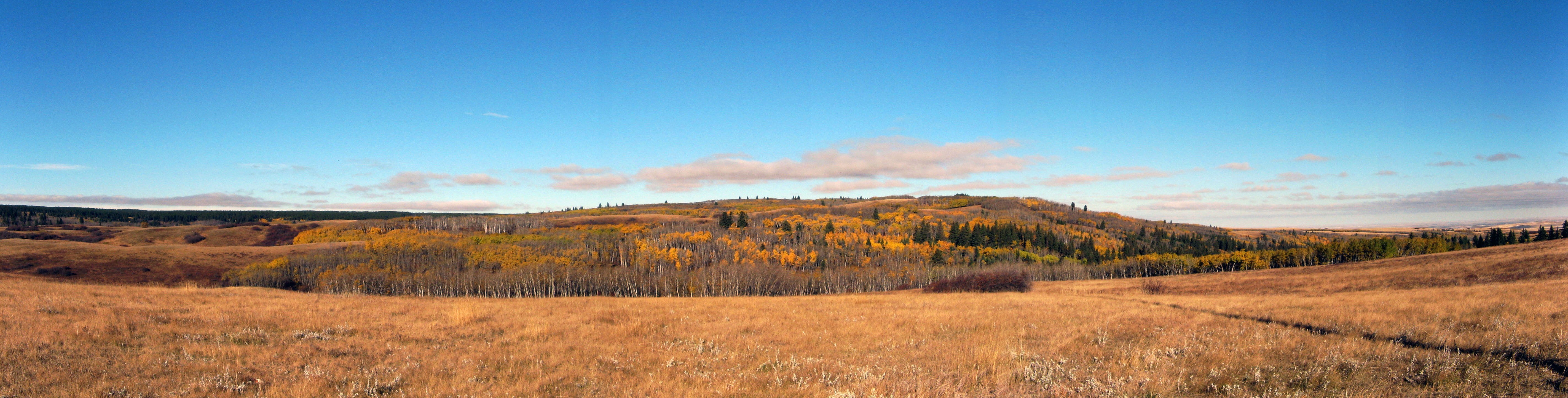
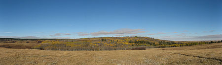 The Cypress Hills
The hills, because of the higher precipitation they receive, support extensive forest and also some rare fescue grassland. Most of the flora is shared with the mountains in states such as Montana and Wyoming rather than with the rest of Canada.
History
Historically the Cypress Hills were a meeting and conflict area for various American Indian and First Nations peoples including the Cree, Assiniboine, Atsina, Blackfoot, Saulteaux, Sioux, Crow, and others. During the 19th century Metis settled in the hills, hunting and often wintering there. The Cypress Hills Massacre, a key event in Canadian history leading to the creation of the North-West Mounted Police occurred in the hills when a group of American wolvers from Montana massacred an Assiniboine encampment. Fort Walsh was established to bring law and order to the Canadian border region.
Interprovincial park
Main article: Cypress Hills Interprovincial ParkThe Cypress Hills Provincial Park was established in 1951 in this area, and it was extended into Saskatchewan in 1989, as Cypress Hills Interprovincial Park.[4]
The Alberta portion of the Cypress Hills contains the tourist destination of Elkwater, a community with campground facilities located on the southern shore of Elkwater Lake. The townsite is mainly made up of summer cabins. Elkwater is located about 70 km southeast of Medicine Hat.
Climate
Climate data for Cypress Hills Month Jan Feb Mar Apr May Jun Jul Aug Sep Oct Nov Dec Year Record high °C (°F) 13.5
(56.3)18
(64)19
(66)26
(79)40.5
(104.9)34
(93)34
(93)33.5
(92.3)32
(90)28
(82)21
(70)15
(59)40.5
(104.9)Average high °C (°F) −3.4
(25.9)−1.2
(29.8)2.7
(36.9)9.8
(49.6)15.4
(59.7)19.3
(66.7)22.5
(72.5)22.8
(73.0)16.5
(61.7)10.3
(50.5)1.2
(34.2)−2.9
(26.8)9.4 Daily mean °C (°F) −9.5
(14.9)−7
(19)−2.7
(27.1)3.5
(38.3)8.8
(47.8)12.7
(54.9)15.4
(59.7)15.3
(59.5)9.5
(49.1)4
(39)−4
(25)−8.7
(16.3)3.1 Average low °C (°F) −15.6
(3.9)−12.9
(8.8)−8
(18)−2.9
(26.8)2.3
(36.1)6.2
(43.2)8.2
(46.8)7.6
(45.7)2.5
(36.5)−2.3
(27.9)−9.1
(15.6)−14.4
(6.1)−3.2 Record low °C (°F) −41
(−42)−40
(−40)−35
(−31)−26.5
(−15.7)−11.5
(11.3)−3
(27)0
(32)−4
(25)−10
(14)−28.5
(−19.3)−39
(−38)−41.5
(−42.7)−41.5
(−42.7)Precipitation mm (inches) 35.1
(1.382)28.1
(1.106)41.9
(1.65)40.5
(1.594)76.8
(3.024)96.8
(3.811)69.6
(2.74)47.5
(1.87)58.2
(2.291)36.7
(1.445)35.1
(1.382)40.7
(1.602)606.8
(23.89)Source: Environment Canada[5] See also
- Black Hills - a similar landform in the United States.
- List of highest points of Canadian provinces and territories
References
- ^ Statistics Canada - Highest points by province
- ^ Alex Johnston. Plants and the Blackfoot. Lethbridge: Lethbridge Historical Society, 1987, page 6.
- ^ Gray, Charlotte; The Museum Called Canada: 25 Rooms of Wonder, Random House, 2004 ISBN 978-0679312208
- ^ Government of Saskatchewan - Cypress Hills Interprovincial park
- ^ Environment Canada Canadian Climate Normals 1971–2000, accessed 24 July 2010
- [1] Encyclopedia of Saskatchewan
Categories:- Cypress County, Alberta
- Hills of Alberta
- Hills of Saskatchewan
- Maple Creek No. 111, Saskatchewan
- Natural history of Alberta
- Natural history of Saskatchewan
- Water divides


Wikimedia Foundation. 2010.