- Cypress Hills Interprovincial Park
-
Cypress Hills Interprovincial Park IUCN Category V (Protected Landscape/Seascape)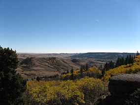
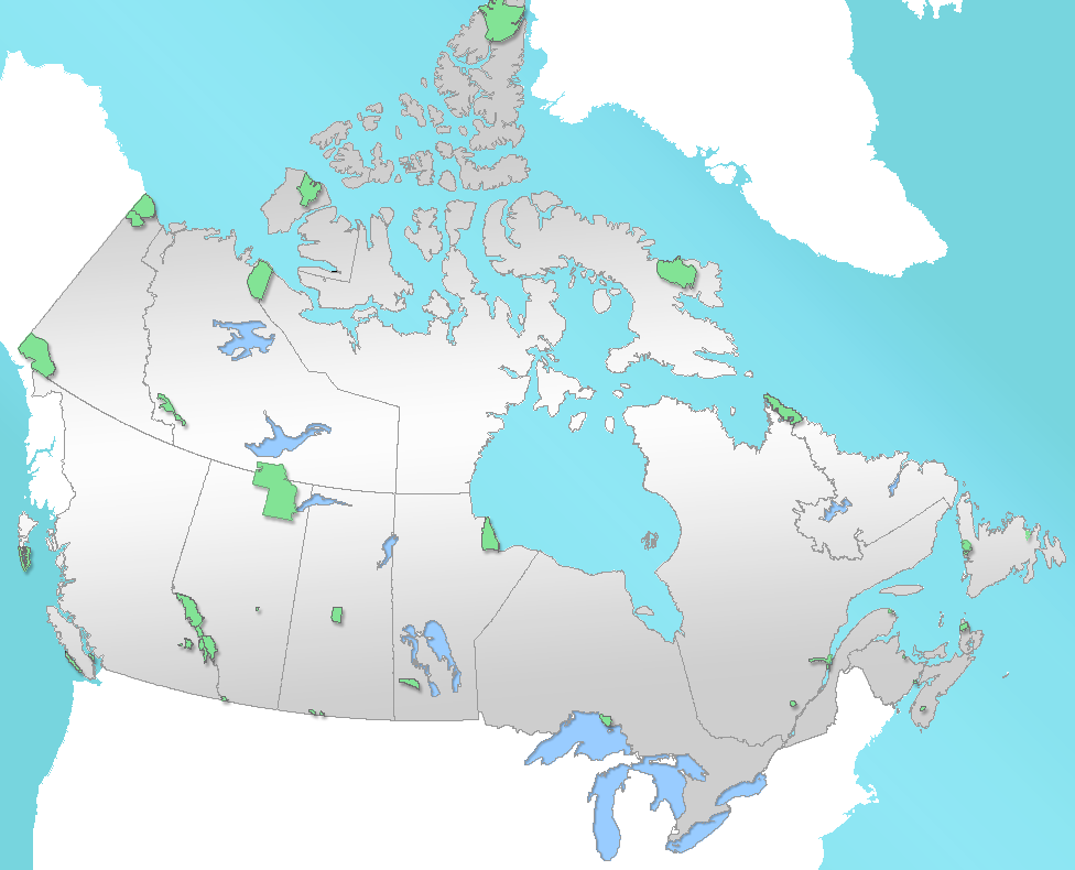
Cypress HillsLocation of Cypress Hills Interprovincial Park in Canada

Location Cypress County, Alberta / Maple Creek No. 111, Saskatchewan, Canada Nearest city Medicine Hat, AB; Maple Creek, SK Coordinates 49°34′30.69″N 110°00′23.05″W / 49.5751917°N 110.0064028°WCoordinates: 49°34′30.69″N 110°00′23.05″W / 49.5751917°N 110.0064028°W Area 400 km2 (150 sq mi) Established 1951 (Alberta)
1989 (interprovincial)Governing body Alberta Tourism, Parks and Recreation and Saskatchewan Environment Cypress Hills Interprovincial Park is an interprovincial park straddling the southern Alberta-Saskatchewan border, located southeast of Medicine Hat. It is Canada's first and only interprovincial park.
The park consists of two protected areas, the 345 km2 (133 sq mi) west block, that straddles the Alberta/Saskatchewan border between Alberta Highway 41, the townsite of Elkwater, Saskatchewan Highway 615, Saskatchewan Highway 271 and Fort Walsh, and the centre block, an additional area of 58 km2 (22 sq mi) in Saskatchewan, west of Saskatchewan Highway 21.
Contents
Geography
Main article: Cypress Hills (Canada)The Cypress Hills plateau rises up to 200 metres above the surrounding prairie, to a maximum elevation of 1,468 metres (4,816 ft), making it Canada's highest point between the Canadian Rockies and the Labrador peninsula and also the highest point in Saskatchewan.[1] The "West Block" of the Cypress Hills spans the provincial border. Battle Creek runs through the central part of the park. Although the hills seem relatively short, in a larger geographic context the plateau does rise gradually from many kilometres away so that the total elevation gain from Medicine Hat is approximately 600 metres.
Nature
Approximately 700 species of plants and animals thrive in the park, including 14 species of orchids.
The park protects the majority of the Cypress Hills landscape, which consists of three separate elevated blocks of lush forest and fescue grassland surrounded by dry mixed-grass prairie. The "west block" and "centre block" are protected as provincial parks, and are managed by Alberta Parks and Protected Areas[2] and Saskatchewan Parks,[3] respectively. The "east block" of the Cypress Hills, situated near Eastend, Saskatchewan, is not part of the park. The Fort Walsh National Historic Site is also located in the park's limits.
Fish species
Fish species include walleye, yellow perch, northern pike, brook trout, brown trout, cutthroat trout, rainbow trout, burbot, common carp, white sucker, and shorthead redhorse.
Activities
On the Alberta side of the west block, key park features include Head of the Mountain, the Elkwater townsite (a cottage community sitting at the same elevation as the Banff townsite), Horseshoe Canyon and Reesor Lake viewpoints (offering 100 km views on a clear day), over 50 km of hiking and mountain biking trails, and Hidden Valley Ski Area. Three lakes sit on the Alberta side of the park (Elkwater Lake, Spruce Coulee Reservoir and Reesor Lake), with another four in Saskatchewan (Harris, Adams, Coulee Lake and Loch Leven).
All year long, park interpreters present education programs to school and youth groups, adult and seniors groups, and a wide range of park visitors.
History
- 1951 - The Cypress Hills Provincial Park was established in Alberta.
- 1989 - On August 25, the governments of Alberta[4] and Saskatchewan[5] signed an agreement committing themselves to cooperation on ecosystem management, education and park promotion.
- 2000 - Fort Walsh National Historic Site (located on the Saskatchewan side of the West Block) joined the collective. Together, these three partner agencies make up the park. Both Alberta and Saskatchewan provincial governments signed the Cypress Hills Interprovincial Park agreement, establishing the first interprovincial park in Canada.
- 2004 - On September 28, Saskatchewan Parks, Alberta Community Development and Parks Canada signed an agreement that declared the park a dark-sky preserve.
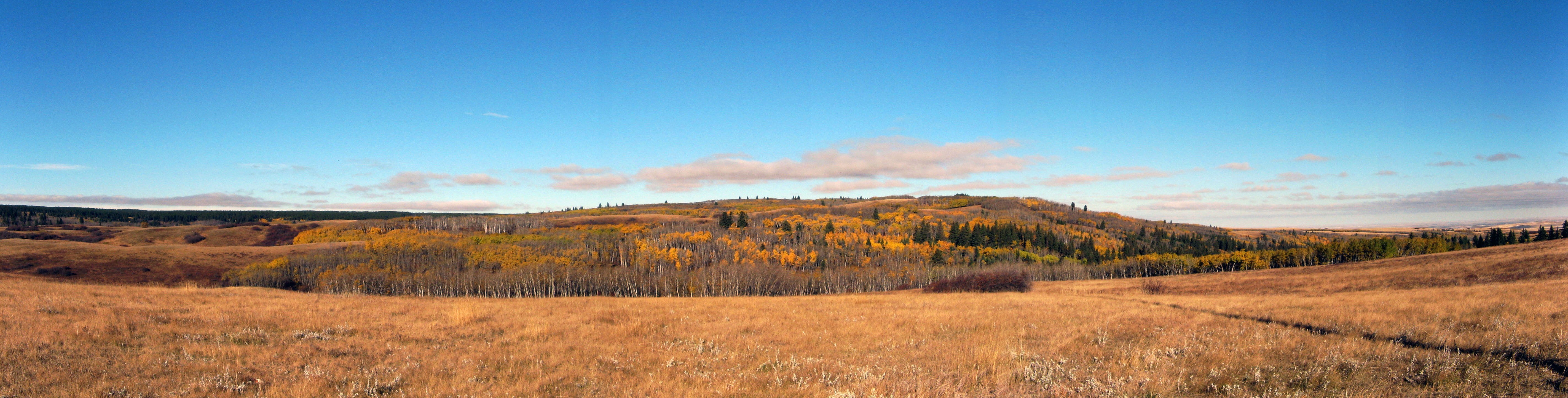
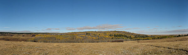 A panorama of Cypress Hills
See also
- List of Alberta provincial parks
- List of Saskatchewan parks
- List of Canadian provincial parks
- List of National Parks of Canada
- List of highest points of Canadian provinces and territories
References
- ^ Statistics Canada - Highest points by province
- ^ Alberta Parks and Protected Areas
- ^ Saskatchewan Parks
- ^ Alberta Government - Cypress Hills Interprovincial Park page
- ^ Saskatchewan Government - Cypress Hills Interprovincial Park page
External links
- Official Park website
- A Road Trip To Cypress Hills
- Cypress Hills Interprovincial Park
- [1] Fish Species of Saskatchewan
National parks 
Provincial parks Athabasca Sand Dunes · Blackstrap · Buffalo Pound · Candle Lake · Cannington Manor · Clarence-Steepbank Lakes · Clearwater River · Crooked Lake · Cumberland House · Cypress Hills · Danielson · Douglas · Duck Mountain · Echo Valley · Fort Carlton · Fort Pitt · Good Spirit Lake · Greenwater Lake · Katepwa Point · Lac La Ronge · Last Mountain House · Makwa Lake · Meadow Lake · Moose Mountain · Narrow Hills · Pike Lake · Rowan's Ravine · Saskatchewan Landing · Saskatchewan River Forks · Stanley Mission · Steele Narrows · St. Victor Petroglyphs · The Battlefords · Touchwood Hills Post · Wildcat Hill · Wood Mountain Post · more...National Historic Sites of Canada in Saskatchewan Addison Sod House · Batoche · Battle of Cut Knife · Battle of Duck Lake · Battle of Fish Creek · Battleford Court House · Bell Farm · Biggar Railway Station · Canadian Bank of Commerce · Claybank Brick Plant · College Building · Cumberland House · Cypress Hills massacre · Doukhobors at Veregin · Forestry Farm Park and Zoo · Former Prince Albert City Hall · Fort de la Corne · Fort Battleford · Fort Carlton · Fort Espérance · Fort Livingstone · Fort Pelly · Fort Pitt · Fort Qu'Appelle · Fort Walsh · Frenchman Butte · Government House · Gravelbourg Ecclesiastical Buildings · Gray Burial Site · Holy Trinity Church · Humboldt Post Office · Île-à-la-Crosse · Keyhole Castle · Last Mountain Lake Bird Sanctuary · Moose Jaw Court House · Motherwell Homestead · Next of Kin Memorial Avenue · Old Government House / Saint-Charles Scholasticate · Saskatchewan Legislative Building and Grounds · Saskatoon Railway Station (Canadian Pacific) · Seager Wheeler's Maple Grove Farm · Steele Narrows · Wanuskewin · more...Urban & Regional parks Big Dig · Carlton Trail Regional Park · Cenotaph · Fishing Lake Regional Park · Narrow Hills Provincial Park · Palliser Regional Park · Statue of Queen Elizabeth II riding Burmese · Statue of Sir John A. Macdonald · Touchwood Hills Provincial Park · Victoria Park · Wascana CentreMuseums Geography of Saskatchewan Athabasca Basin · Carlton Trail · Carswell crater · Cypress Hills · Deep Bay crater · Elbow crater · Gow crater · Mackenzie dike swarm · Madge Lake · Maple Creek crater · Methye Portage · Palliser's Triangle · Pheasant Creek · Red Coat Trail · Saskatchewan Valley · Spruce Falls, Saskatchewan · Viewfield crater · Western Canadian Sedimentary BasinCategories:- IUCN Category V
- Cypress County, Alberta
- Parks in Alberta
- Parks in Saskatchewan
- Dark sky parks
- Maple Creek No. 111, Saskatchewan


Wikimedia Foundation. 2010.