- Nose Hill Park
-
Nose Hill Park 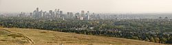
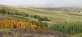
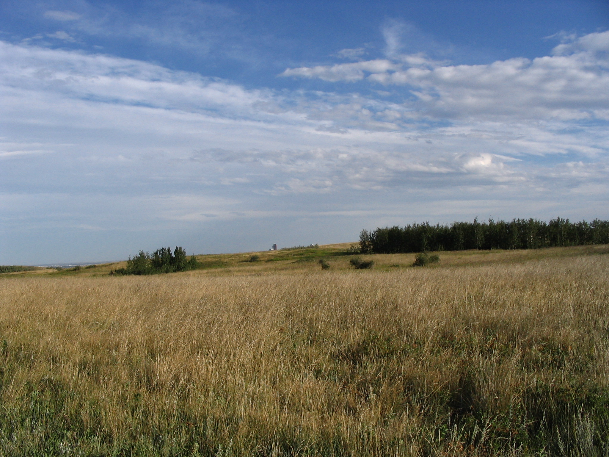
View from the summit
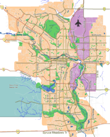
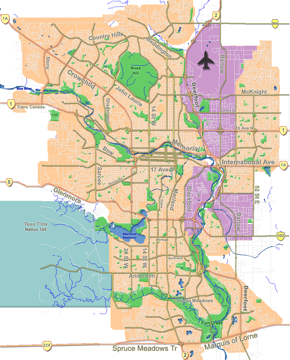
 Location of Nose Hill in Calgary
Type Urban park Location Calgary, Alberta Coordinates 51°07′N 114°07′W / 51.117°N 114.117°W Area 11.27 square kilometres (4.35 sq mi) Created 1980s Operated by City of Calgary Status Open year round Nose Hill Park, one of the largest municipal parks in Canada and North America, is located in the northwest quadrant of Calgary, Alberta. It is a natural environment park, commonly regarded as a retreat from city life and a place to enjoy nature. It is the second-largest park in Calgary, surpassed in size only by Fish Creek Provincial Park.
Contents
Environment
Sensitive vegetation, terrain, and archeological sites exist within the park. It contains a significant native rough fescue grassland ecosystem and over 66 native vascular plant species have been found on the hill including parry oatgrass, prairie crocus, golden bean, bedstraw, and sage.
Grasslands of this nature are considered endangered in North America because more than 95% have been lost to cultivation, tree encroachment, pollution, and development.[citation needed] The grassland is one of 7 major native habitat types on the hill which together provide an excellent habitat for a variety of animals. Over 198 wildlife species have been identified on the hill.
Formation
A large river flowing from the mountains to the west deposited gravels on top of sandstones and shales that formed the hill's bedrock. During the last ice age, about 15, 000 years ago, ice sheets wore away the rock and gravel. At the end of the ice age, retreating ice left glacial till on the hill's top. Glacial Lake Calgary was formed in the area and deposited sediments on the side of the hill. A river, later to be known as the Bow, eroded the sediments and helped shape the south side of the hill.
History
The origin of the hill's name is unclear but common legend tells of a European explorer asking an aboriginal translator the name of the hill seen far off in the distance. The man replied: Nose Hill is the name it was given because from here it resembles the nose of our chief.
In December 1779 a well-known Hudson's Bay Company trader, Peter Fidler, recorded an excursion to the hill he went on with Peigan guides. HBC trader David Thompson wintered at a Peigan encampment on the Bow River in 1787–1788, and in 1800 returned to the area as a North West Company employee. In his journal for the year, Thompson made specific note of Nose Hill. The details of Fidler's journal entry illustrate well how dramatically the region's warm Chinook winds can affect the cold temperatures that characterize winters in southern Alberta. The temperature on the December day of Fidler's visit to Nose Hill was a balmy 14 degrees Celsius (58 degrees Fahrenheit).
Exposed to the drying and warming effects of the recurrent Chinook winds, Nose Hill provided favorable wintering grounds for bison herds which, in turn, attracted people to the hill's grassy slopes. The park today contains numerous tipi rings - circles of stone once used to weigh down the conical-shaped skin dwellings of plains bison hunters. Also within the perimeters of today's park are ancient tool-making stations, a stone cairn, and evidence of bison kills conducted long ago. In 1900, one Euro-Canadian settler in the Nose Hill area described the archaeological residue below the cliffs of the coulee by McPherson Creek as a bone bed nine feet thick and an acre in extent. Establishing the tribal identities of all the people who left archaeological evidence on and around Nose Hill is virtually impossible. Most of the more recent sites, however, probably belonged to the Peigan, who dominated the territory in the vicinity of the Bow Valley when the Europeans first appeared.
John and George McDougall, Methodist missionaries, experienced more typical winter weather when they traveled to Nose Hill to hunt bison some four decades later. En route back to their hunting camp on the bitterly cold night of January 24, 1876, the elder McDougall, George, lost his way. A savage snowstorm delayed efforts to locate the missing man. On February 6, a search party finally discovered McDougall's frozen body on the east side of Nose Creek.
Names currently associated with topographical features in and near Nose Hill Park reflect the impact of the European newcomers and European trade goods on the Peigan. For example, Spy Hill, the westward extension of Nose Hill, derived its present name from the aboriginal practice of communicating with distant colleagues by flashing European trade mirrors from elevated locations. Other effects of the Europeans' arrival were more insidious. The six bison that the Methodist missionaries shot during their ill-fated hunting excursion were mere remnants of southern Alberta's once vast buffalo population. By 1879, the bison herds had vanished from Nose Hill. A new chapter of local history had begun. A fledgling Euro-Canadian community, Fort Calgary, had appeared in the valley beneath Nose Hill.
The area around Nose Hill itself played a significant economic role in Calgary's subsequent physical transformation from police fort to prairie city. Much of the sandstone used to construct the imposing public buildings that became Calgary's hallmark after 1886 came from quarries local entrepreneurs operated on Nose Creek. Stone from the J A Lewis quarry provided the entrance to the Imperial Bank and part of the new city hall erected in 1909. Masons used materials carted into the city from Nose Creek to build James Short School and Calgary's old courthouse as well.
During the construction "boom" years prior to World War I, Nose Creek also made a significant contribution to less reputable facets of the young city's economy. Bordellos built along the banks of the creek helped sustain the local prostitution trade, and further Calgary's growing notoriety as "... the booze, brothel and gambling capital of the far western plains."[1] Business at the brothels flourished until World War I, when competing downtown facilities that operated near the city's saloons and new army barracks diverted attention away from the less accessible Nose Hill and Nose Creek district.
In the fall of 1896, a young Blackfoot man, Running Weasel, died south of the Bow River. His final request provides eloquent testimony to Nose Hill's enduring role as a sentinel presiding over the passage of time. At his death, Running Weasel asked that he be " ... put where he could see the great city [of Calgary] grow beneath his feet."[2] His well-known friend Deerfoot placed his coffin beside Nose Creek.
As Calgary developed and grew, it began encroaching on the hill. Developers discussed constructing a neighbourhood along the hill as early as the late 1940s. Some maps began featuring roads as far northwest as 24th Street and 48 Avenue, though none of these roads were ever constructed north of John Laurie Boulevard or west of 14th Street.[3]
Cattle grazing continued on the hill unabated until 1969, vehicle traffic was tolerated on parts of the hill until 1971, people picnicking or just sightseeing from their car were common sights in summer months. More than 35 years later, remnants of the damage the cars created on the narrow paths can still be seen immediately west of the Calgary Winter Club Parking lot. In 1974 a grassroots group began lobbying the city to protect the area. It was not until the 1980s that Nose Hill Park was officially designated a protected area by the city; it finally gave it this designation in response to plans by developers to build a residential community on the site of the park. Once considered the northern outskirts of Calgary, the park is today surrounded on all sides by residential development. Much has been done to preserve the park. Long abandoned hulks of cars were removed from the coulees in the late 1970s and early 1980s. Today, the park is used year-round by hikers, walkers, cyclists and other outdoor enthusiasts.
Size and location
- 11.27 square kilometres (4.35 sq mi)[4]
- 4.8 km (3.0 mi) from North to South
- 4.0 km (2.5 mi) from East to West
- 1,125 m (3,691 ft) to 1,230 m (4,040 ft) altitude
It is bordered on the South by John Laurie Blvd. N.W., to the West by Shaganappi Tr. N.W., on the East by 14 St. N.W., and on the North by the community of MacEwan.
The park had more than 300 km (190 mi) of informal trails. The city proposed a rehabilitation plan which would provide 60 km (37 mi) of maintained trails and pathways, of which 52 km (32 mi) are dirt and gravel and 8 km (5.0 mi) are asphalt.[5]
Gallery
-

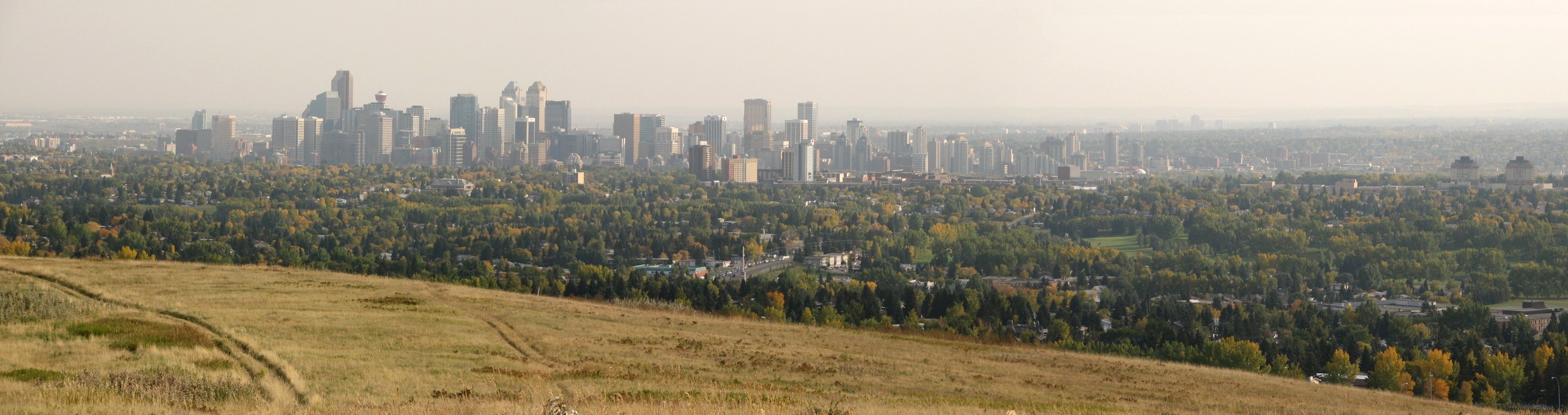
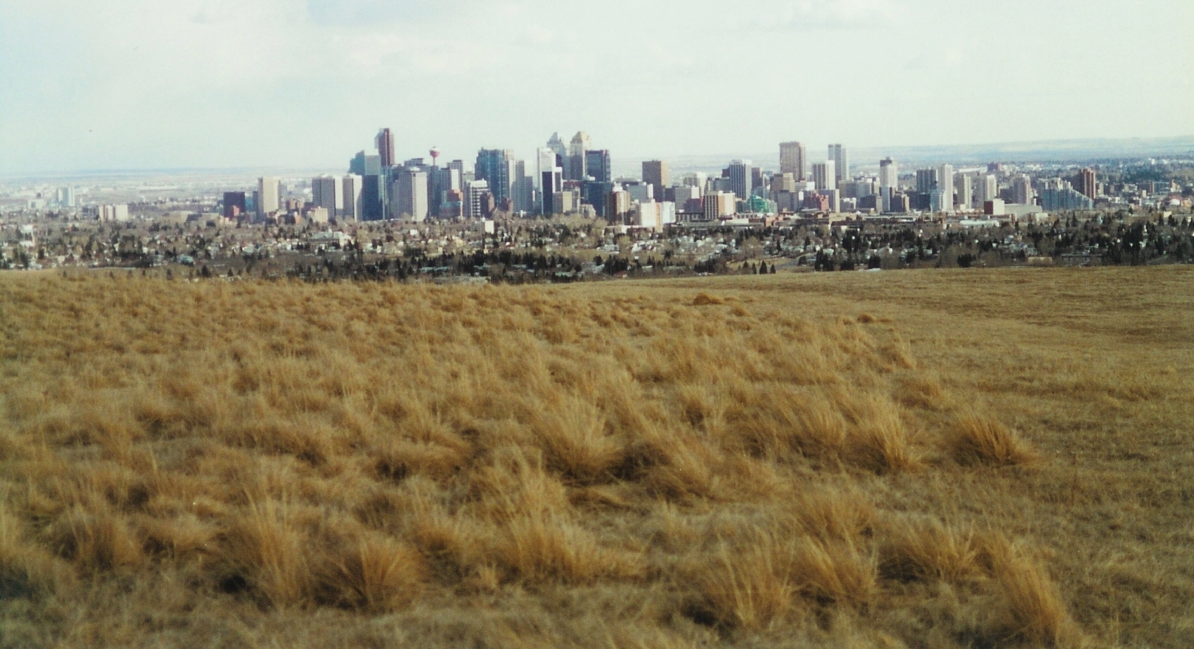
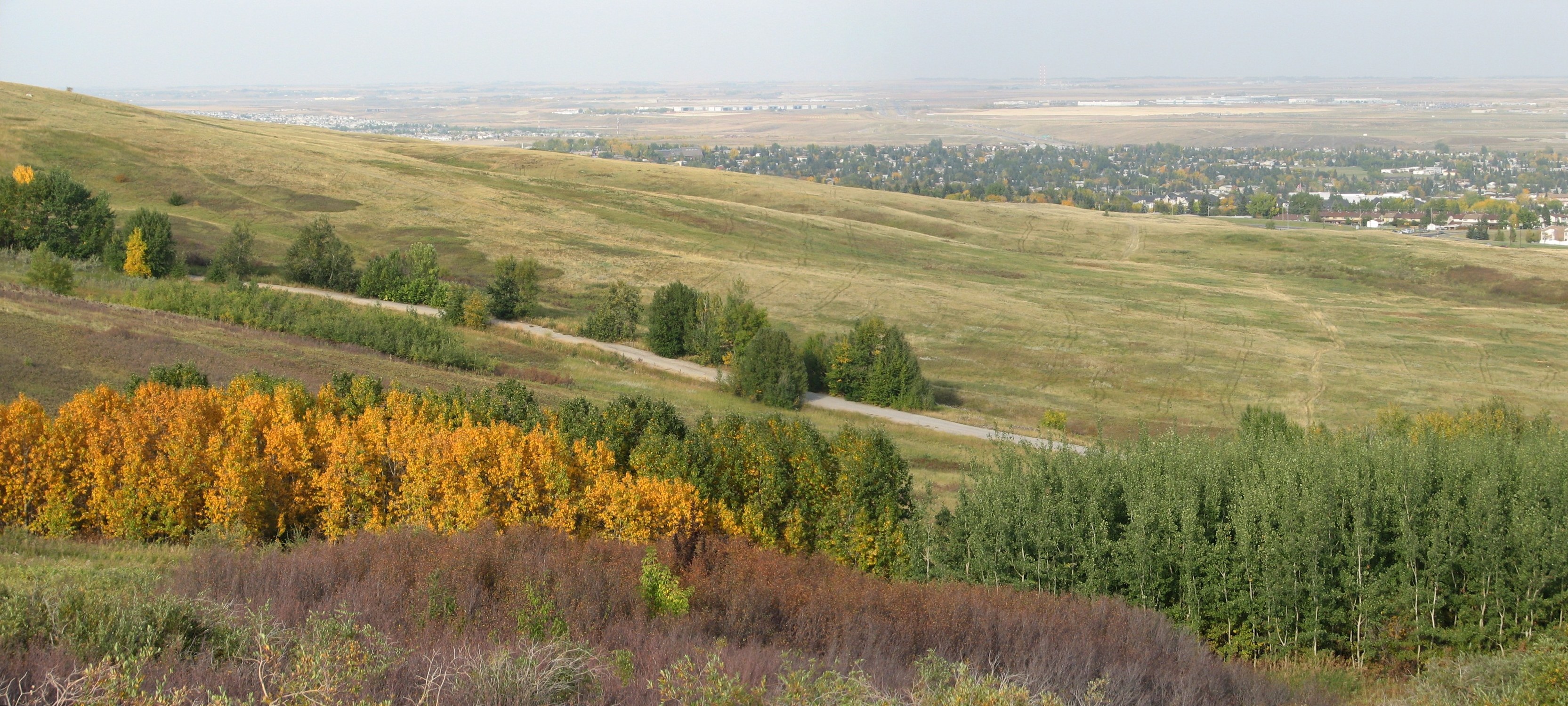
Downtown Calgary seen from Nose Hill
-
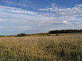
Nose Hill's relatively flat summit
-
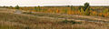
View of Nose Hill Park summit looking northwest
-
View from Nose Hill Park looking north
References
- ^ James Gray, Red Lights on the Prairies, 1971, p. 125.
- ^ Calgary Herald, March 11, 1897
- ^ Bekin’s moving – Calgary City Map (1958)
- ^ City of Calgary. "Nose Hill Park". Archived from the original on 2007-06-08. http://web.archive.org/web/20070608035314/http://content.calgary.ca/CCA/City+Hall/Business+Units/Land+Information+and+Mapping/eMaps/City+Maps/The+Environment/Parklands+and+Wildlife/Nose+Hill+Park+Habitats+Map.htm. Retrieved 2007-07-20.
- ^ City of Calgary (2005). "The Nose Hill Trail and Pathway Plan". Archived from the original on 2007-09-30. http://web.archive.org/web/20070930221148/http://www.calgary.ca/portal/server.pt/gateway/PTARGS_0_2_780_237_0_43/http;/content.calgary.ca/CCA/City+Hall/Business+Units/Parks/Parks/Natural+Environment+Parks/Locations/Natural+Areas+in+NW+Calgary/Nose+Hill+Park/The+Nose+Hill+Trail+and+Pathway+Plan.htm. Retrieved 2007-07-20.
External links
- City of Calgary. "Nose Hill Brochure". http://www.calgary.ca/docgallery/bu/parks_operations/nosehill/nose_hill_brochure.pdf. Retrieved 2007-07-20.

Edgemont MacEwan, Sandstone Valley Beddington Heights Dalhousie
Brentwood
Huntington Hills
Thorncliffe Nose Hill Park

Charleswood Collingwood, Cambrian Heights North Haven Attractions and landmarks in Calgary Landmarks - The Bow
- Baitun Nur
- Burns Building
- Calgary Tower
- Fairmont Palliser
- Mewata Armouries
- Stephen Avenue
- Suncor Energy Centre
- +15
- Tallest buildings
- Bridges
Attractions - Aero Space Museum of Calgary
- Bow River pathway
- Calaway Park
- Canada Olympic Park
- Fort Calgary
- Glenbow Museum
- Heritage Park Historical Village
- The Military Museums
- Stampede
- Hart House
- World of Science
- Zoo
- Festivals
Venues Parks - Battalion
- Bowness
- Central Memorial
- Confederation
- Devonian Gardens
- Edworthy
- Fish Creek
- Millennium
- Nose Hill
- Olympic Plaza
- Peacekeeper
- Prince's Island
Malls Parks in Alberta World Heritage Sites - Canadian Rocky Mountain Parks
- Dinosaur Provincial Park
- Head-Smashed-In Buffalo Jump
- Waterton Glacier International Peace Park
- Wood Buffalo National Park

National parks Provincial parks Urban parks - Calgary Zoo
- Devonian Gardens
- Edworthy Park
- Mill Woods Park
- Muttart Conservatory
- North Saskatchewan River Valley
- Nose Hill
- Oldman River Valley
- Edmonton Valley Zoo
- Pearce Estate Wetland
Museums and historic sites - Alberta Central Railway Museum
- Canadian Grain Elevator Discovery Center
- Cold Lake Air Force
- Ellis Bird Farm
- Fort Calgary
- Fort Edmonton Park
- Fort Victoria
- Fort Whoop-Up
- Frank Slide
- Galt Historic Railway Park
- Heritage Acres Farm Museum
- Heritage Park
- Krause Milling Co.
- Pioneer Acres
- Prairie Elevator Museum
- Reynolds-Alberta
- Ritchie Mill
- Royal Alberta
- Royal Tyrrell
- Scandia Eastern Irrigation District Museum
- Spruce Grove Grain Elevator Museum
- St. Albert Grain Elevator Park
- South Peace Centennial Museum
- Ukrainian Village
- Warner elevator row
- Whyte
- National historic sites
- Provincial historic sites
Categories:- Parks in Calgary
- Visitor attractions in Calgary

Wikimedia Foundation. 2010.