- Oldman River valley parks system
-
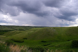 Old Man River valley during a thunderstorm
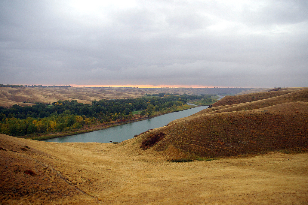
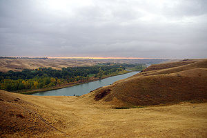 Old Man River valley at sunrise
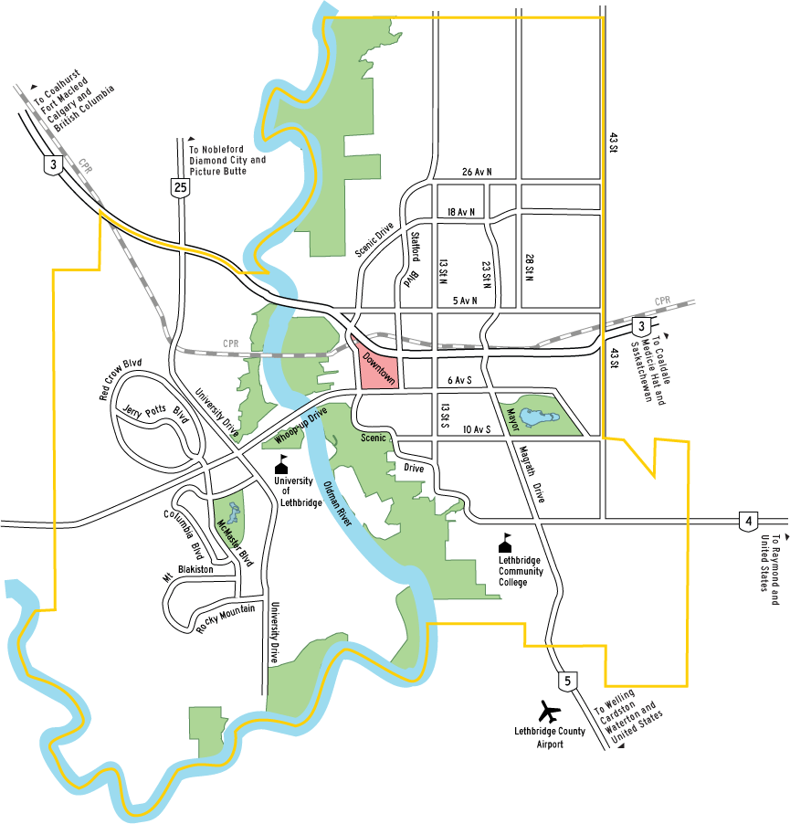
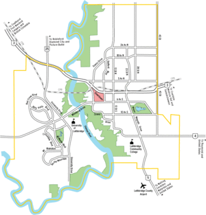 Map of Lethbridge showing parks
The Oldman River valley parks system is a continuous collection of eight urban parks in the Oldman River valley of Lethbridge, Alberta, 100 metres below the prairie level. The parks were created in the 1980s as part of the city's Urban Parks Project. Today they are a combined 16 km² (4,000 acres) in size and comprise one of the largest urban park systems in North America, and the third largest in Canada.[1]
Contents
Parks
Eight parks make up the system:
- Alexander Wilderness Park
- Botterill Bottom Park
- Bull Trail Park
- Elizabeth Hall Wetlands
- Indian Battle Park
- Nature Reserve
- Peenaquim Park
- Popson Park
Pavan Park and Cottonwood Park are in the river valley, but are separated from the rest of the system.
Amenities
The park system contains campgrounds, playgrounds, eating areas and several kilometres of cyclist/pedestrian trails, including part of the Coal Banks Trail system. Well-known attractions in the system include Fort Whoop-Up, Helen Schuler Coulee Centre and the High Level Bridge. A golf course is adjacent to Elizabeth Hall Wetlands.
Wildlife
Various wildlife live in the park system, including deer, hawks, owls, rabbits, snakes, fox, coyotes, badgers, porcupines, pelicans, beavers, muskrats, ground squirrels and cranes.[2]
Vegetation
Tree species native to the Old Man River valley are Populus deltoides, Populus balsamifera and Populus angustifolia. These three species interbreed, producing a very diverse forest with varying leaf shapes and branch patters. In fact, this area is the only place in the world where three poplar species hybridize.[2]
History
People began to settle in the river valley in the late 19th century, and by 1884, the population was about 250. The next year, many of the families had moved to the prairie level, with more leaving after serious floods in 1902 and 1908. The area was subdivided in 1912, and 83 families settled in the community, which was called Riverside, by the early 1950s. After a serious flood in 1953, Lethbridge City Council moved all the families out of the valley and designated it as parkland recreation.[2]
Indian Battle Park had been created by 1960, and the Lethbridge Nature Reserve was established near Indian Battle Park in the mid-1970s. The Lethbridge Naturalists Society and Public School Board built a nature centre in 1980, which was formally opened in 1982 as the Helen Schuler Coulee Centre.[2]
Beginning in 1981, the City of Lethbridge purchased new parkland using funds from Urban Parks for the Future, a project run by the provincial government and funded by the Heritage Trust Fund. Such parks include: Pavan Park, Alexander Wilderness Park, Peenaquim Park, Lethbridge Nature Reserve and Elizabeth Hall Wetlands, Indian Battle Park, Bull Trail Park, Botterill Bottom Park, and Popson Park.[2]
Notes
- ^ "2007 National Fair Program Preview". Historica Fairs. Historica. http://www.histori.ca/fairs/default.do?page=.main_ob§ion=fairs&rinfo=sb_sas&cont=overview. Retrieved 2007-02-16.
- ^ a b c d e "Field Guide Booklet" (PDF). The Lethbridge Naturalists Society. http://www.lethbridge.ca/NR/rdonlyres/F286C2B1-59B5-4B7E-819E-2A830AD404F2/0/CouleestoCottonwoodsbrochure.pdf. Retrieved 2010-01-21.
External links
Parks in Alberta World Heritage Sites - Canadian Rocky Mountain Parks
- Dinosaur Provincial Park
- Head-Smashed-In Buffalo Jump
- Waterton Glacier International Peace Park
- Wood Buffalo National Park

National parks Provincial parks Urban parks - Calgary Zoo
- Devonian Gardens
- Edworthy Park
- Mill Woods Park
- Muttart Conservatory
- North Saskatchewan River Valley
- Nose Hill
- Oldman River Valley
- Edmonton Valley Zoo
- Pearce Estate Wetland
Museums and historic sites - Alberta Central Railway Museum
- Canadian Grain Elevator Discovery Center
- Cold Lake Air Force
- Ellis Bird Farm
- Fort Calgary
- Fort Edmonton Park
- Fort Victoria
- Fort Whoop-Up
- Frank Slide
- Galt Historic Railway Park
- Heritage Acres Farm Museum
- Heritage Park
- Krause Milling Co.
- Pioneer Acres
- Prairie Elevator Museum
- Reynolds-Alberta
- Ritchie Mill
- Royal Alberta
- Royal Tyrrell
- Scandia Eastern Irrigation District Museum
- Spruce Grove Grain Elevator Museum
- St. Albert Grain Elevator Park
- South Peace Centennial Museum
- Ukrainian Village
- Warner elevator row
- Whyte
- National historic sites
- Provincial historic sites
Categories:- Parks in Lethbridge
- Valleys of Alberta


Wikimedia Foundation. 2010.