- North Saskatchewan River valley parks system
-
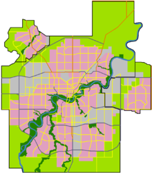 The North Saskatchewan River flows through the City of Edmonton from the southwest to the northeast
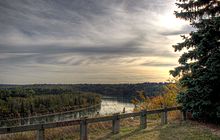 The North Saskatchewan River valley west of William Hawrelak Park in Edmonton
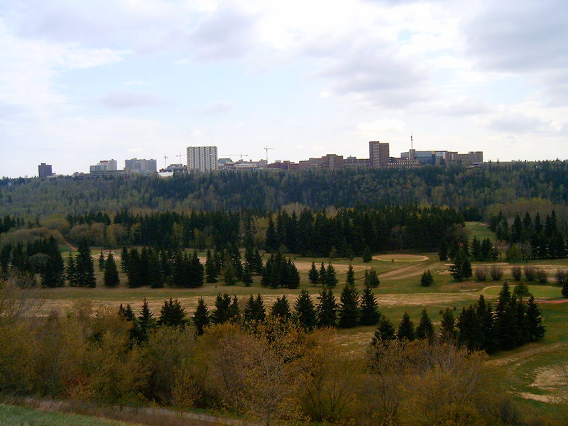
 Looking south over the North Saskatchewan River valley, with a view of Victoria Golf Course and the University of Alberta
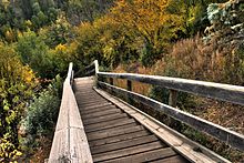 Wooden stairs into the river valley
The North Saskatchewan River valley parks system is a continuous collection of urban parks in the North Saskatchewan River valley of Edmonton, Alberta.
Edmonton's river valley comprises over 20 major parks and attractions and forms one of the largest expanses of connected urban parkland in North America.[1][2] Referred to as a "Ribbon of Green",[2] the public river valley parks provide a unique urban escape area with park styles ranging from fully serviced urban parks to campsite-like facilities with few amenities.[citation needed] At 7,400 ha (18,000 acres) in size and 48 km (30 mi) in length, the river valley parks system consists of 22 ravines, which have a combined total length of 103 km (64 mi).[2] It also includes 11 lakes.[citation needed] Most of the city has bike and walking trail connections.[3] These trails are also part of the 235 km (146 mi) Waskahegan walking trail.[citation needed]
Several golf courses, both public and private, are also located in the river valley. The long summer daylight hours of this northern city provide for extended play well into the evening. Golf courses and the park system become a winter recreation area during this season. Cross-country skiing and skating are popular during the long winter. Four downhill ski slopes are located in the river valley as well, two within the city and two immediately outside.
The City of Edmonton has named five parks in its river valley parks system in honour of each of "The Famous Five".
Contents
Parks and facilities
The largest area in the river valley is occupied by municipal parks:
- Hermitage Park
- Forest Heights Park
- Emily Murphy Park
- Rundle Park
- Dawson Park
- William Hawrelak Park
- Gold Bar Park
- Louise McKinney Park
- Sir Wilfrid Laurier Park
- Goldstick Park
- Queen Elizabeth Park
- Whitemud Park
- Capilano Park
- Kinsmen Park
- Terwillegar Park
- Kinnaird Park and Ravine
- Victoria Park
The City also operates several public facilities in the river valley:
- Fort Edmonton Park
- Edmonton Valley Zoo
- Muttart Conservatory
- John Janzen Nature Centre
- Riverside Golf Course
- Victoria Golf Course (the oldest municipal course in Canada)
- Rundle Park Golf Course
The provincial government owns the following sites in the river valley:
- Strathcona Science Provincial Park
- Alberta Legislature Building and grounds
- Royal Alberta Museum and Government House
Hiking, cycling, and multi-use trails run throughout these parks and connect to other trails through the city and outside as well forming an integrated system. The river valley parks in particular are part of the Waskahegan and Trans Canada trail systems.
Wildlife
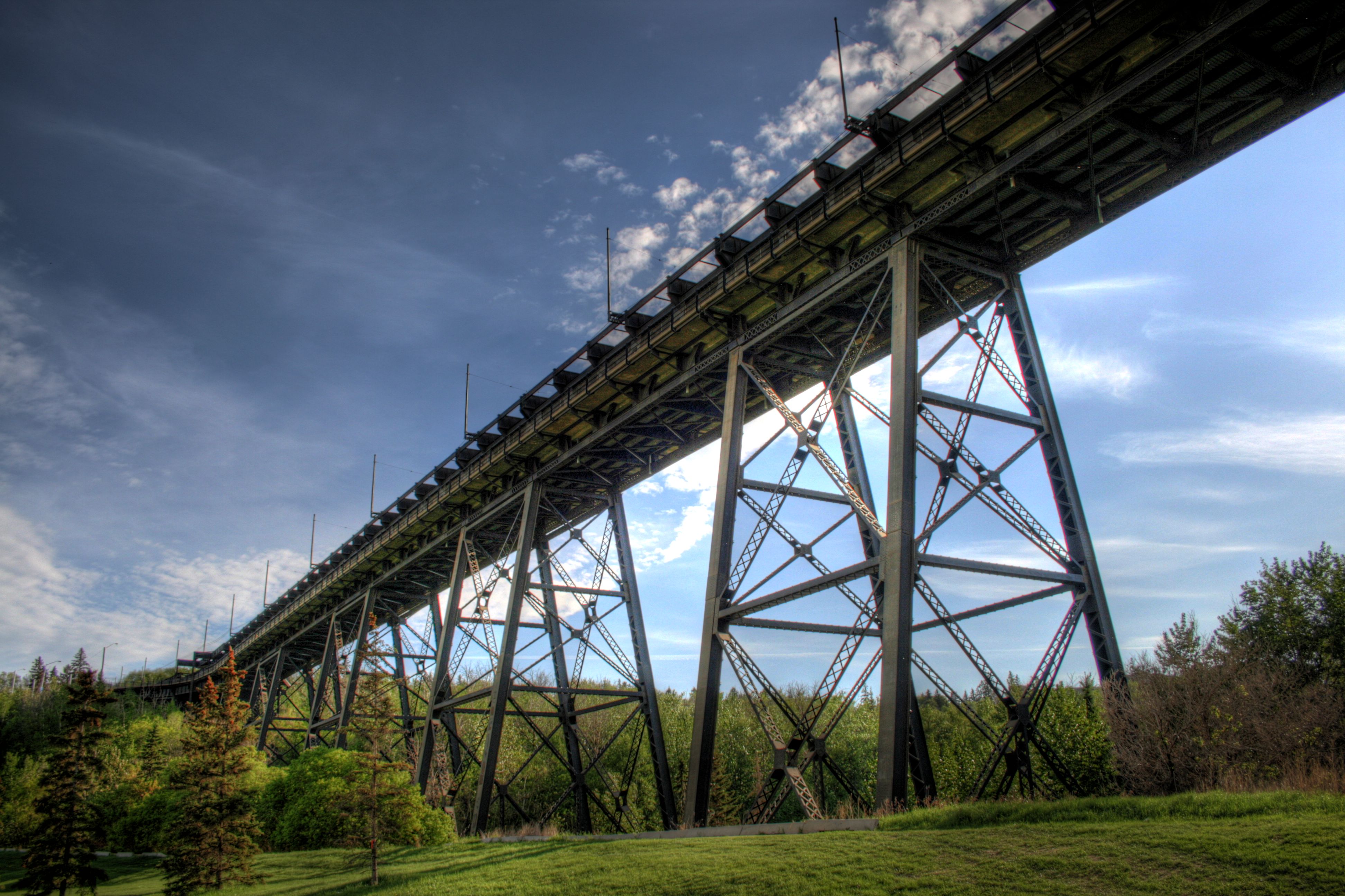
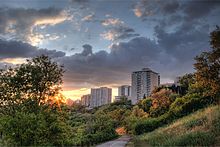 Trail into the river valley, near downtown
Edmonton's river valley park system is home to porcupines, deer, coyotes, bears, skunks, muskrats, rabbits, and beavers.
Edmonton's streets and parklands are also home to one of the largest remaining concentrations of healthy American Elm trees in the world, unaffected by Dutch Elm disease, which has wiped out vast numbers of such trees in eastern North America. Jack Pine, Lodgepole Pine, White Spruce, White Birch, Aspen, Green Ash, Basswood, various poplars and willows, and Manitoba Maple are also abundant; Bur Oak is increasingly popular. Introduced tree species include Blue Spruce, Norway Maple, Red Oak, Sugar Maple, Common Horse-chestnut, McIntosh Apple, and Evans Cherry. Three walnut species -- Butternut, Manchurian Walnut and Black Walnut -- have survived in Edmonton.[4]
Politics and planning
The River Valley Alliance is a grouping of municipal governments in the Edmonton region that have committed to expanding the River Valley Parks System outside of Edmonton's city limits. The plan calls for a 18,000-acre (73 km2) zone to be called the "Capital Region Valley Park" stretched over 88 kilometres running from Devon to Fort Saskatchewan.[5]
In January 2008, the City of Edmonton paid a record C$7 million to buy a parcel of land to fill in a gap in the otherwise continuous chain of parks. The city further promised to spend C$20 million of pedestrian bridges and trails, but said that the as yet unnamed park would be left in an undeveloped state.[6]
See also
References
- ^ "River Valley Parks". City of Edmonton. http://www.edmonton.ca/attractions_recreation/parks_rivervalley/river-valley-parks.aspx. Retrieved 2011-09-20.
- ^ a b c "Ribbon of Green: North Saskatchewan River Valley and Ravine System Master Plan". City of Edmonton. http://www.edmonton.ca/environmental/documents/Ribbon_of_GreenMaster_Plan.pdf#xml=http://search1.edmonton.ca/texis/ThunderstoneSearchService/pdfhi.txt?query=north+saskatchewan+river+valley&pr=www.edmonton.ca&prox=page&rorder=750&rprox=250&rdfreq=0&rwfreq=0&rlead=750&rdepth=0&sufs=1&order=r&cq=&id=4d9aed517. Retrieved 2011-09-20.
- ^ "Edmonton Roadway Bicycle Map" (PDF). City of Edmonton, Transportation Department. January, 2007. Archived from the original on 2007-10-29. http://web.archive.org/web/20071029155815/http://www.edmonton.ca/RoadsTraffic/bikemap/2007+Cycle+Edm+Map+-+front.pdf. Retrieved 2007-10-27.
- ^ Barkley, Shelley (2007-05-22). "Juglans sp. (Butternut/Walnut)". Government of Alberta. http://www1.agric.gov.ab.ca/$department/deptdocs.nsf/all/opp4044?opendocument=. Retrieved 2007-10-27.
- ^ "Our Vision". River Valley Alliance. http://www.rivervalley.ab.ca/our-vision/. Retrieved 2010-08-11.
- ^ "Filling a gap in valley trail system". Edmonton Journal. 2008-01-05. http://www.canada.com/edmontonjournal/news/local/story.html?id=b473b4fa-460d-4a5e-801f-f576a2712754&k=45416. Retrieved 2008-01-07.
External links
Parks in Alberta World Heritage Sites - Canadian Rocky Mountain Parks
- Dinosaur Provincial Park
- Head-Smashed-In Buffalo Jump
- Waterton Glacier International Peace Park
- Wood Buffalo National Park

National parks Provincial parks Urban parks - Calgary Zoo
- Devonian Gardens
- Edworthy Park
- Mill Woods Park
- Muttart Conservatory
- North Saskatchewan River Valley
- Nose Hill
- Oldman River Valley
- Edmonton Valley Zoo
- Pearce Estate Wetland
Museums and historic sites - Alberta Central Railway Museum
- Canadian Grain Elevator Discovery Center
- Cold Lake Air Force
- Ellis Bird Farm
- Fort Calgary
- Fort Edmonton Park
- Fort Victoria
- Fort Whoop-Up
- Frank Slide
- Galt Historic Railway Park
- Heritage Acres Farm Museum
- Heritage Park
- Krause Milling Co.
- Pioneer Acres
- Prairie Elevator Museum
- Reynolds-Alberta
- Ritchie Mill
- Royal Alberta
- Royal Tyrrell
- Scandia Eastern Irrigation District Museum
- Spruce Grove Grain Elevator Museum
- St. Albert Grain Elevator Park
- South Peace Centennial Museum
- Ukrainian Village
- Warner elevator row
- Whyte
- National historic sites
- Provincial historic sites
Categories:- Parks in Edmonton
- Valleys of Alberta
- Lists of Canadian municipal parks
- Saskatchewan River
- Canyons and gorges of Canada
- River valleys
- Visitor attractions in Edmonton
- Trans Canada Trail


Wikimedia Foundation. 2010.