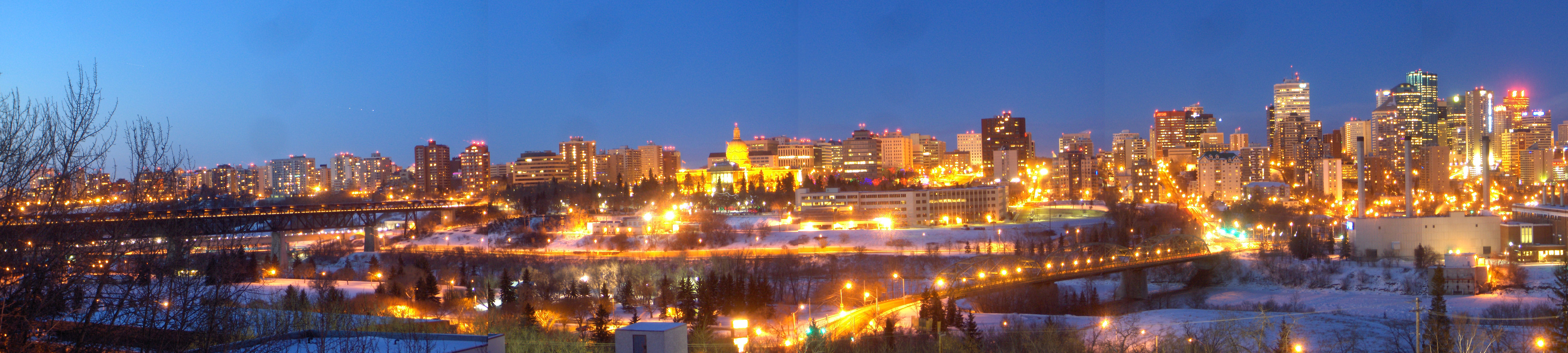
- Downtown Edmonton
-
Coordinates: 53°32′25″N 113°29′54″W / 53.54028°N 113.49833°W
Downtown Edmonton is bounded by 109 Street to the west, 105 Avenue to the north, 97 Street to the east, 97 Avenue, 100 Avenue, and Rossdale Road to the south and Jasper Avenue to the southeast (the downtown core), though many people consider part or all of the surrounding neighborhoods to be part of downtown. The downtown core is bordered by the neighbourhoods of Oliver to the west, Queen Mary Park to the northwest, Central McDougall to the North, McCauley to the northeast, Boyle Street (Jasper-East) to the east, Riverdale to the east and southeast, and Rossdale to the south. Within the downtown core are five districts: the Commercial Core, Government Centre, Warehouse District, McKay Avenue and Rice Howard Way. Sometimes the Northedge (part of Queen Mary Park) is referred to as part as downtown, as is Oliver.
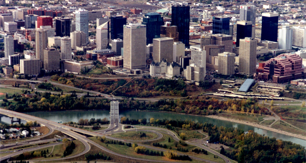
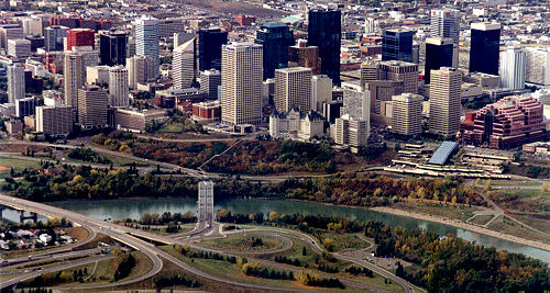 Downtown Edmonton from the air
Contents
Streets and districts
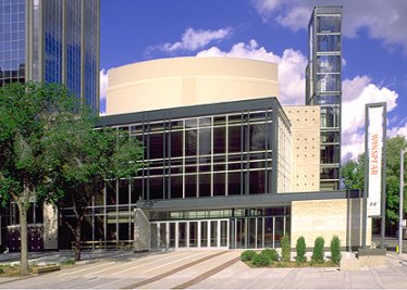
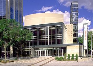 Edmonton's Winspear Centre in the Arts District.
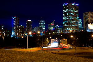 Image of Downtown Edmonton and Low Level Bridge from 98 Avenue.
Arts District and Churchill Square
Main article: Churchill Square, EdmontonThe arts district is in the eastern part of the core with many award winning institutions like the Francis Winspear Centre for Music (home of the Edmonton Symphony Orchestra) and the Citadel Theatre. Edmonton City Hall is also located here with all these building facing onto Sir Winston Churchill Square. It is also the site of the new Art Gallery of Alberta, which recently opened in early 2010, and the Stanley A. Milner Library, Edmonton Public Library's main branch.
Churchill Square (Officially "Sir Winston Churchill Square") is the main square downtown square in Edmonton, and is the heart of the Arts District. The square plays host to a large majority of festivals and events in Greater Edmonton. It is bordered on the north by 102A Avenue, on the west by 100 Street, on the south by Harbin Road (102 Avenue) and on the east by Rue Hull (99) Street. Recently, the portion of 102A Avenue that cut Churchill Square off from Edmonton's City Hall has been closed off to vehicular traffic as a way to better connect Churchill Square with the fountains and some festivities on the plaza at City Hall.[1]
Edmonton City Centre
Edmonton City Centre (formerly Eaton Centre and Edmonton Centre) is a two part shopping mall with over 170 services on 102 Avenue. It is anchored by The Bay, CBC, Winners and Empire Theatres. It has four office towers (using the mall as a podium), plus a Delta hotel. When Edmonton Centre and the Eaton Centre became one in the late '90s after the demise of Eaton's, a newer and larger pedestrian skyway was built to connect the two malls which also contains a number of shops. Also in the late '90s (after the malls became one), the mall received a huge makeover itself. Recently the mall itself has been attracting some higher end retailers.
Government Centre
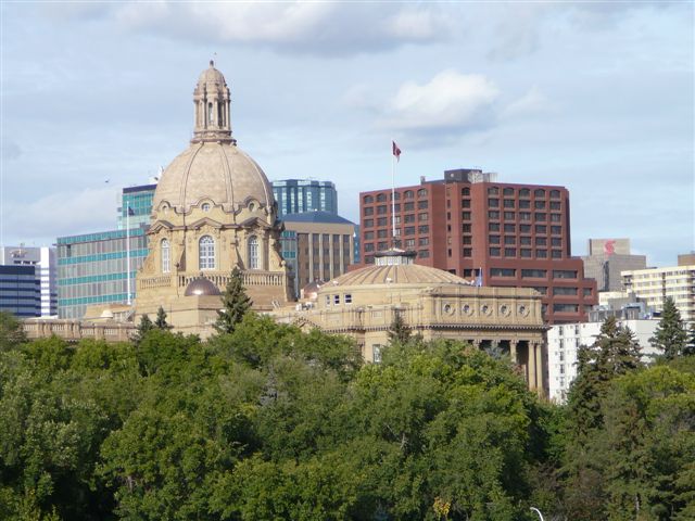
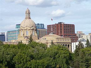 Alberta Legislature Building viewed from the High Level Bridge.
Government Centre is located at the southwest corner of the downtown core and is the home of the Alberta provincial government. The most notable feature of this part of downtown is the Alberta Legislature Building and its surrounding parks, fountains, and gardens.
An underground pedway system connects the Legislature to several of the surrounding buildings, including the historic Bowker Building and the Frederick W. Haultain Building.
Federal government offices were housed in the Federal Building at the north-east corner of Government Centre until they relocated to Canada Place, located at the east edge of downtown, in the 1980s. Today, the Federal Building is undergoing a $356 million renovation due to be completed in 2012 for provincial government offices and a new underground parking structure.[2][3]
Transit service is provided by a transit center located near the Federal Building and by Grandin station located just to the west.
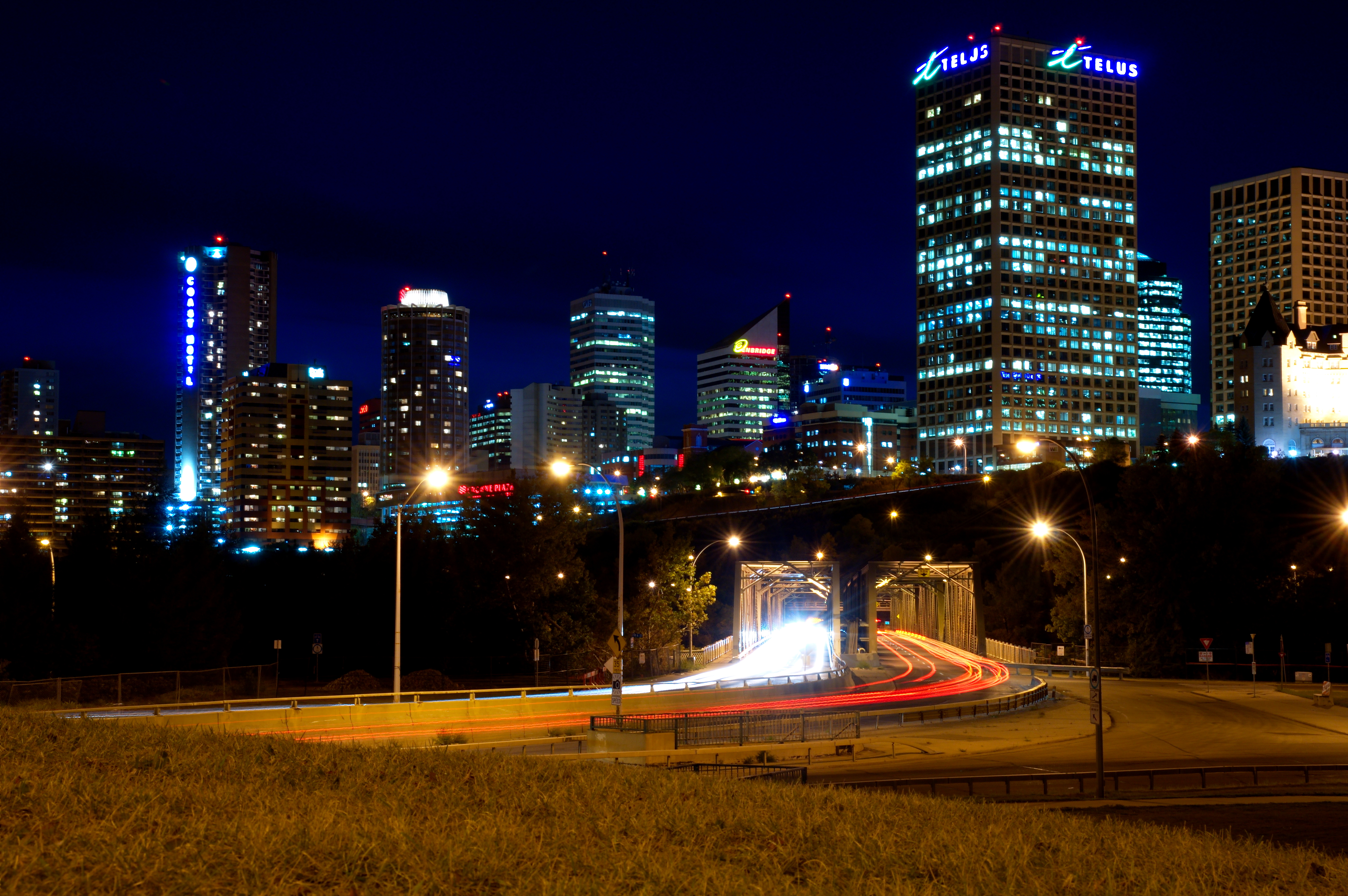
Jasper Avenue
Jasper Avenue
101 Avenue Maintained by: the City of Edmonton Length: 6.3 km (3.9 mi) Location: Edmonton West end: 125 Street / 102 Avenue Major
junctions:124 Street, 109 Street, 105 Street, 101 Street, 97 Street, 95 Street, 82 Street East end: 77 Street Jasper Avenue is the city's "main street". It starts at 82 Street in the east, running south west along the south edge of Boyle Street until it reaches the downtown core. It then runs due west through downtown and the neighborhood of Oliver until it reaches 124 Street. Jasper Avenue is a major public transit route as several of Edmonton's busiest bus routes travel along it. The LRT travels underneath Jasper Avenue between 99 and 110 Streets.
 Jasper Avenue on a bright morning.
Jasper Avenue has no street number but sits where 101 Avenue would otherwise be. Jasper Avenue is home to many of Edmonton's oldest heritage buildings (for example the Hotel Macdonald) and some of Edmonton's tallest office towers, including Canadian Western Bank Place and Scotia Place; however, the presence of the former limits that of the latter, and many tall buildings are found just off Jasper where land is easier to obtain. Together with help from nearby streets like 100 Avenue, 104 Street, 101 Street, and 102 Avenue, the Jasper West area (west of 97 Street) is one of the major retail, living, commercial, and entertainment districts of the city.
McKay Avenue
McKay Avenue School is an important historical building located in downtown Edmonton. Named for Dr. William Morrison MacKay, a doctor with the Hudson's Bay Company. Construction began in 1904 when the cornerstone was laid by the Governor General of Canada, Lord Minto. The building was named a provincial historic resource in 1976. Due to declining enrollments, the school was closed in 1983. Today, the building has a new lease on life, and is the home of the Edmonton Public School Board Archives And Museum. In addition to its educational role, the building was also used by the Alberta Legislature during 1906 and 1907, when the legislature's first two sittings were held here. The 1881 Schoolhouse, an older wood frame building and Edmonton's oldest school, is located on the same site.[4]
Rice Howard Way
104 Street Maintained by: the City of Edmonton Length: 1.7 km (1.1 mi) Location: Edmonton South end: Rossdale Road Major
junctions:Rossdale Road, 97 Avenue, Jasper Avenue, 104 Avenue North end: 104 Avenue Rice Howard Way comprises 100A Street between Jasper Avenue and 102 Avenue and 101A Avenue between 100 St and 101 St. The portion of 101A Avenue between 100A Street and 101 Street was closed to traffic, making it an open air pedestrian walkway. The rest of Rice Howard Way is open to vehicular traffic. Rice Howard Way has a few prominent office towers like Scotia Place and some restaurants.
Rice Howard Way's southern edge (100A St at Jasper Avenue) has an entrance to the Central LRT station.
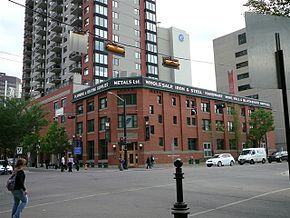
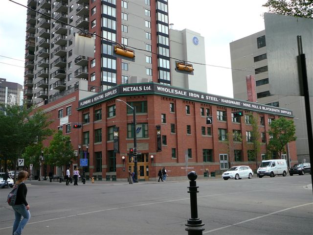
Warehouse District and 104 Street
 A warehouse in the downtown core surrounded by modern highrises.
The Warehouse District is located between Jasper Avenue and 104 Avenue and between 102 Street and 109 Street. During the first decade of the 20th century, the Hudson's Bay Company began selling its land holdings in this area, and businesses were quick to move in. Between 1909 and 1914, no fewer than two dozen warehouses were constructed.[5]
In the later part of the century, warehouses closed and the buildings were redeveloped into commercial enterprises. In the late 1990s lofts were created in these former warehouses. In recent years, the area has seen a revival, with new lofts and condos being constructed or proposed, along with many designer shops. The area also includes Canada's first urban format Sobey's Fresh Market, flanking the curved Birks building as the entrance to 104 Street at Jasper Avenue and serving the new residential population.
104 Street (in between Jasper Avenue and 104 Avenue) is the main road in the Warehouse District. It features shops, restaurants, cafes and a variety of service shops. On Saturdays during the summer month (May–October) it hums with Edmonton's original farmer's market, the City Market. The area is also famous for lofts in old warehouses. The street is very dense, and has seen new projects completed in 2009 (Icon I), and others to be completed in 2010 (Icon II). A proposed 40 and 50 story building complex is currently being proposed for a site on the NW corner of 104 Street and 102 Avenue.
Demographics
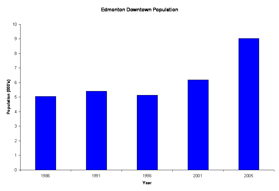
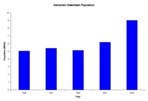 Downtown population from 1986 to 2005
The population of downtown Edmonton is still low when compared with other Canadian cities, despite major rejuvenation initiatives. As a result of a booming economy and development of major condominium and apartment projects, the population of the downtown core is rising steadily.[6] It is estimated now there are over 11,000 people living in downtown.
Year Female Male Total Source 1986 2,170 2,880 5,050 Federal Census 1991 2,380 3,015 5,395 Federal Census 1996 2,205 2,925 5,130 Federal Census 2001 2,845 3,330 6,175 Federal Census 2005 4,216 4,811 9,027 Municipal Census 2008 5,008 5,351 10,359 Municipal Census 2009 5,455 6,117 11,572 Municipal Census[7] Light Rail Transit Service
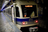 Bay/Enterprise Square LRT Station with the new LRV's in use.
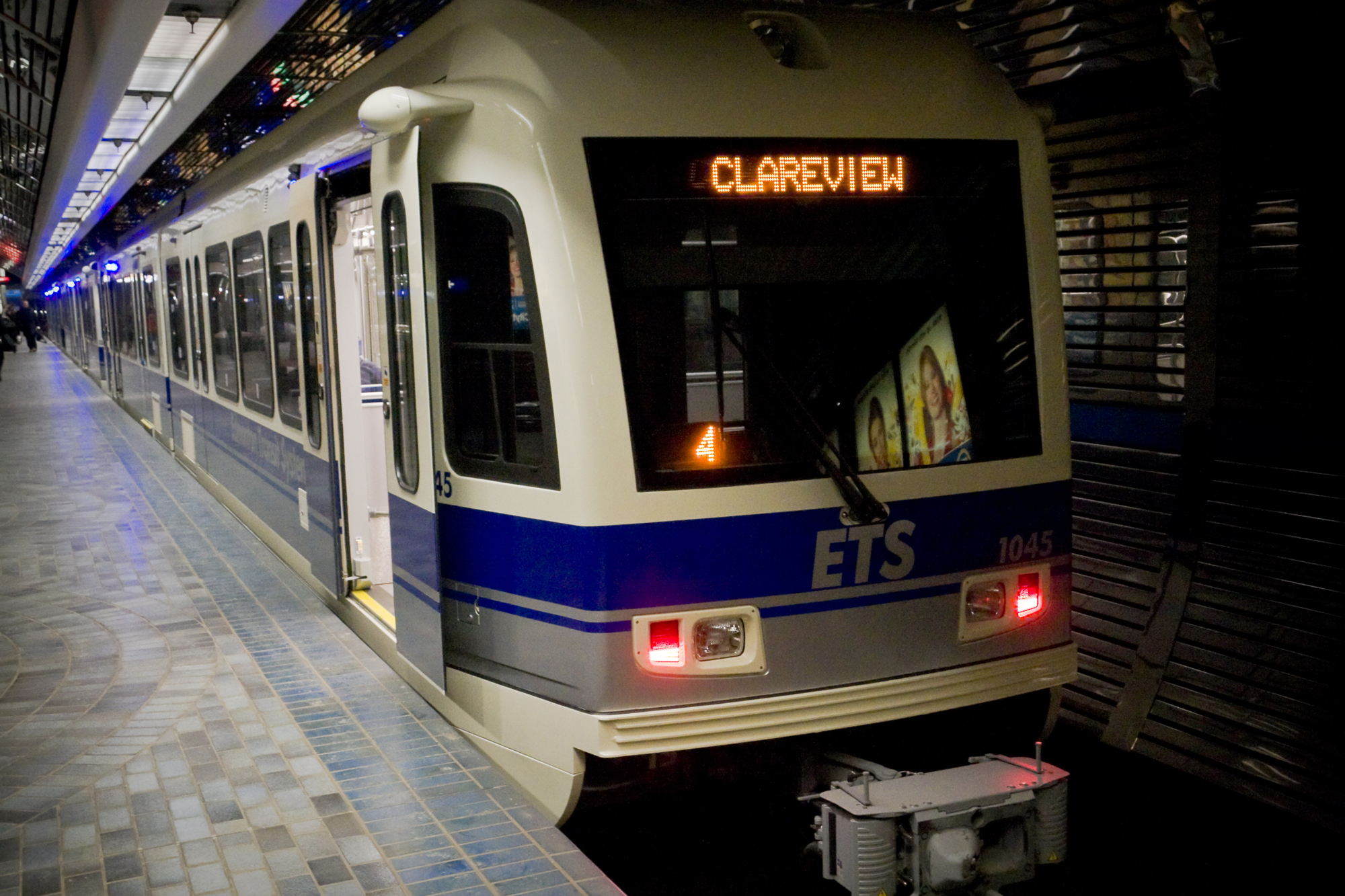
Edmonton Transit System's light rail system runs beneath the downtown core, with one station at Churchill Square (Churchill Station), three stations along Jasper Avenue (Central, Bay/Enterprise Square and Corona) and one station at government centre (Grandin). From Grandin Station, the LRT continues south over the North Saskatchewan River to three University of Alberta stations (University, Health Sciences/Jubilee, and South Campus), as a part of the South extension. From Churchill Station, the LRT travels north east towards Commonwealth Stadium and Rexall Place. Current proposals include an extension north of downtown to Grant MacEwan University, Royal Alexandra Hospital, Kingsway Mall, and the Northern Alberta Institute of Technology (NAIT).
Education
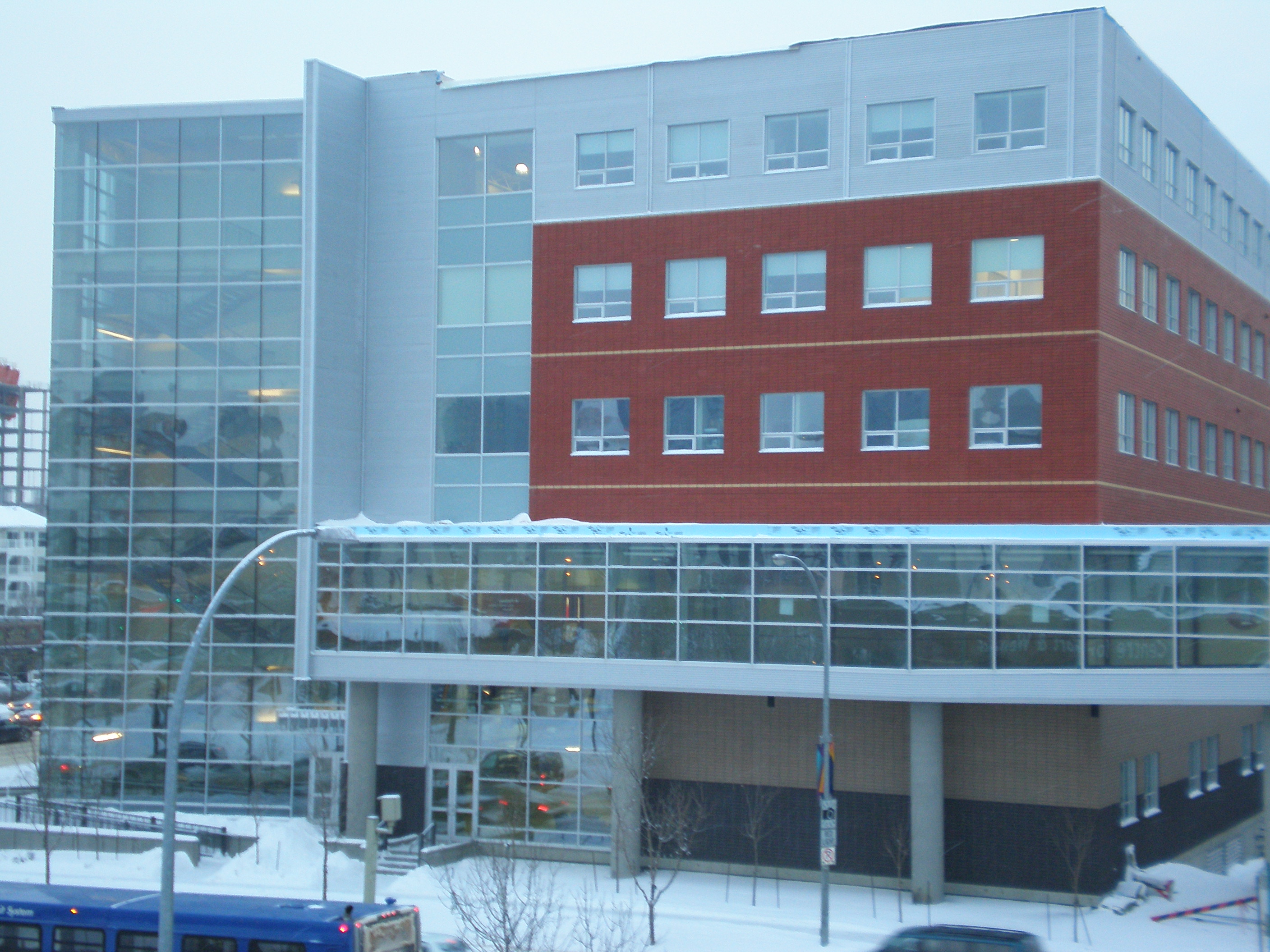
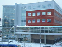 The Robins Health Learning Centre in Grant MacEwan.
There are several institutions providing educational opportunities in the downtown core. The largest of these is Grant MacEwan University whose City Centre Campus is located along the northern edge of the downtown core between 105 Street and 111 Street, and between 104 Avenue and 105 Avenue. This site used to be part of an old Canadian National rail yard that started redevelopment in the 1990s. MacEwan University also operates the Alberta College Campus located near the southern edge of the downtown core on McDonald Drive.
The University of Alberta has redeveloped the site of the Bay building on Jasper Avenue between 102 Street and 103 Street as Enterprise Square (2008). "The building will house TEC Edmonton, a jointly operated research commercialization centre presently located in the U of A's Research Transition Facility."[8] The opening of Enterprise Square marks the University's 100th Anniversary and first presence north of the river since it was founded in 1908. Enterprise Square also houses the University's Alumni Services, Faculty of Extension programs, and a U of A Bookstore.
The Edmonton Public School Board operates a high school, Centre High, in the redeveloped Boardwalk and Revillon buildings.
The University of Lethbridge maintains a small campus on three floors of a building on the south-west corner of 108 Street and 100 Avenue near the Government Centre. NorQuest College is located between 107 Street and 108 Street at 102 Avenue and provides upgrading and diploma services.
 Downtown Edmonton
Notes
- ^ "Avenue between City Hall and Churchill Square to close". CBC News. December 14, 2009. http://www.cbc.ca/canada/edmonton/story/2009/12/14/edm-road-closed.html. Retrieved September 21, 2011.
- ^ Archie McLean, "Federal building to get $356M makeover",Edmonton Journal, June 18, 2008.
- ^ Government of Alberta Ministry of Infrastructure. "The Federal Building and Centennial Plaza Project". Government of Alberta. http://www.infrastructure.alberta.ca/3562.htm. Retrieved September 21, 2011.
- ^ History of McKay Avenue School
- ^ Lawrence Herzog, "Edmontons Warehouse District",Real Estate Weekly, Vol 21 No. 25, June 26, 2003.
- ^ On March 13, 2007, as part of its first 2006 Census release, Statistics Canada released a map titled, "Edmonton CMA, Population Change 2001 To 2006 By 2006 Census Tract". The map shows the population of the downtown core and some of the surrounding areas grew in excess of 10% between 2001 and 2006. As additional census data is released, more details should become available.
- ^ City of Edmonton. "2009 Municipal Census Summary Report of All Questions - Downtown". http://www.edmonton.ca/city_government/documents/Summary_Report_of_All_Questions_DOWNTOWN.pdf. Retrieved 2009-09-18.
- ^ The University describes its plans for use of the Bay building in their press release announcing approval to purchase the building.
External links
- University of Alberta Purchase of Hudson Bay Building
- Edmonton Public School Board Archives and Museum
- Downtown Business Association
- City Market on 104 Street
- Downtown Edmonton Community League
Roads in Edmonton, Sherwood Park, and St. Albert, Alberta, Canada North-south streets - Clover Bar Road
- Broadmoor Boulevard
- Victoria Trail
- 34 Street
- 50 Street
- 66 Street
- 91 Street
- 97 Street
- Parsons Road (99 Street)
- Gateway Boulevard
- Calgary Trail (104 Street)
- 105 Street
- 109 Street
- 111 Street
- 113/114 Street
- 119/122 Street
- 124 Street
- 127 Street
- 156 Street
- Mayfield Road
- 170 Street
- Winterburn Road (215 Street)
East-west streets - Ellerslie Road (9 Avenue SW)
- 23 Avenue NW
- 34 Avenue NW
- Roper Road (51 Avenue)
- 61/63 Avenue
- Fox Drive
- University Avenue
- Whyte (82) Avenue
- 100 Avenue
- Baseline Road (101 Avenue)
- Jasper Avenue
- Stony Plain Road (101 Avenue)
- 107 Avenue (of Nations)
- 111/112 Avenue (Norwood Boulevard)
- 118 (Alberta) Avenue
- 137 Avenue
- 153 Avenue
- 167 Avenue
Other streets - Argyll Road
- Belgravia Road
- Bellerose Drive
- Boudreau Road
- Campbell Road
- Castle Downs Road
- Fort Road
- Giroux Road
- Hebert Road
- Kingsway (Avenue)
- McKenney Avenue
- Mill Woods Road
- Princess Elizabeth Avenue
- Queen Elizabeth Park Road
- St. Albert Trail
- Saskatchewan Drive
- Scona Road
- Sherwood Drive
- Sir Winston Churchill Avenue
- Walterdale Hill
Freeways and highways - 2 (QE2 Highway)
- 14
- 15 (Manning Drive)
- 16 (Yellowhead Trail)
- 16A
- 21
- 28
- 28A
- 37 (259 Avenue)
- Sherwood Park Freeway (100)
- Anthony Henday Drive (216)
- 627
- Whitemud Drive (628)
- Wye Road (630)
- Villeneuve Road (633)
- 814
- 825
- Groat Road
- Ray Gibbon Drive
- Terwillegar Drive
- Wayne Gretzky Drive
More Edmonton neighbourhoods Central West - Aldergrove
- Belmead
- Breckenridge Greens
- Britannia Youngstown
- Callingwood
- Cameron Heights
- Canora
- Crestwood
- Dechene
- Donsdale
- Edgemont
- Elmwood
- Gariepy
- Glastonbury
- Glenwood
- Granville
- Grovenor
- The Hamptons
- High Park
- Jamieson Place
- Jasper Park
- Jasper Place
- La Perle
- Laurier Heights
- Lymburn
- Lynnwood
- Mayfield
- McQueen
- Meadowlark Park
- Oleskiw
- Ormsby Place
- Parkview
- Patricia Heights
- Place LaRue
- Potter Greens
- Quesnell Heights
- Rio Terrace
- Rosenthal
- Secord
- Sherwood
- Suder Greens
- Summerlea
- Stewart Greens
- Terra Losa
- Thorncliff
- Webber Greens
- Wedgewood Heights
- West Jasper Place
- West Meadowlark Park
- Westridge
- Westview Village
Southwest - Allard
- Allendale
- Ambleside
- Aspen Gardens
- Bearspaw
- Belgravia
- Blackburne
- Blackmud Creek
- Blue Quill
- Blue Quill Estates
- Brander Gardens
- Brookside
- Bulyea Heights
- Callaghan
- Carter Crest
- Chappelle
- Desrochers
- Duggan
- Empire Park
- Ermineskin
- Falconer Heights
- Grandview Heights
- Greenfield
- Haddow
- Henderson Estates
- Heritage Valley Town Centre
- Hodgson
- Keheewin
- Keswick
- Lansdowne
- Leger
- Lendrum Place
- MacEwan
- Mactaggart
- Magrath Heights
- Malmo Plains
- McKernan
- Ogilvie Ridge
- Parkallen
- Petrolia
- Pleasantview
- Queen Alexandra
- Ramsay Heights
- Rhatigan Ridge
- Richford
- Rideau Park
- Royal Gardens
- Rutherford
- Skyrattler
- South Terwillegar
- Steinhauer
- Sweet Grass
- Terwillegar Towne
- Twin Brooks
- Westbrook Estates
- Windermere Estates
Southeast - Argyll
- Avonmore
- Bisset
- Burnewood
- Capilano
- Charlesworth
- Crawford Plains
- Daly Grove
- Ekota
- Ellerslie
- Forest Heights
- Fulton Place
- Gold Bar
- Greenview
- Hazeldean
- Hillview
- Holyrood
- Idylwylde
- Jackson Heights
- Kameyosek
- Kenilworth
- King Edward Park
- Kiniski Gardens
- Knottwood
- Lakewood
- Larkspur
- Laurel
- Lee Ridge
- Maple
- Maple Ridge
- The Meadows
- Menisa
- Meyokumin
- Meyonohk
- Michaels Park
- Millbourne
- Millhurst
- Mill Woods
- Mill Woods Town Centre
- Minchau
- The Orchards at Ellerslie
- Ottewell
- Pollard Meadows
- Richfield
- Ridgewood
- Ritchie
- Sakaw
- Satoo
- Silver Berry
- Southwood
- Summerside
- Tamarack
- Tawa
- Terrace Heights
- Tipaskan
- Tweddle Place
- Walker
- Weinlos
- Wild Rose
- Woodvale
Northwest - Albany
- Athlone
- Baranow
- Baturyn
- Beaumaris
- Caernarvon
- Calder
- Canossa
- Carlisle
- Carlton
- Chambery
- Cumberland
- Dovercourt
- Dunluce
- Elsinore
- Goodridge Corners
- Griesbach
- Hawks Ridge
- Hudson
- Inglewood
- Kensington
- Lauderdale
- Lorelei
- Oxford
- Pembina
- Prince Charles
- Rapperswill
- Rosslyn
- Sherbrooke
- Starling
- Trumpeter
- Wellington
- Woodcroft
Northeast - Abbottsfield
- Balwin
- Bannerman
- Beacon Heights
- Belle Rive
- Bellevue
- Belmont
- Belvedere
- Bergman
- Beverly Heights
- Brintnell
- Canon Ridge
- Casselman
- Clareview Campus
- Cromdale
- Crystallina Nera
- Delwood
- Eaux Claires
- Ebbers
- Evansdale
- Evergreen
- Fraser
- Glengarry
- Hairsine
- Highlands
- Hollick-Kenyon
- Homesteader
- Joviz
- Kernohan
- Kildare
- Kilkenny
- Killarney
- Kirkness
- Klarvatten
- Lago Lindo
- Matt Berry
- Mayliewan
- McConachie
- McLeod
- Miller
- Montrose
- Newton
- Northmount
- Ozerna
- Overlanders
- Rundle Heights
- Schonsee
- Sifton Park
- Virginia Park
- York
- Business revitalization zones: 124 Street and Area
- Alberta Avenue
- Beverly
- Chinatown and Little Italy
- Downtown
- Fort Road and Area
- Inglewood
- Northwest Industrial
- Old Strathcona
- Stony Plain Road
- Quarters
 The Edmonton portalCategories:
- Neighbourhoods in Edmonton
- Roads in Edmonton
- Central business districts in Canada
- Visitor attractions in Edmonton

Wikimedia Foundation. 2010.