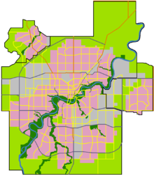
- Maple, Edmonton
-
Maple is a neighbourhood in southeast Edmonton, Alberta, Canada that was established in 2010 through the adoption of the Maple Neighbourhood Structure Plan (NSP).[1]
Maple is located within The Meadows and was originally considered Neighbourhood 7 within The Meadows Area Structure Plan (ASP).[2]
It is bounded on the west by a Canadian National rail line, north by Whitemud Drive, east by Anthony Henday Drive, and south by The Meadows Neighbourhood 5.[1][2]
Surrounding neighbourhoods

Southeast Industrial Maple Ridge Industrial Strathcona County 
Tamarack 
Strathcona County  Maple
Maple 

Tamarack
The Meadows Neighbourhood 5The Meadows Neighbourhood 5 Strathcona County References
- ^ a b "Bylaw 15396 – Maple Neighbourhood Structure Plan". City of Edmonton. 2010-04-12. http://sirepub.edmonton.ca/sirepub/cache/2/x1h3ejn52bvgt045gbuf1ybv/5678101292011101234644.PDF. Retrieved 2011-01-29.
- ^ a b "The Meadows Area Structure Plan (Office Consolidation)". City of Edmonton. June 2010. http://www.edmonton.ca/city_government/documents/The_Meadows_ASP_Consolidation.pdf. Retrieved 2011-01-29.
Categories:- Neighbourhoods in Edmonton
- Edmonton Capital Region geography stubs
Wikimedia Foundation. 2010.

