Magrath Heights, Edmonton
- Magrath Heights, Edmonton
-
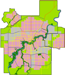
Magrath Heights is a neighbourhood in southwest Edmonton, Alberta, Canada that was established in 2003 through the adoption of the Magrath Heights Neighbourhood Area Structure Plan (NASP).[1]
Magrath Heights is located within Terwillegar Heights and was originally considered Neighbourhood 4B within the Terwillegar Heights Servicing Concept Design Brief (SCDB).[2]
It is bounded on the west by Rabbit Hill Road (142 Street), north by 23 Avenue, east and southeast by the Whitemud Creek ravine, and south by the Mactaggart neighbourhood.[1][2]
Surrounding neighbourhoods
 |
Leger |
Hodgson |
Whitemud Creek Ravine South |
|
| Terwillegar Towne |
 |
Whitemud Creek Ravine Twin Brooks |
 Magrath Heights Magrath Heights  |
 |
| Terwillegar South |
Mactaggart |
Whitemud Creek Ravine Twin Brooks |
References
Coordinates: 53°27′00″N 113°33′36″W / 53.450°N 113.560°W / 53.450; -113.560
Categories: - Neighbourhoods in Edmonton
- Edmonton Capital Region geography stubs
Wikimedia Foundation.
2010.
Look at other dictionaries:
Edmonton — This article is about the capital of Alberta. For other uses, see Edmonton (disambiguation). Edmonton City City of Edmonton … Wikipedia
List of neighbourhoods in Edmonton — Map of Edmonton and adjoining St. Albert and Sherwood Park This is a list of residential neighbourhoods in Edmonton, Alberta, Canada. Unlike the category list, neighbourhoods are grouped geographically so that, to a greater or lesser degree, a… … Wikipedia
Downtown Edmonton — Coordinates: 53°32′25″N 113°29′54″W / 53.54028°N 113.49833°W / 53.54028; 113.49833 Downtown Edmonton … Wikipedia
Duggan, Edmonton — Location of Duggan in Edmonton Duggan is … Wikipedia
Dickinsfield, Edmonton — This article is about Dickinsfield and the neighbourhoods of Evansdale and Northmount in Edmonton. For other uses of Evansdale, see Evansdale. For other uses of Northmount, see Northmount (disambiguation). Dickinsfield is bounded on the south by… … Wikipedia
McQueen, Edmonton — McQueen is a residential neighbourhood located in west Edmonton, Alberta, Canada. It is named for the Rev. David George McQueen, who served 43 years as minister at Edmonton s First Presbyterian Church from 1887 to 1930.[1] McQueen Road is a road … Wikipedia
Ottewell, Edmonton — Residential street corner in Ottewell. Ottewell is a large residential neighbourhood in south east Edmonton, Alberta, Canada. The area is named for the Ottewell family, who were among the first settlers south of the river in the 1880s .[1] The n … Wikipedia
Montrose, Edmonton — For other uses of Montrose, see Montrose (disambiguation). Rexall Place arena in Montrose. Montrose is a residential neighbourhood in north east Edmonton, Alberta, Canada. Edmonton s Rexall Place, home of the Edmonton Oilers and E … Wikipedia
McCauley, Edmonton — Coordinates: 53°33′23″N 113°29′02″W / 53.55639°N 113.48389°W / 53.55639; 113.48389 … Wikipedia
Delton, Edmonton — Location of Delton in Edmonton Delt … Wikipedia