- List of neighbourhoods in Edmonton
-
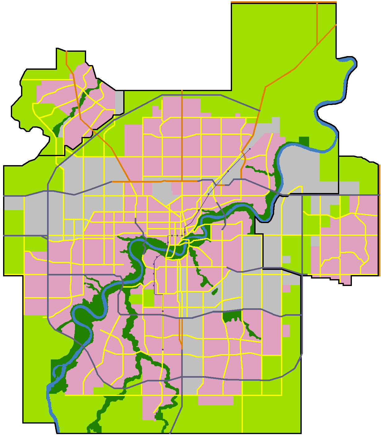
 Map of Edmonton and adjoining St. Albert and Sherwood Park
This is a list of residential neighbourhoods in Edmonton, Alberta, Canada. Unlike the category list, neighbourhoods are grouped geographically so that, to a greater or lesser degree, a neighbourhood is grouped with other neighbourhoods that are geographically close.
Contents
Downtown Edmonton
The downtown core of Edmonton, officially named as Downtown, is generally bounded by 109 Street to the west, 104 Avenue to the north, 97 Street to the east, Jasper Avenue to the southeast, and 97 Avenue, 100 Avenue, and Rossdale Road to the south.
 The Downtown Core
Districts (unofficial) within the downtown core:
- Arts District
- Commercial Core
- Government Centre
- Jasper West
- Mackay Avenue
- Rice Howard Way
- Warehouse District
Neighbourhoods adjacent to Downtown
 Looking north west towards Downtown Edmonton.
The following neighbourhoods are immediately adjacent to the downtown core, and are sometimes considered, unofficially, to be part of downtown. They fall completely within an area bounded by the North Saskatchewan River on the south and south east, 82 Street to the east, 112 Avenue on the north, and 124 Street on the west.
Other neighbourhoods in Inner Edmonton
These neighbourhoods are located north of 111 Avenue, south of Yellowhead Trail, west of the LRT right of way, and east of 121 Street. The Edmonton City Centre Airport is also located within this area.
- Alberta Avenue
- Cloverdale
- Delton
- Eastwood
- Elmwood Park
- Parkdale
- Prince Rupert
- Spruce Avenue
- Strathearn
- Westwood
West Edmonton
West Edmonton includes the neighbourhoods within an area bounded by 124 Street on the east, the city limits on the west, 111 Avenue on the north, and the North Saskatchewan River on the south.
Jasper Place
These neighbourhoods were part of the Town of Jasper Place, which amalgamated with Edmonton in 1964. Prior to amalgamation, Jasper Place stretched from 118 Avenue to the north to the North Saskatchewan River in the south, and from 149 Street in the east to 170 Street in the west. The town's main street was Stony Plain Road.[1]
- Britannia Youngstown
- Canora
- Elmwood
- Glenwood
- High Park
- Jasper Park
- Mayfield
- Lynnwood
- Meadowlark Park
- Patricia Heights
- Rio Terrace
- Sherwood
- West Jasper Place
- West Meadowlark Park
The Grange
The Grange is a group of suburban neighbourhoods in West Edmonton bounded by Whitemud Drive on the north, Anthony Henday Drive on the east, the future Lessard Road extension on the south and 215 Street (Winterburn Road) on the west.
Lewis Farms
Lewis Farms is a group of suburban neighbourhoods in West Edmonton bounded by Stony Plain Road on the north, Anthony Henday Drive on the east, Whitemud Drive on the south and 231 Street on the west.
- Breckenridge Greens
- Potter Greens
- Rosenthal
- Secord
- Stewart Greens
- Suder Greens
- Webber Greens
Other West Edmonton
- Aldergrove
- Belmead
- Callingwood North
- Callingwood South
- Cameron Heights
- Crestwood
- Dechene
- Donsdale
- Edgemont
- Gariepy
- Glenora
- Grovenor
- West Glenora
- Westgrove
- Jamieson Place
- La Perle
- Laurier Heights
- Buena Vista
- Lymburn
- McQueen
- North Glenora
- Oleskiw
- Ormsby Place
- Parkview
- Valleyview
- Place LaRue
- Quesnell Heights
- Summerlea
- Terra Losa
- Thorncliff
- Wedgewood Heights
- Westmount
- Groat Estates
- Westridge
- Westview Village
Southwest Edmonton
Neighbourhoods in southwest Edmonton are those located within the city limits that are south of the North Saskatchewan River and west of Gateway Boulevard. It excludes those neighbourhoods north of University Avenue and Whyte Avenue, which are included under South Central Edmonton.
Heritage Valley
A newer area of southwest Edmonton, located at the far southern fringe of the city. Neighbourhoods in Heritage Valley are located south of Anthony Henday Drive, west of Calgary Trail/Highway 2, north of the city limits (41 Avenue SW), and east of the Whitemud Creek Ravine. Heritage Valley neighbourhoods include:
- Allard
- Blackburne
- Blackmud Creek
- Callaghan
- Chappelle
- Heritage Valley Town Centre
- MacEwan
- Richford
- Rutherford
Kaskitayo/Petrolia
The following neighbourhoods are generally considered part of the area known as Petrolia, Kaskitayo, or Heritage (not to be confused with Heritage Valley). The majority of this area developed between 1965 and 1980. This area is bounded by the Whitemud Creek Ravine to the west, Calgary Trail to the east, Whitemud Drive to the north, and the Blackmud Creek Ravine to the south.
- Aspen Gardens
- Blue Quill
- Blue Quill Estates
- Bearspaw
- Duggan
- Ermineskin
- Greenfield
- Keheewin
- Rideau Park
- Royal Gardens
- Skyrattler
- Steinhauer
- Sweet Grass
- Twin Brooks
- Westbrook Estates
Old Strathcona and area
The following neighbourhoods are located near the University of Alberta, in the area former occupied by the City of Strathcona, in an area of southwest Edmonton bounded by the North Saskatchewan River to the north, the Whitemud Creek Ravine and the North Saskatchewan River to the west, Calgary Trail to the east, and 61 Avenue to the south.
- Allendale
- Belgravia
- Garneau
- Grandview Heights
- McKernan
- Parkallen
- Queen Alexandra
- Strathcona
- Windsor Park
Riverbend
The following neighbourhoods are generally considered part of Riverbend, the area located south and east of the North Saskatchewan River, west of the Whitemud Creek ravine, and a transmission line and utility corridor at roughly 28 Avenue.
- Brander Gardens
- Brookside
- Bulyea Heights
- Carter Crest
- Falconer Heights
- Ogilvie Ridge
- Henderson Estates
- Ramsay Heights
- Rhatigan Ridge
Southgate
The following neighbourhoods are located in close proximity to Southgate Centre and, accordingly, are often collectively referred to as the "Southgate" area. These neighbourhoods are bounded by the Whitemud Ravine to the west, Calgary Trail to the east, Whitemud Drive to the south and the University of Alberta Farm and 61 Avenue to the north.
- Empire Park
- Lansdowne
- Lendrum Place
- Malmo Plains
- Pleasantview
Terwillegar Heights
The following neighbourhoods in southwest Edmonton are generally considered part of Terwillegar, the area located south of a transmission line and utility corridor at roughly 28 Avenue, west of the Whitemud Creek Ravine, north and east of Anthony Henday Drive, and east of the North Saskatchewan River.
- Haddow
- Hodgson
- Leger
- Magrath Heights
- Mactaggart
- Terwillegar Towne
- Terwillegar South
Windermere
One of the newest areas of the city, new neighborhoods began developing in Windermere in 2006. Windermere consists of the area located south of the Anthony Henday Drive, east of the North Saskatchewan River, west of the Whitemud Creek Ravine and north of the city limits (41 Avenue SW).
- Ambleside
- Keswick
- Windermere Estates
Southeast Edmonton
Neighbourhoods in southeast Edmonton are those neighbourhoods within the city limits, east of Gateway Boulevard and south of Whyte Avenue. It also includes those neighbourhoods located north of Whyte Avenue, east of 85 Street and south of the North Saskatchewan River.
Ellerslie
Ellerslie is an area bounded by Gateway Boulevard to the west, Anthony Henday Drive to the north, 66 Street to the east and the city limits (41 Avenue SW) to the south. It includes four residential neighbourhoods, including one under the same name, and one industrial neighbourhood. The residential neighbourhoods approved to date include:
- Ellerslie
- The Orchards at Ellerslie
- Summerside
The Meadows
The Meadows is an area east of Mill Woods that will include seven neighbourhoods when fully developed. It is bounded by 34 Street on the west, Whitemud Drive on the north, and Anthony Henday Drive (Highway 216) on the south and east. Neighbourhoods approved for development to date include:
- Larkspur
- Laurel
- Maple
- Silver Berry
- Tamarack
- Wild Rose
Mill Woods
Mill Woods is further divided into eight communities. The communities with their respective neighbourhoods are:
Burnewood
Knottwood
- Ekota
- Menisa
- Satoo
Lakewood
Millhurst
Millbourne
Ridgewood
Southwood
Woodvale
Other Southeast Edmonton
- Argyll
- Avonmore
- Bonnie Doon
- Capilano
- Charlesworth
- Forest Heights
- Fulton Place
- Hardisty
- Gold Bar
- Hazeldean
- Holyrood
- Idylwylde
- Kenilworth
- King Edward Park
- Maple Ridge
- Ottewell
- Ritchie
- Terrace Heights
- Walker
Northwest Edmonton
Northwest Edmonton includes those neighbourhoods located inside the city limits that are north of Yellowhead Trail and west of 97 Street, as well as those neighbourhoods north of 111 Avenue and west of 121 Street.
Big Lake
Big Lake is bounded on the north by Big Lake and 137 Avenue, east by Ray Gibbon Drive, southeast by Anthony Henday Drive (Highway 216), south by Yellowhead Trail (Highway 16), and west by 231 Street (Hillview Road). The City of St. Albert and Parkland County are located beyond 137 Avenue and 231 Street respectively. This does not include the Big Lake Estates subdivision at the northeast corner of Yellowhead Trail and 231 Street.[2]
- Hawks Ridge
- Starling
- Trumpeter
Castle Downs
Castle Downs is bounded on the north by the Transportation and Utility Corridor (Anthony Henday Drive), the south by 137 Avenue, the east by 97 Street, and the west by 127 Street. This does not include Griesbach (east of Castle Downs Road, south of 153 Avenue south).[3] Castle Downs was once the location of the Edmonton International Speedway. (Year subdivision established in brackets).
The Palisades
The Palisades is bound by Anthony Henday Drive to the north, 142 Street to the west, 137 Avenue to the south and 127 Street to the east.[3]
- Albany
- Carlton
- Cumberland
- Hudson
- Oxford
- Pembina
Other Northwest Edmonton
- Athlone
- Dunvegan
- Calder
- Dovercourt
- Goodridge Corners
- Griesbach
- Inglewood
- Kensington
- Lauderdale
- Prince Charles
- Rosslyn
- Sherbrooke
- Wellington
- Woodcroft
Northeast Edmonton
Northeast Edmonton includes neighbourhoods within the city limits located north of Yellowhead Trail and east of 97 Street, as well as those neighbourhoods located south of the Yellowhead Trail, north of the North Saskatchewan River, and east of the LRT right-of-way.
Beverly
These neighbourhoods are located in the area that was part of, or located near, the Town of Beverly prior to its amalgamation with Edmonton on December 31, 1961. Those areas near the town had coal mines for which the town provided the workforce.
- Abbottsfield
- Beacon Heights
- Bergman
- Beverly Heights
- Rundle Heights
Casselman-Steele Heights
Clareview
Hermitage
Lake District
Lake District is a grouping of nine neighbourhoods bounded by 97 Street to the west, Anthony Henday Drive to the north, 66 Street to the east and 153 Avenue to the south.
- Crystallina Nera
- Eaux Claires
- Joviz
- Klarvatten
- Lago Lindo
- Mayliewan
- Ozerna
- Schonsee
Pilot Sound
Pilot Sound is a grouping of five residential and two industrial neighbourhoods bounded by 66 Street to the west, Anthony Henday Drive to the north and east, and 153 Avenue to the south. Four of the five residential neighbourhoods planned to date include:
Other Northeast Edmonton
- Balwin
- Belle Rive
- Bellevue
- Belvedere
- Cromdale
- Delwood
- Evansdale (Dickinsfield)
- Evergreen
- Glengarry
- Highlands
- Kildare
- Kilkenny
- Killarney
- Montrose
- Newton
- Northmount (Dickinsfield)
- Virginia Park
Tent cities and housing crisis
With the major boom in the Alberta economy in the mid to late 2000s, vacancy rates reached an all time low. At the same time, rents and other housing costs continued to increase without a comparable cost-of-living increase in the incomes of those living and working in Alberta. This created a housing crisis in Edmonton.
One of the results of this crisis was that small tent cities appeared in many places in the city. Most of these were located near the downtown core and in the river valley.
Many of the people living in the tents were working poor who had not been able to obtain or retain suitable permanent housing. The Government of Alberta instituted a Homelessness and Eviction Prevenention Fund "to provide short-term assistance to prevent Albertans from becoming homeless and to help individuals and families stabilize their shelter arrangements."[4] While people seeking support from the fund were required to provide evidence of need, for example, "an eviction notice or arrears statement from a landlord; and confirmation, such as a bank statement, to show they have limited funds to cover the rent shortfall,"[5] Global News reported on July 17, 2007, that there was some abuse by individuals who seemed to be addicted to crack.
Business revitalization zones
The business revitalization zone (BRZ) program was established to allow certain commercial areas of the city to administer and promote themselves internally. Many of the zones (or districts) that emerged from this have since acquired a virtual "neighbourhood" status by the people of Edmonton. Most zones now offer a unique street shopping environment (many have restaurants and nightlife too) and have become popular destinations for both Edmontonians and visitors to the city. None of these zones are officially designated as neighbourhoods unto themselves however. The City of Calgary also uses BRZs, and other cities have equivalent systems.
See also: Business Improvement District.
- 124 Street and Area
- 97 Street and Area
- Alberta Avenue
- Beverly
- Downtown (within the Downtown Commercial Core)
- Fort Road and Area
- Inglewood (within the neighbourhood of Inglewood)
- Kingsway
- Northwest Industrial
- Old Strathcona
- Stony Plain Road
References
- ^ Real Estate Weekly (October 2002). "When Jasper Place Joined Edmonton". http://www.rewedmonton.ca/content_view2?CONTENT_ID=216. Retrieved 2007-05-01.
- ^ "Big Lake Area Structure Plan (Office Consolidation)". City of Edmonton. September 2011. http://www.edmonton.ca/city_government/documents/Big_Lake_ASP_Consolidation.pdf. Retrieved 2010-05-17.
- ^ a b Information derived from reference text. City of Edmonton, Naming Edmonton. Edmonton: University of Alberta Press, 2004. ISBN 0-88864-423-X
- ^ Homeless and Eviction Prevention Fund
- ^ Frequently Asked Questions
External links
- "Edmonton Federation of Community Leagues". Archived from the original on 2007-04-03. http://web.archive.org/web/20070403084829/http://www.efcl.org/links/. Retrieved 2007-05-01.
Categories:- Neighbourhoods in Edmonton
- Edmonton-related lists


Wikimedia Foundation. 2010.