- Athlone, Edmonton
-
For other uses of Athlone, see Athlone (disambiguation).For other uses of Dunvegan see Dunvegan (disambiguation).
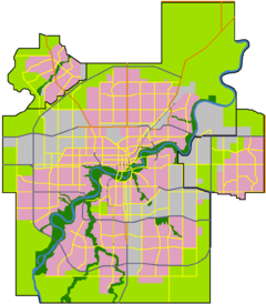
 Location of Athlone in Edmonton
Athlone is a residential neighbourhood in north west Edmonton, Alberta, Canada. The neighbourhood is named for the Earl of Athlone, Canada's Governor-General from 1940-46.[1] The western portion of the neighbourhood is also referred to as Dunvegan.
Residential development in Athlone, according to the 2001 federal census, began before the end of World War II when approximately one out of every fifteen (6.6%) of all residences were constructed. Most residential development in Athlone occurred between the end of the war and 1970. During this period, just over half (56.1%) of all residences were constructed. There was very little residential development between 1970 and 1990. The 1990s saw a period of renewed development in the neighbourhood with one in three residences (33.3%) of residences being built between 1991 and 2001.[2]
The most common type of residence in the neighbourhood, according to the 2005 municipal census, is the single family dwelling. These account for four out of every five (80.2%) of all the residences in the neighbourhood. Row houses account for another one in seven (14.9%) of all residences. Most of the remaining residences are duplexes.[3] Just under three out of every four (73%) of all residences are owner occupied with just over one out of every four (27%) being rented.[4]
There are three schools in the neighbourhood. Athlone Elementary School and Wellington Junior High School are operated by the Edmonton Public School System, while Sir John Thompson Catholic Junior High School is operated by the Edmonton Catholic School System.
The neighbourhood is bounded on the east by 127 Street. The southern boundary is located half a block south of 127 Street. The northern boundary to the east of 135 Street is 132 Avenue, and west of 135 street is located half a block south of 132 Avenue. The western boundary north of 130 Avenue is located approximately half a block west of 139 Street and south of 130 Avenue it is located approximately half a block west of 138 Street.
Surrounding neighbourhoods

Bonnaventure Industrial, McArthur Industrial[5] Wellington Kensington Bonnaventure Industrial, McArthur Industrial 
Calder  Athlone

Brown Industrial Hagmann Estate Industrial Hagmann Estate Industrial Notes
- ^ From the neighbourhood description in the City of Edmonton map utility.
- ^ http://censusdocs.edmonton.ca/DD23/FEDERAL%202001/Neighbourhood/ATHLONE.pdf
- ^ Duplexes include triplexes and fourplexes.
- ^ http://censusdocs.edmonton.ca/C05002/MUNICIPAL%202005/Neighbourhood/ATHLONE.pdf
- ^ McArthur Industrial is a narrow industrial subdivision located between Athlone and St. Albert Trail. To the west of St. Albert Trail is Bonnaventure Industrial.
External links
Categories:- Neighbourhoods in Edmonton

Wikimedia Foundation. 2010.