- Roche-a-Cri State Park
Geobox|Protected area
name = Roche-a-Cri State Park
category =Wisconsin State Park
category_iucn = V
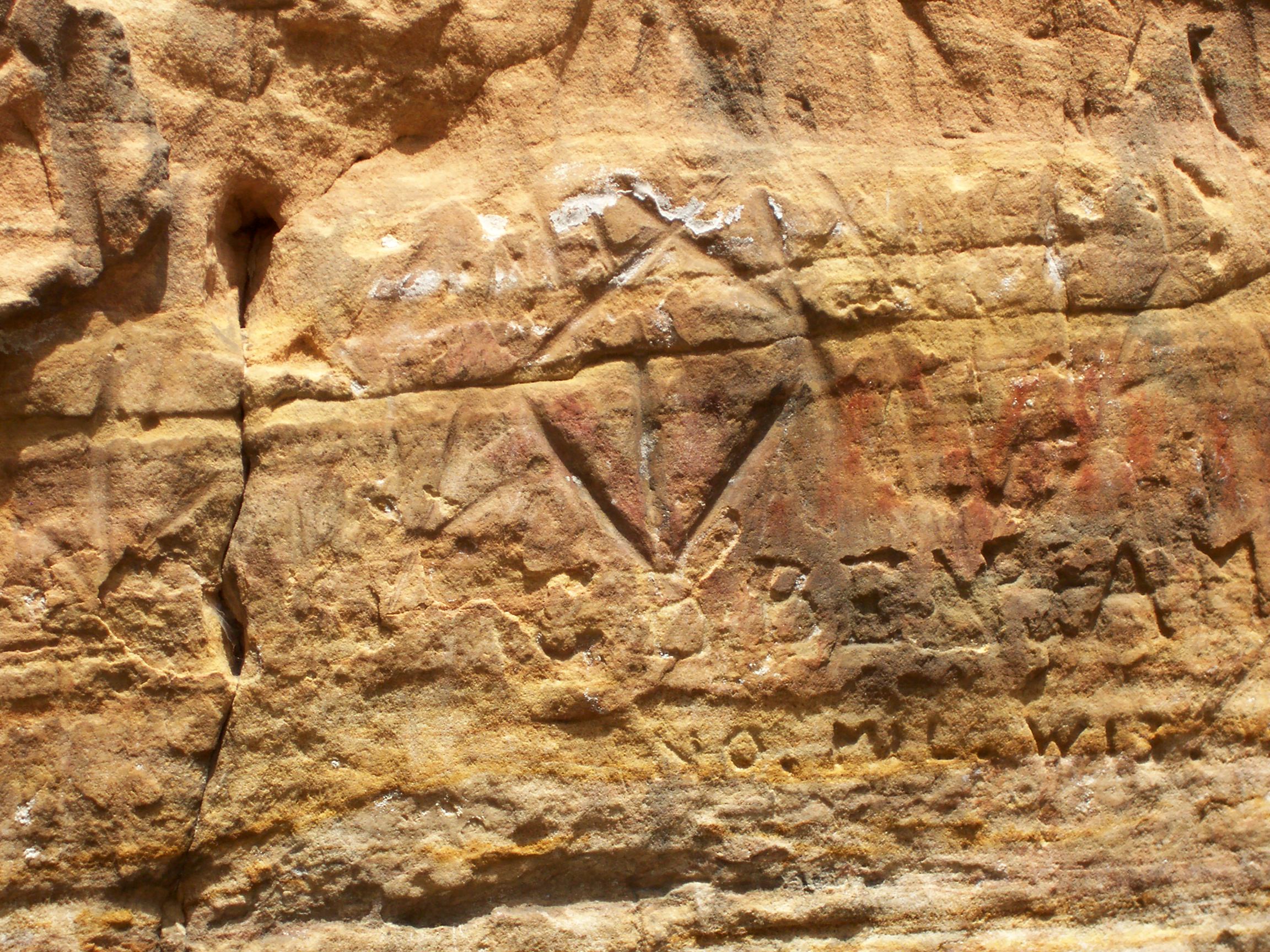
image_caption = TheRoche-a-Cri Petroglyphs .
country = United States
country_
state = Wisconsin
state_
state_type = State
region_type = County
region = Adams
city_type = City
location = Friendship
lat_d = 44
lat_m = 0
lat_s = 9
lat_NS = N
long_d = 89
long_m = 49
long_s = 10
long_EW = W
area_unit = acre
area_imperial = 604
area_round = 1
established = 1948
map_locator = Wisconsin

management_body =Wisconsin Department of Natural Resources Roche-a-Cri State Park (from the French for "crevice in the rock") is a
state park north of Adams and Friendship in centralWisconsin . The park, convert|605|acre|km2 in area, was established in 1948.The park features a 300 ft rock outcropping with Native American
petroglyph s—theRoche-a-Cri Petroglyphs —and a wooden stairway to the top, as well as more than convert|5|mi|km of hiking trails. [http://areas.wildernet.com/pages/area.cfm?areaID=WISPRC&CU_ID=1]External links
* [http://www.dnr.state.wi.us/org/land/parks/specific/roche-a-cri/ Roche-A-Cri State Park] official website

Wikimedia Foundation. 2010.