Richard Bong State Recreation Area

Richard Bong State Recreation Area

Geobox|Protected area
name = Richard Bong State Recreation Area
category = Wisconsin State Park
category_iucn = V


image_caption =
etymology_type = Named for
etymology = Richard Bong
country = United States
country_

state = Wisconsin
state_

state_type = State
region_type = County
region = Kenosha
city_type = City
location = Kansasville
lat_d = 42
lat_m = 38
lat_s = 2
lat_NS = N
long_d = 88
long_m = 8
long_s = 36
long_EW = W
area_unit = acre
area_imperial = 4515
area_round = 1
established = 1963
map_locator = Wisconsin


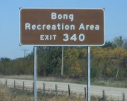
management_body =Wisconsin Department of Natural Resources

Richard Bong State Recreation Area is a 4,515 acres (18 km²) unit of the state park system of the U.S. state of Wisconsin. It is located west of Brighton, Wisconsin. This managed prairie contains 8.3 miles (13 km) of mountain bike trails. Other recreational activities include high power rocketry, dogsledding, falconry, ATV sports, land sailing, horseback riding, hunting, camping with amenities, including ultralight aviation. There is a wildlife preserve. Whooping cranes and great egrets are known to nest there.

The park is on land once intended for an Air Force base, Richard Bong Air Force Base. Its namesake is World War II veteran aviator Maj. Richard Ira Bong. Part of what was intended to be the convert|12500|ft|m|sing=on main airstrip is still visible from aerial photos of the site. The area has been the subject of a number of marijuana-related jokes due to sharing its name with a type of pipe used for smoking cannabis, and its highway exit sign is among the top ten most stolen road signs in America.Fact|date=July 2008

External links

* [http://www.dnr.state.wi.us/org/land/parks/specific/bong/ Richard Bong State Recreation Area] official website


Wikimedia Foundation. 2010.

Игры ⚽ Нужно сделать НИР?

Look at other dictionaries:

  • Richard Bong — Richard Ira Bong    …   Wikipedia

  • Chippewa Moraine State Recreation Area — Coordinates: 45°13′01″N 91°23′16″W / 45.21694°N 91.38778°W / 45.21694; 91.38778 …   Wikipedia

  • Richard Bong Air Force Base — Infobox Airport name = Richard Bong Air Force Base image width = 300 caption = Remains of Bong AFB, 14 April 2000 image2 width = 200 caption2 = Location of Richard Bong Air Force Base IATA = ICAO = FAA = type = Military owner = United States Air… …   Wikipedia

  • Bong (disambiguation) — Bong may refer to: * Bong, a device used for smoking cannabis, tobacco, or other substances *The sound of Big Ben chiming on ITN s Ten O clock news have been called the Bongs [http://news.bbc.co.uk/1/hi/entertainment/7183926.stm] * Bong is a… …   Wikipedia

  • State Parks in Wisconsin — Dies ist die Liste der State Parks im US Bundesstaat Wisconsin. Aztalan State Park …   Deutsch Wikipedia

  • Driftless Area National Wildlife Refuge — Coordinates: 42°41′00″N 91°07′30″W / 42.6833333°N 91.125°W / 42.6833333; 91.125 …   Wikipedia

  • Mill Bluff State Park — Coordinates: 43°56′47″N 90°18′55″W / 43.94639°N 90.31528°W / 43.94639; 90.31528 …   Wikipedia

  • Mead Wildlife Area — Welcome sign at the Mead The Mead (George W.) Wildlife Area is a state wildlife area covering 33,000 acres (130 km2) in central Wisconsin. It includes portions of Marathon, Portage, and Wood counties. It is managed by the Wisconsin… …   Wikipedia

  • Mirror Lake State Park — For the lake in Waupaca, Wisconsin, see Mirror Lake (Waupaca). Coordinates: 43°33′54″N 89°49′12″W / 43.565°N 89.82°W / …   Wikipedia

  • Natural Bridge State Park (Wisconsin) — Coordinates: 43°20′39″N 89°55′47″W / 43.34417°N 89.92972°W / 43.34417; 89.92972 …   Wikipedia

Share the article and excerpts

Direct link
Do a right-click on the link above
and select “Copy Link”