Council Grounds State Park

Council Grounds State Park
Wisconsin State Park
Country United States
State Wisconsin
County Lincoln
Location Merrill
 - coordinates 45°11′7″N 89°44′35″W / 45.18528°N 89.74306°W / 45.18528; -89.74306
Area 509 acres (206 ha)
Founded 1938
Management Wisconsin Department of Natural Resources
IUCN category V - Protected Landscape/Seascape

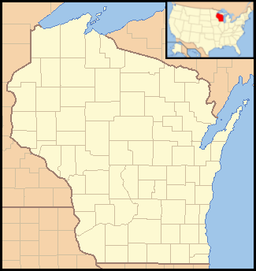
Council Grounds State Park is a 509-acre (206 ha) Wisconsin state park on the Wisconsin River. It was originally a Merrill city park that was donated to the state in 1938, evolving in designation from a state roadside park to a state forest to full state park status in 1978. The Works Progress Administration planted trees and built visitor amenities. The name Council Grounds comes from reports that the site was once used for seasonal gatherings of Native Americans.

External links


Wikimedia Foundation. 2010.

Игры ⚽ Нужна курсовая?

Look at other dictionaries:

  • Black Moshannon State Park — Geobox Protected Area name = Black Moshannon State Park native name = other name = other name1 = category local = Pennsylvania State Park category iucn = III image size = 300 image caption = View of bog and lake from the bog trail in the Black… …   Wikipedia

  • Copper Culture State Park — Oconto Site U.S. National Register of Historic Places U.S. National Historic Landmark …   Wikipedia

  • Mill Bluff State Park — Coordinates: 43°56′47″N 90°18′55″W / 43.94639°N 90.31528°W / 43.94639; 90.31528 …   Wikipedia

  • Mirror Lake State Park — For the lake in Waupaca, Wisconsin, see Mirror Lake (Waupaca). Coordinates: 43°33′54″N 89°49′12″W / 43.565°N 89.82°W / …   Wikipedia

  • Blue Mound State Park — IUCN Kategorie V Lage …   Deutsch Wikipedia

  • Copper Falls State Park — Coordinates: 46°22′35″N 90°38′36″W / 46.37639°N 90.64333°W / 46.37639; 90.64333 …   Wikipedia

  • Brunet Island State Park — IUCN Kategorie V La …   Deutsch Wikipedia

  • Amnicon Falls State Park — IUCN Kategorie V Lage …   Deutsch Wikipedia

  • Nelson Dewey State Park — Coordinates: 42°43′51″N 91°1′10″W / 42.73083°N 91.01944°W / 42.73083; 91.01944 …   Wikipedia

  • Copper Falls State Park — Der Copper Falls State Park ist ein 12,4 km² großer State Park. Er liegt etwa 3 km nordöstlich von Mellen im Ashland County des US Bundesstaates Wisconsin und ist über den Wisconsin Highway 169 erreichbar. Im Masterplan des Jahres 1975 wurden für …   Deutsch Wikipedia

Share the article and excerpts

Direct link
Do a right-click on the link above
and select “Copy Link”