- Crex Meadows
-
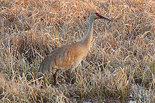
Crex Meadows is a wildlife area that consists of marshes, wetlands, brush prairies, and forests. Crex Meadows is located in near the village of Grantsburg, Wisconsin, in Burnett County, Wisconsin. Its 30,000 acres (120 km2) are home to 270 species of birds and 600 species of plants.[1]
Contents
Geological History
Crex Meadows is included in the Northwest Wisconsin pine barrens. These “barrens” are a large, sandy plain that was left as the glacier withdrew from the area around 13,000 years ago. Crex is located in the southern area of the barrens and contains huge marshes. The Crex Meadows were the result of the glacier that created the early Glacial Lake Grantsburg.[1]
Inhabited History
The Horicon Marsh area has been inhabited by people, including the Fox, Dakota, and Chippewa Indians who used the region mainly for hunting and gathering. During the 17th century, many Indians battles are thought to have occurred in the area. The Chippewa Indians were the rulers of the land when Europeans first arrived in the area during the 18th century.[2]
Starting in the 19th century, the Euro-Americans tried farming the sandy soil, but gave up defeated The lack of wildfires in the area nearly eliminated the brush prairie. A large drainage project in the 1890s resulted in less nesting and migrating to the area by wetland birds and animals.[1]
In 1912, the Crex Carpet Company bought 23,000 acres (93 km2) of today’s Crex Meadows. The company produced grass rugs and created carpet camps in the area. The grass rug business was successful until linoleum floor covering was invented and became popular in homes. Thus, in 1933 the Crex Carpet Company went bankrupt, yet the name of “Crex” lives on.[1]
In 1946, the state of Wisconsin bought 12,000 acres (49 km2) of the now tax delinquent land in order to start the Crex Meadows Wildlife Area.[1]
Wildlife
The National Bird Conservancy categorizes Crex Meadows as one of the top 500 Globally Important Bird Areas in the United States of America. Crex Meadows has a wide variety of bird species and is home to nearly every mammal found in Wisconsin as well as other marsh dwelling species.[3]
Ospreys, eagles, trumpeter swans, Karner blue butterflies, Blandings turtles, and red-necked grebes are some of the engangered and threatened aniamls that find shelter in Crex Meadows. A specific pack of Timber wolves, nicknamed "the Crex pack," have been breeding and living on the property since 1995. Additionally, the peregrine falcon, Caspian tern, and great egret seasonally make their home at Crex.[3]
References
- ^ a b c d e http://dnr.wi.gov/org/land/wildlife/wildlife_areas/crex.htm
- ^ http://www.crexmeadows.org/crexmeadows.htm
- ^ a b http://www.dnr.state.wi.us/org/land/wildlife/wildlife_areas/pdf/crexfull.pdf
External links
- Wisconsin Department of Resource's website on Crex Meadows
- Crex Meadows Brochure from Wisconsin DNR
- A website from Friends of Crex, a Non-Profit Organization that supports wildlife and wildlife education
Categories:- Protected areas of Burnett County, Wisconsin
- State Wildlife Areas of Wisconsin
Wikimedia Foundation. 2010.

